Saint-Antoine-de-Tilly
| Saint-Antoine-de-Tilly | |
|---|---|
| Municipality | |
 | |
 Location within Lotbinière RCM. | |
 Saint-Antoine-de-Tilly Location in southern Quebec. | |
| Coordinates: 46°40′N 71°35′W / 46.667°N 71.583°WCoordinates: 46°40′N 71°35′W / 46.667°N 71.583°W[1] | |
| Country |
|
| Province |
|
| Region | Chaudière-Appalaches |
| RCM | Lotbinière |
| Constituted | July 1, 1855 |
| Government[2] | |
| • Mayor | Ghislain Daigle |
| • Federal riding |
Lotbinière— Chutes-de-la-Chaudière |
| • Prov. riding | Lotbinière-Frontenac |
| Area[2][3] | |
| • Total | 59.60 km2 (23.01 sq mi) |
| • Land | 60.35 km2 (23.30 sq mi) |
|
There is an apparent contradiction between two authoritative sources | |
| Population (2011)[3] | |
| • Total | 1,604 |
| • Density | 26.6/km2 (69/sq mi) |
| • Pop 2006-2011 |
|
| • Dwellings | 784 |
| Time zone | UTC−5 (EST) |
| • Summer (DST) | UTC−4 (EDT) |
| Postal code(s) | G0S 2C0 |
| Area code(s) | 418 and 581 |
| Highways |
|
| Website |
www.saintantoine detilly.com |
Saint-Antoine-de-Tilly is a municipality in the Municipalité régionale de comté de Lotbinière in Quebec, Canada. It is part of the Chaudière-Appalaches region and the population is 1,462 as of 2009.
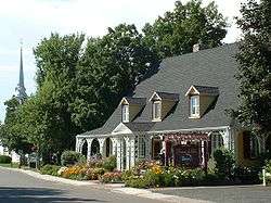
Member of the Most Beautiful Villages of Quebec, Saint-Antoine-de-Tilly has been colonized since the early beginnings of New France. The seigneurie of Villieu was sold in 1700 to Pierre-Noël Le Gardeur de Tilly, and because the seigneurie of Tilly, which is still part of the municipality's name today.
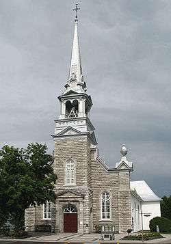
Saint-Antoine is named in honour to Catholic saint Anthony of Padua.
References
- Commission de toponymie du Québec
- Ministère des Affaires municipales, des Régions et de l'Occupation du territoire
Places adjacent to Saint-Antoine-de-Tilly | |
|---|---|
| Municipalities | |
|---|---|
| Parishes | |
| Villages | |
| |
This article is issued from
Wikipedia.
The text is licensed under Creative Commons - Attribution - Sharealike.
Additional terms may apply for the media files.