Saint-Hugues, Quebec
| Saint-Hugues | |
|---|---|
| Municipality | |
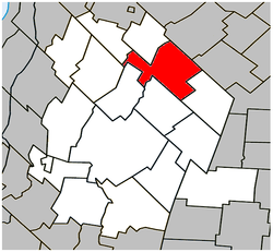 Location within Les Maskoutains RCM. | |
 Saint-Hugues Location in southern Quebec. | |
| Coordinates: 45°48′N 72°52′W / 45.800°N 72.867°WCoordinates: 45°48′N 72°52′W / 45.800°N 72.867°W[1] | |
| Country |
|
| Province |
|
| Region | Montérégie |
| RCM | Les Maskoutains |
| Founded | 1827 |
| Constituted | November 6, 1982 |
| Government[2][3] | |
| • Mayor | Serge Picard |
| • Federal riding | Saint-Hyacinthe—Bagot |
| • Prov. riding | Saint-Hyacinthe |
| Area[2][4] | |
| • Total | 85.90 km2 (33.17 sq mi) |
| • Land | 83.84 km2 (32.37 sq mi) |
| Population (2011)[4] | |
| • Total | 1,292 |
| • Density | 15.4/km2 (40/sq mi) |
| • Pop 2006-2011 |
|
| • Dwellings | 536 |
| Time zone | UTC−5 (EST) |
| • Summer (DST) | UTC−4 (EDT) |
| Postal code(s) | J0H 1N0 |
| Area code(s) | 450 and 579 |
| Highways |
|
| Website |
www |
Saint-Hugues (/ˌseɪnt
History
In 1827 Saint-Hugues was created as a village, later to be incorporated into the county of Bagot.[5]
Demographics
Population
| Canada census – Saint-Hugues, Quebec community profile | |||
|---|---|---|---|
| 2011 | 2006 | ||
| Population: | 1,292 (-1.4% from 2006) | 1,310 (+2.6% from 2001) | |
| Land area: | 83.84 km2 (32.37 sq mi) | 83.84 km2 (32.37 sq mi) | |
| Population density: | 15.4/km2 (40/sq mi) | 15.6/km2 (40/sq mi) | |
| Median age: | 39.6 (M: 39.9, F: 39.5) | 38.9 (M: 38.8, F: 38.9) | |
| Total private dwellings: | 536 | 536 | |
| Median household income: | $60,864 | $44,948 | |
| References: 2011[4] 2006[6] earlier[7] | |||
| Historical Census Data - Saint-Hugues, Quebec[8] | ||||||||||||||||||||||||||
|---|---|---|---|---|---|---|---|---|---|---|---|---|---|---|---|---|---|---|---|---|---|---|---|---|---|---|
|
|
| ||||||||||||||||||||||||
Language
| Canada Census Mother Tongue - Saint-Hugues, Quebec[8] | ||||||||||||||||||
|---|---|---|---|---|---|---|---|---|---|---|---|---|---|---|---|---|---|---|
| Census | Total | French |
English |
French & English |
Other | |||||||||||||
| Year | Responses | Count | Trend | Pop % | Count | Trend | Pop % | Count | Trend | Pop % | Count | Trend | Pop % | |||||
2011 |
1,290 |
1,270 | 98.45% | 15 | 1.16% | 5 | 0.39% | 0 | 0.00% | |||||||||
2006 |
1,305 |
1,255 | 96.17% | 25 | 1.92% | 0 | 0.00% | 25 | 1.92% | |||||||||
2001 |
1,275 |
1,275 | 100.00% | 0 | 0.00% | 0 | 0.00% | 0 | 0.00% | |||||||||
1996 |
1,370 |
1,355 | n/a | 98.91% | 0 | n/a | 0.00% | 0 | n/a | 0.00% | 15 | n/a | 1.09% | |||||
See also
References
- ↑ Reference number 133634 of the Commission de toponymie du Québec (in French)
- 1 2 Ministère des Affaires municipales, des Régions et de l'Occupation du territoire: Saint-Hugues
- ↑ Parliament of Canada Federal Riding History: SAINT-HYACINTHE--BAGOT (Quebec)
- 1 2 3 "2011 Community Profiles". Canada 2011 Census. Statistics Canada. July 5, 2013. Retrieved 2014-03-19.
- ↑ Blanchard, Raoul (1947). Le centre du Canada français: "province de Québec". Beauchemin. p. 76.
- ↑ "2006 Community Profiles". Canada 2006 Census. Statistics Canada. March 30, 2011. Retrieved 2014-03-19.
- ↑ "2001 Community Profiles". Canada 2001 Census. Statistics Canada. February 17, 2012.
- 1 2 Statistics Canada: 1996, 2001, 2006, 2011 census
Adjacent Municipal Subdivisions | |
|---|---|
| Cities | |
|---|---|
| Municipalities | |
| Parishes | |
| Villages | |
| |
This article is issued from
Wikipedia.
The text is licensed under Creative Commons - Attribution - Sharealike.
Additional terms may apply for the media files.