Saint-Basile-le-Grand, Quebec
| Saint-Basile-le-Grand | |
|---|---|
| Ville | |
 Située dans La Vallée-du-Richelieu RCM. | |
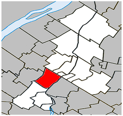
 Saint-Basile-le-Grand Située dans le sud du Québec. | |
| Coordinates: 45°32′N 73°17′W / 45.533°N 73.283°WCoordinates: 45°32′N 73°17′W / 45.533°N 73.283°W[1] | |
| Country |
|
| Province |
|
| Region | Montérégie |
| RCM | La Vallée-du-Richelieu |
| Constituted | June 15, 1871 |
| Government[2][3] | |
| • Maire | Bernard Gagnon |
| • Federal riding | Montarville |
| • Prov. riding | Chambly |
| Area[2][4] | |
| • Total | 36.90 km2 (14.25 sq mi) |
| • Land | 36.10 km2 (13.94 sq mi) |
| Population (2011)[4] | |
| • Total | 16,736 |
| • Density | 463.6/km2 (1,201/sq mi) |
| • Pop 2006-2011 |
|
| • Dwellings | 6,235 |
| Time zone | UTC−5 (EST) |
| • Summer (DST) | UTC−4 (EDT) |
| Postal code(s) | J3N |
| Area code(s) | 450 and 579 |
| Highways |
|
| Website |
www.ville.saint- basile-le-grand.qc.ca |
Saint-Basile-le-Grand is a city located in La Vallée-du-Richelieu Regional County Municipality in southwestern Quebec, Canada. The population as of the Canada 2011 Census was 16,736.
Demographics
PopulationPopulation trend:[5]
|
LanguageMother tongue language (2006)[6]
|
Transportation
Saint-Basile-le-Grand is served by the Saint-Basile-le-Grand commuter rail station on the Réseau de transport métropolitain's Mont-Saint-Hilaire line. Local bus service is provided by the RTM's Vallée du Richelieu sector.
Education
The South Shore Protestant Regional School Board previously served the municipality.[7]
See also
References
- ↑ Reference number 55722 of the Commission de toponymie du Québec (in French)
- 1 2 Ministère des Affaires municipales, des Régions et de l'Occupation du territoire: Saint-Basile-le-Grand
- ↑ Parliament of Canada Federal Riding History: CHAMBLY--BORDUAS (Quebec)
- 1 2 2011 Statistics Canada Census Profile: Saint-Basile-le-Grand, Quebec
- ↑ Statistics Canada: 1996, 2001, 2006, 2011 census
- ↑ 2006 Statistics Canada Community Profile: Saint-Basile-le-Grand, Quebec
- ↑ King, M.J. (Chairperson of the board). "South Shore Protestant Regional School Board" (St. Johns, PQ). The News and Eastern Townships Advocate. Volume 119, No. 5. Thursday December 16, 1965. p. 2. Retrieved from Google News on November 23, 2014.
Adjacent Municipal Subdivisions | |
|---|---|
| Cities | |
|---|---|
| Municipalities | |
| |
This article is issued from
Wikipedia.
The text is licensed under Creative Commons - Attribution - Sharealike.
Additional terms may apply for the media files.