Princeville, Quebec
| Princeville | |
|---|---|
| City | |
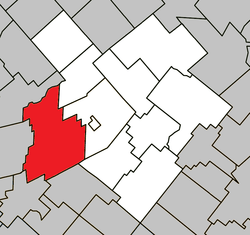 Location within L'Érable RCM. | |
 Princeville Location in southern Quebec. | |
| Coordinates: 46°10′N 71°53′W / 46.167°N 71.883°WCoordinates: 46°10′N 71°53′W / 46.167°N 71.883°W[1] | |
| Country |
|
| Province |
|
| Region | Centre-du-Québec |
| RCM | L'Érable |
| Constituted | February 23, 2000 |
| Government[2] | |
| • Mayor | Gilles Fortier |
| • Federal riding | Mégantic—L'Érable |
| • Prov. riding | Arthabaska |
| Area[2][3] | |
| • Total | 196.70 km2 (75.95 sq mi) |
| • Land | 194.02 km2 (74.91 sq mi) |
| Population (2011)[3] | |
| • Total | 5,693 |
| • Density | 29.3/km2 (76/sq mi) |
| • Pop 2006-2011 |
|
| • Dwellings | 2,497 |
| Time zone | UTC−5 (EST) |
| • Summer (DST) | UTC−4 (EDT) |
| Postal code(s) | G6L 4Y5 |
| Area code(s) | 819 |
| Highways |
|
| Website |
www |
Princeville is a city in the Canadian province of Quebec, located in L'Érable Regional County Municipality in the Centre-du-Québec region.
The population was 5,693 as of the Canada 2011 Census.
History
The county of Stanfold (Princeville) was created by Édouard Leclerc on July 9, 1807 when he established himself on lot 6, rang 12 in Princeville. A monument was erected in his honour on the east section of the 12th rang. Stanfold then had a new division that would become the village of Princeville in 1856. Thus two municipalities would now co-existed.
On February 23, 2000, the municipalities of the city of Princeville and the parish of Princeville become one to form the new city of Princeville.
External links
References
Places adjacent to Princeville, Quebec | |
|---|---|
| Cities | |
|---|---|
| Municipalities | |
| Parishes | |
| |
This article is issued from
Wikipedia.
The text is licensed under Creative Commons - Attribution - Sharealike.
Additional terms may apply for the media files.