Lac-Etchemin, Quebec
| Lac-Etchemin or the Land of The Emmanuel | |
|---|---|
| Municipality | |
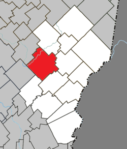 Location within Les Etchemins RCM. | |
 Lac-Etchemin or the Land of The Emmanuel Location in southern Quebec. | |
| Coordinates: 46°24′N 70°30′W / 46.400°N 70.500°WCoordinates: 46°24′N 70°30′W / 46.400°N 70.500°W[1] | |
| Country |
|
| Province |
|
| Region | Chaudière-Appalaches |
| RCM | Les Etchemins |
| Constituted | October 10, 2001 |
| Government[2] | |
| • Mayor | Harold Gagnon |
| • Federal riding | Bellechasse—Les Etchemins—Lévis |
| • Prov. riding | Bellechasse |
| Area[2][3] | |
| • Total | 161.60 km2 (62.39 sq mi) |
| • Land | 157.53 km2 (60.82 sq mi) |
| Population (2011)[3] | |
| • Total | 4,061 |
| • Density | 25.8/km2 (67/sq mi) |
| • Pop 2006-2011 |
|
| • Dwellings | 2,065 |
| Time zone | UTC−5 (EST) |
| • Summer (DST) | UTC−4 (EDT) |
| Postal code(s) | G0R 1S0 |
| Area code(s) | 418 and 581 |
| Highways |
|
| Website |
www.municipalite. lac-etchemin.qc.ca |
Lac-Etchemin is a municipality in and the seat of the Municipalité régionale de comté des Etchemins in Quebec, Canada. It is part of the Chaudière-Appalaches region and the population is 4,088 as of 2009. It takes its name from Etchemin Lake, at the centre of the municipality. "Etchemin" means "men, human beings" in Abenaki language.
Lac-Etchemin is home to winter resort Mont Orignal and the birthplace of controversial religious Community of the Lady of All Nations.
History
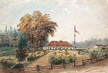
The area near Etchemin Lake was first described in 1828 as lovely by the surveyor Emmanuel. A few years later, in 1835, the region sees its first settler, Commissary General Sir Randolph Isham Routh KCB (1782-1858), who was given a land grant of 9,000 acres (36 km2) for his services to the Crown.
The new municipality of Lac-Etchemin was created in 2001 following the amalgamation of the city of Lac-Etchemin and the parish of Sainte-Germaine-du-Lac-Etchemin.
People linked to Lac-Etchemin
- Joseph-Damase Bégin, Quebec politician
- Denis Bernard, actor and producer
- Marie-Michèle Gagnon, World Cup alpine ski racer
See also
- Etchemin Lake, a water body
- Etchemin River, a stream
- Discharge of Etchemin Lake, a stream
- Little Etchemin River, a stream
- Raquette River (Famine River), a stream
- Flowers River, a stream
- Daaquam River, a stream
- Liste of cities in Chaudière-Appalaches
- List of municipalities in Quebec
References
External links
- (in French) Lac-Etchemin official website
Adjacent Municipal Subdivisions | |
|---|---|
| Municipalities | |
|---|---|
| Parishes | |
| |