Morrison County, Minnesota
| Morrison County, Minnesota | |
|---|---|
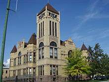 Morrison County Courthouse | |
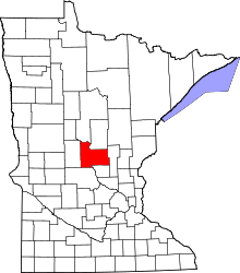 Location in the U.S. state of Minnesota | |
 Minnesota's location in the U.S. | |
| Founded | February 25, 1856[1] |
| Named for | William and Allan Morrison |
| Seat | Little Falls |
| Largest city | Little Falls |
| Area | |
| • Total | 1,153 sq mi (2,986 km2) |
| • Land | 1,125 sq mi (2,914 km2) |
| • Water | 28 sq mi (73 km2), 2.5% |
| Population (est.) | |
| • (2016) | 32,821 |
| • Density | 30/sq mi (10/km2) |
| Congressional district | 8th |
| Time zone | Central: UTC−6/−5 |
| Website |
www |
Morrison County is a county located in the U.S. state of Minnesota. As of the 2010 census, the population was 33,198.[2] Its county seat is Little Falls.[3]
History
First the Dakotah and then the Ojibwe Indians lived in the central Minnesota area around the Mississippi River. French and English fur traders and voyageurs traveled through Minnesota from the 17th century to the 19th century. They used the river to transport their goods and trade with the natives. The county was named for fur trading brothers, William and Allan Morrison.
Three prominent explorers lead expeditions along the river through the area that would be known as Morrison County in the 19th century. Zebulon Montgomery Pike came through in 1805. Governor Lewis B. Cass led an expedition through the area in 1820. Joseph N. Nicollet, explorer and scientist, had created the first accurate map of the area along the river in 1836.
Missionaries were some of the areas first European settlers. Methodist missionaries settled temporarily along the Little Elk River in 1838. The Reverend Frederic and Elisabeth (Taylor) Ayer moved to the Belle Prairie area in 1849. They started a mission and school there for the Ojibwe. Father Francis Xavier Pierz came to the area in 1852 and started many communities in central Minnesota, including Sobieski and Rich Prairie (later renamed Pierz) in Morrison County.
The event that prodded further development of the county was the building of Fort Ripley. In order to construct this military outpost, a dam and sawmill were erected in 1849 by the Little Falls Mill and Land Company. This company was formed by James Green, Allan Morrison, Henry M. Rice, John Irvine, John Blair Smith Todd, and Napoleon Jackson Tecumseh Dana. Fort Ripley was built ostensibly to protect the Winnebago Indians, who had been relocated by Henry Rice from Iowa to central Minnesota west of the Mississippi River, between the Crow Wing and Long Prairie rivers. Rice hoped the Winnebago would act as a buffer between the warring Ojibwe and Dakotah Indians. His plan was unsuccessful and the Winnebago were moved to the Blue Earth River in southern Minnesota in 1855.
Little Falls, the county seat, sprung up when a second dam was built by the Little Falls Company (later called the Little Falls Manufacturing Company). This dam washed out, as the first had done, and Little Falls entered a long period of economic depression and stagnation as far as population growth. Bit by bit, Little Falls grew, until it was officially incorporated as a village in 1879.

Another wave of immigration occurred between 1880 and 1920. A wide variety of ethnic groups[5] chose Morrison County for their new home. This wave of immigration was spurred by the construction of the third dam at Little Falls in 1887. A group of investors from Louisville, Kentucky, led by M. M. Williams, provided the financing for this dam. They wanted to be sure their investment was successful. To this end, they worked to encourage other major industries to locate in the city, touting the water power as a prime feature.
Pine Tree Lumber Company, run by Charles A. Weyerhaeuser and Richard "Drew" Musser,[6] was one such business that took advantage of the water power, with their operations in Little Falls beginning in 1890. Hennepin Paper Company also started operations that year in the city.
The Louisville, Kentucky, investors were also responsible for drawing up a charter to transform Little Falls from a village to a city. This occurred in 1889, with Nathan Richardson, one of the original organizers of Morrison County, becoming the first mayor of the new city.[7]
Geography
According to the U.S. Census Bureau, the county has a total area of 1,153 square miles (2,990 km2), of which 1,125 square miles (2,910 km2) is land and 28 square miles (73 km2) (2.5%) is water.[8]
Major highways
Adjacent counties
- Cass County (north)
- Crow Wing County (northeast)
- Mille Lacs County (east)
- Benton County (southeast)
- Stearns County (south)
- Todd County (west)
National protected area
Demographics
| Historical population | |||
|---|---|---|---|
| Census | Pop. | %± | |
| 1860 | 618 | — | |
| 1870 | 1,681 | 172.0% | |
| 1880 | 5,875 | 249.5% | |
| 1890 | 13,325 | 126.8% | |
| 1900 | 22,891 | 71.8% | |
| 1910 | 24,053 | 5.1% | |
| 1920 | 25,841 | 7.4% | |
| 1930 | 25,442 | −1.5% | |
| 1940 | 27,473 | 8.0% | |
| 1950 | 25,832 | −6.0% | |
| 1960 | 26,641 | 3.1% | |
| 1970 | 26,949 | 1.2% | |
| 1980 | 29,311 | 8.8% | |
| 1990 | 29,604 | 1.0% | |
| 2000 | 31,712 | 7.1% | |
| 2010 | 33,198 | 4.7% | |
| Est. 2016 | 32,821 | [9] | −1.1% |
| U.S. Decennial Census[10] 1790-1960[11] 1900-1990[12] 1990-2000[13] 2010-2016[2] | |||
As of the 2000 census, there were 31,712 people, 11,816 households, and 8,460 families residing in the county. The population density was 28 people per square mile (11/km²). There were 13,870 housing units at an average density of 12 per square mile (5/km²). The racial makeup of the county was 98.48% White, 0.21% Black or African American, 0.32% Native American, 0.25% Asian, 0.03% Pacific Islander, 0.15% from other races, and 0.55% from two or more races. 0.64% of the population were Hispanic or Latino of any race. 45.4% were of German, 18.8% Polish, 7.3% Norwegian and 5.7% Swedish ancestry. 96.7% spoke English, 1.4% Spanish and 1.2% German as their first language.
There were 11,816 households out of which 34.50% had children under the age of 18 living with them, 59.40% were married couples living together, 7.80% had a female householder with no husband present, and 28.40% were non-families. 24.90% of all households were made up of individuals and 11.80% had someone living alone who was 65 years of age or older. The average household size was 2.64 and the average family size was 3.15.
In the county, the population was spread out with 28.00% under the age of 18, 8.00% from 18 to 24, 26.70% from 25 to 44, 21.70% from 45 to 64, and 15.60% who were 65 years of age or older. The median age was 37 years. For every 100 females there were 101.20 males. For every 100 females age 18 and over, there were 99.50 males.
The median income for a household in the county was $37,047, and the median income for a family was $44,175. Males had a median income of $31,037 versus $22,244 for females. The per capita income for the county was $16,566. About 7.50% of families and 11.10% of the population were below the poverty line, including 11.40% of those under age 18 and 18.50% of those age 65 or over.
Communities
Cities
Townships
- Agram Township
- Belle Prairie Township
- Bellevue Township
- Buckman Township
- Buh Township
- Culdrum Township
- Cushing Township
- Darling Township
- Elmdale Township
- Granite Township
- Green Prairie Township
- Hillman Township
- Lakin Township
- Leigh Township
- Little Falls Township
- Morrill Township
- Motley Township
- Mount Morris Township
- Parker Township
- Pierz Township
- Pike Creek Township
- Platte Township
- Pulaski Township
- Rail Prairie Township (now defunct)
- Richardson Township
- Ripley Township
- Rosing Township
- Scandia Valley Township
- Swan River Township
- Swanville Township
- Two Rivers Township
Unincorporated communities
- Belle Prairie
- Center Valley
- Cushing
- Darling
- Freedhem
- Gregory
- Lincoln
- Little Rock
- Morrill
- North Prairie
- Platte
- Ramey
- Shamineau Park
- Sullivan
- Vawter
Politics
| Year | Republican | Democratic | Third parties |
|---|---|---|---|
| 2016 | 73.4% 12,925 | 20.7% 3,637 | 6.0% 1,052 |
| 2012 | 60.8% 10,159 | 36.8% 6,153 | 2.4% 402 |
| 2008 | 58.1% 9,735 | 39.1% 6,547 | 2.8% 461 |
| 2004 | 57.9% 9,698 | 40.5% 6,794 | 1.6% 266 |
| 2000 | 55.9% 8,197 | 35.9% 5,274 | 8.2% 1,206 |
| 1996 | 38.0% 5,054 | 43.1% 5,728 | 18.9% 2,506 |
| 1992 | 34.9% 5,038 | 38.7% 5,588 | 26.4% 3,816 |
| 1988 | 49.9% 6,598 | 48.9% 6,469 | 1.2% 160 |
| 1984 | 54.4% 7,556 | 44.9% 6,225 | 0.7% 99 |
| 1980 | 44.9% 6,296 | 49.4% 6,930 | 5.7% 792 |
| 1976 | 34.5% 4,590 | 61.5% 8,176 | 4.0% 528 |
| 1972 | 46.4% 5,714 | 48.6% 5,993 | 5.1% 622 |
| 1968 | 40.1% 4,511 | 54.3% 6,111 | 5.6% 634 |
| 1964 | 31.9% 3,515 | 67.9% 7,492 | 0.2% 25 |
| 1960 | 37.4% 4,403 | 62.4% 7,337 | 0.2% 24 |
| 1956 | 51.8% 5,042 | 47.8% 4,653 | 0.3% 32 |
| 1952 | 56.9% 6,050 | 42.8% 4,551 | 0.4% 38 |
| 1948 | 38.9% 3,922 | 59.7% 6,026 | 1.4% 144 |
| 1944 | 55.9% 5,035 | 43.6% 3,920 | 0.5% 47 |
| 1940 | 52.4% 5,734 | 47.0% 5,144 | 0.5% 58 |
| 1936 | 27.2% 2,682 | 62.1% 6,112 | 10.7% 1,054 |
| 1932 | 24.1% 2,198 | 73.6% 6,712 | 2.3% 213 |
| 1928 | 42.2% 3,846 | 57.3% 5,222 | 0.6% 51 |
| 1924 | 41.6% 3,128 | 10.2% 769 | 48.1% 3,617 |
| 1920 | 77.6% 5,371 | 16.3% 1,131 | 6.1% 422 |
| 1916 | 48.8% 1,887 | 42.7% 1,650 | 8.5% 327 |
| 1912 | 19.2% 699 | 36.8% 1,341 | 44.0% 1,605[15] |
| 1908 | 53.3% 1,936 | 41.7% 1,513 | 5.0% 183 |
| 1904 | 66.7% 2,498 | 30.1% 1,128 | 3.1% 117 |
| 1900 | 49.3% 1,880 | 48.2% 1,838 | 2.6% 99 |
| 1896 | 51.8% 1,960 | 45.8% 1,734 | 2.4% 92 |
| 1892 | 37.8% 1,135 | 52.7% 1,585 | 9.5% 286 |
See also
References
- ↑ "Minnesota Place Names". Minnesota Historical Society. Retrieved March 18, 2014.
- 1 2 "State & County QuickFacts". United States Census Bureau. Archived from the original on July 15, 2011. Retrieved September 1, 2013.
- ↑ "Find a County". National Association of Counties. Retrieved 2011-06-07.
- ↑ Nelson, Steven (2011). Savanna Soils of Minnesota. Minnesota: Self. pp. 53 - 56. ISBN 978-0-615-50320-2.
- ↑ "Morrison County, MN Immigration - Ethnic Settlements (1840s - Early 1900s)" (PDF). morrisoncountyhistory.org. Retrieved 2018-10-09.
- ↑ "Archived copy". Archived from the original on 2011-03-10. Retrieved 2011-06-26.
- ↑ "History – Morrison County Historical Society". morrisoncountyhistory.org. Retrieved 2018-10-09.
- ↑ "2010 Census Gazetteer Files". United States Census Bureau. August 22, 2012. Archived from the original on September 21, 2013. Retrieved October 21, 2014.
- ↑ "Population and Housing Unit Estimates". Retrieved June 9, 2017.
- ↑ "U.S. Decennial Census". United States Census Bureau. Retrieved October 21, 2014.
- ↑ "Historical Census Browser". University of Virginia Library. Retrieved October 21, 2014.
- ↑ "Population of Counties by Decennial Census: 1900 to 1990". United States Census Bureau. Retrieved October 21, 2014.
- ↑ "Census 2000 PHC-T-4. Ranking Tables for Counties: 1990 and 2000" (PDF). United States Census Bureau. Retrieved October 21, 2014.
- ↑ Leip, David. "Dave Leip's Atlas of U.S. Presidential Elections". uselectionatlas.org. Retrieved 2018-10-09.
- ↑ The leading "other" candidate, Progressive Theodore Roosevelt, received 1,327 votes, while Socialist candidate Eugene Debs received 223 votes, Prohibition candidate Eugene Chafin received 41 votes, and Socialist Labor candidate Arthur Reimer received 14 votes.
External links
- Morrison County government’s website
- Morrison County Record (local newspaper)
- Morrison County Death Index
- Morrison County Historical Society
- General Highway Map of Morrison County (western portion and eastern portion) from the Minnesota Department of Transportation
Places adjacent to Morrison County, Minnesota | ||||||||||
|---|---|---|---|---|---|---|---|---|---|---|
| ||||||||||
Municipalities and communities of Morrison County, Minnesota, United States | ||
|---|---|---|
| Cities | | |
| Townships | ||
| Unincorporated communities | ||
| Indian reservation | ||
| Footnotes | ‡This populated place also has portions in an adjacent county or counties | |