Platte, Minnesota
| Platte, Minnesota | |
|---|---|
| Unincorporated community | |
 Platte, Minnesota Location of the community of Platte within Platte Township, Morrison County  Platte, Minnesota Platte, Minnesota (the US) | |
| Coordinates: 46°06′20″N 94°04′56″W / 46.10556°N 94.08222°WCoordinates: 46°06′20″N 94°04′56″W / 46.10556°N 94.08222°W | |
| Country | United States |
| State | Minnesota |
| County | Morrison |
| Township | Platte Township |
| Elevation | 1,211 ft (369 m) |
| Time zone | UTC-6 (Central (CST)) |
| • Summer (DST) | UTC-5 (CDT) |
| ZIP code | 56364 |
| Area code(s) | 320 |
| GNIS feature ID | 649542[1] |
Platte is an unincorporated community in Platte Township, Morrison County, Minnesota, United States, near Pierz. The community is located along 275th Avenue near its junction with Morrison County Road 48, 233rd Street. State Highway 25 (MN 25) is also in the immediate area. Wolf Creek and the Platte River meet at Platte.
References
Municipalities and communities of Morrison County, Minnesota, United States | ||
|---|---|---|
| Cities | 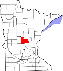 | |
| Townships | ||
| Unincorporated communities | ||
| Indian reservation | ||
| Footnotes | ‡This populated place also has portions in an adjacent county or counties | |
This article is issued from
Wikipedia.
The text is licensed under Creative Commons - Attribution - Sharealike.
Additional terms may apply for the media files.