Kamalgazi
| Kamalgazi | |
|---|---|
| Neighbourhood in Kolkata (Calcutta) | |
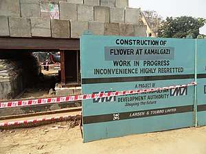 Flyover Under Construction for Extension of E.M. Bypass at Kamalgazi More | |
 Kamalgazi Location in West Bengal, India  Kamalgazi Kamalgazi (India) | |
| Coordinates: 22°26′58″N 88°23′44″E / 22.4495°N 88.3955°ECoordinates: 22°26′58″N 88°23′44″E / 22.4495°N 88.3955°E | |
| Country |
|
| State | West Bengal |
| Division | Presidency |
| District | South 24 Parganas |
| City | Kolkata |
| Established | 1876 |
| Government | |
| • Type | Chairman–Council |
| • Body | Rajpur Sonarpur Municipality |
| Elevation | 9 m (30 ft) |
| Languages | |
| • Official | Bengali, Hindi, English |
| Time zone | UTC+5:30 (IST) |
| PIN | 700103 |
| Telephone code | +91 33 2427/2434/2477/2495 |
| Vehicle registration | WB-01 to WB-10, WB-19, WB-20, WB-22, WB-22U, WB-95, WB-96 |
| Lok Sabha constituency | Jadavpur |
| Vidhan Sabha constituency | Sonarpur Uttar |
| Website |
www |
Kamalgazi is a locality in Rajpur Sonarpur Municipality of South 24 Parganas district in the Indian State of West Bengal. It is a neighbourhood in South Kolkata. It is a part of the area covered by Kolkata Metropolitan Development Authority (KMDA).
Geography
Kamalgazi is located at 22°26′58″N 88°23′44″E / 22.4495°N 88.3955°E. It has an average elevation of 9 metres (30 ft).
Healthcare
Certain areas of the South 24 Parganas district have been identified as having poor ground water and contamination. Specifically, ground water is affected by arsenic contamination.[1]
References
- ↑ "Groundwater Arsenic contamination in West Bengal-India (19 years study )". Groundwater arsenic contamination status of North 24-Parganas district, one of the nine arsenic affected districts of West Bengal-India. SOES. Retrieved 2007-08-24.
Cities, towns and locations in South 24 Parganas district | |||||||||||
|---|---|---|---|---|---|---|---|---|---|---|---|
| Cities, municipal and census towns |
| ||||||||||
| Locations other than cities and towns | |||||||||||
| Related topics |
| ||||||||||
This article is issued from
Wikipedia.
The text is licensed under Creative Commons - Attribution - Sharealike.
Additional terms may apply for the media files.