Namkhana
| Namkhana নামখানা | |
|---|---|
| Village | |
 Namkhana Location in West Bengal, India  Namkhana Namkhana (India) | |
| Coordinates: 21°46′00″N 88°14′00″E / 21.76667°N 88.23333°ECoordinates: 21°46′00″N 88°14′00″E / 21.76667°N 88.23333°E | |
| Country |
|
| State | West Bengal |
| District | South 24 Parganas |
| Population (2011) | |
| • Total | 7,058 |
| Languages | |
| • Official | Bengali, English |
| Time zone | UTC+5:30 (IST) |
| PIN | 743357 |
| ISO 3166 code | IN-WB |
| Lok Sabha constituency | Mathurapur |
| Vidhan Sabha constituency | Kakdwip, Sagar |
| Website |
wb |
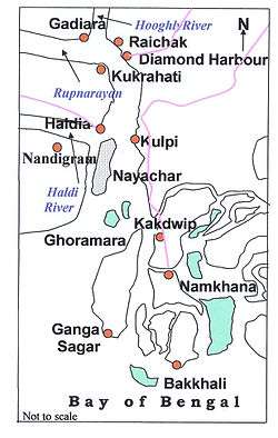
Namkhana is a village in Namkhana CD Block in South 24 Parganas district in the Indian state of West Bengal.
Geography
Namkhana is located at 21°46′00″N 88°14′00″E / 21.766667°N 88.233333°E. It is located on both sides of Hatania Doania creek,
Demographics
Namkhana village has a population of 7,058 of which 3,609 are males and 3,449 are females as per population census 2011.[1]
Literacy
Namkhana village had a literacy rate of 82.50 in 2011, as compared with 76.26 in the whole of West Bengal. Male literacy was 82.50 and female literacy was 74.95.[1]
Transport

NH 12 passes through Namkhana. It is located at a distance of about 80 km from Kolkata.
There is no bridge across the Hatania Doania creek at Namkhana. Four-wheelers are driven on to a ferry, which carries them across the creek.[2]
Namkhana is linked to Sealdah by the Sealdah-Namkhana Line, via Lakshmikantapur and Kakdwip.[3]
References
- 1 2 "Namkhana population – South 24 Parganas, West Bengal". Census 2011. Retrieved 1 November 2014.
- ↑ "Next weekend you can be at ... Frazerganj". The Telegraph, 20 November 2005. Retrieved 1 November 2014.
- ↑ "Eastern Railway Sealdah". Indian Railways. Retrieved 1 November 2014.
External links

Cities, towns and locations in South 24 Parganas district | |||||||||||
|---|---|---|---|---|---|---|---|---|---|---|---|
| Cities, municipal and census towns |
| ||||||||||
| Locations other than cities and towns | |||||||||||
| Related topics |
| ||||||||||