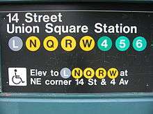
14th Street–Union Square (New York City Subway)
14 Street–Union Square | |||||||||||
|---|---|---|---|---|---|---|---|---|---|---|---|
|
| |||||||||||
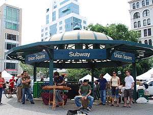 Station entrance within Union Square Park | |||||||||||
| Station statistics | |||||||||||
| Address |
East 14th Street, Park Avenue South & Broadway New York, NY 10003 | ||||||||||
| Borough | Manhattan | ||||||||||
| Locale | Union Square, Gramercy | ||||||||||
| Coordinates | 40°44′05″N 73°59′25″W / 40.73472°N 73.99028°WCoordinates: 40°44′05″N 73°59′25″W / 40.73472°N 73.99028°W | ||||||||||
| Division | A (IRT), B (BMT) | ||||||||||
| Line |
BMT Broadway Line BMT Canarsie Line IRT Lexington Avenue Line | ||||||||||
| Services |
4 5 6 L N Q R W | ||||||||||
| Transit connections |
| ||||||||||
| Structure | Underground | ||||||||||
| Levels | 3 | ||||||||||
| Other information | |||||||||||
| Opened | July 1, 1948[1] | ||||||||||
| Station code | 602[2] | ||||||||||
| Accessible |
| ||||||||||
| Wireless service |
| ||||||||||
| Traffic | |||||||||||
| Passengers (2017) |
34,557,551 (station complex)[4] | ||||||||||
| Rank | 4 out of 425 | ||||||||||
| |||||||||||
| |||||||||||
| |||||||||||
|
| |||||||||||
|
14th Street–Union Square Subway Station (IRT; Dual System BMT) | |||||||||||
| MPS | New York City Subway System MPS | ||||||||||
| NRHP reference # | 05000671[5] | ||||||||||
| Added to NRHP | July 6, 2005 | ||||||||||


14th Street–Union Square is a New York City Subway station complex shared by the BMT Broadway Line, the BMT Canarsie Line and the IRT Lexington Avenue Line. It is located at the intersection of Fourth Avenue and 14th Street, underneath Union Square in Manhattan, and is served by the:
- 4, 6, L, N, and Q trains at all times
- 5 and R trains at all times except late nights
- W train on weekdays
- <6> train weekdays in the peak direction
In 2016, over 34 million passengers entered this station, making it the fourth-busiest station of the New York City Subway.[4]
The complex is located on the border of several neighborhoods with popular business, residential and nightlife destination spots, including the East Village to the southeast, Greenwich Village to the south and southwest, Chelsea to the northwest, and both the Flatiron District and Gramercy Park to the north and northeast.
There are three originally separate stations here, which were combined on July 1, 1948. They now share a mezzanine, common entrance points, and unified signage. This complex was placed on the National Register of Historic Places in 2005.[6]
Station layout
| G | Street Level | Exit/ Entrance |
| B1 | Mezzanine | Fare control, station agent |
| B2 | Side platform, not in service | |
| Northbound local | ← ← (No service: 18th Street) | |
| Island platform, doors will open on the left, right | ||
| Northbound express | ← ← | |
| Southbound express | → → | |
| Island platform, doors will open on the left, right | ||
| Southbound local | → → | |
| Side platform, not in service | ||
| B2 | Northbound local | ← ← ← |
| Island platform, doors will open on the left, right | ||
| Northbound express | ← ← | |
| Southbound express | → → | |
| Island platform, doors will open on the left, right | ||
| Southbound local | → → → → | |
| B3 | Northbound | ← |
| Island platform, doors will open on the left | ||
| Southbound | → | |
Exits
- Two stairs inside Union Square Park on east side of Union Square West at 16th Street[7]
- One stair at southeast corner of Union Square East and 15th Street[7]
- One stair inside Union Square Park on north side of 14th Street between Union Square West and Union Square East[7]
- One stair inside Union Square Park on north side of 14th Street between Union Square West and Union Square East[7]
- One stair on south side of 14th Street between Union Square West and Union Square East[7]
- Two stairs at southwest corner of 4th Avenue and 14th Street[7]
- Two stairs at southeast corner of 4th Avenue and 14th Street[7]

IRT Lexington Avenue Line platforms
14 Street–Union Square | |||||||||||||
|---|---|---|---|---|---|---|---|---|---|---|---|---|---|
|
| |||||||||||||
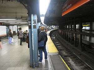 Downtown platform for the local services (left) and express services (right), showing the curvature of the station and the movable platforms | |||||||||||||
| Station statistics | |||||||||||||
| Division | A (IRT) | ||||||||||||
| Line | IRT Lexington Avenue Line | ||||||||||||
| Services |
4 5 6 | ||||||||||||
| Platforms |
2 island platforms (in service) cross-platform interchange 2 side platforms (abandoned) | ||||||||||||
| Tracks | 4 | ||||||||||||
| Other information | |||||||||||||
| Opened | October 27, 1904[8] | ||||||||||||
| Station code | 406[2] | ||||||||||||
| Accessible |
| ||||||||||||
| Accessibility | Cross-platform wheelchair transfer available | ||||||||||||
| Wireless service |
| ||||||||||||
| Station succession | |||||||||||||
| Next north |
Grand Central–42nd Street (express): 4 23rd Street (local): 4 18th Street (local; closed): no service | ||||||||||||
| Next south |
Astor Place (local): 4 Brooklyn Bridge–City Hall (express): 4 | ||||||||||||
| |||||||||||||
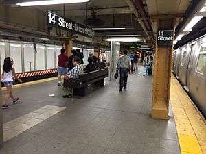
14th Street–Union Square, opened on October 27, 1904, is an express station on the IRT Lexington Avenue Line that has four tracks and two island platforms. The uptown and downtown platforms are offset from each other and slightly curved. Gap-filling movable platforms on the downtown side are automatically operated via proximity sensors when trains arrive. The station's mezzanines are located over the platforms.
The station has two abandoned local side platforms; the northbound one is visible through windows, bordered with wide, bright red frames. From the north end of the downtown platform's mezzanine, the adjacent side platform can be seen through a hole in the plywood.
1991 accident
On August 28, 1991, an accident just north of the station killed five riders and injured 215 others in one of the worst wrecks since a crash at Times Square–42nd Street on the IRT Broadway–Seventh Avenue Line in 1928 that killed 16 people. The train operator, Robert Ray, was intoxicated and had been overshooting platforms during the entire run from Woodlawn in the Bronx. Just north of this station, his Utica Avenue-bound 4 train was to be shifted to the local track due to repair work on the express one. He was running at 40 mph (65 km/h) at a 10 mph (16 km/h) zone and took the switch so fast that only the first car made it through the crossover. The rest of the train was involved in a derailment that led to a massive pile-up. Cars 1435, 1436, 1437, 1439, and 1440 were essentially scrapped on the site, and the IRT Lexington Line suffered heavy structural damage as a result. Service was disrupted for six days (with trains terminating at 59th Street for the duration) as transit workers cleaned up the wreckage. The entire infrastructure, including signals, switches, track, roadbed, cabling, and 23 support columns needed to be replaced. Ray was convicted of manslaughter and sentenced to 15 years in prison, but released in April 2002 for good behavior.[9][10]
The wreck occurred at the entry to a former pocket track. Like 72nd Street on the IRT Broadway–Seventh Avenue Line, this station was built with extra tracks on the approach to the station. These were between the local and express tracks and approximately 300 feet (91 m) long. The idea was to have a "stacking" track where a train could be held momentarily until the platform cleared for it to enter the station. The tracks here and at 72nd Street were rendered useless when train lengths grew beyond these tracks' capacity. When the damage from the 1991 wreck was repaired, the stacking track was removed.
Image gallery
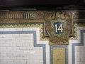 Old IRT "14" eagle cartouche
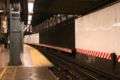 Abandoned side platform behind the wall and the black bars on the right, whose edge is still visible
 Depiction of the platform in a mosaic at the entrance to Spring Street (8th Avenue) station
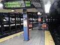 Platforms are not aligned; southbound one (background) is farther north
BMT Broadway Line platforms
14 Street–Union Square | |||||||||||||||
|---|---|---|---|---|---|---|---|---|---|---|---|---|---|---|---|
|
| |||||||||||||||
 | |||||||||||||||
| Station statistics | |||||||||||||||
| Division | B (BMT) | ||||||||||||||
| Line | BMT Broadway Line | ||||||||||||||
| Services |
N Q R W | ||||||||||||||
| Platforms |
2 island platforms cross-platform interchange | ||||||||||||||
| Tracks | 4 | ||||||||||||||
| Other information | |||||||||||||||
| Opened | September 4, 1917[11][12] | ||||||||||||||
| Station code | 015[2] | ||||||||||||||
| Accessible |
| ||||||||||||||
| Wireless service |
| ||||||||||||||
| Station succession | |||||||||||||||
| Next north |
34th Street–Herald Square (express): N 23rd Street (local): N | ||||||||||||||
| Next south |
Eighth Street–New York University (local): N Canal Street (express): N | ||||||||||||||
|
| |||||||||||||||
| Next |
34th Street–Herald Square: N | ||||||||||||||
| Next |
Cortlandt Street (via tunnel): N DeKalb Avenue (via bridge): Q Atlantic Avenue–Barclays Center (via bridge bypass): N | ||||||||||||||
| |||||||||||||||
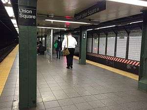
14th Street–Union Square, opened on September 5, 1917, is an express station on the BMT Broadway Line that has four tracks and two island platforms.
It is the southernmost station in Manhattan with a cross-platform interchange between all four Broadway services. A mosaic on the platform side walls is a depiction of "the junction of Broadway and … Bowery Road, 1828," as the area was once known. The mezzanine and crossover level has been reconstructed as well. Some former passageways and stairways have been closed off, including one immediately adjacent to the southernmost staircase on the northbound side.
This station was overhauled in the late 1970s. The MTA replaced the original wall tiles, old signs, and incandescent lighting with the 1970s wall tile band and tablet mosaics, signs and fluorescent lights. They also fixed staircases and platform edges. In 2002, the station was upgraded for ADA-accessibility and its original late 1910s tiling was restored. As part of the upgrade, the MTA repaired the staircases, re-tiled for the walls and floors, upgraded the station's lights and the public address system, installed yellow safety treads along the platform edge, new signs, and new trackbeds in both directions. The station now has an elevator on both platforms as well as connection to the station entrances and passageway to the IRT Lexington Avenue Line.
In 2005, an artwork called City Glow by Chiho Aoshima was installed here.
Image gallery
 Mosaic
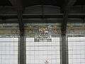 Depiction of the junction of Broadway and Bowery Road in 1828
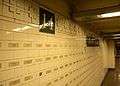 New tile name tablets on the mezzanine with names of 9/11 victims
 Elevator to southbound platform from mezzanine
BMT Canarsie Line platform
Union Square | |||||||
|---|---|---|---|---|---|---|---|
|
| |||||||
 | |||||||
| Station statistics | |||||||
| Division | B (BMT) | ||||||
| Line | BMT Canarsie Line | ||||||
| Services |
L | ||||||
| Platforms | 1 island platform | ||||||
| Tracks | 2 | ||||||
| Other information | |||||||
| Opened | June 30, 1924 | ||||||
| Station code | 117[2] | ||||||
| Accessible |
| ||||||
| Wireless service |
| ||||||
| Former/other names | 14 Street–Union Square | ||||||
| Station succession | |||||||
| Next west |
Sixth Avenue: L | ||||||
| Next east |
Third Avenue: L | ||||||
|
| |||||||
| Next |
Eighth Avenue: L | ||||||
| Next |
Myrtle–Wyckoff Avenues: L | ||||||
| |||||||
Union Square on the BMT Canarsie Line opened on June 30, 1924, as part of the 14th Street–Eastern Line, which ran from Sixth Avenue under the East River and through Williamsburg to Montrose Avenue and Bushwick Avenues.[13][14] The station has two tracks and one island platform with numerous stairways and exits leading from it. There is one mezzanine attached to this station with entrances on the south side of 14th Street between Broadway and University Place. Other entrances in the complex serve the other services that stop here. The original mosaic band of sky blue, sea green, lime green and yellow ochre stands clearly visible above new green-bordered tile panels. The station has been renovated and is now ADA-accessible with a single elevator going up from the platform to the mezzanine.
To improve circulation and to reduce crowding at the station, as part of the 2015–2019 MTA Capital Program, a new escalator will be installed from the east mezzanine to the platform for $15 million. The stairs from the Broadway Line platforms will be rebuilt. This work will take place when this portion of the BMT Canarsie Line will be shut down for the Canarsie Tubes repairs.[15][16]
References
- ↑ The New York Times, Transfer Points Under Higher Fare, June 30, 1948, page 19
- 1 2 3 4 "Station Developers' Information". Metropolitan Transportation Authority. Retrieved June 13, 2017.
- 1 2 3 4 "NYC Subway Wireless – Active Stations". Transit Wireless Wifi. Retrieved May 18, 2016.
- 1 2 "Facts and Figures: Annual Subway Ridership 2012–2017". Metropolitan Transportation Authority. July 12, 2018. Retrieved July 12, 2018.
- ↑ "NPS Focus". National Register of Historic Places. National Park Service. Retrieved January 25, 2012.
- ↑ New York County Listings at the National Register of Historic Places (Structure #05000671)
- 1 2 3 4 5 6 7 8 "MTA Neighborhood Maps: Union Square / Gramercy" (PDF). Metropolitan Transportation Authority. 2015. Retrieved August 6, 2015.
- ↑ The New York Times, Our Subway Open: 150,000 Try It, October 28, 1904
- ↑ http://www.nysubway.com/safety/subwaysafety.html
- ↑ 44:10-50:10 in this video do a small documentary on the accident: https://www.youtube.com/watch?v=2KKVupF7Uug
- ↑ The New York Times, Open First Section of Broadway Line, September 5, 1917
- ↑ The New York Times, Open New Subway to Times Square, January 6, 1918
- ↑ "Subway Tunnel Through". The New York Times. August 8, 1919. Retrieved February 28, 2010.
- ↑ "Celebrate Opening of Subway Link". The New York Times. July 1, 1924. Retrieved February 13, 2010.
- ↑ "Circulation Improvements at Union Square on the Canarsie Line". web.mta.info. Metropolitan Transportation Authority. December 31, 2017. Retrieved February 18, 2018.
- ↑ "MTA Capital Program 2015-2019 Renew. Enhance. Expand.Amendment No. 2 As Proposed to the MTA Board May 2017" (PDF). mta.info. May 24, 2017. Retrieved May 24, 2017.
Further reading
- Lee Stokey. Subway Ceramics : A History and Iconography. 1994. ISBN 978-0-9635486-1-0
External links

nycsubway.org:
- nycsubway.org – IRT East Side Line: 14th Street/Union Square
- nycsubway.org – BMT Broadway Subway: 14th Street/Union Square
- nycsubway.org – BMT Canarsie Line: Union Square
- nycsubway.org – Framing Union Square Artwork by Mary Miss (1998)
- nycsubway.org – Paradise Artwork by Chiho Aoshima (2005)
- nycsubway.org – City Glow Artwork by Chiho Aoshima (2005)
Google Maps Street View:
- 14th Street and Broadway entrance to Canarsie Line from Google Maps Street View
- 14th Street and Fourth Avenue entrance from Google Maps Street View
- Entrance by Union Square East from Google Maps Street View
- Union Square East and 15th Street entrance from Google Maps Street View
- Entrance in Union Square Park from Google Maps Street View
- Union Square West and 16th Street entrance from Google Maps Street View
- Broadway Line platforms from Google Maps Street View
- Canarsie Line platform from Google Maps Street View
- IRT uptown platform from Google Maps Street View
- Mezzanine from Google Maps Street View
Other websites:
- Station Reporter – 14th Street–Union Square Complex
- Forgotten NY – Original 28 - NYC's First 28 Subway Stations
- MTA's Arts For Transit – 14th Street–Union Square
- Abandoned Stations – Abandoned Stations - 14th Street side platforms
| Lexington Ave. Line |
|
|---|---|
| Broadway Line |
|
| Canarsie Line |
|
| |
| Topics |   | |
|---|---|---|
| Lists by county |
| |
| Lists by city | ||
| Other lists | ||
| ||