| [3] |
Name on the Register |
Image |
Date listed[4] |
Location |
City or town |
Description |
|---|
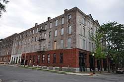
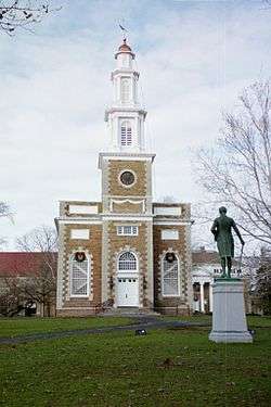
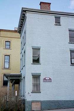
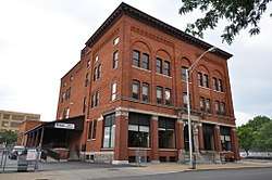
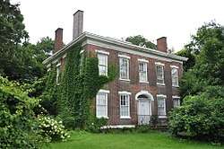
| 1 |
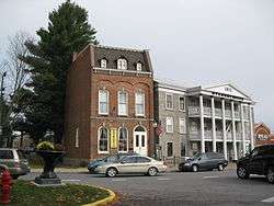
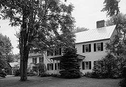
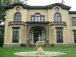
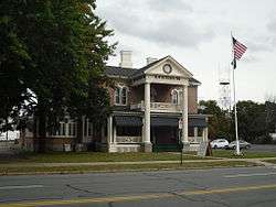
Arsenal House |
|
July 18, 1974
(#74001284) |
514 W. Dominick St.
43°12′56″N 75°28′04″W / 43.215556°N 75.467778°W / 43.215556; -75.467778 (Arsenal House) |
Rome |
|
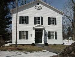
| 2 |
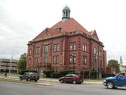
Ava Town Hall |
|
May 18, 1992
(#92000453) |
NY 26 south of the junction with Ava Rd.
43°25′00″N 75°28′50″W / 43.416667°N 75.480556°W / 43.416667; -75.480556 (Ava Town Hall) |
Ava |
|
| 3 |
Bagg's Square East Historic District |
|
July 24, 2017
(#100001362) |
Broad, Catherine, 1st, John, Main, Oriskany, Railroad & 2nd Sts.
43°06′11″N 75°13′24″W / 43.10305°N 75.22325°W / 43.10305; -75.22325 (Bagg's Square East Historic District) |
Utica |
Downtown area with buildings that served canal and railroad traffic from late 19th to mid-20th century |
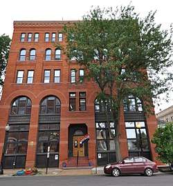
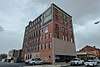
| 4 |
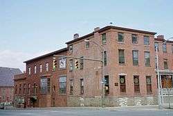
Black River Canal Warehouse |
|
March 7, 2003
(#03000093) |
502 Water St.
43°28′52″N 75°19′40″W / 43.481111°N 75.327778°W / 43.481111; -75.327778 (Black River Canal Warehouse) |
Boonville |
|
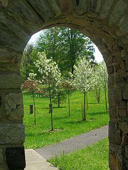
| 5 |
Boonville Historic District |
|
November 16, 1979
(#79001608) |
Schuyler, Post, W. Main and Summit Sts.
43°29′04″N 75°20′13″W / 43.484444°N 75.336944°W / 43.484444; -75.336944 (Boonville Historic District) |
Boonville |
|
| 6 |
Brick Store Building |
|
April 26, 1996
(#96000486) |
Jct. of US 20 and NY 8
42°52′44″N 75°15′07″W / 42.878889°N 75.251944°W / 42.878889; -75.251944 (Brick Store Building) |
Bridgewater |
|
| 7 |
Bridgewater Railroad Station |
|
April 12, 2006
(#06000264) |
US 20
42°52′45″N 75°14′48″W / 42.879167°N 75.246667°W / 42.879167; -75.246667 (Bridgewater Railroad Station) |
Bridgewater |
|
| 8 |
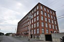
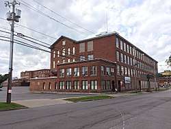
Byington Mill (Frisbie & Stansfield Knitting Company) |
|
May 27, 1993
(#93000458) |
421-423 Broad St.
43°06′09″N 75°13′18″W / 43.10244°N 75.22156°W / 43.10244; -75.22156 (Byington Mill (Frisbie & Stansfield Knitting Company)) |
Utica |
|
| 9 |
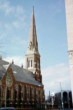
Calvary Episcopal Church |
|
July 3, 2008
(#08000595) |
1101 Howard Ave.
43°05′43″N 75°13′52″W / 43.095217°N 75.231067°W / 43.095217; -75.231067 (Calvary Episcopal Church) |
Utica |
|
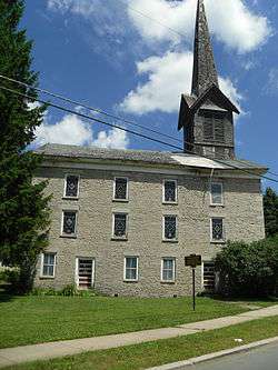
| 10 |
Camroden Presbyterian Church |
|
January 4, 2007
(#06001204) |
8049 E. Floyd Rd.
43°15′11″N 75°21′19″W / 43.2531°N 75.3554°W / 43.2531; -75.3554 (Camroden Presbyterian Church) |
Floyd |
|
| 11 |
Clinton Village Historic District |
|
June 14, 1982
(#82003389) |
North, South, East, West Park Rows, Marvin, Williams, Chestnut, Fountain, College and Utica Sts.
43°02′09″N 75°22′51″W / 43.035833°N 75.380833°W / 43.035833; -75.380833 (Clinton Village Historic District) |
Clinton |
|
| 12 |
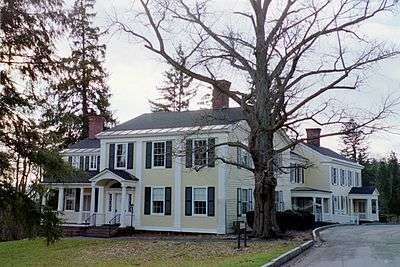
Roscoe Conkling House |
|
May 15, 1975
(#75001214) |
3 Rutger St.
43°05′46″N 75°13′47″W / 43.096111°N 75.229722°W / 43.096111; -75.229722 (Roscoe Conkling House) |
Utica |
|
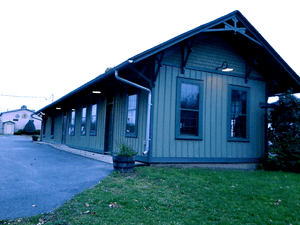
| 13 |
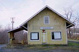
Deansboro Railroad Station |
|
November 15, 2002
(#02001327) |
2707 NY 315
42°59′37″N 75°25′38″W / 42.993611°N 75.427222°W / 42.993611; -75.427222 (Deansboro Railroad Station) |
Deansboro |
|
| 14 |
W.H. Dorrance House |
|
April 29, 1999
(#99000506) |
32 Church St.
43°20′11″N 75°44′39″W / 43.336389°N 75.744167°W / 43.336389; -75.744167 (W.H. Dorrance House) |
Camden |
|
| 15 |
Downtown Genessee Street Historic District |
|
August 24, 2018
(#100002668) |
Generally bounded by Park Ave., Oriskany, John, Park, South, Court & Columbia Sts.
43°06′03″N 75°13′58″W / 43.1007°N 75.2327°W / 43.1007; -75.2327 (Downtown Genessee Street Historic District) |
Utica |
|
| 16 |
Doyle Hardware Building |
|
June 10, 1993
(#93000498) |
330-334 Main St.
43°06′13″N 75°13′24″W / 43.10353°N 75.22334°W / 43.10353; -75.22334 (Doyle Hardware Building) |
Utica |
|
| 17 |
Erwin Library and Pratt House |
|
August 14, 1973
(#73001228) |
104 and 106 Schuyler St.
43°29′02″N 75°20′13″W / 43.483889°N 75.336944°W / 43.483889; -75.336944 (Erwin Library and Pratt House) |
Boonville |
|
| 18 |
First Baptist Church of Deerfield |
|
July 11, 1985
(#85001497) |
Herkimer Rd.
43°06′51″N 75°12′08″W / 43.114167°N 75.202222°W / 43.114167; -75.202222 (First Baptist Church of Deerfield) |
Utica |
|
| 19 |
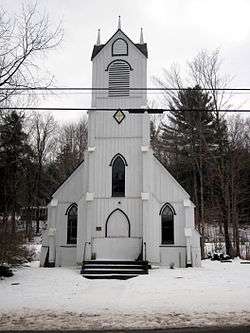
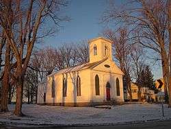
First Congregational Free Church |
|
January 25, 1979
(#79001609) |
177 N. Main St.
42°56′25″N 75°27′38″W / 42.940278°N 75.460556°W / 42.940278; -75.460556 (First Congregational Free Church) |
Oriskany Falls |
|
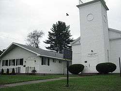
| 20 |
First Methodist Episcopal Church of Rome |
|
January 29, 2010
(#09001286) |
400 N. George St.
43°12′59″N 75°27′31″W / 43.21635°N 75.458506°W / 43.21635; -75.458506 (First Methodist Episcopal Church of Rome) |
Rome |
|
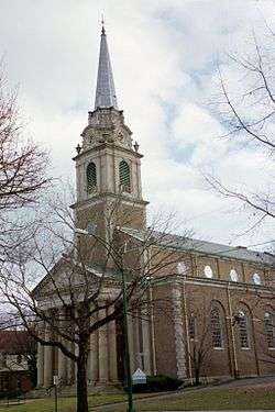
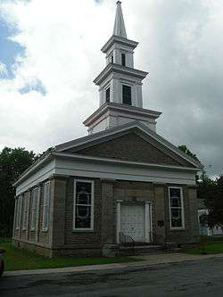
| 21 |
First Presbyterian Church |
|
November 3, 1988
(#88002172) |
1605 Genesee St.
43°05′29″N 75°15′01″W / 43.091389°N 75.250278°W / 43.091389; -75.250278 (First Presbyterian Church) |
Utica |
Church designed by architect Ralph Adams Cram |
| 22 |
Five Lock Combine and Locks 37 and 38, Black River Canal |
|
March 20, 1973
(#73001229) |
NY 46
43°24′11″N 75°21′49″W / 43.403056°N 75.363611°W / 43.403056; -75.363611 (Five Lock Combine and Locks 37 and 38, Black River Canal) |
Boonville |
|
| 23 |
Gen. William Floyd House |
|
June 17, 1971
(#71000549) |
W side of Main St.
43°18′22″N 75°23′02″W / 43.306111°N 75.383889°W / 43.306111; -75.383889 (Gen. William Floyd House) |
Westernville |
|
| 24 |
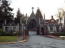
Forest Hill Cemetery |
|
November 9, 2017
(#100001804) |
2201 Oneida St.
43°04′43″N 75°15′26″W / 43.07866°N 75.25725°W / 43.07866; -75.25725 (Forest Hill Cemetery) |
Utica |
Non-sectarian cemetery established in 1850 is final resting place of many locally prominent citizens, including Roscoe Conkling and other members of Congress from the late 19th and early 20th centuries |
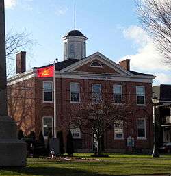
| 25 |
Fort Schuyler Club Building |
|
May 12, 2004
(#04000436) |
254 Genesee St.
43°05′59″N 75°14′07″W / 43.099722°N 75.235278°W / 43.099722; -75.235278 (Fort Schuyler Club Building) |
Utica |
|
| 26 |
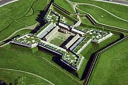
Fort Stanwix National Monument |
|
October 15, 1966
(#66000057) |
Bounded by Dominick, Spring, Liberty, and James Sts.
43°12′42″N 75°27′23″W / 43.211667°N 75.456389°W / 43.211667; -75.456389 (Fort Stanwix National Monument) |
Rome |
|
| 27 |
Fountain Elms |
|
November 3, 1972
(#72001599) |
318 Genesee St.
43°05′49″N 75°14′29″W / 43.096944°N 75.241389°W / 43.096944; -75.241389 (Fountain Elms) |
Utica |
|
| 28 |
Gansevoort-Bellamy Historic District |
|
November 12, 1975
(#75001213) |
Roughly bounded by Liberty, Stuben, and Huntington Sts. to Bissel
43°12′47″N 75°27′21″W / 43.213056°N 75.455833°W / 43.213056; -75.455833 (Gansevoort-Bellamy Historic District) |
Rome |
|
| 29 |
Globe Woolen Company Mills |
|
January 5, 2016
(#15000823) |
805, 809, 811-827 Court & 933 Stark Sts
43°06′09″N 75°14′53″W / 43.102468°N 75.2481587°W / 43.102468; -75.2481587 (Globe Woolen Company Mills) |
Utica |
Intact remnant of the city's heritage as a textile manufacturing center operated from 1873 to 1953 |
| 30 |
Grace Church |
|
May 23, 1997
(#97000419) |
193 Genesee St.
43°06′03″N 75°13′53″W / 43.100833°N 75.231389°W / 43.100833; -75.231389 (Grace Church) |
Utica |
|
| 31 |
Hamilton College Chapel |
|
November 3, 1972
(#72000892) |
Hamilton College campus
43°03′07″N 75°24′22″W / 43.051944°N 75.406111°W / 43.051944; -75.406111 (Hamilton College Chapel) |
Clinton |
|
| 32 |
John C. Hieber Building |
|
July 24, 2007
(#07000756) |
311 Main St.
43°06′15″N 75°13′27″W / 43.10408°N 75.22406°W / 43.10408; -75.22406 (John C. Hieber Building) |
Utica |
Now home to the Utica Children's Museum |
| 33 |
Holland Patent Railroad Station |
|
February 25, 2000
(#00000089) |
Park Ave.
43°14′24″N 75°15′17″W / 43.24°N 75.254722°W / 43.24; -75.254722 (Holland Patent Railroad Station) |
Holland Patent |
|
| 34 |
Holland Patent Stone Churches Historic District |
|
November 21, 1991
(#91001670) |
Roughly bounded by Main St., Park Ave., Park Pl. and Willow Cr.
43°14′28″N 75°15′26″W / 43.241111°N 75.257222°W / 43.241111; -75.257222 (Holland Patent Stone Churches Historic District) |
Holland Patent |
|
| 35 |
Hurd & Fitzgerald Building |
|
June 25, 1993
(#93000500) |
400 Main St.
43°06′12″N 75°13′22″W / 43.10343°N 75.2228°W / 43.10343; -75.2228 (Hurd & Fitzgerald Building) |
Utica |
|
| 36 |
Jervis Public Library |
|
November 4, 1982
(#82001208) |
613 N. Washington St.
43°13′07″N 75°27′16″W / 43.218611°N 75.454444°W / 43.218611; -75.454444 (Jervis Public Library) |
Rome |
|
| 37 |
Lower Genesee Street Historic District |
|
October 29, 1982
(#82001209) |
Roughly bounded by Genesee, Liberty, Seneca, and Whitesboro Sts. (both sides)
43°06′15″N 75°13′42″W / 43.104167°N 75.228333°W / 43.104167; -75.228333 (Lower Genesee Street Historic District) |
Utica |
|
| 38 |
Mappa Hall |
|
May 12, 1982
(#82003388) |
Mappa Ave.
43°16′23″N 75°11′22″W / 43.273056°N 75.189444°W / 43.273056; -75.189444 (Mappa Hall) |
Barneveld |
|
| 39 |
Memorial Church of the Holy Cross |
|
July 20, 2000
(#00000823) |
841 Bleecker St.
43°05′50″N 75°12′49″W / 43.097222°N 75.213611°W / 43.097222; -75.213611 (Memorial Church of the Holy Cross) |
Utica |
|
| 40 |
Middle Mill Historic District |
|
May 28, 1976
(#76001254) |
NY 5A
43°06′18″N 75°17′34″W / 43.105°N 75.292778°W / 43.105; -75.292778 (Middle Mill Historic District) |
New York Mills |
|
| 41 |
Millar-Wheeler House |
|
February 10, 2000
(#00000093) |
1423 Genesee St.
43°05′43″N 75°14′37″W / 43.095278°N 75.243611°W / 43.095278; -75.243611 (Millar-Wheeler House) |
Utica |
|
| 42 |
Mills House |
|
June 13, 1997
(#97000566) |
507 N. George St.
43°13′05″N 75°27′28″W / 43.218056°N 75.457778°W / 43.218056; -75.457778 (Mills House) |
Rome |
|
| 43 |
Munson-Williams-Proctor Arts Institute |
|
September 9, 2010
(#10000727) |
310 Genesee St.
43°05′49″N 75°14′29″W / 43.096944°N 75.241389°W / 43.096944; -75.241389 (Munson-Williams-Proctor Arts Institute) |
Utica |
|
| 44 |
Neck Canal of 1730 |
|
August 15, 1995
(#95001011) |
Cavanaugh Rd. (Co. Rt. 30)
43°07′48″N 75°16′28″W / 43.13°N 75.274444°W / 43.13; -75.274444 (Neck Canal of 1730) |
Marcy |
|
| 45 |
New Century Club |
|
September 12, 1985
(#85002289) |
253 Genesee St.
43°05′58″N 75°14′06″W / 43.099444°N 75.235°W / 43.099444; -75.235 (New Century Club) |
Utica |
|
| 46 |
New York Central Railroad Adirondack Division Historic District |
|
December 23, 1993
(#93001451) |
NYCRR Right-of-Way
43°53′40″N 74°26′26″W / 43.894444°N 74.440556°W / 43.894444; -74.440556 (New York Central Railroad Adirondack Division Historic District) |
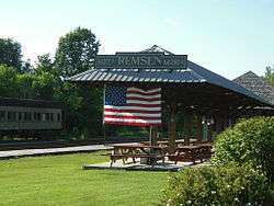
Remsen |
|
| 47 |
New York State Barge Canal |
|
October 15, 2014
(#14000860) |
Linear across county
43°12′06″N 75°26′56″W / 43.201773°N 75.448993°W / 43.201773; -75.448993 (New York State Barge Canal) |
Floyd, Lee, Marcy, Remsen, Rome, Sylvan Beach, Trenton, Utica, Verona, Western |
Successor to Erie Canal approved by state voters in early 20th century to compete with railroads; listing includes two of canal's reservoirs in Adirondacks. |
| 48 |
Rev. Asahel Norton Homestead |
|
July 11, 1985
(#85001546) |
Norton Rd.
43°03′51″N 75°25′07″W / 43.064167°N 75.418611°W / 43.064167; -75.418611 (Rev. Asahel Norton Homestead) |
Kirkland |
|
| 49 |
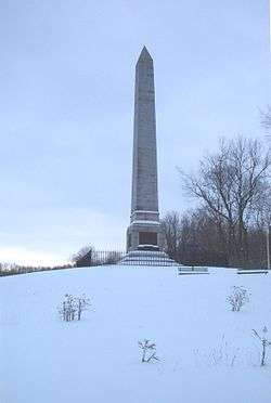
Oriskany Battlefield |
|
October 15, 1966
(#66000558) |
5 miles (8.0 km) east of Rome on NY 69
43°10′07″N 75°22′08″W / 43.168611°N 75.368889°W / 43.168611; -75.368889 (Oriskany Battlefield) |
Rome |
|
| 50 |
Otter Lake Community Church |
|
July 9, 2004
(#04000704) |
NY 28
43°35′30″N 75°06′46″W / 43.591667°N 75.112778°W / 43.591667; -75.112778 (Otter Lake Community Church) |
Otter Lake |
|
| 51 |
Pleasant Valley Grange Hall |
|
February 12, 1999
(#99000058) |
US 20, 2 miles (3.2 km) west of Pleasant Valley
42°55′02″N 75°26′25″W / 42.917222°N 75.440278°W / 42.917222; -75.440278 (Pleasant Valley Grange Hall) |
Sangerfield |
|
| 52 |
Rome Elks Lodge No. 96 |
|
June 5, 2013
(#13000359) |
126 W. Liberty St
43°12′44″N 75°27′33″W / 43.2122395°N 75.4592736°W / 43.2122395; -75.4592736 (Rome Elks Lodge No. 96) |
Rome |
|
| 53 |
Elihu Root House |
|
November 28, 1972
(#72000893) |
101 College Hill Rd.
43°02′59″N 75°24′18″W / 43.049722°N 75.405°W / 43.049722; -75.405 (Elihu Root House) |
Clinton |
|
| 54 |
Rutger-Steuben Park Historic District |
|
September 19, 1973
(#73001230) |
Roughly bounded by Taylor and Howard Aves. including both sides of Rutger Ave. and Steuben Park
43°05′47″N 75°13′39″W / 43.096369°N 75.227494°W / 43.096369; -75.227494 (Rutger-Steuben Park Historic District) |
Utica |
|
| 55 |
St. Joseph's Church |
|
August 22, 1977
(#77000967) |
704-708 Columbia St.
43°06′18″N 75°14′29″W / 43.105°N 75.241389°W / 43.105; -75.241389 (St. Joseph's Church) |
Utica |
|
| 56 |
St. Mark's Church |
|
August 30, 1996
(#96000957) |
19 White St.
43°05′25″N 75°22′47″W / 43.090278°N 75.379722°W / 43.090278; -75.379722 (St. Mark's Church) |
Clark Mills |
|
| 57 |
St. Paul's Church and Cemetery |
|
August 30, 1996
(#96000961) |
Rt. 12, junction with Snowden Hill Rd.
43°00′04″N 75°18′53″W / 43.001111°N 75.314722°W / 43.001111; -75.314722 (St. Paul's Church and Cemetery) |
Paris Hill |
|
| 58 |
St. Stephen's Church |
|
August 30, 1996
(#96000959) |
22-27 Oxford St.
43°04′17″N 75°17′12″W / 43.071389°N 75.286667°W / 43.071389; -75.286667 (St. Stephen's Church) |
New Hartford |
|
| 59 |
Edward W. Stanley Recreation Center |
|
February 17, 2010
(#10000029) |
36 Kirkland Ave.
43°03′11″N 75°22′41″W / 43.053064°N 75.377989°W / 43.053064; -75.377989 (Edward W. Stanley Recreation Center) |
Clinton |
New listing; refnum 10000029 |
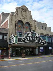
| 60 |
Stanley Theater |
|
August 13, 1976
(#76001255) |
259 Genesee St.
43°05′56″N 75°14′10″W / 43.098889°N 75.236111°W / 43.098889; -75.236111 (Stanley Theater) |
Utica |
|
| 61 |
Tower Homestead and Masonic Temple |
|
October 5, 1977
(#77000968) |
210 Tower St. and Sanger St.
42°55′51″N 75°23′01″W / 42.930833°N 75.383611°W / 42.930833; -75.383611 (Tower Homestead and Masonic Temple) |
Waterville |
|
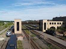
| 62 |
Union Station |
|
April 28, 1975
(#75001215) |
Main St. between John and 1st Sts.
43°06′15″N 75°13′26″W / 43.104167°N 75.223889°W / 43.104167; -75.223889 (Union Station) |
Utica |
|
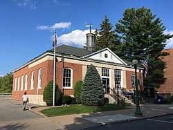
| 63 |
US Post Office-Boonville |
|
November 17, 1988
(#88002457) |
101 Main St.
43°29′03″N 75°20′09″W / 43.484167°N 75.335833°W / 43.484167; -75.335833 (US Post Office-Boonville) |
Boonville |
|
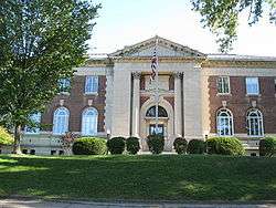
| 64 |
U.S. Post Office, Court House and Custom House |
|
September 17, 2015
(#15000609) |
10 Broad St.
43°06′14″N 75°13′42″W / 43.1038623°N 75.2282523°W / 43.1038623; -75.2282523 (U.S. Post Office, Court House and Custom House) |
Utica |
1929 building renamed after former area congressman is excellent example of Starved Classicism. |
| 65 |
Utica Armory |
|
March 2, 1995
(#95000083) |
1700 Parkway Blvd. E.
43°04′47″N 75°12′33″W / 43.079722°N 75.209167°W / 43.079722; -75.209167 (Utica Armory) |
Utica |
|
| 66 |
Utica Daily Press Building |
|
June 10, 1993
(#93000501) |
310-312 Main St.
43°06′14″N 75°13′28″W / 43.10381°N 75.22445°W / 43.10381; -75.22445 (Utica Daily Press Building) |
Utica |
|
| 67 |
Utica Parks and Parkway Historic District |
|
July 3, 2008
(#08000594) |
Parkway and Pleasant St.
43°04′47″N 75°13′56″W / 43.079767°N 75.232242°W / 43.079767; -75.232242 (Utica Parks and Parkway Historic District) |
Utica |
(new listing, refnum 08000594) |
| 68 |
Utica Public Library |
|
October 29, 1982
(#82001210) |
303 Genesee St.
43°05′49″N 75°14′21″W / 43.096944°N 75.239167°W / 43.096944; -75.239167 (Utica Public Library) |
Utica |
|
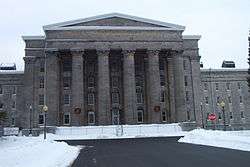
| 69 |
Utica State Hospital |
|
October 26, 1971
(#71000548) |
1213 Court St.
43°06′18″N 75°15′13″W / 43.105°N 75.253611°W / 43.105; -75.253611 (Utica State Hospital) |
Utica |
|
| 70 |
Vernon Center Green Historic District |
|
September 19, 1985
(#85002431) |
Roughly bounded by Park St.
43°03′08″N 75°30′07″W / 43.052222°N 75.501944°W / 43.052222; -75.501944 (Vernon Center Green Historic District) |
Vernon |
|
| 71 |
Vernon Methodist Church |
|
May 20, 1998
(#98000547) |
Jct. of NY 5 and Sconondoa St.
43°04′43″N 75°32′29″W / 43.078611°N 75.541389°W / 43.078611; -75.541389 (Vernon Methodist Church) |
Vernon |
|
| 72 |
Baron von Steuben Memorial Site |
|
August 21, 2009
(#09000635) |
Starr Hill Road
43°20′18″N 75°13′57″W / 43.338461°N 75.232431°W / 43.338461; -75.232431 (Baron von Steuben Memorial Site) |
Remsen |
New listing; refnum 09000635 |
| 73 |
Sylvan Beach Union Chapel |
|
July 24, 2009
(#09000560) |
805 Park Ave.
43°11′57″N 75°43′47″W / 43.199167°N 75.729722°W / 43.199167; -75.729722 (Sylvan Beach Union Chapel) |
Sylvan Beach |
|
| 74 |
Tabernacle Baptist Church |
|
January 4, 2012
(#11001003) |
8 Hopper St.
43°05′55″N 75°14′04″W / 43.098522°N 75.234486°W / 43.098522; -75.234486 (Tabernacle Baptist Church) |
Utica |
|
| 75 |
Waterville Triangle Historic District |
|
April 4, 1978
(#78001888) |
Stafford Ave., Main and White Sts.
42°55′50″N 75°22′43″W / 42.930556°N 75.378611°W / 42.930556; -75.378611 (Waterville Triangle Historic District) |
Waterville |
|
| 76 |
Gen. John G. Weaver House |
|
December 7, 1989
(#89002093) |
711 Herkimer Rd.
43°06′47″N 75°11′50″W / 43.113056°N 75.197222°W / 43.113056; -75.197222 (Gen. John G. Weaver House) |
Utica |
|
| 77 |
Welsh Calvinistic Methodist Church |
|
January 13, 1988
(#87002275) |
Prospect St.
43°19′34″N 75°11′02″W / 43.326111°N 75.183889°W / 43.326111; -75.183889 (Welsh Calvinistic Methodist Church) |
Remsen |
|
| 78 |
Western Town Hall |
|
November 7, 1995
(#95001277) |
Main St. at the junction with Stokes-Westernville Rd.
43°18′29″N 75°22′52″W / 43.308056°N 75.381111°W / 43.308056; -75.381111 (Western Town Hall) |
Westernville |
|
| 79 |
Wethersfield Stone Schoolhouse |
|
September 7, 2005
(#05000991) |
NY 365
43°15′30″N 75°13′15″W / 43.258333°N 75.220833°W / 43.258333; -75.220833 (Wethersfield Stone Schoolhouse) |
Trenton |
|
| 80 |
Whiffen–Ribyat Building |
|
February 23, 2016
(#16000037) |
327-331 Bleecker St.
43°06′03″N 75°13′33″W / 43.100752°N 75.225718°W / 43.100752; -75.225718 (Whiffen–Ribyat Building) |
Utica |
1893 building for local meatpacking company later used by furniture retailer |
| 81 |
Whitestown Town Hall |
|
November 26, 1973
(#73001231) |
8 Park Ave.
43°07′16″N 75°17′30″W / 43.121111°N 75.291667°W / 43.121111; -75.291667 (Whitestown Town Hall) |
Whitesboro |
|
| 82 |
Wright Settlement Cemetery |
|
May 8, 2012
(#12000256) |
Cemetery Rd.
43°14′55″N 75°24′30″W / 43.24860°N 75.40840°W / 43.24860; -75.40840 (Wright Settlement Cemetery) |
Rome |
|
| 83 |
Zion Church |
|
August 21, 1997
(#97000950) |
140 W. Liberty St.
43°12′46″N 75°27′29″W / 43.212778°N 75.458056°W / 43.212778; -75.458056 (Zion Church) |
Rome |
|