| [3] |
Name on the Register |
Image |
Date listed[4] |
Location |
City or town |
Description |
|---|
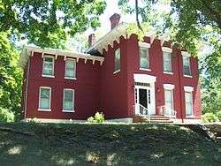
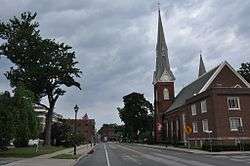
| 1 |
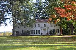
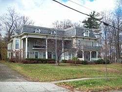
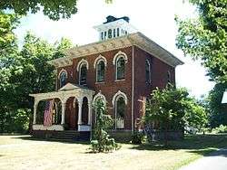
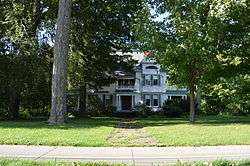
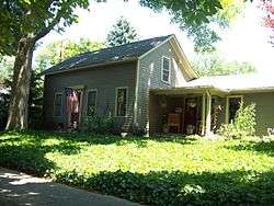
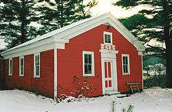
Atwater-Stone House |
|
December 16, 1983
(#83003887) |
29 Water St.
42°19′08″N 79°34′46″W / 42.318889°N 79.579444°W / 42.318889; -79.579444 (Atwater-Stone House) |
Westfield |
|
| 2 |
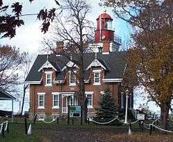
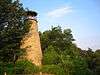
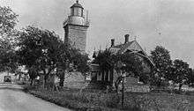
Barcelona Lighthouse and Keeper's Cottage |
|
April 13, 1972
(#72000825) |
East Lake Rd.
42°20′28″N 79°35′43″W / 42.341111°N 79.595278°W / 42.341111; -79.595278 (Barcelona Lighthouse and Keeper's Cottage) |
Westfield |
|
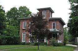
| 3 |
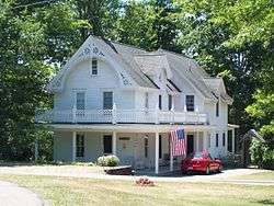
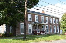
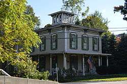
L. Bliss House |
|
September 26, 1983
(#83001647) |
90 W. Main St.
42°19′09″N 79°34′54″W / 42.319167°N 79.581667°W / 42.319167; -79.581667 (L. Bliss House) |
Westfield |
|
| 4 |
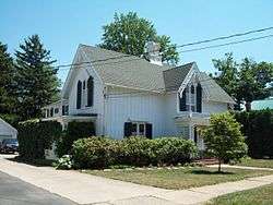
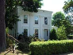
Smith Bly House |
|
October 1, 1974
(#74001223) |
4 N. Maple St.
42°05′34″N 79°22′30″W / 42.092778°N 79.375°W / 42.092778; -79.375 (Smith Bly House) |
Ashville |
|
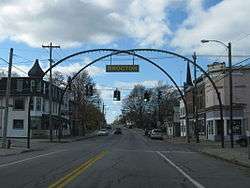
| 5 |
Brocton Arch |
|
February 22, 1996
(#96000133) |
Jct. of Main St. with Lake and Highland Aves.
42°23′19″N 79°26′28″W / 42.388611°N 79.441111°W / 42.388611; -79.441111 (Brocton Arch) |
Brocton |
|
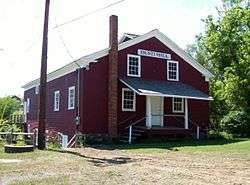
| 6 |
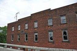
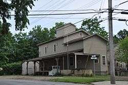
Busti Mill |
|
July 23, 1976
(#76001208) |
Lawson Rd.
42°02′02″N 79°16′52″W / 42.033889°N 79.281111°W / 42.033889; -79.281111 (Busti Mill) |
Busti |
|
| 7 |
Harriet Campbell-Taylor House |
|
September 26, 1983
(#83001648) |
145 S. Portage St.
42°18′52″N 79°34′27″W / 42.314444°N 79.574167°W / 42.314444; -79.574167 (Harriet Campbell-Taylor House) |
Westfield |
|
| 8 |
Chautauqua Institution Historic District |
|
June 19, 1973
(#73001168) |
Bounded by Chautauqua Lake, North and Lowell Aves., and NY 17-J
42°12′33″N 79°28′02″W / 42.209167°N 79.467222°W / 42.209167; -79.467222 (Chautauqua Institution Historic District) |
Chautauqua |
|
| 9 |
Clymer District School No. 5 |
|
August 29, 1994
(#94001004) |
7929 Clymer Center Rd. (Co. Rt. 613)
42°03′17″N 79°34′57″W / 42.054722°N 79.5825°W / 42.054722; -79.5825 (Clymer District School No. 5) |
Clymer |
|
| 10 |
Dunkirk Light |
|
July 19, 1984
(#84002067) |
Dunkirk Harbor
42°29′38″N 79°21′15″W / 42.493889°N 79.354167°W / 42.493889; -79.354167 (Dunkirk Light) |
Dunkirk |
|
| 11 |
Dunkirk Schooner Site |
|
May 1, 2009
(#09000285) |
Lake Erie
42°33′00″N 79°36′00″W / 42.550000°N 79.600000°W / 42.550000; -79.600000 (Dunkirk Schooner Site) |
Dunkirk |
|
| 12 |
East Main Street Historic District |
|
December 16, 1983
(#83003893) |
E. Main St.
42°19′33″N 79°34′09″W / 42.3258°N 79.5692°W / 42.3258; -79.5692 (East Main Street Historic District) |
Westfield |
|
| 13 |
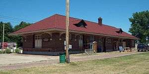
Erie Railroad Station |
|
May 2, 2003
(#03000045) |
211-217 W. Second St.
42°05′40″N 79°14′41″W / 42.094444°N 79.244722°W / 42.094444; -79.244722 (Erie Railroad Station) |
Jamestown |
|
| 14 |
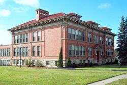
Euclid Avenue School |
|
March 21, 1985
(#85000628) |
28 Euclid Ave.
42°06′30″N 79°14′24″W / 42.108333°N 79.24°W / 42.108333; -79.24 (Euclid Avenue School) |
Jamestown |
|
| 15 |
Fay-Usborne Mill |
|
September 26, 1983
(#83001649) |
48 Pearl St.
42°19′38″N 79°34′38″W / 42.327222°N 79.577222°W / 42.327222; -79.577222 (Fay-Usborne Mill) |
Westfield |
|
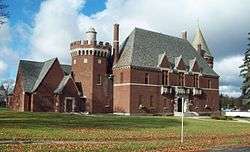
| 16 |
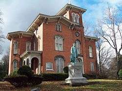
Gov. Reuben Fenton Mansion |
|
October 18, 1972
(#72000824) |
68 S. Main St.
42°05′29″N 79°14′20″W / 42.091389°N 79.238889°W / 42.091389; -79.238889 (Gov. Reuben Fenton Mansion) |
Jamestown |
|
| 17 |
Fredonia Commons Historic District |
|
October 19, 1978
(#78001843) |
Main, Temple, Church, Day, and Center Sts.
42°26′25″N 79°19′55″W / 42.440278°N 79.331944°W / 42.440278; -79.331944 (Fredonia Commons Historic District) |
Fredonia |
|
| 18 |
French Portage Road Historic District |
|
December 16, 1983
(#83003895) |
E. Main and Portage Sts.
42°19′11″N 79°34′33″W / 42.319722°N 79.575833°W / 42.319722; -79.575833 (French Portage Road Historic District) |
Westfield |
|
| 19 |
Frank A. Hall House |
|
September 26, 1983
(#83001650) |
34 Washington St.
42°19′31″N 79°34′41″W / 42.325278°N 79.578056°W / 42.325278; -79.578056 (Frank A. Hall House) |
Westfield |
|
| 20 |
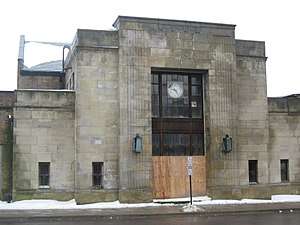
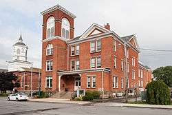
Jamestown Armory |
|
January 12, 1995
(#94001542) |
34 Porter Ave.
42°05′35″N 79°15′18″W / 42.093056°N 79.255°W / 42.093056; -79.255 (Jamestown Armory) |
Jamestown |
|
| 21 |
Jamestown Downtown Historic District |
|
November 19, 2014
(#14000935) |
23-28, 20-408 N. Main, 200-322 Washington, 201-326 Cherry, 207-317 Pine, 215-417 Spring, 8-21, 100-200 E. 4th Sts.
42°05′47″N 79°14′29″W / 42.096365°N 79.241275°W / 42.096365; -79.241275 (Jamestown Downtown Historic District) |
Jamestown |
Historic commercial core of small industrial city |
| 22 |
Lake Shore & Michigan Southern Freight Depot |
|
September 26, 1983
(#83001651) |
English St.
42°19′52″N 79°34′35″W / 42.331111°N 79.576389°W / 42.331111; -79.576389 (Lake Shore & Michigan Southern Freight Depot) |
Westfield |
|
| 23 |
Lake Shore and Michigan Southern Railway Station |
|
December 16, 1983
(#83003897) |
English St.
42°19′41″N 79°34′56″W / 42.3281°N 79.5822°W / 42.3281; -79.5822 (Lake Shore and Michigan Southern Railway Station) |
Westfield |
|
| 24 |
Lakeview Avenue Historic District |
|
March 13, 2017
(#100000753) |
3-907 Lakeview & 55 Newton Aves., 500 E. 6th, 25-47 (odd) & 28 Liberty, 225 & 301 E. 8th, 7 Falconer, 18-19 Strong, Sts.,
42°06′15″N 79°14′12″W / 42.104221°N 79.236577°W / 42.104221; -79.236577 (Lakeview Avenue Historic District) |
Jamestown |
Late 19th-century residential neighborhood home to many of city's wealthier residents at that time |
| 25 |
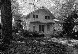
Dr. John Lord House |
|
March 2, 1991
(#91000104) |
Forest Rd. Extension
42°02′34″N 79°16′50″W / 42.042778°N 79.280556°W / 42.042778; -79.280556 (Dr. John Lord House) |
Busti |
|
| 26 |
Gerald Mack House |
|
September 26, 1983
(#83001652) |
79 N. Portage St.
42°19′31″N 79°34′52″W / 42.325278°N 79.581111°W / 42.325278; -79.581111 (Gerald Mack House) |
Westfield |
|
| 27 |
McMahan Homestead |
|
September 26, 1983
(#83001653) |
232 W. Main Rd.
42°18′46″N 79°35′30″W / 42.312778°N 79.591667°W / 42.312778; -79.591667 (McMahan Homestead) |
Westfield |
|
| 28 |
Midway Park |
|
March 9, 2009
(#09000133) |
NY 430
42°12′06″N 79°25′20″W / 42.201667°N 79.422222°W / 42.201667; -79.422222 (Midway Park) |
Maple Springs |
|
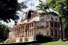
| 29 |
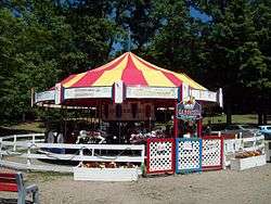
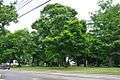
Lewis Miller Cottage, Chautauqua Institution |
|
October 15, 1966
(#66000506) |
NY 17J
42°12′30″N 79°27′56″W / 42.208333°N 79.465556°W / 42.208333; -79.465556 (Lewis Miller Cottage, Chautauqua Institution) |
Chautauqua |
|
| 30 |
Nixon Homestead |
|
September 26, 1983
(#83001654) |
119 W. Main St.
42°19′03″N 79°35′05″W / 42.3175°N 79.584722°W / 42.3175; -79.584722 (Nixon Homestead) |
Westfield |
|
| 31 |
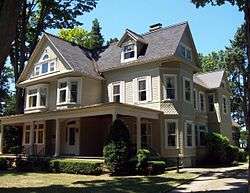
Partridge-Sheldon House |
|
June 2, 2000
(#00000572) |
70 Prospect St.
42°05′21″N 79°14′15″W / 42.089167°N 79.2375°W / 42.089167; -79.2375 (Partridge-Sheldon House) |
Jamestown |
|
| 32 |
Pennsylvania Railroad Station |
|
August 6, 1993
(#93000680) |
Water St.
42°14′43″N 79°29′43″W / 42.245278°N 79.495278°W / 42.245278; -79.495278 (Pennsylvania Railroad Station) |
Mayville |
|
| 33 |
Point Chautauqua Historic District |
|
May 17, 1996
(#96000521) |
Roughly bounded by NY 430 and Chautauqua Lake between Lake and Leet Aves.
42°14′15″N 79°27′37″W / 42.2375°N 79.460278°W / 42.2375; -79.460278 (Point Chautauqua Historic District) |
Mayville |
|
| 34 |
Point Gratiot Lighthouse Complex |
|
December 18, 1979
(#79001568) |
Sycamore Rd.
42°29′37″N 79°21′15″W / 42.493611°N 79.354167°W / 42.493611; -79.354167 (Point Gratiot Lighthouse Complex) |
Dunkirk |
|
| 35 |
Rorig Bridge |
|
September 26, 1983
(#83001655) |
Water St. at Chautauqua Creek
42°18′56″N 79°34′43″W / 42.315556°N 79.578611°W / 42.315556; -79.578611 (Rorig Bridge) |
Westfield |
|
| 36 |
School No. 7 |
|
March 5, 1992
(#92000068) |
Jct. of E. Lake Shore Dr. and N. Serval St.
42°29′46″N 79°19′00″W / 42.496111°N 79.316667°W / 42.496111; -79.316667 (School No. 7) |
Dunkirk |
|
| 37 |
Henry Dwight Thompson House |
|
September 26, 1983
(#83001656) |
29 Wood St.
42°19′00″N 79°34′10″W / 42.316667°N 79.569444°W / 42.316667; -79.569444 (Henry Dwight Thompson House) |
Westfield |
|
| 38 |
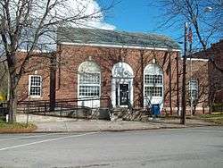
US Post Office-Dunkirk |
|
November 17, 1988
(#88002488) |
410 Central Ave.
42°28′54″N 79°20′01″W / 42.481667°N 79.333611°W / 42.481667; -79.333611 (US Post Office-Dunkirk) |
Dunkirk |
|
| 39 |
US Post Office-Fredonia |
|
November 17, 1988
(#88002515) |
21 Day St.
42°26′28″N 79°19′57″W / 42.441111°N 79.3325°W / 42.441111; -79.3325 (US Post Office-Fredonia) |
Fredonia |
|
| 40 |
Ward House |
|
September 26, 1983
(#83001657) |
118 W. Main St.
42°19′03″N 79°35′03″W / 42.3175°N 79.584167°W / 42.3175; -79.584167 (Ward House) |
Westfield |
|
| 41 |
Welch Factory Building No. 1 |
|
September 26, 1983
(#83001658) |
101 N. Portage St.
42°19′35″N 79°34′55″W / 42.326389°N 79.581944°W / 42.326389; -79.581944 (Welch Factory Building No. 1) |
Westfield |
|
| 42 |
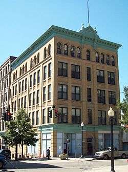
The Wellman Building |
|
August 21, 2009
(#09000629) |
101-103 W. 3rd St. and 215-217 Cherry St.
42°05′46″N 79°14′33″W / 42.096153°N 79.242536°W / 42.096153; -79.242536 (The Wellman Building) |
Jamestown |
|
| 43 |
Reuben Gridley Wright Farm Complex |
|
September 26, 1983
(#83001659) |
233 E. Main St.
42°19′48″N 79°33′59″W / 42.330000°N 79.566389°W / 42.330000; -79.566389 (Reuben Gridley Wright Farm Complex) |
Westfield |
|
| 44 |
Reuben Wright House |
|
September 26, 1983
(#83001660) |
309 E. Main St.
42°19′58″N 79°33′37″W / 42.332778°N 79.560278°W / 42.332778; -79.560278 (Reuben Wright House) |
Westfield |
|
| 45 |
York-Skinner House |
|
September 26, 1983
(#83001661) |
31 Union St.
42°19′21″N 79°34′28″W / 42.3225°N 79.574444°W / 42.3225; -79.574444 (York-Skinner House) |
Westfield |
|
.jpg)