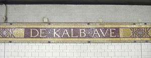
DeKalb Avenue (BMT lines)
DeKalb Avenue | |||||||||||||||||
|---|---|---|---|---|---|---|---|---|---|---|---|---|---|---|---|---|---|
|
| |||||||||||||||||
_by_David_Shankbone.jpg) A Coney Island-bound | |||||||||||||||||
| Station statistics | |||||||||||||||||
| Address |
DeKalb Avenue & Flatbush Avenue Brooklyn, NY 11201 | ||||||||||||||||
| Borough | Brooklyn | ||||||||||||||||
| Locale | Downtown Brooklyn, Fort Greene | ||||||||||||||||
| Coordinates | 40°41′25″N 73°58′56″W / 40.690254°N 73.982277°WCoordinates: 40°41′25″N 73°58′56″W / 40.690254°N 73.982277°W | ||||||||||||||||
| Division | B (BMT) | ||||||||||||||||
| Line |
BMT Brighton Line BMT Fourth Avenue Line | ||||||||||||||||
| Services |
B D N Q R W | ||||||||||||||||
| Transit connections |
| ||||||||||||||||
| Structure | Underground | ||||||||||||||||
| Platforms |
2 island platforms cross-platform interchange | ||||||||||||||||
| Tracks | 6 | ||||||||||||||||
| Other information | |||||||||||||||||
| Opened |
June 22, 1915[1] (Fourth Avenue) August 1, 1920 (Brighton)[2] | ||||||||||||||||
| Station code | 026[3] | ||||||||||||||||
| Accessible |
| ||||||||||||||||
| Wireless service |
| ||||||||||||||||
| Traffic | |||||||||||||||||
| Passengers (2017) |
6,551,184[5] | ||||||||||||||||
| Rank | 66 out of 425 | ||||||||||||||||
| Station succession | |||||||||||||||||
| Next north |
Canal Street (Broadway via Bridge): Q Jay Street–MetroTech (Broadway via Tunnel): N Grand Street (Sixth Avenue via Bridge): B Myrtle Avenue (via Bridge, closed): no regular service | ||||||||||||||||
| Next south |
Atlantic Avenue–Barclays Center (Brighton): B Atlantic Avenue–Barclays Center (Fourth Avenue): D | ||||||||||||||||
|
| |||||||||||||||||
| Next |
14th Street–Union Square (Broadway via Bridge): Q Jay Street–MetroTech (Broadway via Tunnel): N Broadway–Lafayette Street (Sixth Avenue via Bridge): B | ||||||||||||||||
| Next |
Atlantic Avenue–Barclays Center (Brighton): B Atlantic Avenue–Barclays Center (Fourth Avenue): D | ||||||||||||||||
| |||||||||||||||||
| |||||||||||||||||
| |||||||||||||||||


DeKalb Avenue is a local station shared by the BMT Fourth Avenue Line and the BMT Brighton Line of the New York City Subway, located at the intersection of DeKalb and Flatbush Avenues in Brooklyn. It is served by the Q and R train at all times, the B train on weekdays, and the D and N trains during late nights. During rush hours only, a few W train trips in the peak direction also serve this station.
Station layout
| G | Street level | Exit/entrance |
| M | Mezzanine | To exits, fare control, station agent, MetroCard machines |
| P Platform level |
Northbound local via Bridge |
← ← ← (No service: Myrtle Avenue) |
| Island platform, doors will open on the left, right | ||
| Northbound local via Tunnel |
← ← | |
| Northbound express via Bridge |
← | |
| Southbound express from Bridge |
| |
| Southbound local from Tunnel |
| |
| Island platform, doors will open on the left, right | ||
| Southbound local from Bridge |
| |
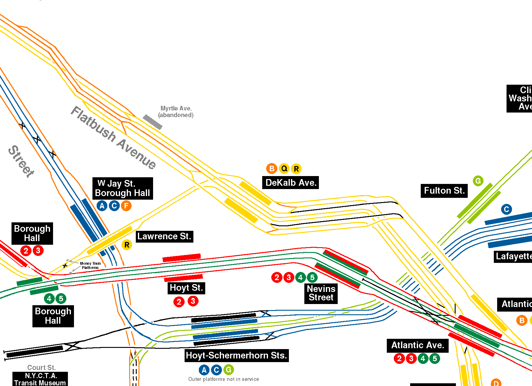
This underground station has six tracks with island platforms between the two outer pairs of tracks, while the two center tracks bypass the station. The platform columns are painted red on their lower halves and cream on their upper halves.
Exits
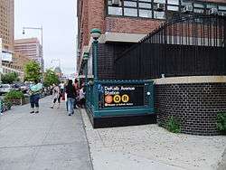
This station has two entrances/exits, each with access to either the east or west side of Flatbush. The staffed exit is near the south end and has two staircases and one elevator from each platform that go up to a waiting area above the platforms and tracks that contains two restrooms open from 5:00 a.m. to midnight. Outside of the turnstile bank is a token booth, a single street stair to the southwest corner of DeKalb Avenue and the Flatbush Avenue Extension built inside a store front, and two staircases that meet at their landings and an elevator that go up to the southeast corner outside an Applebee's restaurant.[8] The centers of the platforms have a crossover that connects them both. Both the crossover and the staffed exit were part of a wide mezzanine area, but most of the mezzanine was closed off and converted to crew rooms.
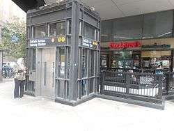
The other entrance/exit is at the station's extreme north end and is unstaffed. An up-only escalator and long staircase from each platform goes up to a mezzanine above the tracks. Two pairs of exit-only turnstiles and one set of three HEET turnstiles provide entrance/exit from the system. This entrance has two street stairs, one to Fleet Street on the east side outside Long Island University Brooklyn and the other to the former Albee Square on the west side, near the City Point development.[8]
Both fare control areas feature a 2005 artwork called DeKalb Improvisation by Stephen Johnson. It consists of a large mural in the main fare control area and several smaller ones in the secondary one.
Track layout
Track layout | ||||||||||||||||||||||||||||||||||||||||||||||||||||||||||||||||||||||||||||||||||||||||||||||||||||||||||||||||||||||||||||||||||||||||||||||||||||||||||||||||||||||||||||||||||||||||||||||||||||||||||||||||||||||||||||||||||||||||||||||||||||||||||||||||||||||||||||||||||||||||||||||||||||||||||||||||||||||||||
|---|---|---|---|---|---|---|---|---|---|---|---|---|---|---|---|---|---|---|---|---|---|---|---|---|---|---|---|---|---|---|---|---|---|---|---|---|---|---|---|---|---|---|---|---|---|---|---|---|---|---|---|---|---|---|---|---|---|---|---|---|---|---|---|---|---|---|---|---|---|---|---|---|---|---|---|---|---|---|---|---|---|---|---|---|---|---|---|---|---|---|---|---|---|---|---|---|---|---|---|---|---|---|---|---|---|---|---|---|---|---|---|---|---|---|---|---|---|---|---|---|---|---|---|---|---|---|---|---|---|---|---|---|---|---|---|---|---|---|---|---|---|---|---|---|---|---|---|---|---|---|---|---|---|---|---|---|---|---|---|---|---|---|---|---|---|---|---|---|---|---|---|---|---|---|---|---|---|---|---|---|---|---|---|---|---|---|---|---|---|---|---|---|---|---|---|---|---|---|---|---|---|---|---|---|---|---|---|---|---|---|---|---|---|---|---|---|---|---|---|---|---|---|---|---|---|---|---|---|---|---|---|---|---|---|---|---|---|---|---|---|---|---|---|---|---|---|---|---|---|---|---|---|---|---|---|---|---|---|---|---|---|---|---|---|---|---|---|---|---|---|---|---|---|---|---|---|---|---|---|---|---|---|---|---|---|---|---|---|---|---|---|---|---|---|---|---|---|---|---|---|---|---|---|---|---|---|---|---|---|---|---|---|---|---|
| ||||||||||||||||||||||||||||||||||||||||||||||||||||||||||||||||||||||||||||||||||||||||||||||||||||||||||||||||||||||||||||||||||||||||||||||||||||||||||||||||||||||||||||||||||||||||||||||||||||||||||||||||||||||||||||||||||||||||||||||||||||||||||||||||||||||||||||||||||||||||||||||||||||||||||||||||||||||||||
North of the station, the outer and bypass tracks head towards the Manhattan Bridge to Manhattan with a flying junction, where express trains can use either the north side of the bridge via the Chrystie Street Connection to the IND Sixth Avenue Line or the south side of the bridge to the BMT Broadway Line. Local trains continue on the middle tracks north along the BMT Fourth Avenue Line into the Montague Street Tunnel towards the BMT Broadway Line or the BMT Nassau Street Line, the latter of which is unused in revenue service.[9]
South of the station, the bypass tracks become the express tracks on the Fourth Avenue Line. The four remaining tracks become six tracks at a flying junction.[9] Trains headed south on the tunnel local tracks or outer tracks proceed to the BMT Brighton Line or switch from those two tracks and provide the route to the Fourth Avenue Line local tracks. In the current service pattern, the tunnel route is not used for Brighton Line trains.[9]
The station has a shortened mezzanine because room was needed for a proposed Lafayette Avenue line. The subway connection was never built. North of this station, near the Manhattan Bridge, there is a provision for a never-built loop back to southern Brooklyn without crossing the Manhattan Bridge into Manhattan. Bellmouths for the unbuilt loop are visible from passing trains. South of this station, a junction was built at Fulton Street for a never-built branch to run via Lafayette Avenue and Broadway.[9]
Service patterns
| Jay Street–MetroTech (BMT Fourth Avenue Line) |
Canal Street (BMT Broadway Line) |
Grand Street (IND Sixth Avenue Line) |
|---|---|---|
| North-west of the station | ||
| BMT Fourth Avenue Line local N R W |
BMT Broadway Line N Q |
IND Sixth Avenue Line express B D |
| tunnel tracks | Manhattan Bridge south | Manhattan Bridge north |
| In the station | ||
| inner platform tracks (tunnel) N R W |
center tracks (bridge, bypass) D N |
outermost tracks (bridge) B D Q |
| South of the station | ||
| BMT Fourth Avenue Line local D N R W |
BMT Fourth Avenue Line express D N |
BMT Brighton Line B Q |
| Atlantic Avenue–Barclays Center (BMT Fourth Avenue Line) |
Atlantic Avenue–Barclays Center (BMT Brighton Line) | |
History

This station opened on June 22, 1915,[1] and was completed on August 1, 1920.[2] Since it opened, DeKalb Avenue has been called "the heart of the BMT", as it is a major transfer point between BMT services, with lines splitting north and south of the station. Platform extensions were built into a curve south of the station in 1927 to allow for longer trains. They were closed and replaced by straight extensions to the north in 1960. The abandoned portions can be seen from the open platforms and trains.
Track configuration
The station has been reconfigured a number of times. The current configuration dates from a 1956–1961 reconstruction project to straighten the platforms and eliminate a level junction north of the station, which had caused a switching bottleneck; a station at Myrtle Avenue was closed as part of the renovation.[10] Other plans, such as connections to the BMT Fulton Street Line and IRT Eastern Parkway Line, were considered at times.
An early plan called the Ashland Place Connection would have allowed trains on the elevated BMT Fulton Street Line to run into the subway through DeKalb Avenue, making the bottleneck even worse.[11][12] This was not built, in part because the city was more interested in building its own system, the IND.[13] However, a whole new subway was also planned, splitting from this line and heading under the East River to the BMT Broadway Line at City Hall. This plan was considered in various forms between late 1916 and 1926. Because of this, the DeKalb Avenue station was also built with provisions for a possible track connection to Nevins Street station.
Until the mid-1950s, though, the extreme outside tracks in each direction hosted the Fourth Avenue Line local tracks and the next pair hosted the Brighton Line. The middle tracks, which bypassed the station, hosted the Fourth Avenue express tracks. A group of level crossovers at the northern end of the station allowed all tracks access to both sides of the Manhattan Bridge and to the Montague Street Tunnel. The Fourth Avenue local tracks led straight onto the Manhattan Bridge west of the station, while the Brighton line tracks led straight to the Montague Street Tunnel, so the crossovers allowed trains from both lines to switch between the bridge and the tunnel.[10] This led to so many train delays on the Fourth Avenue and Brighton lines that in 1952, the junction was earmarked for "top priority" reconstruction.[14]
On November 30, 1955, the New York City Transit Authoity sent a recommendation to the Board of Estimate for the approval of a $13,152,831 contract to eliminate the bottleneck. The elimination of the bottleneck was the first step in a larger plan to improve transit service between Brooklyn and Manhattan.[15]

During the reconstruction of the junction that started in 1956 and was completed by April 1961, the Brighton Line tracks were connected to the Dekalb Avenue station's outermost tracks. A diamond crossover north of the station had caused frequent bottlenecks, but was removed during the realignment and replaced with two flying junctions.[9] All switches immediately north of the station were eliminated. The junction towards the Manhattan Bridge was rebuilt. To make room for a new flying junction, the Myrtle Avenue station was closed. That station's northbound platform remains visible from passing trains, but the southbound platform was demolished to accommodate the new flying junction that replaced the diamond crossover. Platforms were also doubled in length to accommodate ten-car trains of 60-foot-long (18 m) cars.[16] It was estimated that the reconstruction of the junction increased the junction's train capacity by 25%.[14] The Chrystie Street Connection project was also tied to this improvement, as it resulted in more trains using the bridge, as well as connecting trains to the IND Sixth Avenue Line (and thus, to IND lines to the Bronx and Queens).[14][17] Over the years, as more of the business community shifted to midtown, the slower tunnel route became less popular, and it is now the least used of the three northbound routing options.
Station overhauls
After the 1961 reconstruction period, some adjustments were made to the station. In the mid 1960s, the station platforms were extended northward at least 150 feet (46 m) to accommodate for a 600 feet (180 m) train. It also added new '60s modern look tiling.
DeKalb Avenue received another overhaul in the 1970s where the station's structure and over all appearance were improved. The MTA fixed and replaced wall tiles, old signs, and incandescent lighting to the '70s modern look wall tiles, signs and fluorescent lights. Staircases and platform edges were also fixed.
In spite of the renovation, however, the MTA listed the station among the 69 most deteriorated stations in the subway system in 1981.[18]
The latest major overhaul was in 2004–2006. The station was repaired as well as upgraded for ADA-accessibility. The MTA repaired the staircases, retiled the walls, added new tiles to the floors, upgraded the station's lights and public address system, installed ADA yellow safety threads along the platform edge and replaced the trackbeds for all trains entering or bypassing the station. It also installed elevators on both platforms, as well as elevators to the street level.[19]
References
- 1 2 "Through Tube to Coney, 48 Minutes: First Train on Fourth Avenue Route Beats West End Line Eleven Minutes". Brooklyn Daily Eagle. June 22, 1915. Retrieved June 29, 2015 – via Newspapers.com.
- 1 2 "New Subways Add Seven More Miles to BRT on Aug 1". Brooklyn Daily Eagle. July 25, 1920. Retrieved August 19, 2016 – via newspapers.com.
- ↑ "Station Developers' Information". Metropolitan Transportation Authority. Retrieved June 13, 2017.
- ↑ "NYC Subway Wireless – Active Stations". Transit Wireless Wifi. Retrieved May 18, 2016.
- ↑ "Facts and Figures: Annual Subway Ridership 2012–2017". Metropolitan Transportation Authority. July 12, 2018. Retrieved July 12, 2018.
- ↑ Six N trains towards Astoria-Ditmars Boulevard between 10:00 p.m. and 11:00 p.m. on weekdays, as well as a single

- ↑ Five N trains towards Coney Island between 6:00 am and 7:00 am on weekdays are scheduled to stop on the outer track and travel via the bridge.
- 1 2 "MTA Neighborhood Maps: Downtown Brooklyn" (PDF). mta.info. Metropolitan Transportation Authority. 2015. Retrieved July 7, 2015.
- 1 2 3 4 5 Detailed view of current track layout
- See also: Marrero, Robert (January 1, 2017). "472 Stations, 850 Miles" (PDF). B24 Blog, via Dropbox. Retrieved April 27, 2018.
- 1 2 D'Adamo, R. Raleigh (1959). "DeKalb Avenue Station Reconstruction". nycsubway.org. Retrieved May 5, 2017.
- ↑ "Better Fulton St. Transit", New York Times December 30, 1916; page 10 (the first mention of the Ashland Place Connection in the New York Times)
- ↑ "Wants Subway Pushed", New York Times December 20, 1926; page 16 (the last mention of the Ashland Place Connection in the New York Times)
- ↑ "www.nycsubway.org: History of the Independent Subway". www.nycsubway.org. Retrieved November 1, 2016.
- 1 2 3 "DEKALB REBUILDING GETS TOP PRIORITY; Board of Transportation Says Enlargement of B.M.T. Stop Will Eliminate Bottleneck". The New York Times. June 6, 2016. Retrieved July 8, 2016.
- ↑ Katz, Ralph (December 1, 1955). "TRANSIT UNIT ACTS ON A BOTTLENECK; Asks Estimate Board to Let Contract for Track Shifts at De Kalb Ave., Brooklyn". The New York Times. ISSN 0362-4331. Retrieved March 29, 2018.
- ↑ DeKalb Av Escalators
- ↑ "Construction of New IND Tunnel for 6th Ave. Line Begins Today", New York Times April 19, 1961; page 41
- ↑ Gargan, Edward A. (June 11, 1981). "AGENCY LISTS ITS 69 MOST DETERIORATED SUBWAY STATIONS". The New York Times. Retrieved August 13, 2016.
- ↑ MTA (February 2004). "MTA Capital Program Information" (PDF). p. 16. Retrieved March 28, 2010.
Further reading
- "Plans New Transit Tube to Brooklyn", New York Times December 7, 1919; page E1
External links
| Wikimedia Commons has media related to DeKalb Avenue (BMT Fourth Avenue Line). |
- nycsubway.org – BMT Brighton Line: DeKalb Avenue
- nycsubway.org – DeKalb Improvisation Artwork by Stephen T. Johnson (2004):
- nycsubway.org – Detailed track layout around DeKalb Ave:
- Station Reporter — B Train
- Station Reporter — Q Train
- Station Reporter — R Train
- The Subway Nut — DeKalb Avenue Pictures
- MTA's Arts For Transit — DeKalb Avenue (BMT Fourth Avenue Line)
- DeKalb Avenue (east of Flatbush Avenue Extension) entrance from Google Maps Street View
- DeKalb Avenue (west of Flatbush Avenue Extension) entrance from Google Maps Street View
- Fleet Street entrance from Google Maps Street View
- Northbound platform from Google Maps Street View
- Southbound platform from Google Maps Street View