| [3] |
Name on the Register |
Image |
Date listed[4] |
Location |
City or town |
Description |
|---|
| 1 |
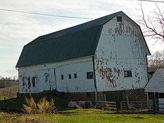
Alasa Farms |
|
October 16, 2009
(#09000835) |
6450 Shaker Rd.
43°12′41″N 76°58′48″W / 43.211278°N 76.980011°W / 43.211278; -76.980011 (Alasa Farms) |
Alton |
|
| 2 |
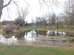
J. and E. Baker Cobblestone Farmstead |
|
November 7, 1995
(#95001281) |
815 Canandaigua Rd.
43°02′04″N 77°18′50″W / 43.034444°N 77.313889°W / 43.034444; -77.313889 (J. and E. Baker Cobblestone Farmstead) |
Macedon |
|
| 3 |
Brick Church Corners |
|
June 5, 1974
(#74001317) |
Jct. of Brick Church and Ontario Center Rds.
43°15′27″N 77°18′21″W / 43.2575°N 77.305833°W / 43.2575; -77.305833 (Brick Church Corners) |
Ontario |
|
| 4 |
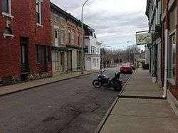
Broad Street-Water Street Historic District |
|
August 14, 1973
(#73001284) |
Broad and Water Sts.
43°03′45″N 76°59′43″W / 43.0625°N 76.995278°W / 43.0625; -76.995278 (Broad Street-Water Street Historic District) |
Lyons |
|
| 5 |
Charles Bullis House |
|
March 20, 1986
(#86000483) |
1727 Canandaigua Rd.
43°04′10″N 77°19′14″W / 43.069444°N 77.320556°W / 43.069444; -77.320556 (Charles Bullis House) |
Macedon |
|
| 6 |
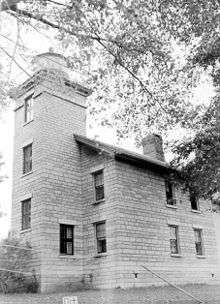
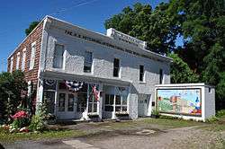
Customs House |
|
May 6, 1980
(#80002787) |
Sentell St.
43°16′01″N 76°59′37″W / 43.266944°N 76.993611°W / 43.266944; -76.993611 (Customs House) |
Sodus Point |
|
| 7 |
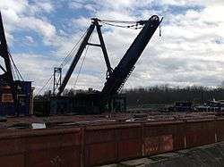
Dipper Dredge No. 3 |
|
December 11, 2007
(#07001257) |
1665 Drydock Rd.
43°03′52″N 77°01′10″W / 43.064444°N 77.019444°W / 43.064444; -77.019444 (Dipper Dredge No. 3) |
Lyons |
|
| 8 |
East Main Street Commercial Historic District |
|
November 21, 1974
(#74001318) |
Between Clinton and William-Cuyler Sts.
43°03′49″N 77°13′49″W / 43.063611°N 77.230278°W / 43.063611; -77.230278 (East Main Street Commercial Historic District) |
Palmyra |
|
| 9 |
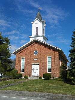
East Palmyra Presbyterian Church |
|
December 31, 2002
(#02001651) |
2102 Whitbeck Rd.
43°05′02″N 77°08′52″W / 43.083889°N 77.147778°W / 43.083889; -77.147778 (East Palmyra Presbyterian Church) |
East Palmyra |
|
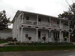
| 10 |
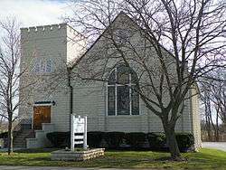
First Methodist Episcopal Church of Walworth |
|
March 27, 2017
(#100000814) |
3679 Main St.
43°08′17″N 77°16′23″W / 43.138063°N 77.272926°W / 43.138063; -77.272926 (First Methodist Episcopal Church of Walworth) |
Walworth |
Landmark in the community since its 1872 construction |
| 11 |
First Presbyterian Church of Ontario Center |
|
June 3, 1998
(#98000665) |
1638 Ridge Rd.
43°13′31″N 77°18′06″W / 43.225278°N 77.301667°W / 43.225278; -77.301667 (First Presbyterian Church of Ontario Center) |
Ontario Center |
|
| 12 |
Gates Hall and Pultneyville Public Square |
|
March 3, 2000
(#00000177) |
Lake Rd.
43°16′48″N 77°11′13″W / 43.28°N 77.186944°W / 43.28; -77.186944 (Gates Hall and Pultneyville Public Square) |
Pultneyville |
|
| 13 |
Grace Episcopal Church Complex |
|
August 19, 1994
(#94000802) |
7-9 Phelps St. and 12 Lawrence St.
43°03′55″N 76°59′25″W / 43.065278°N 76.990278°W / 43.065278; -76.990278 (Grace Episcopal Church Complex) |
Lyons |
|
| 14 |
H. G. Hotchkiss Essential Oil Company Plant |
|
November 2, 1987
(#87001897) |
93-95 Water St.
43°03′46″N 76°59′48″W / 43.062778°N 76.996667°W / 43.062778; -76.996667 (H. G. Hotchkiss Essential Oil Company Plant) |
Lyons |
|
| 15 |
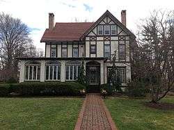
Jackson-Perkins House |
|
July 14, 2006
(#06000567) |
310 High St.
43°02′39″N 77°05′58″W / 43.044167°N 77.099444°W / 43.044167; -77.099444 (Jackson-Perkins House) |
Newark |
|
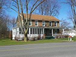
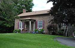
| 16 |
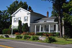
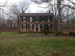
Ambrose S. Lapham House |
|
September 3, 2014
(#14000541) |
352 W. Jackson St.
43°03′38″N 77°14′36″W / 43.060544°N 77.2433057°W / 43.060544; -77.2433057 (Ambrose S. Lapham House) |
Palmyra |
1870 Italianate brick house built by local resident who returned after a successful banking career in Detroit |
| 17 |
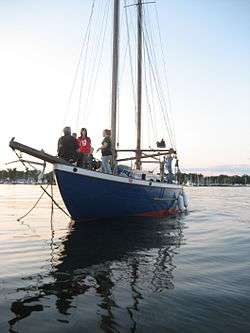
LOTUS (schooner) |
|
May 10, 1990
(#90000694) |
Trestle Landing Marina, Co. Rt. 14 at Sentell Rd.
43°15′59″N 76°59′29″W / 43.266389°N 76.991389°W / 43.266389; -76.991389 (LOTUS (schooner)) |
Sodus Point |
|
| 18 |
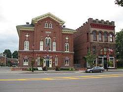
Lyons Downtown Historic District |
|
March 12, 2018
(#SG100002190) |
Broad bounded by Phelps, William, Butternut, Pearl & Canal with portions of Bear, Lawrence, Geneva & Water Sts.
43°03′48″N 76°59′36″W / 43.0634°N 76.9934°W / 43.0634; -76.9934 (Lyons Downtown Historic District) |
Lyons |
Core of county seat, reflecting 18th century origins, 19th-century growth as canal town and 20th-century industrialization |
| 19 |
Market Street Historic District |
|
December 8, 1972
(#72000916) |
Both sides of Market St. between Canal and Main Sts.
43°03′52″N 77°13′47″W / 43.064444°N 77.229722°W / 43.064444; -77.229722 (Market Street Historic District) |
Palmyra |
|
| 20 |
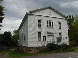
Methodist Episcopal Church of Butler |
|
November 24, 1997
(#97001459) |
Butler Center Rd., jct. with Washburn Rd.
43°10′06″N 76°46′17″W / 43.168333°N 76.771389°W / 43.168333; -76.771389 (Methodist Episcopal Church of Butler) |
Butler Center |
|
| 21 |
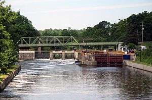
New York State Barge Canal |
|
October 15, 2014
(#14000860) |
Linear across county
43°03′55″N 77°14′47″W / 43.065224°N 77.246491°W / 43.065224; -77.246491 (New York State Barge Canal) |
Arcadia, Clyde, Galen, Lyons, Newark, Palmyra, Savannah |
Successor to Erie Canal approved by state voters in early 20th century to compete with railroads. |
| 22 |
Palmyra Village Historic District |
|
October 16, 2009
(#09000836) |
Portions of Canandaigua, Church, Cuyler, E. and W. Jackson, Market, E. and W. Main Sts.
43°03′50″N 77°14′00″W / 43.063953°N 77.233314°W / 43.063953; -77.233314 (Palmyra Village Historic District) |
Palmyra |
|
| 23 |
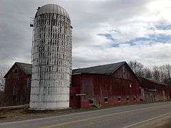
Ezra T. Phelps Farm Complex |
|
August 13, 1997
(#97000843) |
4365 E. Williamson Rd.
43°09′13″N 77°09′51″W / 43.153611°N 77.164167°W / 43.153611; -77.164167 (Ezra T. Phelps Farm Complex) |
Marion |
|
| 24 |
Preston-Gaylord Cobblestone Farmhouse |
|
December 11, 2009
(#09001088) |
7563 Lake Rd.
43°15′57″N 77°01′28″W / 43.265967°N 77.024478°W / 43.265967; -77.024478 (Preston-Gaylord Cobblestone Farmhouse) |
Sodus |
|
| 25 |
Pultneyville Historic District |
|
September 11, 1985
(#85002325) |
Sections of Lake Rd. and Jay St.
43°16′48″N 77°10′54″W / 43.28°N 77.181667°W / 43.28; -77.181667 (Pultneyville Historic District) |
Pultneyville |
|
| 26 |
Red Brick Church |
|
December 8, 1997
(#97001527) |
Jct. of Brick Church Rd. and S. Geneva Rd.
43°11′58″N 77°00′42″W / 43.199444°N 77.011667°W / 43.199444; -77.011667 (Red Brick Church) |
Sodus Center |
|
| 27 |
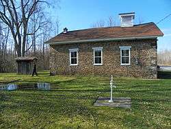
Roe Cobblestone Schoolhouse |
|
September 17, 2008
(#08000920) |
12397 Van Vleck Rd.
43°11′25″N 76°47′00″W / 43.190389°N 76.783453°W / 43.190389; -76.783453 (Roe Cobblestone Schoolhouse) |
Butler |
|
| 28 |
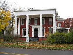
Smith-Ely Mansion |
|
February 10, 1992
(#92000032) |
39 W. Genesee St.
43°05′07″N 76°52′25″W / 43.085278°N 76.873611°W / 43.085278; -76.873611 (Smith-Ely Mansion) |
Clyde |
|
| 29 |
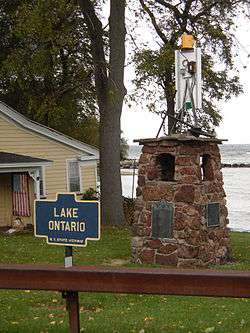
Sodus Point Lighthouse |
|
October 8, 1976
(#76001288) |
Off NY 14 at Lake Ontario
43°16′25″N 76°59′12″W / 43.273611°N 76.986667°W / 43.273611; -76.986667 (Sodus Point Lighthouse) |
Sodus Point |
|
| 30 |
St. Peter, (Shipwreck) |
|
March 22, 2004
(#04000226) |
Address Restricted
43°18′42″N 77°07′52″W / 43.311667°N 77.131111°W / 43.311667; -77.131111 (St. Peter, (Shipwreck)) |
Pultneyville |
|
| 31 |
Towar-Ennis Farmhouse and Barn Complex |
|
October 16, 2009
(#09000967) |
265 NY-14
43°01′12″N 76°59′12″W / 43.019922°N 76.986703°W / 43.019922; -76.986703 (Towar-Ennis Farmhouse and Barn Complex) |
Lyons |
|
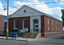
| 32 |
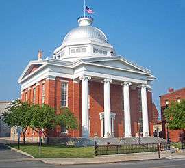
US Post Office-Clyde |
|
November 17, 1988
(#88002472) |
26 S. Park St.
43°05′01″N 76°52′16″W / 43.083611°N 76.871111°W / 43.083611; -76.871111 (US Post Office-Clyde) |
Clyde |
|
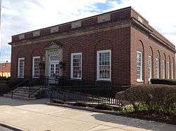
| 33 |
US Post Office-Lyons |
|
May 11, 1989
(#88002349) |
1-5 Pearl St.
43°03′46″N 76°59′37″W / 43.062778°N 76.993611°W / 43.062778; -76.993611 (US Post Office-Lyons) |
Lyons |
|
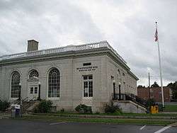
| 34 |
US Post Office-Newark |
|
May 11, 1989
(#88002366) |
300 S. Main St.[5]
43°02′37″N 77°05′43″W / 43.043611°N 77.095278°W / 43.043611; -77.095278 (US Post Office-Newark) |
Newark |
|
| 35 |
Walling Cobblestone Tavern |
|
March 17, 1994
(#94000173) |
7851 Ridge Rd., Hamlet of Wallington
43°13′18″N 77°00′44″W / 43.221667°N 77.012222°W / 43.221667; -77.012222 (Walling Cobblestone Tavern) |
Sodus |
|
| 36 |
Wallington Cobblestone Schoolhouse District No. 8 |
|
March 17, 1994
(#94000172) |
6135 N. Geneva Rd., Hamlet of Wallington
43°13′23″N 77°00′48″W / 43.223056°N 77.013333°W / 43.223056; -77.013333 (Wallington Cobblestone Schoolhouse District No. 8) |
Sodus |
|
| 37 |
Wolcott Square Historic District |
|
May 17, 2001
(#00001692) |
W. Main, Park, and New Hartford Sts.
43°13′12″N 76°48′58″W / 43.22°N 76.816111°W / 43.22; -76.816111 (Wolcott Square Historic District) |
Wolcott |
|
| 38 |
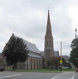
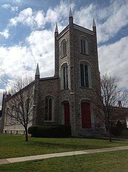
Zion Episcopal Church |
|
November 29, 1996
(#96001388) |
100-120 Main St.
43°03′47″N 77°14′00″W / 43.063056°N 77.233333°W / 43.063056; -77.233333 (Zion Episcopal Church) |
Palmyra |
|
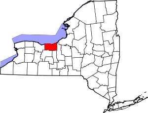


_WAYNE_COUNTY.jpg)