| [3] |
Name on the Register |
Image |
Date listed[4] |
Location |
City or town |
Description |
|---|
| 1 |
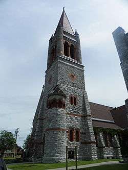
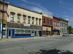
Adams Commercial Historic District |
|
September 29, 2006
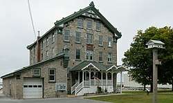
(#06000882) |
Main and North Main Sts. and portions of East and West Church Sts.
43°48′32″N 76°01′28″W / 43.808889°N 76.024444°W / 43.808889; -76.024444 (Adams Commercial Historic District) |
Adams |
|
| 2 |
Levi Anthony Building |
|
September 27, 1985
(#85002451) |
Broadway
44°07′47″N 76°19′47″W / 44.129722°N 76.329722°W / 44.129722; -76.329722 (Levi Anthony Building) |
Cape Vincent |
part of the Cape Vincent Town and Village Multiple Resource Area (MRA) |
| 3 |
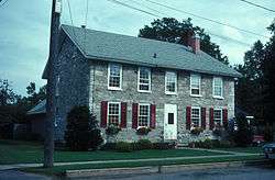
William Archer House |
|
November 19, 1980
(#80002623) |
112 Washington St.
44°00′11″N 75°58′56″W / 44.003056°N 75.982222°W / 44.003056; -75.982222 (William Archer House) |
Brownville |
part of the Stone Houses of Brownville Thematic Resource (TR) |
| 4 |
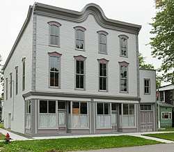
Aubertine Building |
|
September 27, 1985
(#85002452) |
Broadway
44°07′45″N 76°19′55″W / 44.129167°N 76.331944°W / 44.129167; -76.331944 (Aubertine Building) |
Cape Vincent |
part of the Cape Vincent Town and Village MRA |
| 5 |
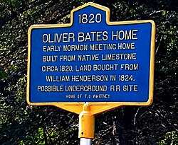
Cyrus Bates House |
|
July 14, 2004
(#04000710) |
7185 NY 3
43°49′28″N 76°12′08″W / 43.824444°N 76.202222°W / 43.824444; -76.202222 (Cyrus Bates House) |
Henderson |
|
| 6 |
Bedford Creek Bridge |
|
October 18, 1989
(#89001617) |
Campbell's Point Rd. over Bedford Creek
43°54′32″N 76°07′12″W / 43.908889°N 76.12°W / 43.908889; -76.12 (Bedford Creek Bridge) |
Hounsfield |
part of the Hounsfield MRA |
| 7 |
Dr. Abner Benton House |
|
August 23, 1984
(#84002405) |
Main St.
44°17′20″N 75°37′36″W / 44.288889°N 75.626667°W / 44.288889; -75.626667 (Dr. Abner Benton House) |
Oxbow |
|
| 8 |
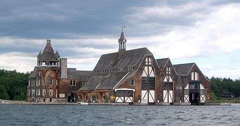
George C. Boldt Yacht House |
|
April 26, 1978
(#78001853) |
Northwest of Alexandria Bay on Wellesley Island
44°20′47″N 75°55′37″W / 44.346389°N 75.926944°W / 44.346389; -75.926944 (George C. Boldt Yacht House) |
Alexandria Bay |
G. W. & W. D. Hewitt, architects. |
| 9 |
John Borland House |
|
September 27, 1985
(#85002453) |
Market St.
44°07′36″N 76°20′12″W / 44.126667°N 76.336667°W / 44.126667; -76.336667 (John Borland House) |
Cape Vincent |
part of the Cape Vincent Town and Village MRA |
| 10 |
Broadway Historic District |
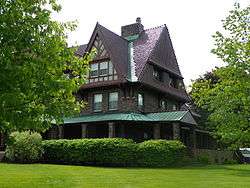
|
September 27, 1985
(#85002455) |
St. Lawrence River, W. edge of Village of Cape Vincent, on Broadway & Tibbetts Point
44°07′26″N 76°20′44″W / 44.123889°N 76.345556°W / 44.123889; -76.345556 (Broadway Historic District) |
Cape Vincent |
part of the Cape Vincent Town and Village MRA |
| 11 |
Gen. Jacob Brown Mansion |
|
November 19, 1980
(#80002624) |
Brown Blvd.
44°00′19″N 75°59′00″W / 44.005278°N 75.983333°W / 44.005278; -75.983333 (Gen. Jacob Brown Mansion) |
Brownville |
part of the Stone Houses of Brownville TR |
| 12 |
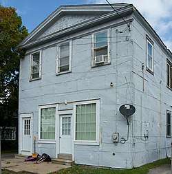
Brownville Hotel |
|
November 19, 1980
(#80002625) |
Brown Blvd. and W. Main St.
44°00′10″N 75°59′02″W / 44.002778°N 75.983889°W / 44.002778; -75.983889 (Brownville Hotel) |
Brownville |
part of the Stone Houses of Brownville TR |
| 13 |
James Buckley House |
|
September 27, 1985
(#85002454) |
Joseph St.
44°07′37″N 76°20′10″W / 44.126944°N 76.336111°W / 44.126944; -76.336111 (James Buckley House) |
Cape Vincent |
part of the Cape Vincent Town and Village MRA |
| 14 |
E. K. Burnham House |
|
September 27, 1985
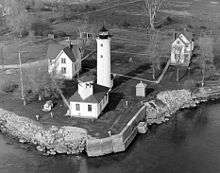
(#85002456) |
565 Broadway
44°07′45″N 76°20′00″W / 44.129167°N 76.333333°W / 44.129167; -76.333333 (E. K. Burnham House) |
Cape Vincent |
part of the Cape Vincent Town and Village MRA |
| 15 |
Buttermilk Flat Schoolhouse No. 22 |
|
June 28, 1996
(#96000671) |
South side of Buttermilk Flat Rd., east of junction with Carter St. Rd.,
44°10′23″N 75°56′57″W / 44.173056°N 75.949167°W / 44.173056; -75.949167 (Buttermilk Flat Schoolhouse No. 22) |
Orleans |
part of the Orleans Multiple Property Submission (MPS) |
| 16 |
Elisha Camp House |
|
April 23, 1973
(#73001196) |
310 General Smith Dr.
43°56′55″N 76°07′05″W / 43.948611°N 76.118056°W / 43.948611; -76.118056 (Elisha Camp House) |
Sackets Harbor |
|
| 17 |
Carter Street Schoolhouse No. 21 |
|
June 28, 1996
(#96000665) |
Junction of Vaadi and Dog Hill Rds., southwest corner
44°07′11″N 75°57′12″W / 44.119722°N 75.953333°W / 44.119722; -75.953333 (Carter Street Schoolhouse No. 21) |
Orleans |
part of the Orleans MPS |
| 18 |
Cedar Grove Cemetery |
|
September 6, 1990
(#90001324) |
Washington St.
44°03′51″N 76°08′02″W / 44.064167°N 76.133889°W / 44.064167; -76.133889 (Cedar Grove Cemetery) |
Chaumont |
part of the Lyme MRA |
| 19 |
Central Garage |
|
October 18, 1996
(#96001172) |
North side of Clayton St., west of junction with Main St., Hamlet of La Fargeville
44°11′41″N 75°58′00″W / 44.194722°N 75.966667°W / 44.194722; -75.966667 (Central Garage) |
Orleans |
part of the Orleans MPS |
| 20 |
Chaumont Grange Hall and Dairymen's League Building |
|
September 6, 1990
(#90001337) |
Main St.
44°03′55″N 76°07′44″W / 44.065278°N 76.128889°W / 44.065278; -76.128889 (Chaumont Grange Hall and Dairymen's League Building) |
Chaumont |
part of the Lyme MRA |
| 21 |
Chaumont Historic District |
|
September 6, 1990
(#90001336) |
Along Main St., roughly between Washington and Church Sts.
44°04′04″N 76°08′00″W / 44.067778°N 76.133333°W / 44.067778; -76.133333 (Chaumont Historic District) |
Chaumont |
part of the Lyme MRA |
| 22 |
Chaumont House |
|
September 6, 1990
(#90001341) |
Main St.
44°04′08″N 76°08′19″W / 44.068889°N 76.138611°W / 44.068889; -76.138611 (Chaumont House) |
Chaumont |
part of the Lyme MRA |
| 23 |
Chaumont Railroad Station |
|
September 6, 1990
(#90001332) |
Main St.
44°04′02″N 76°07′45″W / 44.067222°N 76.129167°W / 44.067222; -76.129167 (Chaumont Railroad Station) |
Chaumont |
part of the Lyme MRA |
| 24 |
Xavier Chevalier House |
|
September 27, 1985
(#85002457) |
Gosier Rd.
44°09′29″N 76°14′27″W / 44.158056°N 76.240833°W / 44.158056; -76.240833 (Xavier Chevalier House) |
Cape Vincent |
part of the Cape Vincent Town and Village MRA |
| 25 |
Church of Saint Lawrence |
|
May 16, 1997
(#97000442) |
Fuller St., junction with Sisson St.
44°20′11″N 75°55′17″W / 44.336389°N 75.921389°W / 44.336389; -75.921389 (Church of Saint Lawrence) |
Alexandria Bay |
part of the Historic Churches of the Episcopal Diocese of Central New York MPS |
| 26 |
Clayton Historic District |
|
September 12, 1985
(#85002368) |
203-215 & 200-326 James St., 500-544 & 507-537 Riverside Dr.
• Boundary increase (listed May 9, 1997, refnum 97000424): 335, 403, 409, 413, 419, and 435 Riverside Dr.
44°14′31″N 76°05′22″W / 44.241944°N 76.089444°W / 44.241944; -76.089444 (Clayton Historic District) |
Clayton |
|
| 27 |
Nicholas Cocaigne House |
|
September 27, 1985
(#85002458) |
Favret Rd.
44°06′58″N 76°18′45″W / 44.116111°N 76.3125°W / 44.116111; -76.3125 (Nicholas Cocaigne House) |
Cape Vincent |
part of the Cape Vincent Town and Village MRA |
| 28 |
Conklin Farm |
|
October 18, 1989
(#89001624) |
Evans Rd.
43°59′02″N 75°59′29″W / 43.983889°N 75.991389°W / 43.983889; -75.991389 (Conklin Farm) |
Hounsfield |
part of the Hounsfield MRA |
| 29 |
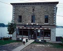
Cornwall Brothers' Store |
|
May 2, 1975
(#75001191) |
2 Howell Pl.
44°20′17″N 75°55′11″W / 44.338056°N 75.919722°W / 44.338056; -75.919722 (Cornwall Brothers' Store) |
Alexandria Bay |
|
| 30 |
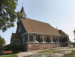
Densmore Methodist Church of the Thousand Islands |
|
May 19, 1988
(#88000591) |
Rt. 100 at Densmore Bay
44°19′19″N 75°57′15″W / 44.321944°N 75.954167°W / 44.321944; -75.954167 (Densmore Methodist Church of the Thousand Islands) |
Alexandria |
|
| 31 |
Dexter Universalist Church |
|
September 19, 2003
(#03000249) |
Brown and Kirby Sts.
44°00′29″N 76°02′41″W / 44.008056°N 76.044722°W / 44.008056; -76.044722 (Dexter Universalist Church) |
Dexter |
|
| 32 |
Remy Dezengremel House |
|
September 27, 1985
(#85002459) |
Rosiere Rd.
44°06′21″N 76°15′39″W / 44.105833°N 76.260833°W / 44.105833; -76.260833 (Remy Dezengremel House) |
Cape Vincent |
part of the Cape Vincent Town and Village MRA |
| 33 |
District School No. 19 |
|
October 18, 1989
(#89001618) |
Co. Rd. 69
43°55′29″N 76°01′53″W / 43.924722°N 76.031389°W / 43.924722; -76.031389 (District School No. 19) |
Hounsfield |
part of the Hounsfield MRA |
| 34 |
District School No. 20 |
|
October 18, 1989
(#89001619) |
NY 3, south of Co. Rd. 75
43°55′34″N 76°06′32″W / 43.926111°N 76.108889°W / 43.926111; -76.108889 (District School No. 20) |
Hounsfield |
part of the Hounsfield MRA |
| 35 |
District School No. 3 |
|
September 6, 1990
(#90001326) |
Junction of NY 3 and County Rd. 57, Putnam Corners
44°04′09″N 76°14′18″W / 44.069167°N 76.238333°W / 44.069167; -76.238333 (District School No. 3) |
Lyme |
part of the Lyme MRA |
| 36 |
Joseph Docteur House |
|
September 27, 1985
(#85002460) |
Rosiere Rd.
44°07′06″N 76°13′52″W / 44.118333°N 76.231111°W / 44.118333; -76.231111 (Joseph Docteur House) |
Cape Vincent |
part of the Cape Vincent Town and Village MRA |
| 37 |
Duvillard Mill |
|
September 27, 1985
(#85002461) |
Broadway
44°07′49″N 76°19′54″W / 44.130278°N 76.331667°W / 44.130278; -76.331667 (Duvillard Mill) |
Cape Vincent |
part of the Cape Vincent Town and Village MRA |
| 38 |
Reuter Dyer House |
|
September 27, 1985
(#85002462) |
Rosiere Rd.
44°06′12″N 76°17′11″W / 44.103333°N 76.286389°W / 44.103333; -76.286389 (Reuter Dyer House) |
Cape Vincent |
part of the Cape Vincent Town and Village MRA |
| 39 |
East Charity Shoal Light |
|
March 27, 2008
(#08000231) |
Northeast Lake Ontario at US-Canada boundary 9.5 miles (15.3 km) southwest of Cape Vincent
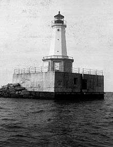
44°02′19″N 76°28′54″W / 44.038611°N 76.481667°W / 44.038611; -76.481667 (East Charity Shoal Light) |
Cape Vincent |
part of the Light Stations of the United States MPS |
| 40 |
East Hounsfield Christian Church |
|
October 18, 1989
(#89001621) |
NY 3
43°58′08″N 75°59′33″W / 43.968889°N 75.9925°W / 43.968889; -75.9925 (East Hounsfield Christian Church) |
Hounsfield |
part of the Hounsfield MRA |
| 41 |
Emerson Place |
|
April 18, 2003
(#03000241) |
20-30 Emerson Place
43°58′24″N 75°53′59″W / 43.973333°N 75.899722°W / 43.973333; -75.899722 (Emerson Place) |
Watertown |
|
| 42 |
Evans-Gaige-Dillenback House |
|
September 6, 1990
(#90001340) |
Evans Rd.
44°04′09″N 76°08′13″W / 44.069167°N 76.136944°W / 44.069167; -76.136944 (Evans-Gaige-Dillenback House) |
Lyme |
part of the Lyme MRA |
| 43 |
Fairview Manor |
|
August 30, 2007
(#07000866) |
38289 NY 12-E
44°13′22″N 76°07′18″W / 44.222675°N 76.121608°W / 44.222675; -76.121608 (Fairview Manor) |
Clayton |
|
| 44 |
First Baptist Church and Cook Memorial Building |
|
February 9, 2005
(#05000016) |
511 State St.
43°58′55″N 75°36′29″W / 43.981944°N 75.608056°W / 43.981944; -75.608056 (First Baptist Church and Cook Memorial Building) |
Carthage |
|
| 45 |
First Presbyterian Society of Cape Vincent |
|
February 5, 2013
(#12001258) |
260 E. Broadway
44°07′36″N 76°20′23″W / 44.126666°N 76.339737°W / 44.126666; -76.339737 (First Presbyterian Society of Cape Vincent) |
Cape Vincent |
from Cape Vincent Town and Village MRA |
| 46 |
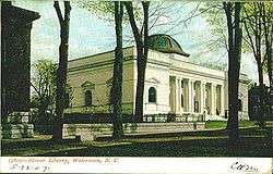
Roswell P. Flower Memorial Library |
|
January 10, 1980
(#80002628) |
229 Washington St.
43°58′23″N 75°54′39″W / 43.973056°N 75.910833°W / 43.973056; -75.910833 (Roswell P. Flower Memorial Library) |
Watertown |
|
| 47 |
Charles Ford House |
|
December 20, 1996
(#96001472) |
West side of Ford St., south of junction with Co. Rd. 181, Hamlet of La Fargeville
44°11′36″N 75°58′17″W / 44.193333°N 75.971389°W / 44.193333; -75.971389 (Charles Ford House) |
Orleans |
part of the Orleans MPS |
| 48 |
Fort Haldimand Site |
|
December 15, 1978
(#78001854) |
Address Restricted
|
Cape Vincent |
|
| 49 |
Jean Philippe Galband du Fort House |
|
September 27, 1985
(#85002463) |
James St.
44°07′34″N 76°20′01″W / 44.126111°N 76.333611°W / 44.126111; -76.333611 (Jean Philippe Galband du Fort House) |
Cape Vincent |
part of the Cape Vincent Town and Village MRA |
| 50 |
Galloo Island Light |
|
August 4, 1983
(#83001682) |
Galloo Island
43°53′18″N 76°26′40″W / 43.888333°N 76.444444°W / 43.888333; -76.444444 (Galloo Island Light) |
Sackets Harbor |
part of the U.S. Coast Guard Lighthouses and Light Stations on the Great Lakes TR |
| 51 |
George Brothers Building |
|
September 6, 1990
(#90001334) |
Mill St.
44°03′56″N 76°07′47″W / 44.065556°N 76.129722°W / 44.065556; -76.129722 (George Brothers Building) |
Chaumont |
part of the Lyme MRA |
| 52 |
George House |
|
September 6, 1990
(#90001338) |
Washington St.
44°03′57″N 76°08′05″W / 44.065833°N 76.134722°W / 44.065833; -76.134722 (George House) |
Chaumont |
part of the Lyme MRA |
| 53 |
Getman Farmhouse |
|
September 6, 1990
(#90001322) |
S. Shore Rd.
43°58′31″N 76°16′25″W / 43.975278°N 76.273611°W / 43.975278; -76.273611 (Getman Farmhouse) |
Lyme |
part of the Lyme MRA |
| 54 |
Glen Building |
|
September 27, 1985
(#85002465) |
Broadway
44°07′42″N 76°20′03″W / 44.128333°N 76.334167°W / 44.128333; -76.334167 (Glen Building) |
Cape Vincent |
part of the Cape Vincent Town and Village MRA |
| 55 |
Grenadier Island Schoolhouse |
|
November 21, 2012
(#12000955) |
Grenadier Island Rd. 3
44°02′53″N 76°21′15″W / 44.048112°N 76.354249°W / 44.048112; -76.354249 (Grenadier Island Schoolhouse) |
Grenadier Island vicinity |
|
| 56 |
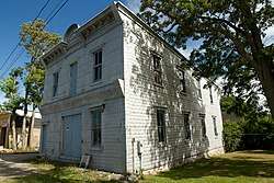
Grindstone Island Upper Schoolhouse |
|
August 14, 2012
(#12000509) |
41591 Cross Island Rd.
44°16′12″N 76°07′45″W / 44.26998°N 76.129183°W / 44.26998; -76.129183 (Grindstone Island Upper Schoolhouse) |
Clayton vicinity |
|
| 57 |
Dr. Samuel Guthrie House |
|
October 18, 1989
(#89001616) |
Co. Rd. 75/Military Rd.
43°57′05″N 76°05′36″W / 43.951389°N 76.093333°W / 43.951389; -76.093333 (Dr. Samuel Guthrie House) |
Hounsfield |
part of the Hounsfield MRA |
| 58 |
Holland Library |
|
November 15, 2002
(#02001330) |
7 Market St.
44°20′11″N 75°55′06″W / 44.336389°N 75.918333°W / 44.336389; -75.918333 (Holland Library) |
Alexandria Bay |
|
| 59 |
Elijah Horr House |
|
June 28, 1996
(#96000666) |
East side of NY 180, north of junction with Woodard Rd., Hamlet of Stone Mills
44°06′49″N 75°58′28″W / 44.113611°N 75.974444°W / 44.113611; -75.974444 (Elijah Horr House) |
Orleans |
part of the Orleans MPS |
| 60 |
Hiram Hubbard House |
|
September 9, 2009
(#09000699) |
34237 NY 126
43°57′41″N 75°41′11″W / 43.961264°N 75.686461°W / 43.961264; -75.686461 (Hiram Hubbard House) |
Champion |
|
| 61 |
Ingleside |
|
April 16, 1980
(#80002622) |
West of Alexandria Bay on Cherry Island
44°19′58″N 75°55′40″W / 44.332778°N 75.927778°W / 44.332778; -75.927778 (Ingleside) |
Alexandria Bay |
|
| 62 |
Irwin Brothers Store |
|
September 15, 1983
(#83001681) |
NY 180
44°06′46″N 75°58′34″W / 44.112778°N 75.976111°W / 44.112778; -75.976111 (Irwin Brothers Store) |
Stone Mills |
|
| 63 |
Jefferson County Courthouse Complex |
|
June 7, 1974
(#74001248) |
SE corner of Arsenal and Sherman Sts.
43°58′31″N 75°54′51″W / 43.975278°N 75.914167°W / 43.975278; -75.914167 (Jefferson County Courthouse Complex) |
Watertown |
|
| 64 |
Johnson House |
|
September 27, 1985
(#85002466) |
Tibbetts Point Rd.
44°06′22″N 76°21′17″W / 44.106111°N 76.354722°W / 44.106111; -76.354722 (Johnson House) |
Cape Vincent |
part of the Cape Vincent Town and Village MRA |
| 65 |
Capt. Simon Johnston House |
|
June 17, 1982
(#82003358) |
507 Riverside Dr.
44°14′31″N 76°05′18″W / 44.241944°N 76.088333°W / 44.241944; -76.088333 (Capt. Simon Johnston House) |
Clayton |
|
| 66 |
KESTREL (steam yacht) |
|
August 12, 1977
(#77000873) |
George C. Boldt Yacht House, Saint Lawrence River
44°20′47″N 75°55′37″W / 44.34639°N 75.92695°W / 44.34639; -75.92695 (KESTREL (steam yacht)) |
Alexandria Bay |
Moored at West New York, New Jersey when listed |
| 67 |
La Farge Land Office |
|
June 28, 1996
(#96000668) |
Junction of Main and Mill Sts., southwest corner, Hamlet of La Fargeville
44°11′35″N 75°58′03″W / 44.193056°N 75.9675°W / 44.193056; -75.9675 (La Farge Land Office) |
Orleans |
part of the Orleans MPS |
| 68 |
La Farge Retainer Houses |
|
August 21, 1997
(#97000941) |
Main St., south of junction of Main St. and Ford Rd.
44°11′28″N 75°58′04″W / 44.191111°N 75.967778°W / 44.191111; -75.967778 (La Farge Retainer Houses) |
Orleans |
part of the Orleans MPS |
| 69 |
La Fargeville United Methodist Church |
|
June 28, 1996
(#96000670) |
West side of Main St., south of junction with Co. Rt. 181, Hamlet of La Fargeville
44°11′27″N 75°58′08″W / 44.190833°N 75.968889°W / 44.190833; -75.968889 (La Fargeville United Methodist Church) |
Orleans |
part of the Orleans MPS |
| 70 |
Lance Farm |
|
September 6, 1990
(#90001323) |
S. Shore Rd.
43°58′52″N 76°15′28″W / 43.981111°N 76.257778°W / 43.981111; -76.257778 (Lance Farm) |
Lyme |
part of the Lyme MRA |
| 71 |
LeRay Hotel |
|
October 29, 1982
(#82001175) |
Main and Noble Sts.
44°05′16″N 75°48′28″W / 44.087778°N 75.807778°W / 44.087778; -75.807778 (LeRay Hotel) |
Evans Mills |
|
| 72 |
LeRay Mansion |
|
July 11, 1974
(#74001245) |
Northeast of Black River on Fort Drum Military Reservation
44°03′00″N 75°45′48″W / 44.05°N 75.763333°W / 44.05; -75.763333 (LeRay Mansion) |
Black River |
|
| 73 |
Vincent LeRay House |
|
November 15, 1973
(#73001195) |
Broadway (NY 12E)
44°07′31″N 76°20′34″W / 44.125278°N 76.342778°W / 44.125278; -76.342778 (Vincent LeRay House) |
Cape Vincent |
part of the Cape Vincent Town and Village MRA |
| 74 |
LeRaysville Archeological District |
|
November 2, 1995
(#95000069) |
Address Restricted
|
Le Ray |
|
| 75 |
Lewis House |
|
September 27, 1985
(#85002467) |
Market St.
44°07′45″N 76°20′18″W / 44.129167°N 76.338333°W / 44.129167; -76.338333 (Lewis House) |
Cape Vincent |
part of the Cape Vincent Town and Village MRA |
| 76 |
Longue Vue Island |
|
November 4, 1982
(#82001176) |
St. Lawrence River
44°18′14″N 75°56′25″W / 44.303889°N 75.940278°W / 44.303889; -75.940278 (Longue Vue Island) |
Alexandria Bay |
|
| 77 |
John Losee House |
|
February 14, 2014
(#14000004) |
17100 Cty. Rd. 155
43°55′01″N 75°55′47″W / 43.916896982082065°N 75.92981259188261°W / 43.916896982082065; -75.92981259188261 (John Losee House) |
Watertown |
|
| 78 |
Madison Barracks |
|
November 21, 1974
(#74001246) |
Military Rd.
43°57′10″N 76°06′35″W / 43.952778°N 76.109722°W / 43.952778; -76.109722 (Madison Barracks) |
Sackets Harbor |
|
| 79 |
Methodist Episcopal Church |
|
June 28, 1996
(#96000663) |
South side of NY 180, west of junction with Gore Rd., Hamlet of Omar
44°15′43″N 75°58′35″W / 44.261944°N 75.976389°W / 44.261944; -75.976389 (Methodist Episcopal Church) |
Orleans |
part of the Orleans MPS |
| 80 |
Methodist-Protestant Church at Fisher's Landing |
|
June 28, 1996
(#96000667) |
Reed Point Rd., near junction with Co. Rd. 195, Hamlet of Fisher's Landing
44°16′34″N 76°00′33″W / 44.276111°N 76.009167°W / 44.276111; -76.009167 (Methodist-Protestant Church at Fisher's Landing) |
Orleans |
part of the Orleans MPS |
| 81 |
A. Newton Farm |
|
May 5, 1997
(#97000356) |
NY 180, junction with Co. Rd. 13, Hamlet of Omar
44°15′45″N 75°58′44″W / 44.2625°N 75.978889°W / 44.2625; -75.978889 (A. Newton Farm) |
Orleans |
part of the Orleans MPS |
| 82 |
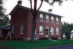
Norton–Burnham House |
|
February 23, 2016
(#16000034) |
8748 NY 178
43°50′45″N 76°11′22″W / 43.845799°N 76.189330°W / 43.845799; -76.189330 (Norton–Burnham House) |
Henderson |
1818 stone house built by early settler was birthplace of City Beautiful movement founder Daniel Burnham |
| 83 |
Paddock Arcade |
|
June 15, 1976
(#76001224) |
Public Square between Arsenal and Stone Sts.
43°58′28″N 75°54′41″W / 43.974444°N 75.911389°W / 43.974444; -75.911389 (Paddock Arcade) |
Watertown |
|
| 84 |
Paddock Mansion |
|
December 11, 1979
(#79001587) |
228 Washington St.
43°58′23″N 75°54′43″W / 43.973056°N 75.911944°W / 43.973056; -75.911944 (Paddock Mansion) |
Watertown |
|
| 85 |
Captain Louis Peugnet House |
|
September 27, 1985
(#85002469) |
Tibbetts Point Rd.
44°07′02″N 76°21′13″W / 44.117222°N 76.353611°W / 44.117222; -76.353611 (Captain Louis Peugnet House) |
Cape Vincent |
part of the Cape Vincent Town and Village MRA |
| 86 |
Pierrepont Manor Complex |
|
September 15, 1977
(#77000943) |
North of Mannsville on Ellisburg St.
43°44′04″N 76°03′42″W / 43.734444°N 76.061667°W / 43.734444; -76.061667 (Pierrepont Manor Complex) |
Mannsville |
|
| 87 |
Point Salubrious Historic District |
|
September 6, 1990
(#90001339) |
Point Salubrious Rd.
44°02′34″N 76°09′20″W / 44.042778°N 76.155556°W / 44.042778; -76.155556 (Point Salubrious Historic District) |
Lyme |
part of the Lyme MRA |
| 88 |
Public Square Historic District |
|
September 7, 1984
March 22, 2016
(#84002409)16000110 |
J.B. Wise & Park Pls., Arcade & Stone Sts.,
43°58′28″N 75°54′37″W / 43.974444°N 75.910278°W / 43.974444; -75.910278 (Public Square Historic District) |
Watertown |
|
| 89 |
Ressequie Farm |
|
October 18, 1989
(#89001622) |
Parker Rd.
43°56′05″N 76°02′31″W / 43.934722°N 76.041944°W / 43.934722; -76.041944 (Ressequie Farm) |
Hounsfield |
part of the Hounsfield MRA |
| 90 |
George Reynolds House |
|
September 27, 1985
(#85002470) |
River Rd.
44°09′50″N 76°15′38″W / 44.163889°N 76.260556°W / 44.163889; -76.260556 (George Reynolds House) |
Cape Vincent |
part of the Cape Vincent Town and Village MRA |
| 91 |
George T. Robinson House |
|
April 17, 2017
(#100000893) |
15082 Bluff Island
44°16′09″N 76°04′13″W / 44.26915°N 76.07017°W / 44.26915; -76.07017 (George T. Robinson House) |
Clayton |
1901 Shingle Style Thousand Island summer house on island in St. Lawrence built by Pittsburgh steel executive for family |
| 92 |
Rock Island Light Station |
|
November 14, 1978
(#78001855) |
North of Fishers Landing on Rock Island
44°16′50″N 76°01′03″W / 44.280556°N 76.0175°W / 44.280556; -76.0175 (Rock Island Light Station) |
Fishers Landing |
|
| 93 |
Rogers Brothers Farmstead |
|
May 11, 1998
(#98000392) |
Dablon Point Rd.
44°04′52″N 76°20′59″W / 44.081111°N 76.349722°W / 44.081111; -76.349722 (Rogers Brothers Farmstead) |
Cape Vincent |
part of the Cape Vincent Town and Village MRA |
| 94 |
John N. Rottiers Farm |
|
September 30, 1996
(#96001022) |
East side of NY 180, approximately 2 miles (3.2 km) south of the Hamlet of Lafargeville
44°09′54″N 75°58′29″W / 44.165°N 75.974722°W / 44.165; -75.974722 (John N. Rottiers Farm) |
Orleans |
part of the Orleans MPS |
| 95 |
The Row |
|
September 6, 1990
(#90001329) |
Main St. at Shaver Creek, Three Mile Bay
44°04′49″N 76°12′18″W / 44.080278°N 76.205°W / 44.080278; -76.205 (The Row) |
Lyme |
part of the Lyme MRA |
| 96 |
Roxy Hotel |
|
September 27, 1985
(#85002472) |
310 Broadway
44°07′39″N 76°20′16″W / 44.1275°N 76.337778°W / 44.1275; -76.337778 (Roxy Hotel) |
Cape Vincent |
part of the Cape Vincent Town and Village MRA |
| 97 |
Cornelius Sacket House |
|
September 27, 1985
(#85002473) |
571 Broadway
44°07′46″N 76°19′58″W / 44.129444°N 76.332778°W / 44.129444; -76.332778 (Cornelius Sacket House) |
Cape Vincent |
part of the Cape Vincent Town and Village MRA |
| 98 |
General Sacket House |
|
September 27, 1985
(#85002464) |
4407 James St.
44°07′18″N 76°19′52″W / 44.121667°N 76.331111°W / 44.121667; -76.331111 (General Sacket House) |
Cape Vincent |
part of the Cape Vincent Town and Village MRA |
| 99 |
Sackets Harbor Battlefield |
|
December 31, 1974
(#74001247) |
Coastline and area from Sackets Harbor SW to and including Horse Island
43°56′43″N 76°07′59″W / 43.945278°N 76.133056°W / 43.945278; -76.133056 (Sackets Harbor Battlefield) |
Sackets Harbor |
|
| 100 |
Sackets Harbor Village Historic District |
|
September 15, 1983
(#83001683) |
Main, Washington, Pike, Edmund, Hill, Hamilton, Broad, and Ambrose Sts.
43°56′44″N 76°07′10″W / 43.945556°N 76.119444°W / 43.945556; -76.119444 (Sackets Harbor Village Historic District) |
Sackets Harbor |
|
| 101 |
St. John's Episcopal Church |
|
September 27, 1985
(#85002476) |
Market St.
44°07′30″N 76°20′08″W / 44.125°N 76.335556°W / 44.125; -76.335556 (St. John's Episcopal Church) |
Cape Vincent |
part of the Cape Vincent Town and Village MRA |
| 102 |
St. Paul's Church |
|
August 30, 1996
(#96000960) |
210 Washington St.
44°00′18″N 75°58′53″W / 44.005°N 75.981389°W / 44.005; -75.981389 (St. Paul's Church) |
Brownville |
Historic Churches of the Episcopal Diocese of Central New York MPS |
| 103 |
St. Paul's Episcopal |
|
June 28, 1996
(#96000669) |
East side of Main St., south of the junction with Co. Rd. 181, Hamlet of La Fargeville
44°11′26″N 75°58′05″W / 44.190556°N 75.968056°W / 44.190556; -75.968056 (St. Paul's Episcopal) |
Orleans |
part of the Orleans MPS |
| 104 |
Saint Paul's Episcopal Church |
|
May 23, 1997
(#97000413) |
308-314 Clay St.
43°58′19″N 75°54′28″W / 43.971944°N 75.907778°W / 43.971944; -75.907778 (Saint Paul's Episcopal Church) |
Watertown |
Historic Churches of the Episcopal Diocese of Central New York MPS |
| 105 |
St. Vincent of Paul Catholic Church |
|
September 27, 1985
(#85002477) |
Kanady St.
44°07′28″N 76°20′24″W / 44.124444°N 76.34°W / 44.124444; -76.34 (St. Vincent of Paul Catholic Church) |
Cape Vincent |
part of the Cape Vincent Town and Village MRA |
| 106 |
Shore Farm |
|
October 18, 1989
(#89001623) |
Military Rd., east of Mill Creek
43°57′27″N 76°06′14″W / 43.9575°N 76.103889°W / 43.9575; -76.103889 (Shore Farm) |
Hounsfield |
part of the Hounsfield MRA |
| 107 |
Stephen Simmons House |
|
October 18, 1989
(#89001615) |
Camps Mills Rd., west of Old Slat Points Rd.
43°56′07″N 76°04′28″W / 43.935278°N 76.074444°W / 43.935278; -76.074444 (Stephen Simmons House) |
Hounsfield |
part of the Hounsfield MRA |
| 108 |
Smith-Ripley House |
|
February 13, 2008
(#08000021) |
29 E. Church St.
43°48′40″N 76°01′16″W / 43.811111°N 76.021111°W / 43.811111; -76.021111 (Smith-Ripley House) |
Adams |
|
| 109 |
Star Grange No. 9 |
|
October 18, 1989
(#89001626) |
Sulphur Springs Rd. between Jericho and Spencer Rds.
43°55′38″N 76°01′40″W / 43.927222°N 76.027778°W / 43.927222; -76.027778 (Star Grange No. 9) |
Hounsfield |
part of the Hounsfield MRA |
| 110 |
Otis Starkey House |
|
September 27, 1985
(#85002478) |
Point St.
44°07′36″N 76°20′06″W / 44.126667°N 76.335°W / 44.126667; -76.335 (Otis Starkey House) |
Cape Vincent |
part of the Cape Vincent Town and Village MRA |
| 111 |
State Street Historic District |
|
September 22, 1983
(#83001684) |
249-401 State St., 246-274 State St. and 106-108 Mechanic St.
43°58′40″N 75°36′36″W / 43.977778°N 75.61°W / 43.977778; -75.61 (State Street Historic District) |
Carthage |
|
| 112 |
Sterlingville Archeological District |
|
November 2, 1995
(#95000070) |
Address Restricted
|
Philadelphia |
|
| 113 |
Stevenson-Frink Farm |
|
October 18, 1989
(#89001625) |
Salt Point Rd.
44°00′10″N 76°03′56″W / 44.002778°N 76.065556°W / 44.002778; -76.065556 (Stevenson-Frink Farm) |
Hounsfield |
part of the Hounsfield MRA |
| 114 |
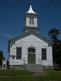
Stone Mills Union Church |
|
December 12, 1976
(#76001223) |
NY 180 near junction with Carter St.
44°06′52″N 75°58′27″W / 44.114444°N 75.974167°W / 44.114444; -75.974167 (Stone Mills Union Church) |
Stone Mills |
|
| 115 |
Storrs' Harbor Naval Shipyard Site |
|
February 7, 2012
(#11001091) |
Address restricted
|
Hounsfield vicinity |
|
| 116 |
Old Stone Shop |
|
September 6, 1990
(#90001328) |
Main St., Three Mile Bay
44°04′56″N 76°11′50″W / 44.082222°N 76.197222°W / 44.082222; -76.197222 (Old Stone Shop) |
Lyme |
part of the Lyme MRA |
| 117 |
Byron J. Strough House |
|
January 2, 1997
(#96001549) |
South side of Clayton St., west of junction with NY 411, Hamlet of La Fargeville
44°11′41″N 75°58′10″W / 44.194722°N 75.969444°W / 44.194722; -75.969444 (Byron J. Strough House) |
Orleans |
part of the Orleans MPS |
| 118 |
Sulphur Springs Cemetery |
|
October 18, 1989
(#89001620) |
Co. Rd. 62, southwest of Spencer Rd.
43°55′27″N 76°01′54″W / 43.924167°N 76.031667°W / 43.924167; -76.031667 (Sulphur Springs Cemetery) |
Hounsfield |
part of the Hounsfield MRA |
| 119 |
Swarthout Site-A04507.000038 |
|
January 24, 2002
(#01001504) |
Address Restricted
|
Clayton |
|
| 120 |
Taft House |
|
September 6, 1990
(#90001297) |
Main St., Three Mile Bay
44°04′50″N 76°12′11″W / 44.080556°N 76.203056°W / 44.080556; -76.203056 (Taft House) |
Lyme |
part of the Lyme MRA |
| 121 |
Talcott Falls Site |
|
June 5, 1974
(#74001244) |
Address Restricted
|
Adams |
|
| 122 |
Taylor Boathouse |
|
September 6, 1990
(#90001330) |
Bay View Dr., Three Mile Bay
44°04′46″N 76°12′02″W / 44.079444°N 76.200556°W / 44.079444; -76.200556 (Taylor Boathouse) |
Lyme |
part of the Lyme MRA |
| 123 |
Taylor Flats |
|
August 28, 2018
(#100002834) |
550 Coffeen St.
43°58′51″N 75°55′15″W / 43.9808°N 75.9208°W / 43.9808; -75.9208 (Taylor Flats) |
Watertown |
1907 apartment building was one of the first upstate to be built for workers with middle-class aspirations. |
| 124 |
Emma Flower Taylor Mansion |
|
October 10, 2002
(#02001114) |
241 Clinton St.
43°58′20″N 75°55′04″W / 43.972222°N 75.917778°W / 43.972222; -75.917778 (Emma Flower Taylor Mansion) |
Watertown |
|
| 125 |
Thomas Memorial AME Zion Church |
|
March 6, 2002
(#02000144) |
715 Morrison St.
43°59′07″N 75°54′55″W / 43.985278°N 75.915278°W / 43.985278; -75.915278 (Thomas Memorial AME Zion Church) |
Watertown |
|
| 126 |
Thousand Island Grange Hall |
|
June 28, 1996
(#96000664) |
East side of Gore Rd., north of junction with NY 180, Hamlet of Omar
44°15′40″N 75°58′20″W / 44.261111°N 75.972222°W / 44.261111; -75.972222 (Thousand Island Grange Hall) |
Orleans |
part of the Orleans MPS |
| 127 |
Thousand Island Park Historic District |
|
November 14, 1982
(#82001177) |
S tip of Wellesley Island
44°17′18″N 76°01′33″W / 44.288333°N 76.025833°W / 44.288333; -76.025833 (Thousand Island Park Historic District) |
Orleans |
|
| 128 |
Three Mile Bay Historic District |
|
September 6, 1990
(#90001327) |
Junction of Church and Depot Sts., Three Mile Bay
44°04′56″N 76°11′53″W / 44.082222°N 76.198056°W / 44.082222; -76.198056 (Three Mile Bay Historic District) |
Lyme |
part of the Lyme MRA |
| 129 |
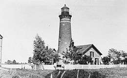
Tibbetts Point Light |
|
July 19, 1984
(#84002412) |
Tibbetts Point
44°06′02″N 76°22′13″W / 44.100556°N 76.370278°W / 44.100556; -76.370278 (Tibbetts Point Light) |
Cape Vincent |
|
| 130 |
Tracy Farm |
|
February 14, 1997
(#97000066) |
East side of Wilder Rd., south of junction with Overbluff Rd.
44°09′09″N 75°59′56″W / 44.1525°N 75.998889°W / 44.1525; -75.998889 (Tracy Farm) |
Orleans |
part of the Orleans MPS |
| 131 |
Trinity Episcopal Church and Parish House |
|
June 30, 2000
(#00000747) |
227 Sherman St.
43°58′24″N 75°54′55″W / 43.973333°N 75.915278°W / 43.973333; -75.915278 (Trinity Episcopal Church and Parish House) |
Watertown |
part of the Historic Churches of the Episcopal Diocese of Central New York MPS |
| 132 |
Union Hall |
|
September 6, 1990
(#90001333) |
S. Shore Rd.
44°00′21″N 76°13′08″W / 44.005833°N 76.218889°W / 44.005833; -76.218889 (Union Hall) |
Lyme |
part of the Lyme MRA |
| 133 |
Union Hotel |
|
June 19, 1972
(#72000849) |
Main and Ray Sts.
43°56′55″N 76°07′24″W / 43.948611°N 76.123333°W / 43.948611; -76.123333 (Union Hotel) |
Sackets Harbor |
|
| 134 |
Union Meeting House |
|
September 27, 1985
(#85002479) |
Millens Bay Rd.
44°10′19″N 76°14′32″W / 44.171944°N 76.242222°W / 44.171944; -76.242222 (Union Meeting House) |
Cape Vincent |
part of the Cape Vincent Town and Village MRA |
| 135 |
United Methodist Church |
|
September 6, 1990
(#90001325) |
S. Shore Rd.
44°00′24″N 76°13′08″W / 44.006667°N 76.218889°W / 44.006667; -76.218889 (United Methodist Church) |
Lyme |
part of the Lyme MRA |
| 136 |
US Post Office-Carthage |
|
November 17, 1988
(#88002470) |
521 State St.
43°58′49″N 75°36′27″W / 43.980278°N 75.6075°W / 43.980278; -75.6075 (US Post Office-Carthage) |
Carthage |
part of the US Post Offices in New York State, 1858-1943, TR |
| 137 |
Claude Vautrin House |
|
September 27, 1985
(#85002480) |
Mason Rd.
44°08′39″N 76°13′43″W / 44.144167°N 76.228611°W / 44.144167; -76.228611 (Claude Vautrin House) |
Cape Vincent |
part of the Cape Vincent Town and Village MRA |
| 138 |
Village of Antwerp Historic District |
|
April 19, 2001
(#01000389) |
Roughly Main, Depot, Maple, VanBuren, Mechanic, Fulton, Academy and Washington Sts., Lexington, Hoyt & Madison Aves.
44°11′53″N 75°36′33″W / 44.198056°N 75.609167°W / 44.198056; -75.609167 (Village of Antwerp Historic District) |
Antwerp |
|
| 139 |
Vogt House |
|
November 19, 1980
(#80002626) |
110 Main St.
44°00′08″N 75°58′52″W / 44.002222°N 75.981111°W / 44.002222; -75.981111 (Vogt House) |
Brownville |
part of the Stone Houses of Brownville TR |
| 140 |
Arthur Walrath House |
|
November 19, 1980
(#80002627) |
114 Corner Pike
44°00′11″N 75°58′55″W / 44.003056°N 75.981944°W / 44.003056; -75.981944 (Arthur Walrath House) |
Brownville |
part of the Stone Houses of Brownville TR |
| 141 |
Watertown Masonic Temple |
|
January 23, 1980
(#80002629) |
240 Washington St.
43°58′23″N 75°54′42″W / 43.973056°N 75.911667°W / 43.973056; -75.911667 (Watertown Masonic Temple) |
Watertown |
|
| 142 |
Menzo Wheeler House |
|
September 6, 1990
(#90001335) |
Main and Depot Sts.
44°04′52″N 76°11′53″W / 44.081111°N 76.198056°W / 44.081111; -76.198056 (Menzo Wheeler House) |
Chaumont |
part of the Lyme MRA |
| 143 |
Wilcox Farmhouse |
|
September 6, 1990
(#90001331) |
Carrying Place Rd.
44°03′33″N 76°15′25″W / 44.059167°N 76.256944°W / 44.059167; -76.256944 (Wilcox Farmhouse) |
Three Mile Bay |
part of the Lyme MRA |
| 144 |
Warren Wilson House |
|
September 27, 1985
(#85002482) |
Favret Rd.
44°07′49″N 76°16′27″W / 44.130278°N 76.274167°W / 44.130278; -76.274167 (Warren Wilson House) |
Cape Vincent |
part of the Cape Vincent Town and Village MRA |
| 145 |
Amos Wood House |
|
January 4, 2012
(#11001000) |
7751 County Road 120
43°44′28″N 76°10′51″W / 43.741083°N 76.180939°W / 43.741083; -76.180939 (Amos Wood House) |
North Landing vicinity; Ellisburg |
|
| 146 |
Wood's Grist Mill |
|
November 2, 1995
(#95000072) |
Address Restricted
|
Wilna |
|

_Schoolhouse.jpg)
.jpg)
_-_Clayton_NY.jpg)
.jpg)
052613_014.JPG)
.jpg)