BMT Canarsie Line
| BMT Canarsie Line | |
|---|---|
 The L, which uses the Canarsie Line through Midtown Manhattan, is colored gray. | |
| Overview | |
| Type | Rapid transit |
| System | New York City Subway |
| Termini |
Eighth Avenue Rockaway Parkway |
| Stations | 27 (3 demolished) |
| Daily ridership | 566,997[1] |
| Operation | |
| Opened | 1865–1931 |
| Owner | City of New York |
| Operator(s) | New York City Transit Authority |
| Character |
At-grade (eastbound track at Wilson Avenue, section from East 105th Street to Rockaway Parkway) Elevated (eastbound track south of Wilson Avenue, Broadway Jct. to north of East 105th Street) Underground (north of Broadway Jct. except for eastbound track at Wilson Avenue) |
| Technical | |
| Number of tracks | 2 |
| Track gauge | 4 ft 8 1⁄2 in (1,435 mm) |
| Electrification | 600V DC third rail |
The Canarsie Line (sometimes referred to as the 14th Street–Eastern Line) is a rapid transit line of the B Division of the New York City Subway system, named after its terminus in the Canarsie neighborhood of Brooklyn. It is served by the L train at all times, which is shown in medium gray on the New York City Subway map and on station signs.
The line is part of the BMT Eastern Division, and is occasionally referred to as the Eastern District Line. This refers to Williamsburg, which was described as Brooklyn's "Eastern District" when the City of Williamsburg was annexed by the former City of Brooklyn. This was the location where the original Brooklyn subway portions of the line were laid out. Only later was the line connected to the tracks leading to Canarsie. Eastern District High School, near the line's Grand Street station, had preserved this toponym until it was closed in 1996, later reopened as Grand Street Educational Campus.
The Canarsie Line was first a steam railroad, then a Brooklyn Rapid Transit Company (BRT), later Brooklyn–Manhattan Transit Corporation (BMT), elevated line. It was extended into Manhattan via subway in 1924–1928. Since the early 2000s, the line's signal system has been converted to an automated system. The Manhattan section of the line is planned to be shut down from early 2019 to mid-2020 to allow for a renovation of the 14th Street Tunnel, which the line uses to cross the East River; during this time L trains will only operate between Bedford Avenue and Rockaway Parkway.
Extent and service
Services that use the Canarsie Line are colored medium gray. The following service uses all of the Canarsie Line:[2]
| Time period | Section of line | |
|---|---|---|
| All times | Entire line |
BMT Canarsie Line | |||||||||||||||||||||||||||||||||||||||||||||||||||||||||||||||||||||||||||||||||||||||||||||||||||||||||||||||||||||||||||||||||||||||||||||||||||||||||||||||||||||||||||||||||||||||||||||||||||||||||||||||||||||||||||||||||||||||||||||||||||||||||||||||||||||||||||||||||||||||||||||||||||||||||||||||||||||||||||||||||||||||||||||||||||||||||||||||||||||||||||||||||||||||||||||||||||||||||||||||||||||||||||||||||||||||||||||||||||||||||||||||||||||||||||||||||||||||||||||||||||||||||||||||||||||||||||||||||||||||||||||||
|---|---|---|---|---|---|---|---|---|---|---|---|---|---|---|---|---|---|---|---|---|---|---|---|---|---|---|---|---|---|---|---|---|---|---|---|---|---|---|---|---|---|---|---|---|---|---|---|---|---|---|---|---|---|---|---|---|---|---|---|---|---|---|---|---|---|---|---|---|---|---|---|---|---|---|---|---|---|---|---|---|---|---|---|---|---|---|---|---|---|---|---|---|---|---|---|---|---|---|---|---|---|---|---|---|---|---|---|---|---|---|---|---|---|---|---|---|---|---|---|---|---|---|---|---|---|---|---|---|---|---|---|---|---|---|---|---|---|---|---|---|---|---|---|---|---|---|---|---|---|---|---|---|---|---|---|---|---|---|---|---|---|---|---|---|---|---|---|---|---|---|---|---|---|---|---|---|---|---|---|---|---|---|---|---|---|---|---|---|---|---|---|---|---|---|---|---|---|---|---|---|---|---|---|---|---|---|---|---|---|---|---|---|---|---|---|---|---|---|---|---|---|---|---|---|---|---|---|---|---|---|---|---|---|---|---|---|---|---|---|---|---|---|---|---|---|---|---|---|---|---|---|---|---|---|---|---|---|---|---|---|---|---|---|---|---|---|---|---|---|---|---|---|---|---|---|---|---|---|---|---|---|---|---|---|---|---|---|---|---|---|---|---|---|---|---|---|---|---|---|---|---|---|---|---|---|---|---|---|---|---|---|---|---|---|---|---|---|---|---|---|---|---|---|---|---|---|---|---|---|---|---|---|---|---|---|---|---|---|---|---|---|---|---|---|---|---|---|---|---|---|---|---|---|---|---|---|---|---|---|---|---|---|---|---|---|---|---|---|---|---|---|---|---|---|---|---|---|---|---|---|---|---|---|---|---|---|---|---|---|---|---|---|---|---|---|---|---|---|---|---|---|---|---|---|---|---|---|---|---|---|---|---|---|---|---|---|---|---|---|---|---|---|---|---|---|---|---|---|---|---|---|---|---|---|---|---|---|---|---|---|---|---|---|---|---|---|---|---|---|---|---|---|---|---|---|---|---|---|---|---|---|---|---|---|---|---|---|---|---|---|---|---|---|---|---|---|---|---|---|---|---|---|---|---|---|---|---|---|---|---|---|---|---|---|---|---|---|---|---|---|---|---|---|---|---|---|---|---|---|---|---|---|---|---|---|---|---|---|---|---|---|---|---|---|---|---|---|
| |||||||||||||||||||||||||||||||||||||||||||||||||||||||||||||||||||||||||||||||||||||||||||||||||||||||||||||||||||||||||||||||||||||||||||||||||||||||||||||||||||||||||||||||||||||||||||||||||||||||||||||||||||||||||||||||||||||||||||||||||||||||||||||||||||||||||||||||||||||||||||||||||||||||||||||||||||||||||||||||||||||||||||||||||||||||||||||||||||||||||||||||||||||||||||||||||||||||||||||||||||||||||||||||||||||||||||||||||||||||||||||||||||||||||||||||||||||||||||||||||||||||||||||||||||||||||||||||||||||||||||||||
The Canarsie Line runs from Eighth Avenue and 14th Street in Manhattan to Rockaway Parkway in Canarsie, Brooklyn. It is double-tracked along its entire length, except for short stretches of layup track in Manhattan and Brooklyn.[3]
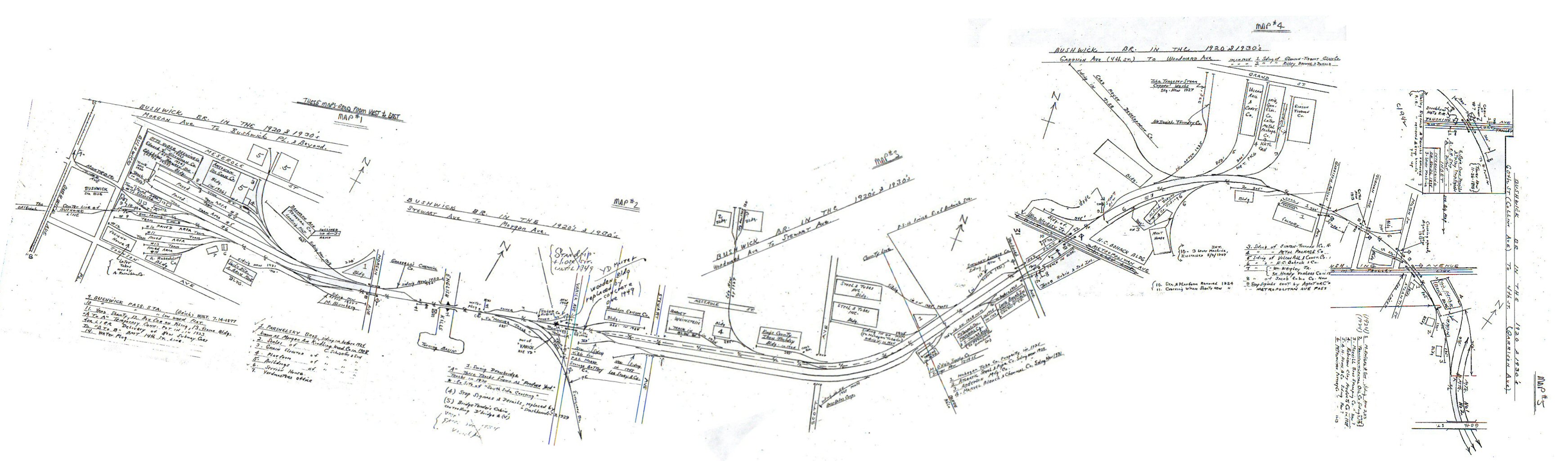
The current line is a two-track subway from its Manhattan terminal to Broadway Junction in the East New York section of Brooklyn, with the exception of a short stretch at Wilson Avenue where it is a double-decked structure with the southbound track outdoors directly above the indoor, ground-level northbound track. Although the northbound track appears to be underground, it is in fact outdoors at ground-level for there are no stairs leading from the northbound platform to the station entrance at the dead-end of Wilson Avenue, southeast of Moffat Street. This is due to the line being pressed directly against the New York Connecting Railroad, which is pressed directly against the border of Trinity Cemetery. There are no express tracks on the Canarsie line; thus, all trains run local service throughout their route.[3] However, in the past, express service has been run between Lorimer Street and Myrtle Avenue by skipping stops via the local tracks. This last operated in August 1956.[4][5]
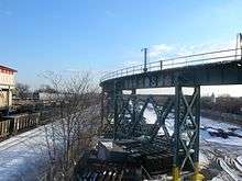
Just before Broadway Junction, the line emerges onto an elevated structure, passing over the BMT Jamaica Line. Between Broadway Junction and Atlantic Avenue are the Canarsie Line's only track connections to the rest of the system, via flyover ramps connecting the Canarsie line to the Jamaica Line and East New York Yard (and, until 1956, the Fulton Street Elevated). The Canarsie Line used to share the structure at Atlantic Avenue with the connection from the Broadway and Fulton Street elevated lines to the Liberty Avenue Elevated (still extant further east as part of the IND Fulton Street Line).[3]
East of Pitkin Avenue, the Canarsie Line enters the two-track elevated structure on which the line was originally grade-separated in 1906, entering Sutter Avenue station. At the next station, Livonia Avenue, the Livonia Avenue Elevated of the IRT New Lots Line passes overhead, and just beyond this point is a single track connection to the Linden Shops, which is now a track and structures facility. Besides the connection at Broadway Junction, this non-electrified yard connection is the only other connection to the rest of the subway system, as it is indirectly a connection to the New Lots Line. B Division-sized equipment cannot access this line, however, because of A Division width restrictions.[3]
Beyond the next station, New Lots Avenue, the elevated structure ends, and an incline brings the Canarsie down to the original 1865 surface right-of-way, the second-oldest such right-of-way on the New York City Transit Authority system. The line operates on this ground-level route to the end of the line at Rockaway Parkway.[3]
History
Steam and elevated era
Before becoming a BRT elevated line in 1906, the Canarsie Line operated as a steam dummy line. It was first owned by the Brooklyn and Rockaway Beach Railroad, chartered December 24, 1863 and opened October 21, 1865,[6]:101 from the Long Island Rail Road in East New York to a pier at Canarsie Landing, very close to the current junction of Rockaway Parkway and the Belt Parkway, where ferries continued on to Rockaway. The line was single-tracked until 1894.[7]
The Canarsie Railroad was chartered on May 8, 1906 as a BRT subsidiary (leased to the Brooklyn Union Elevated Railroad) and acquired the line on May 31, 1906.[6]:192 The line was partly elevated, and electrified with third rail on the elevated part and trolley wire on the rest, south of New Lots Avenue. The Long Island Rail Road, which had used the line north of New Lots to access their Bay Ridge Branch, built a new line just to the west. The East New York terminus was extended several blocks along a section of line formerly used for "East New York Loop" service to the Fulton Street Elevated and the Broadway Elevated (now the BMT Jamaica Line), at a point known as Manhattan Junction (now Broadway Junction).[7]
Service first ran on July 28, 1906 from Canarsie Landing to the Broadway Ferry at the foot of Broadway in Williamsburg, at the East River. This route still exists as the BMT Jamaica Line, except for the last piece to the East River, where the Jamaica Line runs over the Williamsburg Bridge. The route was later extended over the bridge and along the BMT Nassau Street Line to Canal Street and then Chambers Street.[7]
Dual Contracts rebuilding
The Dual Contracts subway expansion scheme around World War I saw the rebuilding of the complex train junction at Manhattan Junction into an even more complex flyover junction now known as Broadway Junction. The expansion extended south to the point at which the Canarsie and Fulton Street Elevateds diverged, including a six-track, three-platform station at Atlantic Avenue. The complex was rebuilt under traffic and opened in stages, reaching completion in 1919.[7]
At the same time, the BRT moved to eliminate remaining operations that required elevated trains to operate under overhead wire. In most cases this meant using third rail on fully grade-separated lines. When third rail was extended on the Canarsie Line it was decided to extend this power mode only as far as the important station at Rockaway Parkway and Glenwood Road. Beyond that point, frequent grade crossings made third rail impractical. This portion of the line was converted to the Canarsie Shuttle using elevated cars in October 1917 and converted to trolley cars on October 18, 1920.[7][8]
One grade crossing was retained at East 105th Street despite the third rail, and was the last public rapid transit grade crossing in New York City.[9] It was closed by 1973[10] as part of the Flatlands Industrial Park project, which was built on either side of the ground-level Canarsie Line. A pedestrian overpass above the tracks was built to replace the grade crossing.[11]
14th Street–Eastern Line
Booth and Flinn was awarded the contract to construct the line on January 13, 1916.[12] Clifford Milburn Holland served as the engineer-in-charge during the construction.[13]
On June 30, 1924, at what is now the other end of the line, a subway line initially known as the 14th Street–Eastern District Line, usually shortened to 14th Street–Eastern Line, was opened running beneath 14th Street in Manhattan, from Sixth Avenue under the East River and through Williamsburg to Montrose Avenue and Bushwick Avenues.[14][15] In 1924, a temporary connection was built from the Long Island Rail Road's Bushwick Yard that ran via Montrose Avenue and then connected to the BMT Canarsie Line under Bushwick Avenue just near the Montrose Avenue station. This was done in order for the delivery of new BMT Standard subway cars for the then isolated Canarsie Line of the New York City Subway.[16] The first of the cars were delivered by this ramp on June 18, 1924.[17]
Four years later, on July 14, 1928, the line was extended further east beneath Wyckoff Avenue and then south paralleling the New York Connecting Railroad to a new station at Broadway Junction, above the existing station on the Broadway Elevated (Jamaica Line). At this time, it was connected to the Canarsie Line.[18][19]
At noon on May 30, 1931, a two-block extension to Eighth Avenue in Manhattan was opened, allowing passengers to transfer to the new IND Eighth Avenue Line. This station was built to look like the other Independent Subway stations. At this point, the Canarsie Line's route took the shape that it still has to this day.[20]
Express service operated along the line along the local track, skipping all stops between Myrtle Avenue and Lorimer Street. This service pattern stopped in August 1956.[4][5]
On November 23, 1942, the Canarsie Shuttle trolley line to Canarsie Landing was replaced by the B42 bus; the right-of-way was abandoned.[21] Parts were built over, and other parts can still be seen as broad alleys or narrow parking lots. This right-of-way ran between East 95th and East 96th Streets as far south as Seaview Avenue. Some trolley poles from the line still exist.[22][23]
By the 1980s, the Canarsie Line was proposed for closure, as it was dilapidated and only had a ridership of 40,000 a day.[7]
Automation and post-automation
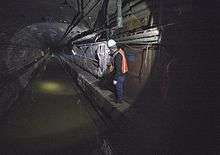
The Canarsie Line is one of only two New York City non-shuttle subway lines that hosts only a single service and does not share operating trackage with any other line or service; the other is the IRT Flushing Line, carrying the 7 and <7> trains. Because of this, it was chosen as the location of the first fully automated line of the New York City Subway.[24] The automation project was among the first in the world to use a radio frequency-based system. The plans for installation were laid out between 1999 and 2002. Communications-based train control (CBTC) was installed in pieces between 2003 and January 2006: the elevated section of the line south of Broadway Junction was completed first, followed by the underground section north of Broadway Junction. The project cost $340 million, with $78 million of it used to upgrade track interlockings on the line.[24]
In spring 2005, the current CBTC-enabled R143-class equipment was expected to run under full automation with a single operator (known as OPTO, or One Person Train Operation) acting as an attendant to monitor the train's operation and take over manual operation if necessary. However, technical mishaps including the test train rolling away by itself delayed the start of automatic train operation.[24] The project caused numerous service disruptions on the L at night and on weekends. Frequently, service was shut down in separate sections of the line, usually from Eighth Avenue to Lorimer Street, Lorimer to Broadway Junction, or Broadway Junction to Rockaway Parkway. During this time, shuttle buses served suspended areas. This project also required the temporary closing of some stations, either in one direction or both directions, and for the line to be operated in two sections.[24]
In June 2005, the Canarsie Line ran full-length 480 feet (150 m) trains with a single operator on weekends. However, as this was a violation of union contracts – which stipulated that there must be one operator per 300 feet (91 m) of train – the MTA was ordered to resume two-person operation at all times.[24]
The system became operational as of February 2009.[25] Automation was achieved with the R143s assigned exclusively to the L, but since the R160As were not CBTC-compatible until August 2010, some trains were manually operated alongside automatically driven trains.[26] The L fully began automatic train operation in early 2012.[27] The CBTC installation increased the train capacity on the line from 20 trains per hour (tph) to 24 tph,[28] as well as permitted the installation of countdown clocks, which show the amount of time until the next train arrives.[24]
14th Street Tunnel shutdown
In January 2016, the BMT Canarsie Line between Bedford and Eighth Avenues was proposed for a partial or full shutdown so that the MTA could repair tunnels damaged by Hurricane Sandy in 2012.[29] The repairs are slated to start in April 2019 and would replace damaged communications, power and signal wires, third rails and tracks, duct banks, pump rooms, circuit breaker houses, tunnel lighting, concrete lining, and fire protection systems.[30][31]
The renovations would cost between $800 million and $1 billion.[29] There were two options: a partial closure for three years or a full closure for 18 months.[32] It was later announced that the MTA had chosen the 18-month full closure option.[33][34][35] To provide alternate service, the MTA devised preliminary mitigation plans in which it proposed adding shuttle bus, ferry, and subway service; adding bus and high-occupancy vehicle lanes; extending train routes; and providing free or improved transfers.[36] The MTA named Judlau Contracting and TC Electric as the project's contractors on April 3, 2017. At this time, the duration of the shutdown was shortened to 15 months, so the shutdown would begin in April 2019 instead of in January.[37]:41 In June 2018, as part of a lawsuit settlement, additional changes were made to the shutdown mitigation plans.[38][39]
Service patterns
Service patterns over this line have varied little through the years; initially, trains ran over the Broadway Elevated from the ferry in Williamsburg (later extended into Manhattan), through Manhattan Junction and on to Canarsie. Then when the subway opened, two services ran from Canarsie to Manhattan: the original route on the Broadway Elevated and the route to 14th Street as the 14th Street-Canarsie Line.
In 1936, due to the institution of new lightweight subway-elevated equipment, a new rush-hour-only service was inaugurated from Eighth Avenue and 14th Street to Lefferts Boulevard at the east end of the Liberty Avenue Elevated (the continuation of the Fulton Street Elevated). The Eighth Avenue–Canarsie route was given BMT marker 16, and trains running to Lefferts Boulevard usually were marked as 13.[40] When the Fulton Street El was torn down, some rush-hour Broadway trains ran through from the Broadway Elevated (Jamaica Line) to Canarsie via the flyover at Broadway Junction; these were marked as 14.[41] In 1967, when all BMT services were given letters, the 16, which used the full Canarsie Line, was designated as LL. The rush-hour Broadway service (14) was designated JJ.[42] The JJ ran until 1968 when it was replaced by the KK which stayed on the Jamaica Line instead of switching to the Canarsie Line at Broadway Junction. The flyover connection has not been used by any regular revenue service since then.[43]
Chaining information
- The entire line is chained BMT Q. This has no relation whatever to lettered train service that operates on the line, which is designated L.[3]
- The tracks on the line are Q1 towards Canarsie and Q2 towards Manhattan.[3]
- Chaining zero is BMT Q, now located at the compass western end of the line at Eighth Avenue and 14th Street in Manhattan. The entire Canarsie Line is coextensive with chaining letter BMT Q and this chaining letter is used for no other line.[3]
- Railroad north on this line is towards Manhattan, and corresponds roughly to a northwesterly to westerly compass direction.[3]
2004 chaining revision
Prior to 2004, the chaining on the Canarsie Line reflected its historic origin. The original elevated right-of-way from the point where it split with the old Fulton Street Elevated at Pitkin and Van Sinderen Avenues in 1906 was designated as BRT chaining line P, and chaining zero for that section was at the same location.[3]
The portion of the 14th Street–Canarsie Line built or rehabilitated under the Dual Contracts and opened in 1924 and 1928 was designated BMT Q beginning at Sixth Avenue and 14th Street in Manhattan and extending to the beginning of BMT P chaining at Pitkin Avenue. Chaining zero for the BMT Q chaining line was also at Sixth Avenue.[3]
When the line was extended to Eighth Avenue in 1931, chaining zero for the BMT Q chaining line was not moved. Rather than change all the signal designations and chaining stations on the line, the new section was extended west from the same zero and designated chaining line BMT QW.[3]
When the installation of automated train operation required the complete replacement of the signal system, the MTA decided to make the entire line BMT Q and move chaining zero to the current compass western end of the line. Therefore, the chaining station of every location on the line had to be changed, a situation rarely seen since the Dual Contracts changes on the old BRT circa 1920.[3]
Station listing
| Station service legend | |
|---|---|
| Stops all times | |
| Stops all times except late nights | |
| Stops weekdays only | |
| Stops rush hours in the peak direction only | |
| Time period details | |
| Station is compliant with the Americans with Disabilities Act | |
| Station is compliant with the Americans with Disabilities Act in the indicated direction only | |
| Elevator access to mezzanine only | |
| Neighborhood (approximate) |
Station | Opened | Transfers and notes | |||
|---|---|---|---|---|---|---|
| Manhattan | ||||||
| Chelsea | Eighth Avenue | May 30, 1931[20] | A | |||
| Sixth Avenue | June 30, 1924[44] | 1 F Connection to PATH at 14th Street | ||||
| Union Square | Union Square | June 30, 1924[44] | N 4 | |||
| East Village | Third Avenue | June 30, 1924[44] | ||||
| First Avenue | June 30, 1924[44] | Northbound M15 Select Bus Service | ||||
| Brooklyn | ||||||
| 14th Street Tunnel under the East River | ||||||
| Williamsburg | Bedford Avenue | June 30, 1924[44] | ||||
| Lorimer Street | June 30, 1924[44] | G | ||||
| Graham Avenue | June 30, 1924[44] | |||||
| Grand Street | June 30, 1924[44] | |||||
| East Williamsburg | Montrose Avenue | June 30, 1924[44] | ||||
| Morgan Avenue | July 14, 1928[19] | |||||
| Bushwick | Jefferson Street | July 14, 1928[19] | ||||
| DeKalb Avenue | July 14, 1928[19] | |||||
| Bushwick/ Ridgewood |
Myrtle–Wyckoff Avenues | July 14, 1928[19] | M originally Myrtle Avenue | |||
| Halsey Street | July 14, 1928[19] | |||||
| Bushwick | Wilson Avenue | July 14, 1928[19] | Station is ADA-accessible in the northbound direction only. | |||
| Bushwick Avenue–Aberdeen Street | July 14, 1928[19] | |||||
| East New York | Broadway Junction | July 14, 1928[19] | J A | |||
| connecting tracks to BMT Jamaica Line (no regular service) | ||||||
| connecting track to East New York Yard | ||||||
| East New York/Brownsville | Atlantic Avenue | December 28, 1906 | Connection to LIRR at East New York | |||
| Sutter Avenue | December 28, 1906 | |||||
| Livonia Avenue | December 28, 1906 | |||||
| connecting track to Linden Shops (No third rail; diesel work trains only) | ||||||
| New Lots Avenue | December 28, 1906 | originally New Lots Road B15 bus to JFK Airport | ||||
| Canarsie | East 105th Street | December 28, 1906 | original surface station, modified to high-level island platform c.1906 | |||
| connecting tracks to Canarsie Yard | ||||||
| Canarsie–Rockaway Parkway | December 28, 1906 | original surface station, extensively rebuilt as terminal station B82 Select Bus Service | ||||
| Flatlands Avenue | line abandoned; station demolished | |||||
| Avenue L | line abandoned; station demolished | |||||
| Canarsie Pier | line abandoned; station demolished | |||||
References
- ↑ MTA. "Average weekday subway ridership". Retrieved April 2, 2014.
- ↑ "Subway Service Guide" (PDF). Metropolitan Transportation Authority. June 25, 2017. Retrieved July 1, 2017.
- 1 2 3 4 5 6 7 8 9 10 11 12 13 Dougherty, Peter (2006) [2002]. Tracks of the New York City Subway 2006 (3rd ed.). Dougherty. OCLC 49777633 – via Google Books.
- 1 2 "Broadway Junction Transportation Study: NYC Department of City Planning Final Report-November 2008" (PDF). nyc.gov. New York City Department of City Planning. November 2008. Archived (PDF) from the original on June 6, 2010. Retrieved October 27, 2015.
- 1 2 "1951 New York City Subway Map". nycsubway.org. New York Telephone. 1951. Retrieved June 11, 2017.
- 1 2 Cudahy, Brian J. (2002). How We Got to Coney Island: The Development of Mass Transportation in Brooklyn and Kings County. Fordham Univ Press. ISBN 978-0-8232-2209-4.
- 1 2 3 4 5 6 Feinman, Mark S. (February 17, 2001). "Early Rapid Transit in Brooklyn, 1878–1913". www.nycsubway.org. Retrieved August 10, 2015.
- ↑ District, New York (State) Public Service Commission First (January 1, 1921). Annual Report for the Year Ended ... The Commission.
- ↑ Bennett, Charles G. (July 24, 1959). "Yes, City Transit System Has a Grade Crossing; City Lets Canarsie Retain Gates At Sole Transit System Crossing". The New York Times. ISSN 0362-4331. Archived from the original on January 30, 2018. Retrieved January 29, 2018.
- ↑ "Last Grade Crossing on Subway System Is Closed". The New York Times. August 6, 1973. ISSN 0362-4331. Archived from the original on December 22, 2017. Retrieved January 29, 2018.
- ↑ Fowler, Glenn (September 6, 1970). "Flatlands Industrial Park, Year Old, Making Strides". The New York Times. ISSN 0362-4331. Archived from the original on January 29, 2018. Retrieved January 29, 2018.
- ↑ "East River Tunnel Contract Awarded". The New York Times. January 14, 1916. Retrieved February 28, 2010.
- ↑ Aronson, Michael (June 15, 1999). "The Digger Clifford Holland". Daily News. New York. Retrieved July 2, 2010.
- ↑ "Subway Tunnel Through". The New York Times. August 8, 1919. Retrieved February 28, 2010.
- ↑ "Celebrate Opening of Subway Link". The New York Times. July 1, 1924. Retrieved February 13, 2010.
- ↑ "Map of Bushwick". Trains Are Fun.
- ↑ "BMT Canarsie Line Car Delivery". www.nycsubway.org.
- ↑ "Last Link of New 14th St-E.D. Subway To Be Opened Today: First Train This Afternoon Will Carry Officials – Citizens to Celebrate". Brooklyn Daily Eagle. July 14, 1928. Retrieved August 25, 2015.
- 1 2 3 4 5 6 7 8 9 "CELEBRATE OPENING OF NEW B. M. T. LINE; Officials and Civic Association Members Fill First Train From Union Square. MET BY BAND AT CANARSIE Crowds Cheer Passing Cars at Stations Along New Route to Jamaica Bay". The New York Times. July 15, 1928. ISSN 0362-4331. Retrieved January 1, 2018.
- 1 2 "Mayor Drives Train in New Subway Link", New York Times May 30, 1931 page 11
- ↑ Brooklyn Streetcars. Arcadia Publishing. September 29, 2008. ISBN 978-1-4396-2045-8.
- ↑ "CANARSIE'S BACKYARD TROLLEY – Forgotten New York". forgotten-ny.com. August 2011. Retrieved June 11, 2017.
- ↑ "TROLLEY POLE, Canarsie – Forgotten New York". forgotten-ny.com. December 1, 2015. Retrieved June 11, 2017.
- 1 2 3 4 5 6 RPA CBTC plan
- ↑ Editor-in-Chief, William C. Vantuono,. "MTA L Line trains go to full CBTC". www.railwayage.com. Retrieved March 13, 2016.
- ↑ NY1 News (February 21, 2009). "L Subway service to be run by computers". Retrieved January 17, 2010.
- ↑ "MTA L Train Response to Squadron" (PDF) (Press release). Metropolitan Transportation Authority. September 6, 2011. Retrieved October 29, 2011.
- ↑ "FTA Report #45 – CBTC2" (PDF). US Federal Transit Administration. 2013. Archived from the original (PDF) on September 6, 2015. Retrieved February 13, 2016.
- 1 2 Fitzsimmons, Emma G. (May 5, 2016). "Shutdown or Less Service? M.T.A. Weighs 2 Options for L Train Project". The New York Times. ISSN 0362-4331. Retrieved May 7, 2016.
- ↑ Warerkar, Tanay (May 6, 2016). "MTA Reveals Details on L Train Shutdown at First Public Meeting". Curbed NY. Retrieved May 7, 2016.
- ↑ Fitzsimmons, Emma G. (April 3, 2017). "M.T.A. Shortens L Train Shutdown to 15 Months". The New York Times. ISSN 0362-4331. Retrieved April 4, 2017.
- ↑ Fitzsimmons, Emma G. (May 5, 2016). "L Train Riders Quiz Transit Officials on Shutdown". The New York Times. Retrieved May 7, 2016.
- ↑ "MTA | news | Decision to Completely Close the Tunnel Follows Months of Community Meetings, Stakeholder and Public Input on Reconstruction Options; MTA Will Develop and Announce Service Plans as 2019 Project Approaches". www.mta.info. Retrieved July 26, 2016.
- ↑ "The L Train Shutdown: Here's How to Commute Between Brooklyn and Manhattan". DNAinfo New York. Archived from the original on August 21, 2016. Retrieved July 26, 2016.
- ↑ Fitzsimmons, Emma G. (July 25, 2016). "L Train Will Shut Down From Manhattan to Brooklyn in '19 for 18 Months". The New York Times. ISSN 0362-4331. Retrieved July 26, 2016.
- ↑ Rivoli, Dan (May 7, 2016). "Looming L train shutdown forces riders to consider future". NY Daily News. Retrieved May 9, 2016.
- ↑ "Capital Program Oversight Committee Meeting" (PDF). mta.info. Metropolitan Transportation Authorityaccessdate=September 15, 2017. July 2017.
- ↑ "Elevators are a win, but L-train shutdown fight still on track". The Villager Newspaper. June 21, 2018. Retrieved June 26, 2018.
- ↑ "L train shutdown prompts 17-hour-a-day 14th St. busway". am New York. June 25, 2018. Retrieved June 26, 2018.
- ↑ "B.M.T. TO SPEED UP QUEENS SERVICE; New Multi-Section Cars to Be Used for Special Rush-Hour Trips Starting Wednesday". The New York Times. September 21, 1936. Retrieved April 16, 2018.
- ↑ "B.M.T. 'El' Lines to Shift Service; City to Close 2 Sections This Week; New Schedules Affect Fulton St., Lexington Ave. and Culver Roads--Free Transfers to the Independent System at Some Stations". The New York Times. May 27, 1940. Retrieved April 16, 2018.
- ↑ Perlmutter, Emanuel (November 16, 1967). "SUBWAY CHANGES TO SPEED SERVICE: Major Alterations in Maps, Routes and Signs Will Take Effect Nov. 26" (PDF). nytimes.com. The New York Times. Retrieved July 7, 2015.
- ↑ Hofmann, Paul (July 1, 1968). "SKIP-STOP SUBWAY BEGINS RUN TODAY; KK Line Links 3 Boroughs --Other Routes Changed". The New York Times. ISSN 0362-4331. Retrieved November 27, 2016.
- 1 2 3 4 5 6 7 8 9 "Celebrate Opening of Subway Link", New York Times July 1, 1924 page 23
External links
Route map:

- Railroad History Database
- NYCsubway.org – BMT 14th Street-Canarsie Line (text used with permission)
| Current services |
| ||||||||||
|---|---|---|---|---|---|---|---|---|---|---|---|
| Defunct services |
| ||||||||||
| Unused labels | |||||||||||
| Stations |
| ||||||||||
| Divisions | |||||||||||
| Other lists | |||||||||||
| History |
| ||||||||||
| Infrastructure | |||||||||||
| Arts and culture | |||||||||||
| Miscellaneous | |||||||||||
| Other rapid transit in NYC |
| ||||||||||

Crossings of the East River | ||||
|---|---|---|---|---|
| ||||