Canal Street (New York City Subway)
Canal Street | |||||||||||||
|---|---|---|---|---|---|---|---|---|---|---|---|---|---|
|
| |||||||||||||
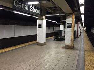
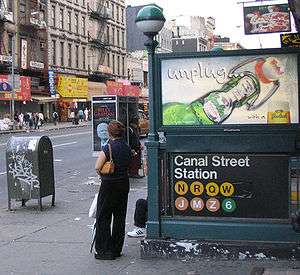 Entrance to the station platforms before the rerouting of the M train. | |||||||||||||
| Station statistics | |||||||||||||
| Address |
Canal Street between Broadway & Centre Street New York, NY 10013 | ||||||||||||
| Borough | Manhattan | ||||||||||||
| Locale | Chinatown, Little Italy, SoHo | ||||||||||||
| Coordinates | 40°43′5″N 74°0′0″W / 40.71806°N 74.00000°WCoordinates: 40°43′5″N 74°0′0″W / 40.71806°N 74.00000°W | ||||||||||||
| Division | A (IRT), B (BMT) | ||||||||||||
| Line |
BMT Broadway Line IRT Lexington Avenue Line BMT Nassau Street Line | ||||||||||||
| Services |
4 6 J N Q R W Z | ||||||||||||
| Transit connections |
| ||||||||||||
| Structure | Underground | ||||||||||||
| Levels | 2 (Manhattan Bridge platforms cross at an angle and under the other three lines) | ||||||||||||
| Other information | |||||||||||||
| Opened |
September 4, 1917 (BMT Manhattan Bridge & Nassau St Lines) January 16, 1978 (IRT)[1] | ||||||||||||
| Station code | 623[2] | ||||||||||||
| Accessible |
| ||||||||||||
| Wireless service |
| ||||||||||||
| Traffic | |||||||||||||
| Passengers (2017) |
16,285,516 (station complex)[4] | ||||||||||||
| Rank | 15 out of 425 | ||||||||||||
| |||||||||||||
| |||||||||||||
| |||||||||||||


Canal Street is a New York City Subway station complex. It is located in the Manhattan neighborhoods of Chinatown and SoHo, and is shared by the BMT Broadway Line, the IRT Lexington Avenue Line, and the BMT Nassau Street Line. It is served by the:
Station layout
| G | Street level | Exit/entrance |
| B1 Lexington Avenue Line platforms |
Side platform, doors will open on the right | |
| Northbound local | ← ← | |
| Northbound express | ← | |
| Southbound express | | |
| Southbound local | → (No service: Worth Street) → | |
| Side platform, doors will open on the right | ||
| B1 Nassau Street Line platforms |
Eastbound | No regular service |
| Island platform, not in service | ||
| Former eastbound | Trackbed | |
| Eastbound (former westbound) |
← | |
| Island platform, doors will open on the left | ||
| Westbound | | |
| B2 Broadway line platforms (via Tunnel) |
Side platform, doors will open on the right | |
| Northbound | ← ← | |
| Northbound | ← City Hall layup track → | |
| Southbound | ← City Hall layup track → | |
| Southbound | | |
| Side platform, doors will open on the right | ||
| B3 Broadway Line platforms (via Bridge) |
Side platform, doors will open on the right | |
| Northbound | ← ← | |
| Southbound | (No service: Myrtle Avenue) | |
| Side platform, doors will open on the right | ||
The complex consists of four originally separate stations joined by underground passageways. Three of the four are perpendicular to Canal Street, crossing at Broadway (Broadway Main Line), Lafayette Street (Lexington Avenue Line) and Centre Street (Nassau Street Line). The Broadway-Manhattan Bridge Line platforms are directly underneath Canal Street itself. The Bridge Line platforms serve as transfer passageways between all other lines. After leaving Canal Street, the Manhattan Bridge Line makes a hard right onto Broadway.
The complex was fully renovated between 1999 and 2004. The Broadway Main Line station was restored to its original look with new mosaics featuring Chinese characters, reflecting the station's location in Chinatown. The symbols on the red wall plaques mean "money" and "luck" and the "Canal Street" name tablet has ideographs that read "China" and "Town." During the most recent renovation in the 1990s, the original mosaics were uncovered but then either removed or covered over again. One of the original tablets has been preserved at the New York Transit Museum.
Some relative depths of the stations in the Canal Street complex are as follows:
- IRT Lexington Avenue Line, 20 feet below street
- BMT Nassau Street Line, 20 feet
- BMT Broadway Line, main branch, 40 feet
- BMT Broadway Line, Manhattan Bridge branch, 50 feet
Exits
The complex has a total of 13 staircase entrances and 2 separate elevator entrances for the Lexington Avenue Line’s platforms.[6]
| Exit location | Exit type | Number of exits | Platforms primarily served |
|---|---|---|---|
| NE corner of Broadway and Canal Street | Staircase | 1 | Broadway Main Line |
| NW corner of Broadway and Canal Street | Staircase | 2 | Broadway Main Line |
| SE corner of Broadway and Canal Street | Staircase | 2 | Broadway Main Line |
| SW corner of Broadway and Canal Street | Staircase | 2 | Broadway Main Line |
| SW corner of Centre Street and Canal Street | Staircase | 1 | Nassau Street Line |
| NE corner of Lafayette Street and Canal Street | Staircase | 1 | Broadway Bridge Line Lexington Avenue Line (northbound) |
| Elevator | 1 | Lexington Avenue Line (northbound) | |
| NW corner of Lafayette Street and Canal Street | Staircase | 1 | Broadway Bridge Line Lexington Avenue Line (southbound) |
| Elevator | 1 | Lexington Avenue Line (southbound) | |
| SE corner of Lafayette Street and Canal Street | Staircase | 2 | Broadway Bridge Line Lexington Avenue Line (northbound) |
| SW corner of Lafayette Street and Canal Street | Staircase | 1 | Broadway Bridge Line Lexington Avenue Line (southbound) |
The BMT Nassau Street Line platforms had two additional exits. One exit was accessible only from the now-abandoned eastern platform.[7] The other exit, now converted to an emergency exit and crew rooms, is accessible from the passageway to the abandoned platform from the northbound BMT Broadway Line express platform. This exit leads to the northeastern corner of Canal Street and Centre Street, and features a provision for an escalator.
IRT Lexington Avenue Line platforms
Canal Street | |||||||||||
|---|---|---|---|---|---|---|---|---|---|---|---|
|
| |||||||||||
 | |||||||||||
| Station statistics | |||||||||||
| Division | A (IRT) | ||||||||||
| Line | IRT Lexington Avenue Line | ||||||||||
| Services |
4 6 | ||||||||||
| Structure | Underground | ||||||||||
| Platforms | 2 side platforms | ||||||||||
| Tracks | 4 | ||||||||||
| Other information | |||||||||||
| Opened | October 27, 1904[8] | ||||||||||
| Station code | 410[2] | ||||||||||
| Accessible |
| ||||||||||
| Wireless service |
| ||||||||||
| Station succession | |||||||||||
| Next north |
Spring Street: 4 | ||||||||||
| Next south |
Worth Street (closed): no service Brooklyn Bridge–City Hall: 4 | ||||||||||
|
| |||||||||||
| Next |
Bleecker Street: 4 | ||||||||||
| Next |
Brooklyn Bridge–City Hall: 4 | ||||||||||
| |||||||||||
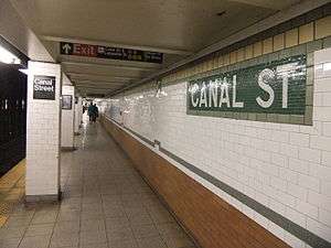
Canal Street on the IRT Lexington Avenue Line is a local station that has four tracks and two side platforms. This station, opened on October 27, 1904, as part of the original subway.[9][10] Due to platform lengthening in the 1940s and 1950s, there are two distinct sections of this station. The original portion has tile-covered I-beams with small and large mosaics and an ornamental ceiling. The newer portion has 1950s green tile at the end of the platforms. There are also IND-type "To Canal Street" signs. New lights were installed. Non-original name tables and small "C" mosaics exist.
Each platform has its own ADA-accessible elevator (outside fare control) that leads to either northern corner of Canal and Lafayette Streets. These elevators were installed when the complex was renovated in the late 1990s and early 2000s. The northbound platform's elevator leads to the northeastern corner of that intersection, while the southbound platform's elevator leads to the northwestern corner. Because the elevators are outside fare control, there is no free ADA-accessible transfer between the northbound and the southbound platforms; however, both of the IRT platforms are connected to the BMT Bridge Line platforms, and thus to each other and to the rest of the complex, via stairways.
Image gallery
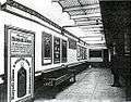 The station used to have skylights to let natural light in (1905)
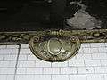 Terra-cotta plaque by Heins & LaFarge / Atlantic Terra Cotta Company, 1904
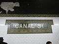 Name tablet by Heins & LaFarge / Manhattan Glass Tile Company, 1904
BMT Nassau Street Line platforms
Canal Street | |||||||||||
|---|---|---|---|---|---|---|---|---|---|---|---|
|
| |||||||||||
 | |||||||||||
| Station statistics | |||||||||||
| Division | B (BMT) | ||||||||||
| Line | BMT Nassau Street Line | ||||||||||
| Services |
J Z | ||||||||||
| Structure | Underground | ||||||||||
| Platforms | 2 island platforms (1 in regular service) | ||||||||||
| Tracks | 3 (2 in regular service) | ||||||||||
| Other information | |||||||||||
| Opened | August 4, 1913[11] | ||||||||||
| Rebuilt | 2004 | ||||||||||
| Station code | 104[2] | ||||||||||
| Accessible |
| ||||||||||
| Wireless service |
| ||||||||||
| Station succession | |||||||||||
| Next north |
Bowery: J | ||||||||||
| Next south |
Chambers Street: J | ||||||||||
| |||||||||||
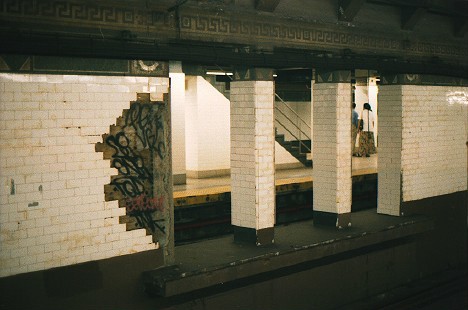
Canal Street on the BMT Nassau Street Line has three tracks and two island platforms, but only the western island platform is accessible to passengers. Formerly, Canal Street resembled a typical express station except that the inner tracks dead-ended at bumper blocks at the south end with a platform-level connection joining the southern ends of the two platforms. These stub-end tracks were last used in the early-1990s, when the station served as the southern terminus for weekend J trains, and were rendered useless when weekend J service was extended to Chambers Street in January 1994.
After a reconfiguration of the Nassau Street Line in 2004, the eastern (former "northbound") platform was abandoned and now used as a storage area and the platform-level connection was removed, allowing the former southbound express track to continue south. The westernmost (former "southbound") platform remains in operation and both tracks provide through service with southbound traffic using the former southbound "local" track and northbound traffic using the former southbound "express" track. The former northbound local track is now used only for non-revenue moves, train storage and emergencies while the northbound express stub track was removed. The former northbound "local" track merges with the former southbound "express" track (the latter of which is currently the northbound track) south of the station.[12]
This station was completed at the end of 1909 and included a bridge over the proposed Canal Street subway to cross underneath.[13] Part of the Canal Street subway was built and is part of the Manhattan Bridge Line.
Delayed by construction of the Chambers Street station, this part of the Nassau/Centre Street subway opened in August 1913.
There was an opening in the center wall about fifty feet from the end of the station[14] that had a narrow platform, which was used by train crews to cross between trains on the center tracks. In 2004, this opening was sealed with new tiling as the eastern platform was in the process of being closed.
South of this station there are unused stub tracks that formerly extended onto the Manhattan Bridge.[15]
In the renovation, the original "Canal Street" mosaics were restored, and new wall and floor tiling were installed.
BMT Broadway Line platforms
Canal Street | |||||||||||||||
|---|---|---|---|---|---|---|---|---|---|---|---|---|---|---|---|
|
| |||||||||||||||
.JPG) Bridge Line platform | |||||||||||||||
| Station statistics | |||||||||||||||
| Division | B (BMT) | ||||||||||||||
| Line | BMT Broadway Line | ||||||||||||||
| Services |
N Q R W | ||||||||||||||
| Structure | Underground | ||||||||||||||
| Levels | 2 | ||||||||||||||
| Platforms | 4 side platforms (2 on each level) | ||||||||||||||
| Tracks | 6 (4 upper level, 2 of them not for passenger service, 2 lower level) | ||||||||||||||
| Other information | |||||||||||||||
| Opened |
September 4, 1917[16] (Manhattan Bridge) January 5, 1918[17] (Broadway Line) | ||||||||||||||
| Rebuilt | 1988-2001 | ||||||||||||||
| Station code |
018 (Main Line station) 019 (Bridge station)[2] | ||||||||||||||
| Accessible |
| ||||||||||||||
| Wireless service |
| ||||||||||||||
| Former/other names | Broadway (lower level) | ||||||||||||||
| Station succession | |||||||||||||||
| Next north |
14th Street–Union Square (express): N Prince Street (local): N | ||||||||||||||
| Next south |
City Hall (via Tunnel): N Myrtle Avenue (via Bridge, closed): no regular service DeKalb Avenue (via Bridge to Brighton): Q Atlantic Avenue–Barclays Center (via Bridge to Fourth Avenue): N | ||||||||||||||
| Notes | The MTA defines this platform set as different stations in internal documents, but depicts the two levels of platform sets with one station symbol on maps. | ||||||||||||||
| |||||||||||||||
The four platforms of Canal Street, located on two separate levels, are considered the same station by the MTA on maps, but separate stations on other things, regardless are both a part of the BMT Broadway Line. One set of platforms is for trains traveling to Lower Manhattan and the Montague Street Tunnel; the other set is for trains coming from the Manhattan Bridge.
Main Line platforms (upper level)
Canal Street on the Main Line has four tracks and two side platforms. Only the outer local tracks, provide through service via the Montague Street Tunnel. The center tracks, which have never seen revenue service, begin at the unused lower level of City Hall and run north to here, dead-ending at bumper blocks about two-thirds of the way through. The center tracks can be used for layups, but this use has been completely made redundant with the nearby City Hall lower level being used as a layup yard instead.[12]
As part of the Dual Contracts, these center tracks were to have continued up Broadway, fed by traffic from Brooklyn and the Montague Street Tunnel; local service was to have terminated at the upper level of City Hall. That plan was dropped prior to the line's completion. A new plan favored local service via City Hall's upper level, reconstruction south of that station to join the local tracks with the rest of the line and express service via the Manhattan Bridge. Thus, City Hall's lower level was abandoned during construction and never placed in service. Today, just north of this station, the actual express tracks coming off the Manhattan Bridge curve north, rise up and replace the stub-end center tracks from City Hall's lower level.
In the late 1960s, New York City Transit extended the platforms for 10 car trains, and fixed the station's structure and overall appearance by replacing the original wall tiles, old signs, and incandescent lighting to 70's style wall tiles, signs and fluorescent lights. They also fixed staircases and platform edges.
In 2001, the upper level received a major overhaul before the Bridge level reopened. Among the repairs included the staircases, re-tiling for the walls, new tiling on the floors, upgrading the station's lights and the public address system, installing ADA yellow safety treads along the platform edges, new signs, and new track beds in both directions.
Bridge Line platforms (lower level)
Canal Street on the Manhattan Bridge route has two tracks and two side platforms. When it originally opened, this station was known as Broadway. Although technically located on the BMT Broadway Line, it was originally a distinct station from the main line. It is located on the lower level and oriented perpendicular to the other portions of the complex. East of the station, the tracks cross the south side of the Manhattan Bridge to enter Brooklyn. West of the station, the bridge tracks curve to the north, and ramp up between the tracks from the local upper level platform to form the express tracks.
Under the Dual Contracts, this station was meant to be part of a crosstown line under Canal Street, running from the Manhattan Bridge to the Hudson River, or towards West Street; however, prior to the opening of the Broadway Line, the BMT decided to route Manhattan Bridge traffic to the Broadway express tracks instead. After the lower level tracks curve north from the Bridge Line platforms, the tunnel continues straight ahead, past the diverge to the Broadway line. The bellmouths going westward from the west end of the station are a provision from the original plans and run for about 100 feet. Also, sitting on one of the trackways is a storage building.
The original tile on this station read simply "Broadway" and there was a small either wood or metal sign attached to the wall beneath the tile name that read "Canal Street."
With the exception of a three-month period in 1990, train service to these platforms was suspended from 1988 to 2001 during the Manhattan Bridge reconstruction project. The platforms remained open as the transfer passageways between the rest of the complex. Service between Manhattan and Brooklyn was redirected to the Main Line platforms and the Montague Street Tunnel. The three-month period was supposed to have allowed train service while work on the bridge was not being done, but on December 27, 1990, the discovery of missing steel plates and corrosion that threatened the bridge's integrity halted this service.[18][19] In 1997, a temporary art exhibit known as the Canal Street Canal by Alexander Brodsky, was installed on the northbound trackway. It consisted of a large waterproof tub filled with water, with Venetian canal boats floating inside.[20] The platforms reopened on July 22, 2001 with new tiling on the floors, upgraded lights and public address system, ADA yellow safety treads along the platform edge, new signs, and new trackbeds in both directions.
East of this station are the trackways leading from Chambers Street on the BMT Nassau Street Line. These trackways led onto the Manhattan Bridge south side tracks, while Broadway trains ran on the north side tracks of the bridge. These tracks were disconnected with the opening of the Chrystie Street Connection in 1967 and no longer have rails or any other infrastructure.
Image gallery
 Main Line platform
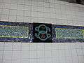 Mosaic on Bridge Line platform
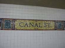 Name tablet mosaics
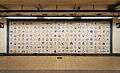 A permanent art installation titled Empress Voyage February 22, 1794 (1998) by Bing Lee. This is in a passage leading to the Bridge Line platform.
References
- ↑ "City Subways Add 3 Transfer Points". The New York Times. January 16, 1978. p. B2.
- 1 2 3 4 "Station Developers' Information". Metropolitan Transportation Authority. Retrieved June 13, 2017.
- 1 2 3 4 "NYC Subway Wireless – Active Stations". Transit Wireless Wifi. Retrieved May 18, 2016.
- ↑ "Facts and Figures: Annual Subway Ridership 2012–2017". Metropolitan Transportation Authority. July 12, 2018. Retrieved July 12, 2018.
- ↑ The first five

- ↑ "MTA Neighborhood Maps: SoHo / TriBeCa" (PDF). mta.info. Metropolitan Transportation Authority. 2015. Retrieved August 21, 2015.
- ↑ http://ltvsquad.com/2015/11/03/the-abandoned-canal-street-jmz-platform
- ↑ "Our Subway Open: 150,000 Try It". The New York Times. October 28, 1904 – via nycsubway.org.
- ↑ "New York City subway opens - Oct 27, 1904". HISTORY.com. October 27, 1904. Retrieved October 25, 2015.
- ↑ James Blaine Walker, Fifty Years of Rapid Transit, 1864-1917, published 1918, pp. 162-191
- ↑ "Passenger Killed on Loop's First Day". The New York Times. August 5, 1913. p. 2.
- 1 2 Marrero, Robert (January 1, 2017). "472 Stations, 850 Miles" (PDF). B24 Blog, via Dropbox. Retrieved April 27, 2018.
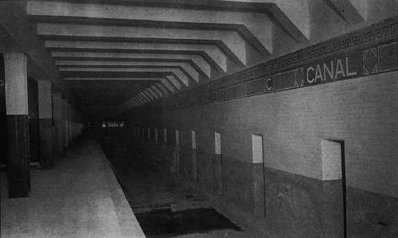
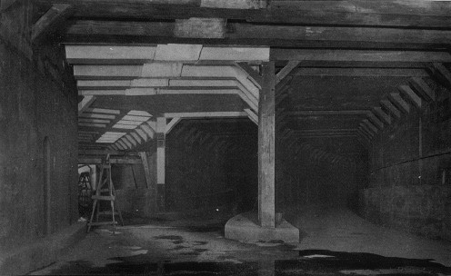
- ↑ http://www.columbia.edu/~brennan/abandoned/Canal.platf.jpg From the Abandoned Stations website: A Public Service Commission photo from 1909 shows the east platform with non-tiled steel columns. The view is looking south, showing the wall between the center tracks. The stepped structure at the base of wall near the image center is part of the bridge over the projected Canal St subway, not even begun at the time. The station looks completed, about four years before it opened. There is a rough strip near the platform edge. Track was to be installed by the operating company.
- ↑ http://www.columbia.edu/~brennan/abandoned/Canal.openoldside.jpg
- ↑ http://www.columbia.edu/~brennan/abandoned/Canal.junction.jpg From the Abandoned Stations website: "Another Public Service Commission image shows the tunnel just south of the station as it was in 1909. Here, as in the plan, the trackways curving in from the Manhattan Bridge line, right, just run into the main line on the level. At left is the track opening into the east track of Canal St station. This arrangement was rebuilt in 1913-1914, shifting the track to Canal St station a little farther back, so that when the Manhattan Bridge trains began running in 1915, they reached the east side of Chambers St without crossing the tracks of the Williamsburg Bridge trains".
- ↑ "Open First Section of Broadway Line". The New York Times. September 5, 1917.
- ↑ "Open New Subway to Times Square". The New York Times. January 6, 1918 – via nycsubway.org.
- ↑ Hevesi, Dennis (December 28, 1990). "Hazards Halt Manhattan Bridge Subway Line". The New York Times. Retrieved March 18, 2010.
- ↑ Sims, Calvin (January 8, 1991). "New York Reopened Bridge Subway Line In Spite of Warnings". The New York Times. Retrieved March 18, 2010.
- ↑ "Canal Street Canal, Alexander Brodsky (1997)". nycsubway.org. Retrieved May 18, 2010.
Further reading
- Lee Stokey. Subway Ceramics : A History and Iconography. 1994. ISBN 978-0-9635486-1-0
External links
| Wikimedia Commons has media related to Canal Street (New York City Subway). |
nycsubway.org:
- nycsubway.org – IRT East Side Line: Canal Street
- nycsubway.org – BMT Nassau St./Jamaica Line: Canal Street
- nycsubway.org – BMT Broadway Line: Canal Street
- nycsubway.org — Canal Street Canal Artwork by Alexander Brodsky (1997) (no longer in display)
- nycsubway.org — Empress Voyage 2/27/1784 Artwork by Bing Lee (1998)
- Early Rapid Transit in Brooklyn, 1878 to 1913
- Broadway Subway Now Open, Public Service Record, Volume IV, Number 9: September 1917
- Opening of the Broadway Subway, a collection of New York Times articles from 1918 regarding the then-new BMT Broadway Line
Google Maps; Street View (entrances):
Other:
- Station Reporter — Canal Street Complex
- Forgotten NY — Original 28 - NYC's First 28 Subway Stations
- MTA's Arts For Transit — Canal Street
- Abandoned Stations - Canal St east side platform (BMT Nassau/Centre Street Subway)