Baychester Avenue (IRT Dyre Avenue Line)
Baychester Avenue | |||||||||||
|---|---|---|---|---|---|---|---|---|---|---|---|
|
| |||||||||||
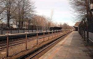 June 2006 view of the platforms of Baychester Avenue station towards the canopies from the Dyre Avenue-bound platform | |||||||||||
| Station statistics | |||||||||||
| Address |
Baychester Avenue & Tillotson Avenue Bronx, NY 10475 | ||||||||||
| Borough | The Bronx | ||||||||||
| Locale | Eastchester, Baychester | ||||||||||
| Coordinates | 40°52′43″N 73°50′18″W / 40.87864°N 73.838369°WCoordinates: 40°52′43″N 73°50′18″W / 40.87864°N 73.838369°W | ||||||||||
| Division | A (IRT, formerly NYW&B) | ||||||||||
| Line | IRT Dyre Avenue Line | ||||||||||
| Services |
5 | ||||||||||
| Structure | Embankment | ||||||||||
| Platforms | 2 side platforms | ||||||||||
| Tracks | 3 (2 in regular service) | ||||||||||
| Other information | |||||||||||
| Opened |
May 29, 1912 (NYW&B station) May 15, 1941 (re-opened as a Subway station) | ||||||||||
| Station code | 443[1] | ||||||||||
| Traffic | |||||||||||
| Passengers (2017) |
1,054,373[2] | ||||||||||
| Rank | 350 out of 425 | ||||||||||
| Station succession | |||||||||||
| Next north |
Eastchester–Dyre Avenue: 5 | ||||||||||
| Next south |
Gun Hill Road: 5 | ||||||||||
| |||||||||||
| |||||||||||
| |||||||||||


Baychester Avenue is a station on the IRT Dyre Avenue Line of the New York City Subway, located at the intersection of Baychester and Tillotson Avenues in the Bronx. It is served by the 5 train at all times.
Station layout
| P Platform level |
Side platform, doors will open on the right | |
| Northbound local | ← | |
| Northbound express | Trackbed | |
| Southbound express | No regular service | |
| Southbound local | → | |
| Side platform, doors will open on the right | ||
| M | Mezzanine | to entrances/exits, station agent, MetroCard vending machines |
| G | Street Level | Entrances/Exits |
Originally opened on May 29, 1912 as a local station of the New York, Westchester and Boston Railway, it was closed on December 12, 1937 when the NYW&B went bankrupt. In 1940, the City of New York purchased the right of way from the Bronx line southward. In 1941, a shuttle service was implemented between Dyre Avenue and East 180th Street using IRT gate cars. In 1957, a physical connection was made to the White Plains Road line and through service provided.
The station has two side platforms and three tracks with space for a fourth. It is on an embankment with a cut in the embankment for the street to run below (Baychester Avenue).
Exit
The station house is on street level below the platforms and tracks on their extreme north end. A staircase from each platform goes down to an underpass, where on the Dyre Avenue-bound side, a single exit-only turnstile leads to a set of doors to the streets. The main fare control area is on the Manhattan-bound side. It has a set of doors to the underpass, another to the platform stairs, a turnstile bank, token booth, and doors to the streets.[3]
References
- ↑ "Station Developers' Information". Metropolitan Transportation Authority. Retrieved June 13, 2017.
- ↑ "Facts and Figures: Annual Subway Ridership 2012–2017". Metropolitan Transportation Authority. July 12, 2018. Retrieved July 12, 2018.
- ↑ "MTA Neighborhood Maps: Williamsbridge & Co-op City" (PDF). mta.info. Metropolitan Transportation Authority. 2015. Retrieved 20 July 2016.
External links
| Wikimedia Commons has media related to Baychester Avenue (IRT Dyre Avenue Line). |
- nycsubway.org – IRT White Plains Road Line: Baychester Avenue
- Station Reporter — 5 Train
- The Subway Nut — Baychester Avenue Pictures
- New York, Westchester and Boston Railway - Baychester Avenue Station
- Baychester Avenue entrance from Google Maps Street View
- Platforms from Google Maps Street View
| Preceding station | New York, Westchester and Boston Railway | Following station | ||
|---|---|---|---|---|
| Former services | ||||
| Gun Hill Road | Main Line | Eastchester–Dyre Avenue | ||
Express | |
|---|---|
| |
| Dyre Ave. Line | |
|---|---|
| |