| [3] |
Name on the Register |
Image |
Date listed[4] |
Location |
City or town |
Description |
|---|
| 1 |
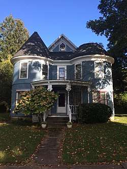
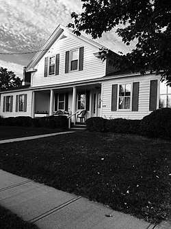
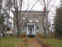
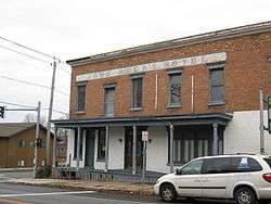
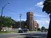
Leonard Ames Farmhouse |
|
November 14, 1991
(#91001630) |
5707 Main St.
43°27′38″N 76°14′30″W / 43.460556°N 76.241667°W / 43.460556; -76.241667 (Leonard Ames Farmhouse) |
Mexico |
|
| 2 |
Orson Ames House |
|
December 4, 2001
(#01001318) |
3339 Main St.
43°27′35″N 76°14′07″W / 43.459722°N 76.235278°W / 43.459722; -76.235278 (Orson Ames House) |
Mexico |
|
| 3 |
Arthur Tavern |
|
November 14, 1991
(#91001632) |
Junction of Clarke Rd. and NY 16
43°29′42″N 76°14′57″W / 43.495°N 76.249167°W / 43.495; -76.249167 (Arthur Tavern) |
Arthur |
|
| 4 |
Smith H. Barlow House |
|
November 15, 1988
(#88002214) |
Harwood Dr.
43°38′36″N 76°04′30″W / 43.643333°N 76.075°W / 43.643333; -76.075 (Smith H. Barlow House) |
Lacona |
|
| 5 |
Brosemer Brewery |
|
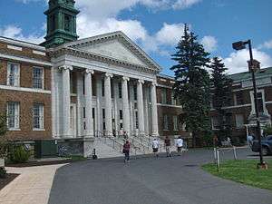
March 29, 2010
(#10000102) |
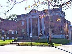
472 W. First St.
43°26′45″N 76°30′11″W / 43.445833°N 76.503056°W / 43.445833; -76.503056 (Brosemer Brewery) |
Oswego |
|
| 6 |
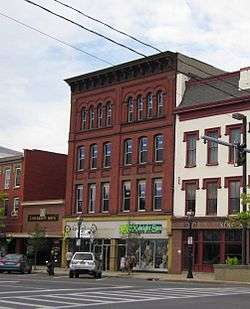
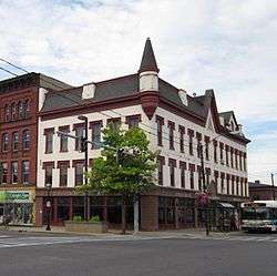
Buckhout-Jones Building |
|
December 4, 2001
(#01001322) |
5-13 W. Bridge St.
43°27′24″N 76°30′41″W / 43.456667°N 76.511389°W / 43.456667; -76.511389 (Buckhout-Jones Building) |
Oswego |
|
| 7 |
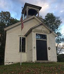
Carley's Mills Schoolhouse |
|
January 5, 2005
(#04001449) |
County Route 84
43°22′24″N 76°07′02″W / 43.373333°N 76.117222°W / 43.373333; -76.117222 (Carley's Mills Schoolhouse) |
Hastings |
|
| 8 |
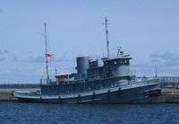
CHANCELLOR (tugboat) |
|
February 18, 2000
(#00000050) |
Oswego River
43°19′11″N 76°25′03″W / 43.319722°N 76.4175°W / 43.319722; -76.4175 (CHANCELLOR (tugboat)) |
Fulton |
|
| 9 |
Peter Chandler House |
|
November 14, 1991
(#91001626) |
5897 Main St.
43°27′35″N 76°13′45″W / 43.459722°N 76.229167°W / 43.459722; -76.229167 (Peter Chandler House) |
Mexico |
|
| 10 |
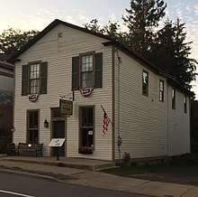
Starr Clark Tin Shop |
|
December 4, 2001
(#01001323) |
3250 Main St.
43°27′35″N 76°13′43″W / 43.459722°N 76.228611°W / 43.459722; -76.228611 (Starr Clark Tin Shop) |
Mexico |
|
| 11 |
Edwin W. and Charlotte Clarke House |
|
February 26, 2002
(#02000052) |
80 E. Mohawk St.
43°27′24″N 76°30′02″W / 43.456667°N 76.500556°W / 43.456667; -76.500556 (Edwin W. and Charlotte Clarke House) |
Oswego |
|
| 12 |
Phineas Davis Farmstead |
|
June 20, 1991
(#91000524) |
5422 North Rd.
43°27′55″N 76°13′37″W / 43.465278°N 76.226944°W / 43.465278; -76.226944 (Phineas Davis Farmstead) |
Mexico |
|
| 13 |
Derrick Boat No. 8 |
|
January 7, 2015
(#14001129) |
1 W. 1st St.
43°27′42″N 76°30′58″W / 43.4615582°N 76.5162334°W / 43.4615582; -76.5162334 (Derrick Boat No. 8) |
Oswego |
Built in 1927, it is one of the few surviving steam-powered barges to have worked on the New York State Barge Canal |
| 14 |
John B. and Lydia Edwards House |
|
December 4, 2001
(#01001316) |
144 E. Third St.
43°27′17″N 76°30′16″W / 43.454722°N 76.504444°W / 43.454722; -76.504444 (John B. and Lydia Edwards House) |
Oswego |
|
| 15 |
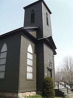
First Baptist Church |
|
November 15, 1988
(#88002218) |
Harwood Dr.
43°38′38″N 76°04′40″W / 43.643889°N 76.077778°W / 43.643889; -76.077778 (First Baptist Church) |
Sandy Creek |
|
| 16 |
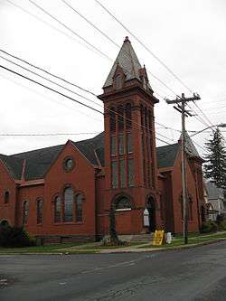
First Congregational Church and Society of Volney |
|
June 29, 2001
(#01000675) |
NY 3
43°20′18″N 76°20′19″W / 43.338333°N 76.338611°W / 43.338333; -76.338611 (First Congregational Church and Society of Volney) |
Volney |
|
| 17 |
First National Bank of Lacona |
|
November 15, 1988
(#88002219) |
Harwood Dr. and Salina St.
43°38′36″N 76°04′10″W / 43.643333°N 76.069444°W / 43.643333; -76.069444 (First National Bank of Lacona) |
Lacona |
|
| 18 |
Fort Brewerton |
|
March 7, 1973
(#73001247) |
State and Lansing Sts.
43°14′32″N 76°08′29″W / 43.242222°N 76.141389°W / 43.242222; -76.141389 (Fort Brewerton) |
Brewerton |
|
| 19 |
Fort Ontario |
|
December 18, 1970
(#70000426) |
E. 7th St. and Lake Ontario
43°27′55″N 76°30′31″W / 43.465278°N 76.508611°W / 43.465278; -76.508611 (Fort Ontario) |
Oswego |
|
| 20 |
Fowler-Loomis House |
|
November 14, 1991
(#91001628) |
6022 Main St.
43°27′32″N 76°13′16″W / 43.458889°N 76.221111°W / 43.458889; -76.221111 (Fowler-Loomis House) |
Mexico |
|
| 21 |
Franklin Square Historic District |
|
August 4, 1982
(#82003394) |
Roughly bounded by 3rd, 6th, Van Buren, and Bridge Sts.
43°27′25″N 76°30′59″W / 43.456944°N 76.516389°W / 43.456944; -76.516389 (Franklin Square Historic District) |
Oswego |
|
| 22 |
Fulton Public Library |
|
January 15, 1999
(#98001616) |
160 S. First St.
43°19′10″N 76°24′59″W / 43.319444°N 76.416389°W / 43.319444; -76.416389 (Fulton Public Library) |
Fulton |
|
| 23 |
Nathan and Clarissa Green House |
|
February 26, 2002
(#02000054) |
98 West Eighth St.
43°27′22″N 76°31′13″W / 43.456111°N 76.520278°W / 43.456111; -76.520278 (Nathan and Clarissa Green House) |
Oswego |
|
| 24 |
Hamilton Farmstead |
|
November 18, 1991
(#91001657) |
5644 Hamilton St.
43°28′30″N 76°13′52″W / 43.475°N 76.231111°W / 43.475; -76.231111 (Hamilton Farmstead) |
Mexico |
|
| 25 |
Holyoke Cottage |
|
November 15, 1988
(#88002216) |
Seber Shore Rd.
43°38′45″N 76°09′56″W / 43.645833°N 76.165556°W / 43.645833; -76.165556 (Holyoke Cottage) |
Sandy Creek |
|
| 26 |
Hunter-Oliphant Block |
|
July 21, 1995
(#95000880) |
215-219 W. First St.
43°27′20″N 76°30′39″W / 43.455556°N 76.510833°W / 43.455556; -76.510833 (Hunter-Oliphant Block) |
Oswego |
|
| 27 |
Kingsford Historic District |
|
January 22, 2014
(#13001114) |
Roughly W. Bridge, W. Mohawk, W. Oneida, W. 4th, and W. 5th Sts.
43°27′12″N 76°30′48″W / 43.453445°N 76.5131997°W / 43.453445; -76.5131997 (Kingsford Historic District) |
Oswego |
|
| 28 |
Kingsford House |
|
August 21, 1997
(#97000951) |
150 W. Third St.
43°27′16″N 76°30′47″W / 43.454444°N 76.513056°W / 43.454444; -76.513056 (Kingsford House) |
Oswego |
|
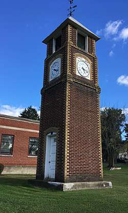
| 29 |
Lacona Clock Tower |
|
November 15, 1988
(#88002220) |
Harwood Dr.
43°38′36″N 76°04′12″W / 43.643333°N 76.07°W / 43.643333; -76.07 (Lacona Clock Tower) |
Lacona |
|
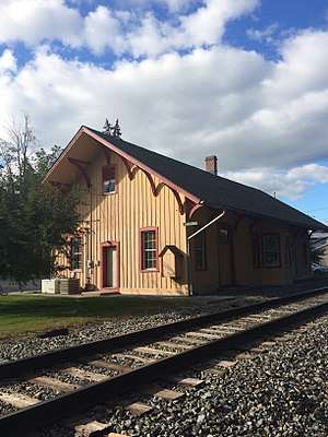
| 30 |
Lacona Railroad Station and Depot |
|
January 24, 2002
(#01001499) |
11 Park Ave.
43°38′34″N 76°04′13″W / 43.642778°N 76.070278°W / 43.642778; -76.070278 (Lacona Railroad Station and Depot) |
Lacona |
|
| 31 |
Hamilton and Rhoda Littlefield House |
|
February 26, 2002
(#02000051) |
44 E. Oneida St.
43°27′25″N 76°30′16″W / 43.456944°N 76.504444°W / 43.456944; -76.504444 (Hamilton and Rhoda Littlefield House) |
Oswego |
|
| 32 |
Market House |
|
June 20, 1974
(#74001292) |
Water St.
43°27′26″N 76°30′39″W / 43.457222°N 76.510833°W / 43.457222; -76.510833 (Market House) |
Oswego |
|
| 33 |
John and Harriet McKenzie House |
|
December 4, 2001
(#01001314) |
96 W. Eighth St.
43°27′23″N 76°31′13″W / 43.456389°N 76.520278°W / 43.456389; -76.520278 (John and Harriet McKenzie House) |
Oswego |
|
| 34 |
Methodist Church |
|
November 15, 1988
(#88002213) |
Harwood Dr.
43°38′37″N 76°04′58″W / 43.643611°N 76.082778°W / 43.643611; -76.082778 (Methodist Church) |
Sandy Creek |
|
| 35 |
Mexico Academy and Central School |
|
November 14, 1991
(#91001633) |
3338 Main St.
43°27′37″N 76°14′06″W / 43.460278°N 76.235°W / 43.460278; -76.235 (Mexico Academy and Central School) |
Mexico |
|
| 36 |
Mexico Octagon Barn |
|
June 20, 1991
(#91000527) |
5276 Ames St.
43°27′08″N 76°14′31″W / 43.452222°N 76.241944°W / 43.452222; -76.241944 (Mexico Octagon Barn) |
Mexico |
|
| 37 |
Mexico Railroad Depot |
|
June 20, 1991
(#91000523) |
5530 Scenic Ave.
43°28′09″N 76°13′57″W / 43.469167°N 76.2325°W / 43.469167; -76.2325 (Mexico Railroad Depot) |
Mexico |
|
| 38 |
The Mexico Stone Store |
|
March 23, 2010
(#10000103) |
3201 Main St.
43°27′35″N 76°13′33″W / 43.459708°N 76.225836°W / 43.459708; -76.225836 (The Mexico Stone Store) |
Mexico |
|
| 39 |
Mexico Village Historic District |
|
June 20, 1991
(#91000528) |
Main, Jefferson, Church, and Spring Sts.
43°27′29″N 76°13′46″W / 43.458056°N 76.229444°W / 43.458056; -76.229444 (Mexico Village Historic District) |
Mexico |
|
| 40 |
Montcalm Park Historic District |
|
May 25, 2001
(#01000555) |
Roughly Montcalm St., W. 6th St., W. Schuyler St., and Bronson St.
43°27′35″N 76°31′11″W / 43.459722°N 76.519722°W / 43.459722; -76.519722 (Montcalm Park Historic District) |
Oswego |
|
| 41 |
Mount Adnah Cemetery |
|
February 2, 2001
(#01000046) |
706 East Broadway
43°19′14″N 76°24′12″W / 43.320556°N 76.403333°W / 43.320556; -76.403333 (Mount Adnah Cemetery) |
Fulton |
|
| 42 |
NASH (harbor tug) |
|
December 4, 1991
(#91002059) |
H. Lee White Marine Museum, West 1st Street Pier
43°27′52″N 76°30′58″W / 43.464536°N 76.51605°W / 43.464536; -76.51605 (NASH (harbor tug)) |
Oswego |
Last surviving Army ship which served at D-Day |
| 43 |
New York State Barge Canal |
|
October 15, 2014
(#14000860) |
Linear across county
43°19′26″N 76°25′08″W / 43.324005°N 76.418931°W / 43.324005; -76.418931 (New York State Barge Canal) |
Cleveland, Constantia, Fulton, Granby, Hastings, Minetta, Phoenix, Schroeppel, Scriba, Volney, West Phoenix |
Successor to Erie Canal approved by state voters in early 20th century to compete with railroads. |
| 44 |
Northrup-Gilbert House |
|
February 4, 2000
(#00000049) |
25 Church St.
43°13′43″N 76°17′49″W / 43.228611°N 76.296944°W / 43.228611; -76.296944 (Northrup-Gilbert House) |
Phoenix |
|
| 45 |
Oak Street School |
|
July 3, 2003
(#03000243) |
205 Oak St.
43°18′43″N 76°25′07″W / 43.311944°N 76.418611°W / 43.311944; -76.418611 (Oak Street School) |
Fulton |
|
| 46 |
Oswego Armory |
|
May 19, 1988
(#88000610) |
265 W. First St.
43°27′14″N 76°30′35″W / 43.453889°N 76.509722°W / 43.453889; -76.509722 (Oswego Armory) |
Oswego |
|
| 47 |
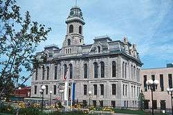
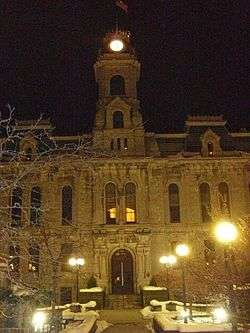
Oswego City Hall |
|
February 20, 1973
(#73001248) |
W. Oneida St.
43°27′19″N 76°30′42″W / 43.455278°N 76.511667°W / 43.455278; -76.511667 (Oswego City Hall) |
Oswego |
|
| 48 |
Oswego City Library |
|
September 22, 1971
(#71000554) |
120 E. 2nd St.
43°27′24″N 76°30′25″W / 43.456667°N 76.506944°W / 43.456667; -76.506944 (Oswego City Library) |
Oswego |
|
| 49 |
Oswego County Courthouse |
|
December 7, 2000
(#00001418) |
East Bridge St.
43°27′26″N 76°30′22″W / 43.457222°N 76.506111°W / 43.457222; -76.506111 (Oswego County Courthouse) |
Oswego |
|
| 50 |
Oswego and Syracuse Railroad Freight House |
|
November 9, 2017
(#100001806) |
20-24 W. Utica St.
43°27′09″N 76°30′36″W / 43.45255°N 76.50987°W / 43.45255; -76.50987 (Oswego and Syracuse Railroad Freight House) |
Oswego |
1848 stone structure is second oldest surviving rail-related building in the state |
| 51 |
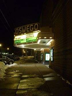
Oswego Theater |
|
September 19, 1988
(#88001590) |
138 W. Second St.
43°27′21″N 76°30′46″W / 43.455833°N 76.512778°W / 43.455833; -76.512778 (Oswego Theater) |
Oswego |
|
| 52 |
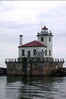
Oswego West Pierhead Lighthouse |
|
December 1, 2000
(#00001468) |
Lake Ontario, 0.5 miles (0.80 km) north of the Oswego River
43°28′24″N 76°31′02″W / 43.473333°N 76.517222°W / 43.473333; -76.517222 (Oswego West Pierhead Lighthouse) |
Oswego |
|
| 53 |
Oswego Yacht Club |
|
March 23, 2010
(#10000105) |
41 Lake St.
43°27′44″N 76°31′16″W / 43.462203°N 76.5212°W / 43.462203; -76.5212 (Oswego Yacht Club) |
Oswego |
|
| 54 |
Daniel and Miriam Pease House |
|
February 26, 2002
(#02000053) |
361 Cemetery Rd.
43°25′33″N 76°33′37″W / 43.425833°N 76.560278°W / 43.425833; -76.560278 (Daniel and Miriam Pease House) |
Oswego |
|
| 55 |
Newton M. Pitt House |
|
November 15, 1988
(#88002209) |
8114 Harwood Dr.
43°38′37″N 76°05′00″W / 43.643611°N 76.083333°W / 43.643611; -76.083333 (Newton M. Pitt House) |
Sandy Creek |
|
| 56 |
Pleasant Lawn Cemetery |
|
October 5, 2005
(#05001125) |
NY 69A
43°24′08″N 76°08′31″W / 43.402222°N 76.141944°W / 43.402222; -76.141944 (Pleasant Lawn Cemetery) |
Parish |
|
| 57 |
Pontiac Hotel |
|
July 21, 1983
(#83001758) |
W. 1st St.
43°26′14″N 76°30′37″W / 43.437222°N 76.510278°W / 43.437222; -76.510278 (Pontiac Hotel) |
Oswego |
|
| 58 |
John Wells Pratt House |
|
December 10, 1999
(#99001490) |
177 S. 1st St.
43°19′06″N 76°24′53″W / 43.318333°N 76.414722°W / 43.318333; -76.414722 (John Wells Pratt House) |
Fulton |
|
| 59 |
Pulaski Village Historic District |
|
September 8, 1983
(#83004525) |
Jefferson, Broad, Bridge, Hubbel and Lake Sts.
43°34′01″N 76°07′43″W / 43.566944°N 76.128611°W / 43.566944; -76.128611 (Pulaski Village Historic District) |
Pulaski |
|
| 60 |
Red Mill Farm |
|
November 14, 1991
(#91001629) |
7177 Red Mill Rd.
43°25′28″N 76°08′45″W / 43.424444°N 76.145833°W / 43.424444; -76.145833 (Red Mill Farm) |
Colosse |
|
| 61 |
Richardson-Bates House |
|
September 5, 1975
(#75001220) |
135 E. 3rd St.
43°27′21″N 76°30′16″W / 43.455833°N 76.504444°W / 43.455833; -76.504444 (Richardson-Bates House) |
Oswego |
|
| 62 |
Riverside Cemetery |
|
August 19, 1993
(#93000854) |
E. River Rd. south of the junction with NY 57
43°25′24″N 76°28′34″W / 43.423333°N 76.476111°W / 43.423333; -76.476111 (Riverside Cemetery) |
Oswego |
|
| 63 |
Samuel Sadler House |
|
November 15, 1988
(#88002212) |
N. Main St.
43°38′55″N 76°05′07″W / 43.648611°N 76.085278°W / 43.648611; -76.085278 (Samuel Sadler House) |
Sandy Creek |
|
| 64 |
St. James' Church |
|
August 30, 1996
(#96000958) |
North St., junction with Bridge St.
43°14′02″N 75°52′56″W / 43.233889°N 75.882222°W / 43.233889; -75.882222 (St. James' Church) |
Cleveland |
|
| 65 |
St. John's Episcopal Church |
|
May 27, 1993
(#93000442) |
670 Main St.
43°13′53″N 76°18′04″W / 43.231389°N 76.301111°W / 43.231389; -76.301111 (St. John's Episcopal Church) |
Phoenix |
|
| 66 |
Charles M. Salisbury House |
|
November 15, 1988
(#88002217) |
9089 Church St.
43°38′29″N 76°04′06″W / 43.641389°N 76.068333°W / 43.641389; -76.068333 (Charles M. Salisbury House) |
Lacona |
|
| 67 |
Sandy Creek Historic District |
|
November 15, 1988
(#88002208) |
Junction of Lake Rd. and US 11
43°38′39″N 76°05′10″W / 43.644167°N 76.086111°W / 43.644167; -76.086111 (Sandy Creek Historic District) |
Sandy Creek |
|
| 68 |
Schroeppel House |
|
September 9, 1982
(#82003395) |
Morgan Rd.
43°12′20″N 76°13′08″W / 43.205556°N 76.218889°W / 43.205556; -76.218889 (Schroeppel House) |
Schroeppel |
|
| 69 |
Selkirk Lighthouse |
|
March 30, 1979
(#79001618) |
West of Pulaski on Lake Rd.
43°34′28″N 76°12′07″W / 43.574444°N 76.201944°W / 43.574444; -76.201944 (Selkirk Lighthouse) |
Pulaski |
|
| 70 |
Sheldon Hall |
|
May 13, 1980
(#80002741) |
Washington Blvd.
43°27′16″N 76°32′12″W / 43.454444°N 76.536667°W / 43.454444; -76.536667 (Sheldon Hall) |
Oswego |
|
| 71 |
Matthew Shoecraft House |
|
November 15, 1988
(#88002210) |
Ridge Rd. at Smartville Rd.
43°38′33″N 76°03′45″W / 43.6425°N 76.0625°W / 43.6425; -76.0625 (Matthew Shoecraft House) |
Lacona |
|
| 72 |
Timothy Skinner House |
|
June 20, 1991
(#91000526) |
5355 Scenic Ave.
43°27′40″N 76°13′57″W / 43.461111°N 76.2325°W / 43.461111; -76.2325 (Timothy Skinner House) |
Mexico |
|
| 73 |
Slack Farmstead |
|
November 14, 1991
(#91001627) |
5174 Row Rd.
43°27′07″N 76°11′07″W / 43.451944°N 76.185278°W / 43.451944; -76.185278 (Slack Farmstead) |
Mexico |
|
| 74 |
George B. Sloan Estate |
|
August 11, 1988
(#88001237) |
107 W. Van Buren St.
43°27′35″N 76°31′17″W / 43.459722°N 76.521389°W / 43.459722; -76.521389 (George B. Sloan Estate) |
Oswego |
|
| 75 |
Fred Smart House |
|
November 15, 1988
(#88002215) |
Salina St.
43°38′35″N 76°04′08″W / 43.643056°N 76.068889°W / 43.643056; -76.068889 (Fred Smart House) |
Lacona |
|
| 76 |
Standard Yarn Company Building |
|
May 15, 2008
(#08000410) |
317 W. 1st St.
43°27′08″N 76°30′30″W / 43.452222°N 76.508333°W / 43.452222; -76.508333 (Standard Yarn Company Building) |
Oswego |
|
| 77 |
State Street Methodist Episcopal Church |
|
February 20, 2013
(#13000030) |
357 State St.
43°19′06″N 76°24′35″W / 43.318371°N 76.409744°W / 43.318371; -76.409744 (State Street Methodist Episcopal Church) |
Fulton |
1894 Romanesque Revival church represents city's prosperity at that time |
| 78 |
Stillman Farmstead |
|
June 20, 1991
(#91000525) |
NY 104 between Co. Rt. 58 and US 11
43°27′33″N 76°09′47″W / 43.459167°N 76.163056°W / 43.459167; -76.163056 (Stillman Farmstead) |
Mexico |
|
| 79 |
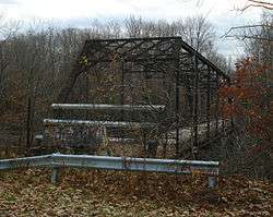
Stillwater Bridge |
|
November 7, 1997
(#97001385) |
Dam Rd. over Salmon R.
43°32′41″N 75°55′20″W / 43.544722°N 75.922222°W / 43.544722; -75.922222 (Stillwater Bridge) |
Stillwater |
|
| 80 |
Sweet Memorial Building |
|
April 26, 1990
(#90000695) |
821 Main St.
43°13′45″N 76°17′58″W / 43.229167°N 76.299444°W / 43.229167; -76.299444 (Sweet Memorial Building) |
Phoenix |
|
| 81 |
Tanner Block |
|
December 25, 2009
(#09001269) |
175-177 W. First St.
43°27′25″N 76°30′41″W / 43.456922°N 76.511444°W / 43.456922; -76.511444 (Tanner Block) |
Oswego |
|
| 82 |
Thayer Farmstead |
|
November 14, 1991
(#91001631) |
5933 Church St.
43°27′11″N 76°13′35″W / 43.453056°N 76.226389°W / 43.453056; -76.226389 (Thayer Farmstead) |
Mexico |
|
| 83 |
Trinity Church |
|
October 29, 1982
(#82001231) |
NY 49
43°14′52″N 76°00′29″W / 43.247778°N 76.008056°W / 43.247778; -76.008056 (Trinity Church) |
Constantia |
|
| 84 |
Newman Tuttle House |
|
November 15, 1988
(#88002211) |
Harwood Dr. at Ridge Rd.
43°38′37″N 76°03′51″W / 43.643611°N 76.064167°W / 43.643611; -76.064167 (Newman Tuttle House) |
Lacona |
|
| 85 |
U.S. Customhouse |
|
November 21, 1976
(#76001262) |
W. Oneida St. between 1st and 2nd Sts.
43°27′17″N 76°30′40″W / 43.454722°N 76.511111°W / 43.454722; -76.511111 (U.S. Customhouse) |
Oswego |
|
| 86 |
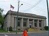
US Post Office-Fulton |
|
May 11, 1989
(#88002519) |
214 S. First St.
43°19′03″N 76°24′53″W / 43.3175°N 76.414722°W / 43.3175; -76.414722 (US Post Office-Fulton) |
Fulton |
|
| 87 |
David Van Buren House |
|
June 9, 1988
(#88000726) |
Van Buren Dr., W end at the Oswego River
43°21′37″N 76°25′45″W / 43.360278°N 76.429167°W / 43.360278; -76.429167 (David Van Buren House) |
Fulton |
|
| 88 |
John Van Buren Tavern |
|
November 3, 1988
(#88002377) |
NY 57 and Van Buren Dr.
43°21′35″N 76°25′45″W / 43.359722°N 76.429167°W / 43.359722; -76.429167 (John Van Buren Tavern) |
Fulton |
|
| 89 |
Volkert Van Buren House |
|
October 7, 1988
(#88001707) |
NY 57 and Distin Rd.
43°22′01″N 76°25′34″W / 43.366944°N 76.426111°W / 43.366944; -76.426111 (Volkert Van Buren House) |
Fulton |
|
| 90 |
Walton and Willett Stone Store |
|
May 24, 1976
(#76001263) |
1 Seneca St.
43°27′35″N 76°30′43″W / 43.459722°N 76.511944°W / 43.459722; -76.511944 (Walton and Willett Stone Store) |
Oswego |
|
| 91 |
Washington Square Historic District |
|
December 25, 2009
(#09001270) |
E. 4th St., E. Oneida St., E. 3rd St.
43°27′26″N 76°30′16″W / 43.457117°N 76.504383°W / 43.457117; -76.504383 (Washington Square Historic District) |
Oswego |
|
| 92 |
Asa and Caroline Wing House |
|
December 4, 2001
(#01001317) |
3392 NY 69
43°25′15″N 76°09′52″W / 43.420833°N 76.164444°W / 43.420833; -76.164444 (Asa and Caroline Wing House) |
Mexico |
|
| 93 |
Woodruff Block |
|
April 20, 1995
(#95000473) |
17 W. Cayuga St.
43°27′28″N 76°30′46″W / 43.457778°N 76.512778°W / 43.457778; -76.512778 (Woodruff Block) |
Oswego |
|
%2C_8_Montcalm_St..jpg)
.jpg)
%2C_Oswego%2C_New_York.jpg)
.jpg)