| [3] |
Name on the Register |
Image |
Date listed[4] |
Location |
City or town |
Description |
|---|
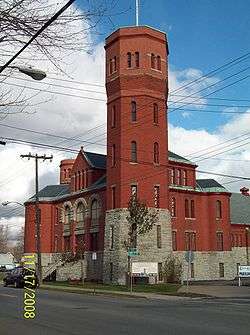
| 1 |
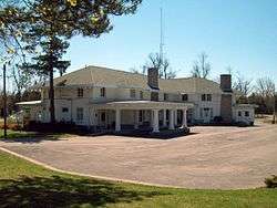
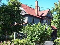
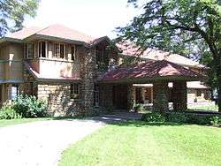
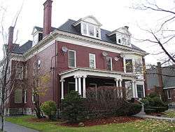
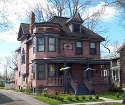
Automobile Club of Buffalo |
|
June 20, 2012
(#12000341) |
10405 Main Street
42°58′47″N 78°35′56″W / 42.979857°N 78.599013°W / 42.979857; -78.599013 (Automobile Club of Buffalo) |
Clarence |
|
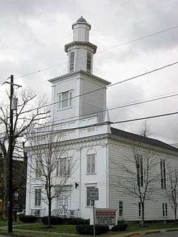
| 2 |
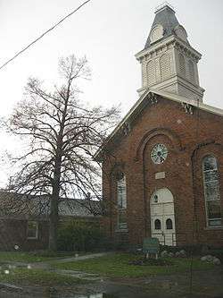
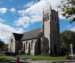
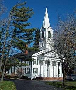
Baker Memorial Methodist Episcopal Church |
|
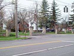
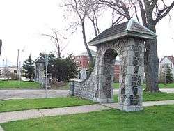
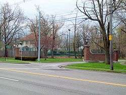
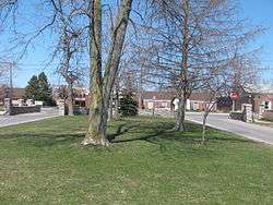
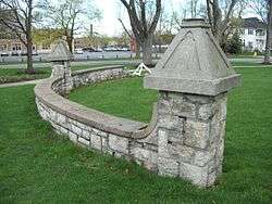
November 28, 2012
(#12000981) |
345 Main St.
42°46′05″N 78°37′20″W / 42.768106°N 78.62223°W / 42.768106; -78.62223 (Baker Memorial Methodist Episcopal Church) |
East Aurora |
|
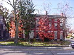
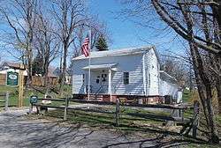
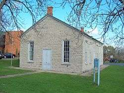
| 3 |
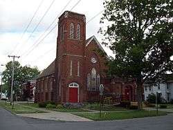
The Baptist Church of Springville |
|
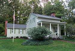
December 5, 2008
(#08001140) |
37 N. Buffalo St.
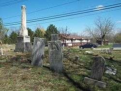
42°30′35″N 78°40′02″W / 42.509761°N 78.667089°W / 42.509761; -78.667089 (The Baptist Church of Springville) |
Springville |
|
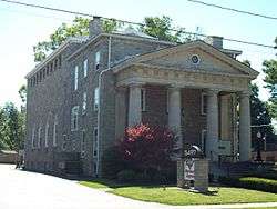
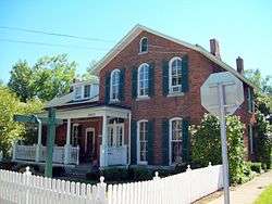
| 4 |
Broadway Historic District |
|
February 17, 2015
(#15000005) |
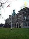
5423–5658 Broadway
42°54′00″N 78°40′13″W / 42.9000608°N 78.670387°W / 42.9000608; -78.670387 (Broadway Historic District) |
Lancaster |
Architecture from many late 19th and early 20th centuries on this stretch of street |
| 5 |
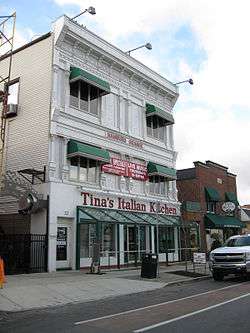
Bruce-Briggs Brick Block |
|
November 30, 1999
(#99001409) |
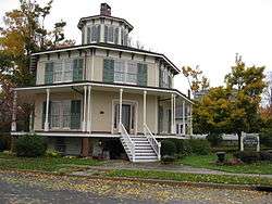
5481-5483-5485 Broadway
42°53′57″N 78°40′02″W / 42.899167°N 78.667222°W / 42.899167; -78.667222 (Bruce-Briggs Brick Block) |
Lancaster |
part of the Lancaster, New York Multiple Property Submission (MPS) |
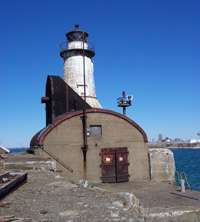
| 6 |
Buffalo Harbor South Entrance Light |
|
November 16, 2007
(#07001191) |
Stony Pt. end of Buffalo Harbor S breakwater
42°50′00″N 78°52′03″W / 42.833333°N 78.8675°W / 42.833333; -78.8675 (Buffalo Harbor South Entrance Light) |
Lackawanna |
part of the Light Stations of the United States MPS |
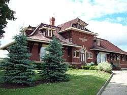
| 7 |
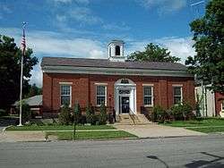
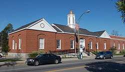
Buffalo, Rochester and Pittsburgh Railroad Station |
|
November 7, 1991
(#91001669) |
227 W. Main St.
42°30′32″N 78°40′32″W / 42.509006°N 78.675481°W / 42.509006; -78.675481 (Buffalo, Rochester and Pittsburgh Railroad Station) |
Springville |
|
| 8 |
Buffalo, Rochester and Pittsburgh Railroad Station |
|
August 30, 2007
(#07000871) |
395 S. Lincoln Ave.
42°45′31″N 78°44′51″W / 42.758611°N 78.7475°W / 42.758611; -78.7475 (Buffalo, Rochester and Pittsburgh Railroad Station) |
Orchard Park |
|
| 9 |
Chapel of Our Lady Help of Christians |
|
December 14, 1978
(#78001851) |
4125 Union Rd.
42°55′34″N 78°45′14″W / 42.926111°N 78.753889°W / 42.926111; -78.753889 (Chapel of Our Lady Help of Christians) |
Cheektowaga |
|
| 10 |
Central Avenue Historic District |
|
November 12, 2014
(#14000911) |
16-50 Central Ave., 1-5 W. Main & 40 Clark Sts.
42°54′03″N 78°40′22″W / 42.9009623°N 78.6728664°W / 42.9009623; -78.6728664 (Central Avenue Historic District) |
Lancaster |
Historic core of village |
| 11 |
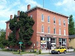
Citizens National Bank |
|
April 5, 1996
(#96000295) |
5 W. Main St.
42°30′32″N 78°40′04″W / 42.508889°N 78.667778°W / 42.508889; -78.667778 (Citizens National Bank) |
Springville |
|
| 12 |
Clark-Lester House |
|
November 30, 1999
(#99001408) |
5454 Broadway
42°54′00″N 78°40′06″W / 42.9°N 78.668333°W / 42.9; -78.668333 (Clark-Lester House) |
Lancaster |
part of the Lancaster, New York MPS |
| 13 |
Community of True Inspiration Residence |
|
June 25, 2013
(#13000447) |
919 Mill Rd.
42°50′00″N 78°45′01″W / 42.833245°N 78.750306°W / 42.833245; -78.750306 (Community of True Inspiration Residence) |
West Seneca |
|
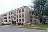
| 14 |
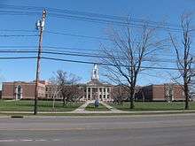
Depew High School |
|
August 23, 2016
(#16000593) |
591 Terrace Blvd.
42°54′12″N 78°41′39″W / 42.9033085°N 78.694088°W / 42.9033085; -78.694088 (Depew High School) |
Depew |
Early example of standardized school building, constructed in 1914 and expanded to present size in 1927. After school use ended in 2008, was sold and is being converted into senior housing. |
| 15 |
DePew Lodge No. 823, Free and Accepted Masons |
|
November 30, 1999
(#99001410) |
5497 Broadway
42°53′56″N 78°40′00″W / 42.898889°N 78.666667°W / 42.898889; -78.666667 (DePew Lodge No. 823, Free and Accepted Masons) |
Lancaster |
part of the Lancaster, New York MPS |
| 16 |
East Hill Historic District |
|
August 5, 2015
(#15000512) |
98-367 E. Main St
42°30′30″N 78°39′30″W / 42.5084613°N 78.6583569°W / 42.5084613; -78.6583569 (East Hill Historic District) |
Springville |
Original residential district in village |
| 17 |
East Main-Mechanic Streets Historic District |
|
January 24, 2002
(#01001506) |
Approximately at the junction of East Main and Mechanic Sts.
42°30′30″N 78°39′59″W / 42.508333°N 78.666389°W / 42.508333; -78.666389 (East Main-Mechanic Streets Historic District) |
Springville |
|
| 18 |
Eaton Site |
|
April 3, 1979
(#79001581) |
Address Restricted
|
West Seneca |
|
| 19 |
Eberhardt Mansion |
|
September 8, 1983
(#83001671) |
2746 Delaware Ave.
42°57′32″N 78°52′12″W / 42.958889°N 78.87°W / 42.958889; -78.87 (Eberhardt Mansion) |
Kenmore |
|
| 20 |
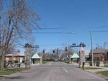
Entranceway at Main Street at Darwin Drive |
|
July 23, 2009
(#09000554) |
Main St. at Darwin Dr.
42°57′42″N 78°46′42″W / 42.961661°N 78.778344°W / 42.961661; -78.778344 (Entranceway at Main Street at Darwin Drive) |
Amherst |
part of the Suburban Development of Buffalo, New York MPS |
| 21 |
Entranceway at Main Street at High Park Boulevard |
|
July 23, 2009
(#09000555) |
Main St. at High Park Blvd.
42°57′52″N 78°48′01″W / 42.964486°N 78.800369°W / 42.964486; -78.800369 (Entranceway at Main Street at High Park Boulevard) |
Amherst |
part of the Suburban Development of Buffalo, New York MPS |
| 22 |
Entranceway at Main Street at Lafayette Boulevard |
|
July 23, 2009
(#09000556) |
Main St. at Lafayette Blvd.
42°57′37″N 78°45′39″W / 42.960192°N 78.760939°W / 42.960192; -78.760939 (Entranceway at Main Street at Lafayette Boulevard) |
Amherst |
part of the Suburban Development of Buffalo, New York MPS |
| 23 |
Entranceway at Main Street at LeBrun Road |
|
July 23, 2009
(#09000557) |
Main St. at LeBrun Rd.
42°57′52″N 78°47′52″W / 42.964325°N 78.797653°W / 42.964325; -78.797653 (Entranceway at Main Street at LeBrun Road) |
Amherst |
part of the Suburban Development of Buffalo, New York MPS |
| 24 |
Entranceway at Main Street at Roycroft Boulevard |
|
December 7, 2005
(#05001378) |
Main St., junction with Roycroft Blvd.
42°57′44″N 78°46′48″W / 42.962208°N 78.779986°W / 42.962208; -78.779986 (Entranceway at Main Street at Roycroft Boulevard) |
Amherst |
part of the Suburban Development of Buffalo, New York MPS |
| 25 |
Entranceway at Main Street at Westfield Road and Ivyhurst Road |
|
July 23, 2009
(#09000558) |
Main St. at Westfield Rd. and Ivyhurst Rd.
42°57′51″N 78°48′06″W / 42.964214°N 78.801731°W / 42.964214; -78.801731 (Entranceway at Main Street at Westfield Road and Ivyhurst Road) |
Amherst |
part of the Suburban Development of Buffalo, New York MPS |
| 26 |
Entranceways at Main Street at Lamarck Drive and Smallwood Drive |
|
December 7, 2005
(#05001379) |
Main St. at Lamarck Dr. and Smallwood Dr.
42°57′45″N 78°46′27″W / 42.9625°N 78.774167°W / 42.9625; -78.774167 (Entranceways at Main Street at Lamarck Drive and Smallwood Drive) |
Amherst |
part of the Suburban Development of Buffalo, New York MPS |
| 27 |
J. Eshelman and Company Store |
|
May 6, 1982
(#82003356) |
6000 Goodrich Rd.
43°00′38″N 78°38′15″W / 43.010556°N 78.6375°W / 43.010556; -78.6375 (J. Eshelman and Company Store) |
Clarence Center |
|
| 28 |
Fiddlers Green Historic District |
|
September 14, 2018
(#100002922) |
65-85 Franklin & 23-37 N Buffalo Sts.
42°30′32″N 78°40′17″W / 42.5088°N 78.6715°W / 42.5088; -78.6715 (Fiddlers Green Historic District) |
Springville |
Core of present-day village, where buildings date to earliest settlement in 1818 |
| 29 |
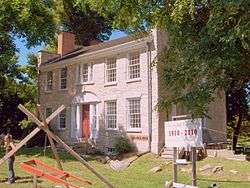
Millard Fillmore House |
|
May 30, 1974
(#74001235) |
24 Shearer Ave.
42°46′06″N 78°37′21″W / 42.768333°N 78.6225°W / 42.768333; -78.6225 (Millard Fillmore House) |
East Aurora |
|
| 30 |
First Church of Evans Complex |
|
April 12, 2006
(#06000257) |
7431 Erie Rd.
42°41′00″N 79°00′48″W / 42.683333°N 79.013333°W / 42.683333; -79.013333 (First Church of Evans Complex) |
Derby |
|
| 31 |
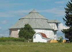
Gamel Hexadecagon Barn |
|
September 29, 1984
(#84002386) |
Shirley Rd.
42°34′39″N 78°55′39″W / 42.5775°N 78.9275°W / 42.5775; -78.9275 (Gamel Hexadecagon Barn) |
North Collins |
part of the Central Plan Dairy Barns of New York Thematic Resource (TR) |
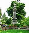
| 32 |
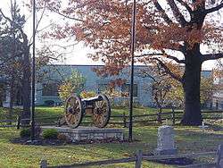
Garrison Cemetery |
|
October 10, 2002
(#02001113) |
Aero Dr.
42°56′49″N 78°43′50″W / 42.946944°N 78.730556°W / 42.946944; -78.730556 (Garrison Cemetery) |
Cheektowaga |
|
| 33 |
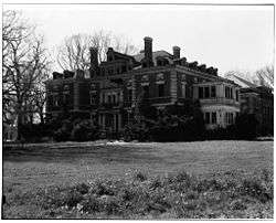
Graycliff |
|
October 1, 1998
(#98001222) |
6472-6482 Lakeshore Rd.
42°42′44″N 78°58′20″W / 42.712222°N 78.972222°W / 42.712222; -78.972222 (Graycliff) |
Derby |
Designed by Frank Lloyd Wright as the summer estate for Isabelle and Darwin Martin (1926-31,) Graycliff is also a New York State Landmark |
| 34 |
Hamburg Downtown Historic District |
|
December 4, 2012
(#12000997) |
11–235 Main Street
42°42′58″N 78°50′04″W / 42.716214°N 78.834373°W / 42.716214; -78.834373 (Hamburg Downtown Historic District) |
Hamburg |
Intact downtown core of suburban village |
| 35 |
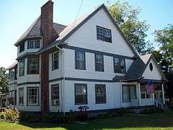
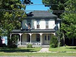
Warren Hull House |
|
May 11, 1992
(#92000456) |
5976 Genesee St.
42°56′44″N 78°37′23″W / 42.945556°N 78.623056°W / 42.945556; -78.623056 (Warren Hull House) |
Lancaster |
|
| 36 |
Johnson-Jolls Complex |
|
May 6, 1980
(#80002611) |
S-4287 S. Buffalo St.
42°45′28″N 78°44′39″W / 42.757778°N 78.744167°W / 42.757778; -78.744167 (Johnson-Jolls Complex) |
Orchard Park |
|
| 37 |
Kibler High School |
|
January 15, 1999
(#98001612) |
284 Main St.
43°00′42″N 78°52′53″W / 43.011667°N 78.881389°W / 43.011667; -78.881389 (Kibler High School) |
Tonawanda |
|
| 38 |
Kleis Site |
|
April 20, 1979
(#79001580) |
Address Restricted
|
Hamburg |
|
| 39 |
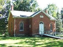
Lancaster District School No. 6 |
|
November 18, 2008
(#08001076) |
3703 Bowen Rd.
42°52′53″N 78°38′24″W / 42.881389°N 78.64°W / 42.881389; -78.64 (Lancaster District School No. 6) |
Lancaster |
|
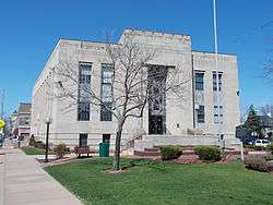
| 40 |
Lancaster Municipal Building |
|
November 30, 1999
(#99001420) |
5423 Broadway
42°54′00″N 78°40′14″W / 42.9°N 78.670556°W / 42.9; -78.670556 (Lancaster Municipal Building) |
Lancaster |
part of the Lancaster, New York MPS |
| 41 |
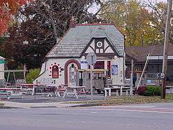
Liebler-Rohl Gasoline Station |
|
November 30, 1999
(#99001411) |
5500 Broadway
42°53′58″N 78°39′59″W / 42.899444°N 78.666389°W / 42.899444; -78.666389 (Liebler-Rohl Gasoline Station) |
Lancaster |
part of the Lancaster, New York MPS |
| 42 |
Miller-Mackey House |
|
November 30, 1999
(#99001422) |
5440 Broadway
42°54′01″N 78°40′09″W / 42.900278°N 78.669167°W / 42.900278; -78.669167 (Miller-Mackey House) |
Lancaster |
part of the Lancaster, New York MPS |
| 43 |
Newton–Hopper Village Site |
|
April 3, 2012
(#12000176) |
Address Restricted
|
Elma |
|
| 44 |
New York State Barge Canal |
|
October 15, 2014
(#14000860) |
Linear across county
43°01′13″N 78°52′30″W / 43.020363°N 78.875025°W / 43.020363; -78.875025 (New York State Barge Canal) |
Amherst, Tonawanda |
Successor to Erie Canal approved by state voters in early 20th century to compete with railroads. |
| 45 |
Dr. John J. Nowak House |
|
November 30, 1999
(#99001414) |
5539 Broadway
42°53′51″N 78°39′49″W / 42.8975°N 78.663611°W / 42.8975; -78.663611 (Dr. John J. Nowak House) |
Lancaster |
part of the Lancaster, New York MPS |
| 46 |
Old Sardinia Town Hall |
|
December 23, 2008
(#08001231) |
12070 Savage Road
42°32′58″N 78°30′29″W / 42.549508°N 78.508081°W / 42.549508; -78.508081 (Old Sardinia Town Hall) |
Sardinia |
|
| 47 |
Pioneer Cemetery |
|
January 4, 2012
(#11000997) |
West side of N. Main St. between Gold St. & Beach Rd.
42°39′11″N 79°02′07″W / 42.653139°N 79.035386°W / 42.653139; -79.035386 (Pioneer Cemetery) |
Evans Center |
|
| 48 |
Former Reformed Mennonite Church |
|
July 3, 2003
(#03000596) |
5178 Main St.
42°57′39″N 78°45′35″W / 42.960833°N 78.759722°W / 42.960833; -78.759722 (Former Reformed Mennonite Church) |
Williamsville |
|
| 49 |
Rich-Twinn Octagon House |
|
February 10, 1995
(#95000050) |
145 Main St.
43°01′19″N 78°29′44″W / 43.021944°N 78.495556°W / 43.021944; -78.495556 (Rich-Twinn Octagon House) |
Akron |
|
| 50 |
John Richardson House |
|
November 30, 1999
(#99001419) |
5653 Broadway
42°53′48″N 78°39′29″W / 42.896667°N 78.658056°W / 42.896667; -78.658056 (John Richardson House) |
Lancaster |
part of the Lancaster, New York MPS |
| 51 |
Rider-Hopkins Farm and Olmsted Camp |
|
January 15, 1999
(#98001613) |
12820 Benton Rd.
42°31′52″N 78°30′43″W / 42.531111°N 78.511944°W / 42.531111; -78.511944 (Rider-Hopkins Farm and Olmsted Camp) |
Sardinia |
|
| 52 |
Roycroft Campus |
|
November 8, 1974
(#74001236) |
Main and W. Grove Sts.
42°46′01″N 78°37′09″W / 42.766944°N 78.619167°W / 42.766944; -78.619167 (Roycroft Campus) |
East Aurora |
|
| 53 |
George and Gladys Scheidemantel House |
|
August 5, 1993
(#93000778) |
363 Oakwood Ave.
42°45′56″N 78°37′18″W / 42.765556°N 78.621667°W / 42.765556; -78.621667 (George and Gladys Scheidemantel House) |
East Aurora |
|
| 54 |
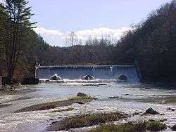
Scobey Power Plant and Dam |
|
September 20, 1996
(#96000296) |
Junction of Scobey Hill Rd. and Cattaraugus Cr.
42°28′42″N 78°41′56″W / 42.478333°N 78.698889°W / 42.478333; -78.698889 (Scobey Power Plant and Dam) |
Springville |
|
| 55 |
John P. Sommers House |
|
January 4, 2012
(#11000998) |
33 Lake Ave.
42°53′53″N 78°40′06″W / 42.898183°N 78.668439°W / 42.898183; -78.668439 (John P. Sommers House) |
Lancaster |
part of the Lancaster, New York MPS |
| 56 |
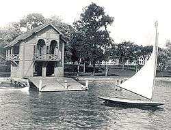
Spaulding-Sidway Boathouse |
|
May 20, 1998
(#98000552) |
2296 W. Oakfield Rd.
42°58′16″N 78°58′38″W / 42.971111°N 78.977222°W / 42.971111; -78.977222 (Spaulding-Sidway Boathouse) |
Grand Island |
|
| 57 |
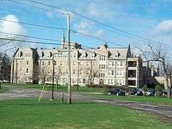
St. Mary of the Angels Motherhouse Complex |
|
October 24, 2002
(#02001046) |
400 Mill St.
42°58′19″N 78°44′52″W / 42.971944°N 78.747778°W / 42.971944; -78.747778 (St. Mary of the Angels Motherhouse Complex) |
Williamsville |
|
| 58 |
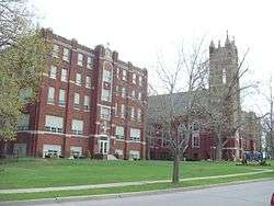
Thomas Indian School |
|
January 25, 1973
(#73001188) |
NY 438 on Cattaraugus Reservation
42°32′22″N 78°59′48″W / 42.539444°N 78.996667°W / 42.539444; -78.996667 (Thomas Indian School) |
Irving |
|
| 59 |
Tonawanda (25th Separate Company) Armory |
|
January 28, 1994
(#93001539) |
79 Delaware Ave.
43°02′39″N 78°52′22″W / 43.044167°N 78.872778°W / 43.044167; -78.872778 (Tonawanda (25th Separate Company) Armory) |
Tonawanda |
Castellated armory building constructed in 1896; part of the Army National Guard Armories in New York State MPS |
| 60 |
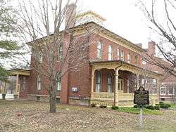
Tonawanda Municipal Building |
|
June 12, 2013
(#13000370) |
2919 Delaware Ave.
42°57′49″N 78°52′11″W / 42.963619°N 78.8698°W / 42.963619; -78.8698 (Tonawanda Municipal Building) |
Kenmore |
Art Deco municipal building constructed in 1930s. |
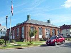
| 61 |
US Post Office-Akron |
|
November 17, 1988
(#88002449) |
118 Main St.
43°01′13″N 78°29′53″W / 43.020321°N 78.497956°W / 43.020321; -78.497956 (US Post Office-Akron) |
Akron |
part of the US Post Offices in New York State, 1858-1943, TR |
| 62 |
US Post Office-Angola |
|
November 17, 1988
(#88002452) |
80 N. Main St.
42°38′23″N 79°01′42″W / 42.639722°N 79.028333°W / 42.639722; -79.028333 (US Post Office-Angola) |
Angola |
part of the US Post Offices in New York State, 1858-1943, TR |
| 63 |
US Post Office-Depew |
|
November 17, 1988
(#88002481) |
165 Warsaw St.[5]
42°54′14″N 78°41′25″W / 42.903889°N 78.690278°W / 42.903889; -78.690278 (US Post Office-Depew) |
Depew |
part of the US Post Offices in New York State, 1858-1943, TR |
| 64 |
US Post Office-Lancaster |
|
May 11, 1989
(#88002340) |
5406 Broadway St.[6]
42°54′01″N 78°40′17″W / 42.900278°N 78.671389°W / 42.900278; -78.671389 (US Post Office-Lancaster) |
Lancaster |
part of the US Post Offices in New York State, 1858-1943, TR |
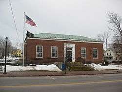
| 65 |
US Post Office-Springville |
|
May 11, 1989
(#88002433) |
75 Franklin St.
42°30′34″N 78°39′58″W / 42.509444°N 78.666111°W / 42.509444; -78.666111 (US Post Office-Springville) |
Springville |
part of the US Post Offices in New York State, 1858-1943, TR |
| 66 |
US Post Office-Tonawanda |
|
May 11, 1989
(#88002437) |
96 Seymour St.
43°01′01″N 78°52′47″W / 43.016944°N 78.879722°W / 43.016944; -78.879722 (US Post Office-Tonawanda) |
Tonawanda |
part of the US Post Offices in New York State, 1858-1943, TR |
| 67 |
Herman B. VanPeyma House |
|
November 30, 1999
(#99001417) |
5565 Broadway
42°53′51″N 78°39′42″W / 42.8975°N 78.661667°W / 42.8975; -78.661667 (Herman B. VanPeyma House) |
Lancaster |
part of the Lancaster, New York MPS |
| 68 |
Villa Maria Motherhouse Complex |
|
July 14, 2006
(#06000571) |
600 Doat St.
42°54′37″N 78°47′55″W / 42.910278°N 78.798611°W / 42.910278; -78.798611 (Villa Maria Motherhouse Complex) |
Cheektowaga |
|
| 69 |
West End Historic District |
|
March 12, 2018
(#SG100002187) |
90-171 W Main, 17 Park & 186-244 Franklin Sts. & 24-110 N Central Ave.
42°30′32″N 78°40′17″W / 42.508784°N 78.671490°W / 42.508784; -78.671490 (West End Historic District) |
Springville |
Intact enclave of religious buildings and houses at west side of village developed in late 19th and early 20th centuries following 1878 Springville and Sardinia Railroad completion |
| 70 |
Williamsville Christian Church |
|
May 22, 2002
(#02000546) |
5658 Main St.
42°57′48″N 78°44′33″W / 42.963333°N 78.7425°W / 42.963333; -78.7425 (Williamsville Christian Church) |
Williamsville |
|
| 71 |
Williamsville Junior and Senior High School |
|
May 12, 2008
(#08000407) |
5950 Main St.
42°57′53″N 78°43′59″W / 42.964783°N 78.732997°W / 42.964783; -78.732997 (Williamsville Junior and Senior High School) |
Williamsville |
|
| 72 |
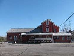
Williamsville Water Mill Complex |
|
September 22, 1983
(#83001675) |
56 and 60 Spring St.
42°57′48″N 78°43′56″W / 42.963333°N 78.732222°W / 42.963333; -78.732222 (Williamsville Water Mill Complex) |
Williamsville |
|
| 73 |
Zuidema-Idsardi House |
|
November 30, 1999
(#99001416) |
5556 Broadway
42°53′54″N 78°39′45″W / 42.898333°N 78.6625°W / 42.898333; -78.6625 (Zuidema-Idsardi House) |
Lancaster |
part of the Lancaster, New York MPS |
.jpg)
.JPG)
.JPG)