| [3] |
Name on the Register |
Image |
Date listed[4] |
Location |
City or town |
Description |
|---|
| 1 |
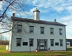
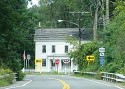
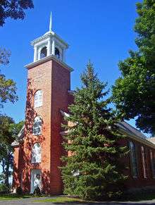
Ancram Hamlet Historic District |
|
January 13, 2017
(#100000477) |
Cty Rte. 7, NY Rte 82, Cty Rte 8
42°03′01″N 73°38′11″W / 42.0504°N 73.6363°W / 42.0504; -73.6363 (Ancram Hamlet Historic District) |
Ancram |
Core of country town that grew up around state's first ironworks |
| 2 |
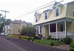
Austerlitz Historic District |
|
May 25, 2018
(#100002507) |
NY 22, Harvey Mtn., E Hill, W Hill & Old Rds
42°18′24″N 73°28′22″W / 42.3067°N 73.4729°W / 42.3067; -73.4729 (Austerlitz Historic District) |
Austerlitz |
"Old Austerlitz" is a well-preserved group of buildings reflecting influx of settlers from New England between the end of the 18th century and 1870. |
| 3 |
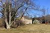
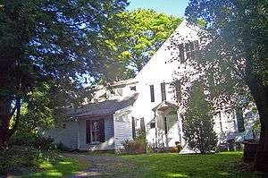
Daniel and Clarissa Baldwin House |
|
June 27, 2012
(#12000366) |
1018 Dugway Rd.
42°19′02″N 73°32′11″W / 42.317114°N 73.536497°W / 42.317114; -73.536497 (Daniel and Clarissa Baldwin House) |
Spencertown |
|
| 4 |
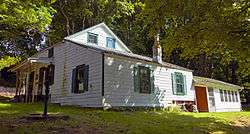
Barringer–Overbaugh–Lasher House |
|
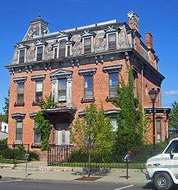
December 2, 2014
(#14000980) |
321 Main St.
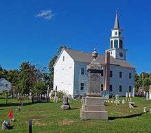
42°07′57″N 73°52′48″W / 42.1326092°N 73.8798846°W / 42.1326092; -73.8798846 (Barringer–Overbaugh–Lasher House) |
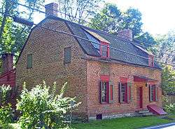
Germantown |
Recently renovated house of early working-class settlers built around 1800; main section is one of the few remaining examples in the area of New World Dutch timber construction methods |
| 5 |
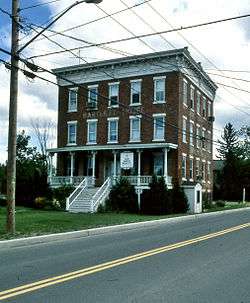
Bartlett House |
|
May 8, 2012
(#12000268) |
2258 NY 66
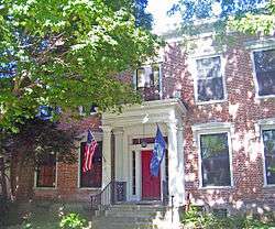
42°19′37″N 73°37′06″W / 42.326975°N 73.618442°W / 42.326975; -73.618442 (Bartlett House) |
Ghent |
Railroad hotel for the New York and Harlem and Hudson and Boston Railroads |
| 6 |
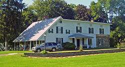
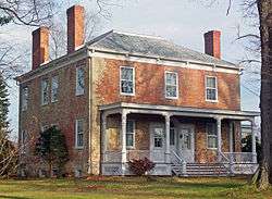
Blinn-Pulver Farmhouse |
|
February 12, 2003
(#03000025) |
219 Hudson Ave.
42°20′57″N 73°36′14″W / 42.349167°N 73.603889°W / 42.349167; -73.603889 (Blinn-Pulver Farmhouse) |
Chatham |
|
| 7 |
Bouwerie |
|
October 7, 1983
(#83003918) |
Buckwheat Bridge Rd.
42°05′22″N 73°48′46″W / 42.089444°N 73.812778°W / 42.089444; -73.812778 (Bouwerie) |
Clermont |
|
| 8 |
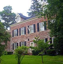
Thomas Brodhead House |
|
October 7, 1983
(#83003919) |
US 9
42°05′24″N 73°49′21″W / 42.09°N 73.8225°W / 42.09; -73.8225 (Thomas Brodhead House) |
Clermont |
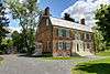
Intact 1795 Federal style brick house |
| 9 |
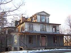
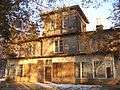
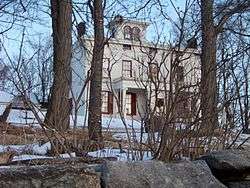
Dr. Oliver Bronson House and Estate |
|
July 31, 2003
(#03001035) |
West of US 9
42°14′35″N 73°47′08″W / 42.243031°N 73.785464°W / 42.243031; -73.785464 (Dr. Oliver Bronson House and Estate) |
Hudson |
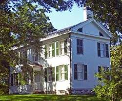
First house built in Hudson River Bracketed style. Now on prison grounds. |
| 10 |
Dr. Oliver Bronson House and Stables |
|
February 20, 1973
(#73001173) |
South of Hudson off US 9
42°14′28″N 73°47′06″W / 42.241225°N 73.784892°W / 42.241225; -73.784892 (Dr. Oliver Bronson House and Stables) |
Hudson |
|
| 11 |
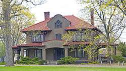
Burroughs–Foland Farm |
|
May 12, 2014
(#14000205) |
2323 US 9
42°06′46″N 73°48′33″W / 42.112799°N 73.809239°W / 42.112799; -73.809239 (Burroughs–Foland Farm) |
Livingston |
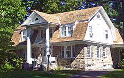
Farm's 1903 main house is a rare rural Mission Revival style house in New York |
| 12 |
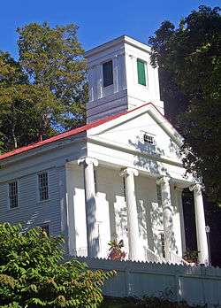
Church of Our Saviour |
|
February 14, 1997
(#97000067) |
NY 22, near the junction with US 20, Hamlet of Lebanon Springs
42°28′27″N 73°22′50″W / 42.474167°N 73.380556°W / 42.474167; -73.380556 (Church of Our Saviour) |
New Lebanon |
|
| 13 |
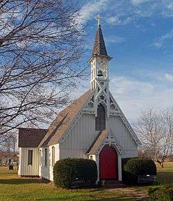
Church of St. John in the Wilderness |
|
August 10, 1995
(#95000963) |
Junction of NY 344 and Valley View Rd.
42°07′14″N 73°31′09″W / 42.120556°N 73.519167°W / 42.120556; -73.519167 (Church of St. John in the Wilderness) |
Copake Falls |
|
| 14 |
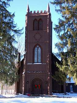
Church of St. John the Evangelist |
|
April 13, 1972
(#72000827) |
Chittenden Rd.
42°18′30″N 73°44′51″W / 42.308333°N 73.7475°W / 42.308333; -73.7475 (Church of St. John the Evangelist) |
Stockport |
|
| 15 |
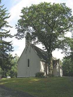
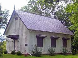
Clarkson Chapel |
|
October 7, 1983
(#83003920) |
NY 9G
42°05′37″N 73°53′48″W / 42.093611°N 73.896667°W / 42.093611; -73.896667 (Clarkson Chapel) |
Clermont |
1860 Carpenter Gothic chapel built by Livingston family |
| 16 |
Claverack Free Library |
|
January 7, 1998
(#97001624) |
629 NY 23B
42°13′22″N 73°44′09″W / 42.222778°N 73.735833°W / 42.222778; -73.735833 (Claverack Free Library) |
Claverack |
1932 Colonial Revival library |
| 17 |
Clermont |
|
February 18, 1971
(#71000535) |
Clermont State Park
42°04′59″N 73°55′40″W / 42.083056°N 73.927778°W / 42.083056; -73.927778 (Clermont) |
Germantown |
Seat of Livingston family lands in region |
| 18 |
Clermont Academy |
|
October 7, 1983
(#83003931) |
US 9
42°05′12″N 73°49′34″W / 42.086667°N 73.826111°W / 42.086667; -73.826111 (Clermont Academy) |
Clermont |
Wooden Federal style building erected in 1834 is oldest school building in state, although no longer in use. |
| 19 |
Clermont Civic Historic District |
|
July 3, 2003
(#03000604) |
1795 US 9
42°05′14″N 73°49′34″W / 42.087222°N 73.826111°W / 42.087222; -73.826111 (Clermont Civic Historic District) |
Clermont |
19th-century buildings from early years of town |
| 20 |
Clermont Estates Historic District |
|
May 7, 1979
(#79001572) |
South of Germantown
42°06′07″N 73°54′53″W / 42.101944°N 73.914722°W / 42.101944; -73.914722 (Clermont Estates Historic District) |
Germantown |
Subsumed into Hudson River Historic District along with Sixteen Mile District |
| 21 |
Columbia Turnpike-East Tollhouse |
|
June 23, 2016
(#16000411) |
NY 23
42°11′04″N 73°29′26″W / 42.184440°N 73.490565°W / 42.184440; -73.490565 (Columbia Turnpike-East Tollhouse) |
Hillsdale |
1830s wooden house was part of major transportation route into Massachusetts for most of 19th century |
| 22 |
Columbia Turnpike-West Tollhouse |
|
December 28, 2000
(#00001571) |
NY 23B
42°14′21″N 73°45′37″W / 42.239167°N 73.760278°W / 42.239167; -73.760278 (Columbia Turnpike-West Tollhouse) |
Greenport |
|
| 23 |
Charles H. Coons Farm |
|
July 22, 2015
(#15000475) |
516 Church Ave.
42°06′43″N 73°53′06″W / 42.1118108°N 73.884866°W / 42.1118108; -73.884866 (Charles H. Coons Farm) |
Germantown |
Complex built by successful 19th-century fruit farm includes Picturesque farmhouse and New World Dutch barn |
| 24 |
Coons House |
|
October 7, 1983
(#83003932) |
NY 9G
42°05′33″N 73°53′41″W / 42.0925°N 73.894722°W / 42.0925; -73.894722 (Coons House) |
Clermont |
1850 home is only temple-style Greek Revival building in Clermont. |
| 25 |
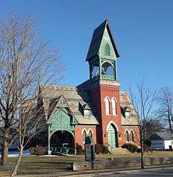
Copake Falls Methodist Episcopal Church |
|
July 11, 2012
(#12000405) |
Miles Rd.
42°07′10″N 73°31′27″W / 42.119578°N 73.524265°W / 42.119578; -73.524265 (Copake Falls Methodist Episcopal Church) |
Copake Falls |
Now the Roeliff Jansen Historical Society |
| 26 |
Copake Grange Hall |
|
July 3, 2001
(#01000291) |
Empire Rd., south of Old Route 22
42°06′09″N 73°33′01″W / 42.1025°N 73.550278°W / 42.1025; -73.550278 (Copake Grange Hall) |
Copake |
|
| 27 |
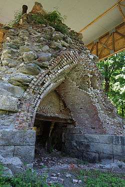
Copake Iron Works Historic District |
|
April 18, 2007
(#07000334) |
Taconic State Park
42°07′09″N 73°30′50″W / 42.119286°N 73.513794°W / 42.119286; -73.513794 (Copake Iron Works Historic District) |
Copake Falls |
|
| 28 |
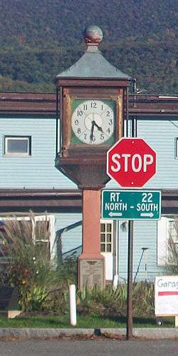
Copake Memorial Clock |
|
February 3, 2012
(#11001089) |
Main St.
42°06′13″N 73°32′58″W / 42.103481°N 73.549569°W / 42.103481; -73.549569 (Copake Memorial Clock) |
Copake |
1944 World War II memorial has become symbol of this small town |
| 29 |
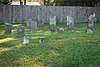
Copake United Methodist Church and Copake Cemetery |
|
June 27, 2007
(#07000624) |
Church St.
42°06′14″N 73°33′05″W / 42.103889°N 73.551389°W / 42.103889; -73.551389 (Copake United Methodist Church and Copake Cemetery) |
Copake |
|
| 30 |
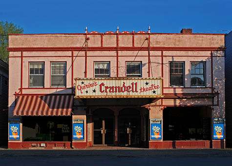
Crandell Theatre |
|
September 18, 2017
(#100001623) |
46-48 Main St.
42°21′48″N 73°35′44″W / 42.363238°N 73.595549°W / 42.363238; -73.595549 (Crandell Theatre) |
Chatham |
|
| 31 |
Crow Hill |
|
May 9, 1997
(#97000412) |
Junction of NY 9H and Co. Rt. 21, northwest corner
42°23′22″N 73°41′24″W / 42.389444°N 73.69°W / 42.389444; -73.69 (Crow Hill) |
Kinderhook |
|
| 32 |
Dick House |
|
July 29, 2009
(#09000573) |
641 Co. Rte. 8
42°07′36″N 73°51′17″W / 42.126783°N 73.854778°W / 42.126783; -73.854778 (Dick House) |
Germantown |
|
| 33 |
Donnelly House |
|
August 2, 2000
(#00000880) |
Cty. Rd. 5
42°26′49″N 73°26′00″W / 42.446944°N 73.433333°W / 42.446944; -73.433333 (Donnelly House) |
New Lebanon |
|
| 34 |
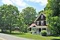
Dr. Joseph P. Dorr House |
|
October 31, 2007
(#07001123) |
2745 NY 23
42°10′58″N 73°31′05″W / 42.182778°N 73.518056°W / 42.182778; -73.518056 (Dr. Joseph P. Dorr House) |
Hillsdale |
|
| 35 |
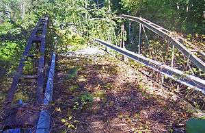
Double-Span Whipple Bowstring Truss Bridge |
|
April 17, 1980
(#80002598) |
Van Wyck Lane
42°12′54″N 73°43′45″W / 42.215°N 73.729167°W / 42.215; -73.729167 (Double-Span Whipple Bowstring Truss Bridge) |
Claverack |
Shaw Bridge, currently closed to all traffic, is only bridge of this type with two spans in the country |
| 36 |
Henry A. and Evanlina Dubois House |
|
December 6, 2004
(#04001340) |
105 Ten Broeck Ln.
42°14′23″N 73°46′53″W / 42.239722°N 73.781389°W / 42.239722; -73.781389 (Henry A. and Evanlina Dubois House) |
Hudson |
|
| 37 |
Emmanuel Lutheran Church of Harlemville and Cemetery |
|
January 24, 2002
(#01001505) |
Cty. 21 and Pheasant Ln., Harlemville Rd. at Ten Broeck Rd.
42°15′54″N 73°35′03″W / 42.265°N 73.584167°W / 42.265; -73.584167 (Emmanuel Lutheran Church of Harlemville and Cemetery) |
Harlemville |
|
| 38 |
Cornelius H. Evans House |
|
November 1, 1974
(#74001226) |
414-416 Warren St.
42°15′04″N 73°47′19″W / 42.251111°N 73.788611°W / 42.251111; -73.788611 (Cornelius H. Evans House) |
Hudson |
Intact 1861 house of local brewer and two-term city mayor |
| 39 |
George Felpel House |
|
August 21, 1997
(#97000927) |
60 NY 9H
42°13′41″N 73°43′54″W / 42.228056°N 73.731667°W / 42.228056; -73.731667 (George Felpel House) |
Claverack |
1922 Colonial Revival house built with remaining stones from Claverack College |
| 40 |
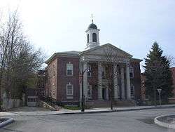
First Columbia County Courthouse |
|
January 7, 1998
(#97001623) |
549 NY 23B
42°13′23″N 73°44′35″W / 42.223056°N 73.743056°W / 42.223056; -73.743056 (First Columbia County Courthouse) |
Claverack |
1786 courthouse, now apartments, was original court of Harry Croswell sedition trial |
| 41 |
First Presbyterian Church |
|
September 7, 1979
(#79001574) |
Church St.
42°24′55″N 73°40′36″W / 42.415278°N 73.676667°W / 42.415278; -73.676667 (First Presbyterian Church) |
Valatie |
|
| 42 |
Forth House |
|
June 11, 2010
(#10000331) |
2751 US-9
42°09′30″N 73°46′14″W / 42.158361°N 73.770547°W / 42.158361; -73.770547 (Forth House) |
Livingston |
|
| 43 |
Front Street-Parade Hill-Lower Warren Street Historic District |
|
March 5, 1970
(#70000420) |
Front and Warren Sts.
42°15′19″N 73°47′42″W / 42.255278°N 73.795°W / 42.255278; -73.795 (Front Street-Parade Hill-Lower Warren Street Historic District) |
Hudson |
Superseded by later Hudson Historic District after some properties demolished |
| 44 |
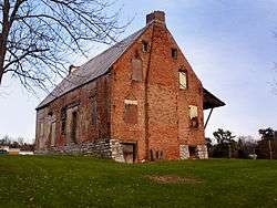
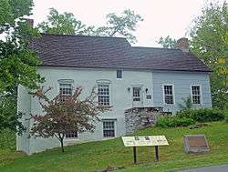
German Reformed Sanctity Church Parsonage |
|
January 30, 1976
(#76001209) |
Maple Ave.
42°08′30″N 73°52′59″W / 42.141667°N 73.883056°W / 42.141667; -73.883056 (German Reformed Sanctity Church Parsonage) |
Germantown |
Parsonage remaining from early days of Palatine German settlement in the region built in two sections in mid-18th century. Oldest building in town.[5] |
| 45 |
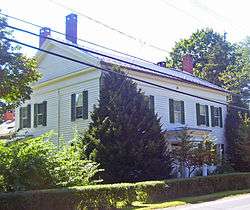
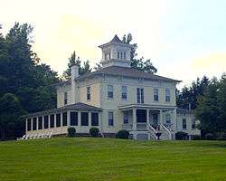
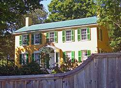
Elisha Gilbert House |
|
September 7, 1984
(#84002098) |
US 20
42°28′09″N 73°25′46″W / 42.469167°N 73.429444°W / 42.469167; -73.429444 (Elisha Gilbert House) |
New Lebanon |
|
| 46 |
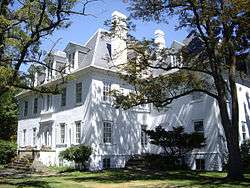
Hickory Hill |
|
October 7, 1983
(#83003934) |
Buckwheat Bridge Rd.
42°05′39″N 73°49′06″W / 42.094167°N 73.818333°W / 42.094167; -73.818333 (Hickory Hill) |
Clermont |
|
| 47 |
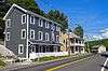
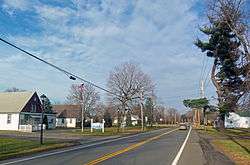
Hillsdale Hamlet Historic District |
|
January 27, 2010
(#09001283) |
NY-22 and NY-23, Anthony, Cold Water and Maple Sts., Old Town and Pill Hill Rds.
42°10′48″N 73°31′18″W / 42.179881°N 73.521636°W / 42.179881; -73.521636 (Hillsdale Hamlet Historic District) |
Hillsdale |
Historic core of small country town |
| 48 |
Stephen Hogeboom House |
|
August 21, 1997
(#97000944) |
562 NY 23B
42°13′21″N 73°44′33″W / 42.2225°N 73.7425°W / 42.2225; -73.7425 (Stephen Hogeboom House) |
Claverack |
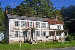
Intact late 18th-century house at original center of community later renovated in Greek Revival style |
| 49 |
House at New Forge |
|
December 14, 1987
(#87002143) |
128 New Forge Rd.
42°06′23″N 73°40′32″W / 42.106389°N 73.675556°W / 42.106389; -73.675556 (House at New Forge) |
New Forge |
|
| 50 |
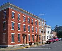
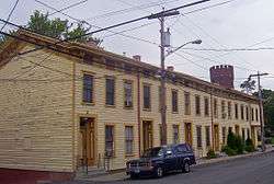
Houses at 37-47 North Fifth St. |
|
November 15, 2003
(#03001142) |
37-47 N. Fifth St.
42°15′02″N 73°47′09″W / 42.250556°N 73.785833°W / 42.250556; -73.785833 (Houses at 37-47 North Fifth St.) |
Hudson |
Intact frame Italianate worker houses from the 1870s. Used today by substance-abuse rehabilitation program. |
| 51 |
Hudson Almshouse |
|
September 19, 2008
(#08000921) |
400 State St., at the head of 4th St.
42°15′09″N 73°47′13″W / 42.252552°N 73.786844°W / 42.252552; -73.786844 (Hudson Almshouse) |
Hudson |
|
| 52 |
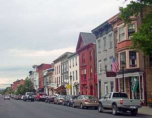
Hudson Historic District |
|
October 21, 1985
(#85003363) |
Roughly bounded by Warren and State Sts., Eighth and Seventh Sts., E. Allen and Allen St., and Penn Central RR
42°15′00″N 73°47′18″W / 42.25°N 73.788333°W / 42.25; -73.788333 (Hudson Historic District) |
Hudson |
City's downtown developed along grid pattern devised in 1785; over 700 contributing properties from late 18th to early 20th centuries. Warren Street is the most intact 19th-century commercial street in the state. |
| 53 |
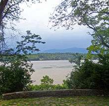
Hudson River Heritage Historic District |
|
December 14, 1990
(#90002219) |
East side of the Hudson River between Germantown and Staatsburg
42°00′39″N 73°55′19″W / 42.0109°N 73.9219°W / 42.0109; -73.9219 (Hudson River Heritage Historic District) |
Germantown |
35 square miles (91 km2) along east bank of river, shared with Dutchess County, retaining architecture and land use from semi-feudal colonial era. Largest historic district on U.S. mainland. |
| 54 |
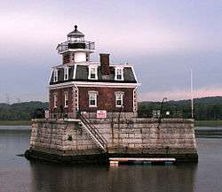
Hudson/Athens Lighthouse |
|
May 29, 1979
(#79003796) |
South of Middle Ground Flats in Hudson River
42°15′06″N 73°48′32″W / 42.251667°N 73.808889°W / 42.251667; -73.808889 (Hudson/Athens Lighthouse) |
Hudson |
1873 Second Empire lighthouse on caisson is model for Stepping Stones Light off Long Island |
| 55 |
Dr. Abram Jordan House |
|
September 9, 1999
(#99001135) |
137 NY 23
42°13′29″N 73°43′27″W / 42.224722°N 73.724167°W / 42.224722; -73.724167 (Dr. Abram Jordan House) |
Claverack |
Intact 1822 Greek Revival house |
| 56 |
Kinderhook Village District |
|
July 24, 1974
(#74001227) |
Both sides of US 9
42°23′29″N 73°42′02″W / 42.391389°N 73.700556°W / 42.391389; -73.700556 (Kinderhook Village District) |
Kinderhook |
Intact collection of 18th- and early 19th-century buildings in Martin Van Buren's hometown. |
| 57 |
Knollcroft |
|
August 14, 1985
(#85002287) |
CR 9
42°23′32″N 73°31′51″W / 42.392222°N 73.530833°W / 42.392222; -73.530833 (Knollcroft) |
New Concord |
|
| 58 |
Lace House |
|
February 21, 1985
(#85000336) |
NY 22 and Miller Rd.
42°22′36″N 73°25′45″W / 42.376667°N 73.429167°W / 42.376667; -73.429167 (Lace House) |
Canaan |
1806 Federal-style house preserved intact |
| 59 |
Lebanon Springs Union Free School |
|
November 21, 1991
(#91001727) |
NY 22 east of the junction with Cemetery Rd.
42°28′26″N 73°22′58″W / 42.473889°N 73.382778°W / 42.473889; -73.382778 (Lebanon Springs Union Free School) |
New Lebanon |
|
| 60 |
Linlithgo Reformed Church of Livingston |
|
February 1, 2006
(#05001614) |
447 Church Rd.
42°08′40″N 73°46′36″W / 42.144444°N 73.776667°W / 42.144444; -73.776667 (Linlithgo Reformed Church of Livingston) |
Livingston |
|
| 61 |
Livingston Memorial Church and Burial Ground |
|
September 12, 1985
(#85002271) |
CR 10 & Wire Rd.
42°10′16″N 73°50′50″W / 42.171111°N 73.847222°W / 42.171111; -73.847222 (Livingston Memorial Church and Burial Ground) |
Linlithgo |
|
| 62 |
Henry W. Livingston House |
|
February 18, 1971
(#71000536) |
North of Bell's Pond
42°10′36″N 73°44′58″W / 42.176667°N 73.749444°W / 42.176667; -73.749444 (Henry W. Livingston House) |
Livingston |
|
| 63 |
William Henry Ludlow House |
|
August 8, 1997
(#97000826) |
465 NY 23B
42°13′29″N 73°44′46″W / 42.224722°N 73.746111°W / 42.224722; -73.746111 (William Henry Ludlow House) |
Claverack |
|
| 64 |
Ludlow-Van Rensselaer House |
|
August 21, 1997
(#97000945) |
465 NY 23B
42°13′31″N 73°44′48″W / 42.225278°N 73.746667°W / 42.225278; -73.746667 (Ludlow-Van Rensselaer House) |
Claverack |
|
| 65 |
Lynch Hotel |
|
June 10, 2005
(#05000573) |
41 Ferry Rd.
42°21′22″N 73°47′12″W / 42.356111°N 73.786667°W / 42.356111; -73.786667 (Lynch Hotel) |
Nutten Hook |
|
| 66 |
James Lynch House |
|
November 13, 2009
(#09000906) |
33 Ferry Road
42°21′15″N 73°47′08″W / 42.354278°N 73.785669°W / 42.354278; -73.785669 (James Lynch House) |
Nutten Hook |
|
| 67 |
Melius-Bentley House |
|
August 11, 1982
(#82005024) |
North of Pine Plains on Mt. Ross Rd.
42°00′19″N 73°42′36″W / 42.005278°N 73.71°W / 42.005278; -73.71 (Melius-Bentley House) |
Ancram |
|
| 68 |
Mellenville Railroad Station |
|
September 29, 2000
(#00001120) |
NY 217
42°15′11″N 73°40′05″W / 42.253056°N 73.668056°W / 42.253056; -73.668056 (Mellenville Railroad Station) |
Mellenville |
|
| 69 |
Jacob P. Mesick House |
|
August 21, 1997
(#97000947) |
68 Van Wyck Ln.
42°12′47″N 73°43′37″W / 42.213056°N 73.726944°W / 42.213056; -73.726944 (Jacob P. Mesick House) |
Claverack |
Greek Revival house on large farm built ca. 1840 |
| 70 |
Harmon Miller House |
|
August 8, 1997
(#97000827) |
6109 9H
42°12′56″N 73°44′09″W / 42.215556°N 73.735833°W / 42.215556; -73.735833 (Harmon Miller House) |
Claverack |
"Brookbound", 1878 home of prosperous local farmer, is one of the few Second Empire buildings in Claverack area |
| 71 |
Stephen Miller House |
|
August 8, 1997
(#97000825) |
114 NY 23
42°13′20″N 73°43′38″W / 42.222222°N 73.727222°W / 42.222222; -73.727222 (Stephen Miller House) |
Claverack |
1790 farmhouse is representative of era's architecture in area. |
| 72 |
Mount Lebanon Shaker Society |
|
October 15, 1966
(#66000511) |
U.S. 20
42°26′51″N 73°23′07″W / 42.4475°N 73.385278°W / 42.4475; -73.385278 (Mount Lebanon Shaker Society) |
New Lebanon |
Oldest surviving Shaker colony in continuous existence in U.S. |
| 73 |
Cornelius S. Muller House |
|
August 8, 1997
(#97000823) |
602 NY 23B
42°13′22″N 73°44′20″W / 42.222778°N 73.738889°W / 42.222778; -73.738889 (Cornelius S. Muller House) |
Claverack |
1767 Dutch-English brick house was site of courts martial during Revolution |
| 74 |
New Concord Historic District |
|
January 19, 2010
(#09001268) |
County Route 9
42°23′43″N 73°31′35″W / 42.395361°N 73.526503°W / 42.395361; -73.526503 (New Concord Historic District) |
New Concord |
|
| 75 |
North Chatham Historic District |
|
September 4, 2012
(#12000596) |
NY 203, County Roads 32 & 17, Depot St., Mill Ln., Bunker Hill & Dom Rds.
42°28′31″N 73°37′57″W / 42.47536°N 73.63259°W / 42.47536; -73.63259 (North Chatham Historic District) |
North Chatham |
|
| 76 |
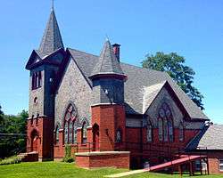
North Hillsdale Methodist Church |
|
October 1, 2010
(#10000811) |
1012 County Rte 21
42°14′14″N 73°30′29″W / 42.237361°N 73.508056°W / 42.237361; -73.508056 (North Hillsdale Methodist Church) |
North Hillsdale |
|
| 77 |
Oak Hill |
|
June 26, 1979
(#79001573) |
North of Linlithgo on Oak Hill Rd.
42°12′00″N 73°50′40″W / 42.2°N 73.844444°W / 42.2; -73.844444 (Oak Hill) |
Linlithgo |
|
| 78 |
Olana |
|
October 15, 1966
(#66000509) |
Church Hill, E end of Rip Van Winkle Bridge
42°12′52″N 73°49′47″W / 42.214444°N 73.829722°W / 42.214444; -73.829722 (Olana) |
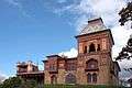
Church Hill |
Moorish Revival home of Hudson River School artist Frederick Church |
| 79 |
Old Parsonage |
|
October 7, 1983
(#83003935) |
Buckwheat Bridge Rd.
42°05′32″N 73°49′07″W / 42.092222°N 73.818611°W / 42.092222; -73.818611 (Old Parsonage) |
Clermont |
|
| 80 |
Peck House |
|
July 22, 1999
(#99000869) |
NY 203
42°28′30″N 73°38′00″W / 42.475°N 73.633333°W / 42.475; -73.633333 (Peck House) |
Chatham |
|
| 81 |
Persons of Color Cemetery at Kinderhook |
|
March 22, 2016
(#16000107) |
E. of Rothermel Ave.
42°23′44″N 73°42′15″W / 42.395505°N 73.704275°W / 42.395505; -73.704275 (Persons of Color Cemetery at Kinderhook) |
Kinderhook |
Fifteen graves on a plot in local park established as African-American cemetery by local resident's 1816 bequest. |
| 82 |
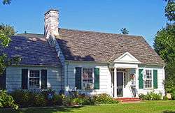
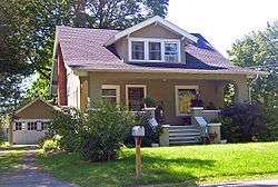
Harriet Phillips Bungalow |
|
August 21, 1997
(#97000946) |
438 NY 23B
42°13′40″N 73°44′58″W / 42.227778°N 73.749444°W / 42.227778; -73.749444 (Harriet Phillips Bungalow) |
Claverack |
Intact 1926 bungalow; possibly a catalog home from a defunct competitor of Sears |
| 83 |
Pine View Farm |
|
June 6, 2002
(#02000614) |
567 Collins St.
42°12′59″N 73°30′16″W / 42.216389°N 73.504444°W / 42.216389; -73.504444 (Pine View Farm) |
Hillsdale |
|
| 84 |
Rev. Dr. Elbert S. Porter House |
|
August 21, 1997
(#97000949) |
6163 New York State Route 9H
42°13′17″N 73°44′03″W / 42.221364°N 73.734211°W / 42.221364; -73.734211 (Rev. Dr. Elbert S. Porter House) |
Claverack |
|
| 85 |
Pratt Homestead |
|
November 13, 2009
(#09000907) |
866 Route 203
42°19′44″N 73°33′04″W / 42.328889°N 73.551111°W / 42.328889; -73.551111 (Pratt Homestead) |
Spencertown |
|
| 86 |
William and Victoria Pulver House |
|
April 6, 2005
(#05000260) |
2329 Cty Rd. 8
42°05′01″N 73°45′30″W / 42.083611°N 73.758333°W / 42.083611; -73.758333 (William and Victoria Pulver House) |
Snyderville |
|
| 87 |
Reformed Dutch Church of Claverack |
|
June 21, 2001
(#01000673) |
NY 9H, north of NY 23B
42°13′42″N 73°43′56″W / 42.228333°N 73.732222°W / 42.228333; -73.732222 (Reformed Dutch Church of Claverack) |
Claverack |
1767 church, renovated and expanded in the 19th century, is oldest institutional building in county |
| 88 |
Requa House |
|
November 15, 2002
(#02001325) |
9 Requa Rd.
42°27′32″N 73°46′04″W / 42.458889°N 73.767778°W / 42.458889; -73.767778 (Requa House) |
Stuyvesant |
|
| 89 |
Richmond Hill |
|
July 6, 1988
(#88000917) |
CR 31
42°07′36″N 73°49′11″W / 42.126667°N 73.819722°W / 42.126667; -73.819722 (Richmond Hill) |
Livingston |
|
| 90 |
Riders Mills Historic District |
|
August 2, 2000
(#00000877) |
NY 66, Bachus Rd., Riders Mills Rd.
42°28′43″N 73°33′40″W / 42.478611°N 73.561111°W / 42.478611; -73.561111 (Riders Mills Historic District) |
Chatham |
|
| 91 |
Simeon Rockefeller House |
|
July 2, 2009
(#09000479) |
524 Columbia Co. Rte. 8
42°07′52″N 73°51′50″W / 42.131111°N 73.863889°W / 42.131111; -73.863889 (Simeon Rockefeller House) |
Germantown vicinity |
|
| 92 |
Rossman-Prospect Avenue Historic District |
|
October 21, 1985
(#85003364) |
Prospect and Rossman Aves.
42°14′40″N 73°46′46″W / 42.244444°N 73.779444°W / 42.244444; -73.779444 (Rossman-Prospect Avenue Historic District) |
Hudson |
First planned subdivision in city outside of original grid plan in late 19th century |
| 93 |
Rowe-Lant Farm |
|
March 23, 2010
(#10000099) |
983 NY-295
42°24′19″N 73°32′16″W / 42.405353°N 73.537703°W / 42.405353; -73.537703 (Rowe-Lant Farm) |
East Chatham |
|
| 94 |
R. and W. Scott Ice Company Powerhouse and Ice House Site |
|
February 21, 1985
(#85000337) |
River Rd.
42°21′28″N 73°47′22″W / 42.357778°N 73.789444°W / 42.357778; -73.789444 (R. and W. Scott Ice Company Powerhouse and Ice House Site) |
Stuyvesant |
|
| 95 |
Silvernail Homestead |
|
June 11, 2010
(#10000332) |
383 Poole Hill Rd.
42°01′08″N 73°37′11″W / 42.019014°N 73.619683°W / 42.019014; -73.619683 (Silvernail Homestead) |
Ancram |
|
| 96 |
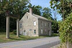
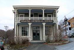
Simons General Store |
|
April 23, 1973
(#73001171) |
Ancram Sq.
42°03′02″N 73°38′16″W / 42.050556°N 73.637778°W / 42.050556; -73.637778 (Simons General Store) |
Ancram |
|
| 97 |
Sixteen Mile District |
|
March 7, 1979
(#79001571) |
West of Clermont along Hudson River
41°57′12″N 73°55′29″W / 41.953333°N 73.924722°W / 41.953333; -73.924722 (Sixteen Mile District) |
Clermont |
|
| 98 |
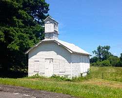
Snyderville Schoolhouse |
|
July 28, 2004
(#04000754) |
Cty Rd. 8, north side, west of Green Acres Rd.
42°04′52″N 73°45′10″W / 42.081111°N 73.752778°W / 42.081111; -73.752778 (Snyderville Schoolhouse) |
Snyderville |
|
| 99 |
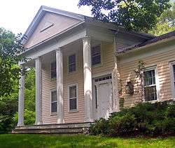
Spencertown Academy |
|
April 3, 1973
(#73001174) |
NY 203, east of the junction with CR 7
42°19′19″N 73°32′39″W / 42.321944°N 73.544167°W / 42.321944; -73.544167 (Spencertown Academy) |
Spencertown |
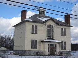
1847 Greek Revival schoolhouse used until 1970 |
| 100 |
Spencertown Historic District |
|
May 25, 2018
(#100002508) |
NY 203, Elm & South Sts.
42°19′24″N 73°32′46″W / 42.3233°N 73.5462°W / 42.3233; -73.5462 (Spencertown Historic District) |
Spencertown |
Center of town of Austerlitz, reflecting mid-18th century establishment by settlers from Massachusetts when area was contested between that colony and New York. |
| 101 |
Spengler Bridge |
|
February 23, 1973
(#73001172) |
Spengler Rd. over Kinderhook Creek
42°25′51″N 73°35′59″W / 42.430833°N 73.599722°W / 42.430833; -73.599722 (Spengler Bridge) |
Chatham |
|
| 102 |
St. John's Lutheran Church |
|
June 30, 2009
(#09000480) |
1273 Co. Rte. 7
42°02′58″N 73°38′19″W / 42.049533°N 73.638631°W / 42.049533; -73.638631 (St. John's Lutheran Church) |
Ancram |
|
| 103 |
St. John's Evangelical Lutheran Church |
|
January 11, 2002
(#01001437) |
923 NY 19
42°05′36″N 73°47′48″W / 42.093333°N 73.796667°W / 42.093333; -73.796667 (St. John's Evangelical Lutheran Church) |
Livingston |
|
| 104 |
St. Luke's Church |
|
October 7, 1983
(#83003936) |
US 9
42°05′14″N 73°49′32″W / 42.087222°N 73.825556°W / 42.087222; -73.825556 (St. Luke's Church) |
Clermont |
1857 Gothic Revival church designed by Richard M. Upjohn; no longer in use. |
| 105 |
St. Peter's Presbyterian Church and Spencertown Cemetery |
|
August 2, 2002
(#02000821) |
Cty. Rte. 7, at NY 203
42°19′20″N 73°32′47″W / 42.322222°N 73.546389°W / 42.322222; -73.546389 (St. Peter's Presbyterian Church and Spencertown Cemetery) |
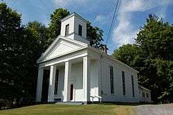
Spencertown |
1771 New England-style frame church moved across road in 1826. Cemetery dates to 1760. |
| 106 |
Steepletop |
|
November 11, 1971
(#71000534) |
Northeast of Austerlitz on E. Hill Rd.
42°19′12″N 73°26′54″W / 42.32°N 73.448333°W / 42.32; -73.448333 (Steepletop) |
Austerlitz |
Home and farm of poet Edna St. Vincent Millay from 1923 until her death in 1950. Now Millay Colony for the Arts |
| 107 |
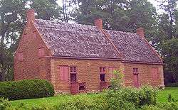
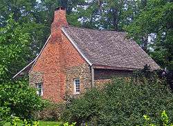
Stone Jug |
|
April 20, 1978
(#78001847) |
South of Germantown at NY 9G and Jug Rd.
42°06′11″N 73°53′47″W / 42.103056°N 73.896389°W / 42.103056; -73.896389 (Stone Jug) |
Germantown |
Unusual stone house (with later brick additions) built in 1752 by Lasher family, Palatine immigrants to the area. Center of a farm of 20 acres (81,000 m2) that includes a mid-19th-century farmhouse |
| 108 |
Stephen Storm House |
|
January 7, 1998
(#97001616) |
51 NY 217
42°13′35″N 73°42′53″W / 42.226389°N 73.714722°W / 42.226389; -73.714722 (Stephen Storm House) |
Claverack |
Intact 1810 Federal-style house combining urban and rural aspects of style |
| 109 |
Stuyvesant Falls Mill District |
|
September 15, 1976
(#76001210) |
New St. and SR 22
42°21′23″N 73°44′03″W / 42.356389°N 73.734167°W / 42.356389; -73.734167 (Stuyvesant Falls Mill District) |
Stuyvesant Falls |
|
| 110 |
Stuyvesant Railroad Station |
|
January 27, 1999
(#99000055) |
Riverview Ave.
42°23′20″N 73°47′01″W / 42.388889°N 73.783611°W / 42.388889; -73.783611 (Stuyvesant Railroad Station) |
Stuyvesant |
|
| 111 |
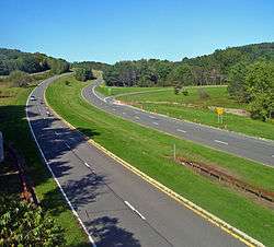
Taconic State Parkway |
|
December 8, 2005
(#05001398) |
Taconic State Pkwy, from Kensico Dam Plaza N to I-90
41°50′35″N 73°41′30″W / 41.843056°N 73.691667°W / 41.843056; -73.691667 (Taconic State Parkway) |
Gallatin, Taghkanic, Claverack, Ghent, Austerlitz, Chatham |
Scenic divided highway planned by Franklin D. Roosevelt for state park access. Built between the 1920s and early 1960s, epitomizing peak period of parkway design. |
| 112 |
Teviotdale |
|
October 10, 1979
(#79003794) |
Wire Rd.
42°09′13″N 73°50′26″W / 42.153611°N 73.840556°W / 42.153611; -73.840556 (Teviotdale) |
Linlithgo |
|
| 113 |
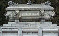
Gov. Samuel J. Tilden Monument |
|
July 14, 2006
(#06000573) |
Cemetery Rd.
42°28′30″N 73°23′09″W / 42.475°N 73.385833°W / 42.475; -73.385833 (Gov. Samuel J. Tilden Monument) |
New Lebanon |
|
| 114 |
Tracy Memorial Village Hall Complex |
|
January 5, 2016
(#15000953) |
77 Main St.
42°21′49″N 73°35′50″W / 42.363717°N 73.5971092°W / 42.363717; -73.5971092 (Tracy Memorial Village Hall Complex) |
Chatham |
1913 Neoclassical village hall building launched the career of architect Horace Whittier Peaslee |
| 115 |
Trinity Episcopal Church |
|
September 2, 1997
(#97000948) |
601 NY 23B
42°13′22″N 73°44′17″W / 42.222778°N 73.738056°W / 42.222778; -73.738056 (Trinity Episcopal Church) |
Claverack |
1901 Arts and Crafts church now used as residence |
| 116 |
Turtle House |
|
April 2, 2001
(#01000309) |
14 Fabiano Blvd.
42°15′38″N 73°46′04″W / 42.260556°N 73.767778°W / 42.260556; -73.767778 (Turtle House) |
Greenport |
|
| 117 |
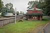
Union Station |
|
May 1, 1974
(#74001225) |
NY 66 at intersection with NY 295
42°21′42″N 73°35′53″W / 42.361667°N 73.598056°W / 42.361667; -73.598056 (Union Station) |
Chatham |
|
| 118 |
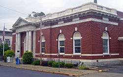
US Post Office-Hudson |
|
November 17, 1988
(#88002508) |
402 Union St.
42°15′01″N 73°47′22″W / 42.250278°N 73.789444°W / 42.250278; -73.789444 (US Post Office-Hudson) |
Hudson |
Classical detail on front of 1911 building echoes county courthouse across street |
| 119 |
Johannis L. Van Alen Farm |
|
April 26, 1973
(#73001175) |
School House Rd.
42°26′10″N 73°44′32″W / 42.436111°N 73.742222°W / 42.436111; -73.742222 (Johannis L. Van Alen Farm) |
Stuyvesant |
|
| 120 |
Luycas Van Alen House |
|
December 24, 1967
(#67000011) |
East of Kinderhook on NY 9H off U.S. 9
42°22′47″N 73°41′45″W / 42.379722°N 73.695833°W / 42.379722; -73.695833 (Luycas Van Alen House) |
Kinderhook |
Well-preserved surviving 1737 Dutch colonial brick farmhouse |
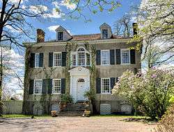
| 121 |
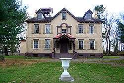
Martin Van Buren National Historic Site |
|
October 15, 1966
(#66000510) |
East of Kinderhook on NY 9H
Boundary increase (listed July 11, 2012, refnum 12000406): 1013 Old Post Rd.
42°22′11″N 73°42′15″W / 42.369722°N 73.704167°W / 42.369722; -73.704167 (Martin Van Buren National Historic Site) |
Kinderhook |
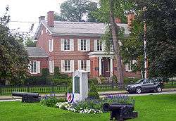
Home of Martin Van Buren; also known as Lindenwald |
| 122 |
Jan Van Hoesen House |
|
August 1, 1979
(#79001570) |
NY 66
42°15′22″N 73°45′09″W / 42.256111°N 73.7525°W / 42.256111; -73.7525 (Jan Van Hoesen House) |
Claverack |
1720s Dutch brick house |
| 123 |
William W. Van Ness House |
|
August 8, 1997
(#97000824) |
270 NY 9H
42°14′22″N 73°43′33″W / 42.239444°N 73.725833°W / 42.239444; -73.725833 (William W. Van Ness House) |
Claverack |
|
| 124 |
Van Rensselaer Lower Manor House |
|
January 7, 1998
(#97001615) |
103 NY 23B
42°13′29″N 73°43′32″W / 42.224722°N 73.725556°W / 42.224722; -73.725556 (Van Rensselaer Lower Manor House) |
Claverack |
Two 18th century stone houses joined in building with major local historical significance |
| 125 |
Conyn Van Rensselaer House |
|
October 20, 2009
(#09000861) |
644 Spook Rock Rd.
42°12′01″N 73°45′15″W / 42.200289°N 73.754292°W / 42.200289; -73.754292 (Conyn Van Rensselaer House) |
Claverack |
|
| 126 |
Henry (Hendrick) I. Van Rensselaer House |
|
September 16, 1993
(#93000947) |
Junction of Yates Rd. and NY 9H/23
42°11′18″N 73°45′26″W / 42.188333°N 73.757222°W / 42.188333; -73.757222 (Henry (Hendrick) I. Van Rensselaer House) |
Greenport |
|
| 127 |
Jacob Rutsen Van Rensselaer House and Mill Complex |
|
September 9, 1982
(#82003352) |
NY 23
42°13′16″N 73°42′39″W / 42.221111°N 73.710833°W / 42.221111; -73.710833 (Jacob Rutsen Van Rensselaer House and Mill Complex) |
Claverack |
|
| 128 |
Van Salsbergen House |
|
November 10, 2010
(#10000915) |
333 Joslen Blvd.
42°16′10″N 73°46′05″W / 42.269444°N 73.768056°W / 42.269444; -73.768056 (Van Salsbergen House) |
Hudson vicinity |
|
| 129 |
James G. Van Valkenburgh House |
|
April 11, 2002
(#02000358) |
31 Co. Rd. 13
42°25′18″N 73°36′30″W / 42.421667°N 73.608333°W / 42.421667; -73.608333 (James G. Van Valkenburgh House) |
Chatham |
|
| 130 |
Van Valkenburgh-Isbister Farm |
|
April 12, 2006
(#06000268) |
1129-1142 Columbia County Rte 22
42°19′15″N 73°41′28″W / 42.320833°N 73.691111°W / 42.320833; -73.691111 (Van Valkenburgh-Isbister Farm) |
Ghent |
|
| 131 |
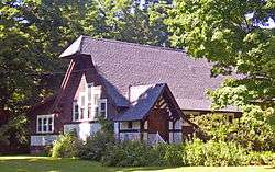
The Wilbor House |
|
June 30, 1997
(#97000567) |
0.25 miles (0.40 km) northeast of the junction of I-90 and Thorne Rd.
42°26′43″N 73°33′35″W / 42.445278°N 73.559722°W / 42.445278; -73.559722 (The Wilbor House) |
Old Chatham |
|
| 132 |
Wild's Mill Complex |
|
June 14, 1982
(#82003353) |
U.S. 9 and NY 203
42°24′47″N 73°40′52″W / 42.413056°N 73.681111°W / 42.413056; -73.681111 (Wild's Mill Complex) |
Valatie |
Several former mills, including one five-story brick building built in 1846. Last remaining mill demolished around 1986. |
| 133 |
Nathan Wild House |
|
May 30, 1991
(#91000612) |
3007 Main St.
42°24′51″N 73°40′46″W / 42.414167°N 73.679444°W / 42.414167; -73.679444 (Nathan Wild House) |
Valatie |
Residence of local prominent figure who owned the Wild's Mill Complex |
| 134 |
Elisha Williams House |
|
December 9, 1999
(#99001483) |
7 Aitkin Ave.
42°14′50″N 73°46′24″W / 42.247222°N 73.773333°W / 42.247222; -73.773333 (Elisha Williams House) |
Hudson |
1810 Brick Federal house was home of nine-term state assemblyman and nationally known orator |
| 135 |
John S. Williams House and Farm |
|
December 16, 1996
(#96001424) |
Shaker Museum Rd., approximately 1 mile (1.6 km) south of the junction with I-90
42°26′18″N 73°35′06″W / 42.438333°N 73.585°W / 42.438333; -73.585 (John S. Williams House and Farm) |
Chatham |
|
| 136 |
Oliver Wiswall House |
|
September 4, 1980
(#80002599) |
West of Hudson
42°14′47″N 73°48′34″W / 42.246389°N 73.809444°W / 42.246389; -73.809444 (Oliver Wiswall House) |
Hudson |
|
| 137 |
William A. Witbeck House |
|
December 12, 1994
(#94001371) |
Co. Rd. 26A, east of the junction with Gibbons Rd.
42°23′18″N 73°45′35″W / 42.388333°N 73.759722°W / 42.388333; -73.759722 (William A. Witbeck House) |
Stuyvesant |
|


.jpg)
.jpg)
.jpg)
.jpg)