BMT Fourth Avenue Line
| BMT Fourth Avenue Line | |||
|---|---|---|---|
   | |||
| Overview | |||
| Type | Rapid transit line | ||
| System | New York City Subway | ||
| Status | Operational | ||
| Locale | Brooklyn, New York City, NY | ||
| Termini |
Court Street Bay Ridge–95th Street | ||
| Stations | 16 | ||
| Services | 3 | ||
| Operation | |||
| Opened | 1915-1925 | ||
| Owner | New York City | ||
| Operator(s) | New York City Transit Authority | ||
| Character | Underground | ||
| Technical | |||
| Number of tracks | 2-6 | ||
| Track gauge | 4 ft 8 1⁄2 in (1,435 mm) | ||
| Electrification | 600V DC third rail | ||
| |||
The BMT Fourth Avenue Line is a rapid transit line of the New York City Subway, mainly running under Fourth Avenue in Brooklyn. The line is served by the D, N, and R at all times, and a few rush-hour W trains. The R and W run local while the D and N run express at all times except late nights, when they run local. The line was originally built by the Brooklyn Rapid Transit Company (BRT; later Brooklyn–Manhattan Transit Corporation, or BMT) and is now internally operated as part of the New York City Subway's B Division.
The fully underground line starts as a two-track line in Downtown Brooklyn west of Court Street, connecting to the BMT Broadway Line and BMT Nassau Street Line in Manhattan via the Montague Street Tunnel under the East River. It travels east under Montague and Willoughby Streets to DeKalb Avenue, where it then turns southeast under Flatbush Avenue. At DeKalb Avenue, the express tracks, which continue from the Manhattan Bridge to the northwest, split off from the BMT Brighton Line and join the Fourth Avenue Line. At Atlantic Avenue–Barclays Center, the line curves southwest under Fourth Avenue to the end of the line at Bay Ridge–95th Street. Going south from Atlantic Avenue, the BMT West End Line splits from both the local and express tracks south of 36th Street, while the express tracks continue as the BMT Sea Beach Line south of 59th Street.
Fourth Avenue never had a streetcar line or elevated railway due to the provisions of the assessment charged to neighboring property owners when the street was widened.[1] Construction of the line was only undertaken because of the efforts of the local communities. After the line was opened, development resulting from the line's construction transformed communities such as Dyker Heights, Fort Hamilton and Bay Ridge. One station, Myrtle Avenue, was abandoned in 1956 as part of the reconfiguration of the busy DeKalb Avenue Junction.
Route
BMT Fourth Avenue Line |
|---|
Coming south from DeKalb Avenue and off of Fulton Street, the four-track line runs entirely under Fourth Avenue to just past 59th Street. South of 36th Street, the West End Line, formerly the New Utrecht Avenue elevated line, branches off eastwards, running to its terminus at Coney Island–Stillwell Avenue.[2]:17–18 Until 1954, the BMT Culver Line also branched off from here, replaced by the Culver Shuttle until 1975, when it was discontinued.[3][4] At 64th Street, after the Sea Beach Line branches off eastwards towards Coney Island via an open-cut right-of-way, the line becomes two-tracked and continues under Fourth Avenue to its terminus at Bay Ridge–95th Street.[5] While this section of the line was built with two tracks, there are provisions to add two additional express tracks between 59th and 85th Streets if the need ever arises.[6]
In its upper section, the line serves Brooklyn Heights and Downtown Brooklyn.[7] The central section serves Park Slope east of Fourth Avenue, on the west side, Boerum Hill then Gowanus; and Sunset Park to the south.[8] In its lower section, it serves the communities of Bay Ridge and Fort Hamilton.[9]
Services
The following services use the Fourth Avenue Line:[10]
| Route | Stops | |||||
|---|---|---|---|---|---|---|
| Time period | West of DeKalb Ave | DeKalb Ave | Between Atlantic Ave and 36 St |
Between 36 St and 59 St |
Between 59 St and 95 St | |
| All except nights | no service | express | no service | |||
| Nights | no service | local | no service | |||
| All except nights | no service | express | local | no service | ||
| Nights | local | no service | ||||
| All times | local | |||||
| Limited rush hours | local | no service | ||||
The line normally carries the Fourth Avenue R service on the local tracks and the Sea Beach N and West End D services on the express tracks. During weekdays, three local N trains per day, in each direction, are designated as W. Manhattan-bound from DeKalb Avenue, the local tracks run via the Montague Street Tunnel to Lower Manhattan, serving either Whitehall Street on the BMT Broadway Line (N, R) or Broad Street on the BMT Nassau Street Line (no service; the last service to use these tracks was the M, rerouted in 2010). The express tracks go to Manhattan via the Manhattan Bridge to either the BMT Broadway Line's Canal Street express station (N) or the IND Sixth Avenue Line's Grand Street station (D).[5]
History
Background
Context
Transportation to the area was first provided in 1889 with the establishment of the 39th Street Ferry, which connected the area to Manhattan. Between 1888 and 1893, a new elevated line was opened along Fifth Avenue. Initially, the line terminated at 27th Street where people could transfer to horse cars. In 1892, the first trolley line was built in Brooklyn, starting at the ferry and running via Second Avenue to 65th Street, and then via Third Avenue. The Fifth Avenue Elevated was then extended to Third Avenue and 65th Street.[11]
A building boom in South Brooklyn started in about 1902 and 1903. Thousands of people started coming to the area from Manhattan and from other places. In 1905 and 1906 realty values increased by about 100 percent, and land values increased. This growth was spurred by the promise of improved transportation access. The improved transportation access transformed the community from an isolated farm community to a center of industrial and commercial life.[11]
Planning
The Fourth Avenue Line was built as part of the Dual Contracts. It replaced the parallel elements of an old, now long-ago-demolished elevated system running above Fifth Avenue and Third Avenue.[6] In 1902, a committee of the West End Board of Trade announced their support for a subway line from the Battery to Coney Island via Atlantic or Hamilton Avenues in front of the Rapid Transit Commission. On April 10, 1905, a citizens' committee was created to aid the creation of the subway line.[12]
In 1906, the plan for the Fourth Avenue subway included a spur via 86th Street running through Dyker Heights and Bensonhurst. At this time the spur was not authorized, but at the time it was viewed as a necessary part of the transportation plan for the area. The line was planned as a four-track line from Dean Street to Fort Hamilton, before being fed by a subway line going under the East River, and by a line over the Manhattan Bridge. An additional two-track spur was to begin at 37th Street before running under private property and 38th Street, before connecting with the South Brooklyn Railway. An additional two-track spur would branch off between 63rd and 64th Streets before connecting with the Sea Beach Railway. South of 65th Street the main line was planned to continue as a four-track line to 100th Street. Another proposal for a branch line was for a subway via New Utrecht Avenue. The line, consisting of four tracks, would have branched off at 40th Street before turning under New Utrecht Avenue and 86th Street to a point between 23rd and 24th Avenues. From there the line would have become an elevated line running to Coney Island. A spur of the Fourth Avenue line via 86th Street would have merged in here.[11]
As a possible alternative to subway construction, engineer F. H. Behr proposed a monorail system for Brooklyn. Each car was proposed to carry 80 to 120 passengers and attain a speed of 100 miles per hour. An application was filed with the Board of Alderman for franchises for four routes, with the first running to South Brooklyn. It would have run from the intersection of Flatbush Avenue and Atlantic Avenue and down Fourth Avenue to 85th or 86th Streets, where it would turn eastward to Stillwell Avenue, where it would turn onto West 12th Street and continue to a terminal loop at Coney Island.[11]
On June 1, 1905, the Rapid Transit Commission adopted the Fourth Avenue route to Fort Hamilton. The proposal, on July 7, 1905, was presented to the Board of Estimate, and was approved by them on July 14. The Mayor signed the bill on July 28. On June 18, 1906, the route was approved by the Appellate Division of the Supreme Court after the Rapid Transit Commission was unable to get the necessary consents of property owners along the planned route. This plan included a connection between the line and the Interborough Rapid Transit Company (IRT)'s extension into Brooklyn which was then planned to run under Flatbush Avenue. A track connection was also planned to another proposed route: this route would have run under Pacific Street, Court Street, and Montague Street, before running under the East River to Manhattan. That route was never built, but provisions were built for it in the south wall of the Montague Street Tunnel south of the Whitehall Street station.[2][13][14]
On December 7, 1906, the Board of Estimate recommended that two bids be let: one for the construction of the line, and one for the construction, equipment, and operation of the line. A spur to Coney Island was added to the plan after the persistency of Frank Hudson. On May 31, 1907, the Rapid Transit Commission requested that the Board of Estimate rescind the above resolution so that bids of construction alone might be asked for, and it authorized the preparation of the plans and contracts. On June 4, 1907, a resolution was passed by the Board of Estimate that authorized the Rapid Transit Commission that rescinded the resolution and authorized the Rapid Transit Commission to let out bids of construction only. On June 27, 1907, the Rapid Transit Commission approved the plans and contracts with the exception of the section between Ashland Place and Fulton Street to Sackett Street and Fourth Avenue.[2][13] The Rapid Transit Commission was succeeded by the Public Service Commission (PSC) on July 1, 1907, and the new commission hesitated to approve the plan for the line.[12] People in South Brooklyn were angered by the delay, and 3,000 people from the area showed up to a meeting on September 11, 1907, urging the PSC to act. In October and November 1907, the PSC approved the plans and contracts with modifications concerning grades and an increase in the height of the subway to fifteen feet.[2][13]
The commissioners, from the PSC, adopted plans for the line on March 10, 1908, and proposed contracts for the line. On March 20, 1908, at a meeting of the Board of Estimate, Controller Metz sent the plan to a committee within the Board for study, angering five hundred supporters of the line at the meeting. Coler, the Brooklyn Borough President, objected to the committee, citing that Mr. Lewis, the Chief Engineer, was against the construction of the project.[13] This resolution was defeated, and the main resolution failed to get a two-thirds majority. Afterwards, Metz procured an injunction that restrained the Board from acting until the debt limit was established: this blocked any immediate action. After hearings, General Tracy announced that the project was $150,000,000 within the debt limit, and Mayor George McClellan and Controller Metz joined with their colleagues to vote unanimously in favor of the Fourth Avenue subway line on March 27, 1908.[12][2]
In 1908, detailed plans were created by the PSC. The plan was changed to not have the line run via IRT trackage. In having it run via its own trackage, the line could be operated by railroads other than the IRT as standard 10 foot-wide railroad cars could fit through the tunnels. To connect to Manhattan without using IRT trackage the line would use part of contracts given for other lines. The line would use the Manhattan Bridge–Revised route, which was approved in 1909 and was originally conceived to connect the IRT Brooklyn Line at Flatbush Avenue, east of the Nevins Street station, to the Canal Street Subway and the proposed Third Avenue Subway going both north and south under the Bowery. The tracks would have used both the north and south tracks on the Manhattan Bridge.[14]
Construction
Contracts were awarded on May 22, 1908 for the section between 43rd Street and the Manhattan Bridge, but the Board of Estimate did not approve them until a taxpayer's lawsuit regarding the city's debt was settled. They were approved on October 29, 1909. During the time between the award and approval of the contracts, a non-partisan political body, with the backing of 25,000 South Brooklyn residents, was created that would only support candidates in the municipal election that pledged support for the Fourth Avenue subway.[2][15][16]
Groundbreaking for the first section of the subway, between DeKalb Avenue and 43rd Street (ending at 36th Street), took place on November 13, 1909 at DeKalb Avenue and Flatbush Avenue, after the plans and surveys for the line were completed.[17] This section was completed in 1916.[14] In June 1911, more than 70 percent of the excavation was completed. The line did not have to be excavated through tough bedrock like in Manhattan; in fact, there was not much difficulty, owing to the fact that Brooklyn soil is sandy. The construction of the first portion of the line was broken up into six sections. The construction of the line was expected to transform communities in South Brooklyn, such as Bay Ridge, Dyker Heights, Fort Hamilton, Bath Beach, and Coney Island.[6][12]
Construction on the section between 27th Street and 43rd Street, Route 11A4, began on December 10, 1909, and it was completed in October 1912. Construction began on Route 11A3, the section between 10th Street and 27th Street, on December 20, 1909. It was completed in May 1912. The section between 10th Street and Sackett Street, Route 11A2, had construction started on it on December 20, 1909, and was completed in September 1912. Four days after the construction of that segment began, construction began on the segment under Ashland Place and under Fourth Avenue between Fulton Street and Sackett Street. Known as Route 11A1 and 11E1, it was completed in 1915. On March 18, 1910, construction began on the four tracks over the Manhattan Bridge. It was completed in September 1912.[14]
Not long after the contracts were awarded, the PSC started negotiating with the BMT and the IRT in the execution of the Dual Contracts. A lease to the Fourth Avenue subway was given to the New York Municipal Railway Corporation, a subsidiary of the BMT, for forty-nine years as part of Contract 4. The Dual Contracts were signed on March 19, 1913.[2] In 1912, during the Dual System negotiations, the construction of an extension of the Fourth Avenue subway was recommended as part of the Dual System, and this recommendation was approved by the Board of Estimate on February 15, 1912. The PSC directed its Chief Engineer to create plans on June 14, 1912, and the contracts for the extension, Route 11B, was awarded on September 16, 1912. Later on, the plan for the extension was modified to include a connection with the Sea Beach Railroad between 64th and 65th Streets.[2]
Construction on the southernmost section of the line to 89th Street, just south of the 86th Street station, began in late October 1912.[6][18] The lower section of the line was constructed along with several branch lines, which replaced former surface railroads. These lines are the BMT West End Line splitting south of 36th Street, and the BMT Sea Beach Line leaving south of 59th Street.[6] In anticipation of the opening of the subway, several housing and development booms occurred along Fourth Avenue, particularly in Bay Ridge.[19] On January 24, 1913, construction begun on Route 11B2, the section between 61st Street and 89th Street. This section was built as a two-track structure under the west side of Fourth Avenue with plans for two future tracks on the east side of the street. The bridge across the Long Island Rail Road's Bay Ridge Branch, but under Fourth Avenue, was built for four tracks, but only the space for the two west tracks were ever used. The 86th Street station was designed for eventual conversion into a four-track, two island platform express station. If the two additional tracks were built, the east platform on all local stops south of 59th Street would be removed. Construction was completed on this section in 1915.[14] On March 15, 1913, construction began on Route 11B1, the section between 43rd Street and 61st Street. Originally, this section was planned to have two tracks, but after the connection to the Sea Beach Line was added to the plan during the middle of construction, the plan was changed to four tracks. This section was completed in 1915.[14]
Differences with the original subway
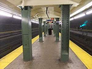
The dimensions of the Fourth Avenue Line are different than those of the original subway opened by the IRT in 1904. The height of the roof above the base rail in IRT lines was 12.83 feet (3.91 m), while the height is 15 feet (4.6 m) on the Fourth Avenue Line, allowing for the possible operation of larger subway cars. Precautions were taken to keep out water, as evidenced by the placement of waterproofing under the floor, along the sides, and over the roof of the tunnel. This was expected to make the subway cooler in hot weather than the original subway. Partitions were created in between the tracks to allow for improved ventilation, and to allow for the safety of employees, niches were provided in the partitions. All of the platforms, both express and local, were built to be straight to avoid the inconvenience of curved platforms. The local stations were originally 435 feet (133 m), while the express stations were originally 480 feet (150 m) long, allowing for eight-car expresses and six-car locals. The stations were all finished in white and marble tile; each station had its own color scheme to allow for regular passengers to identify their station based only on the color of the marble trimmings.[2]
Early years
Opening
The first train to run via the entirety of the line was a test train that operated on June 15, 1915. The trip used the local tracks as the express tracks were not yet completed. A trial trip that ran earlier in the day ripped a piece off of the platform at DeKalb Avenue as it was too broad. At this time, the line was scheduled to be inaugurated with a ceremonial trip on June 19, before being opened to the public on June 21.[20] However, the opening was delayed a day to June 22, 1915, when the line opened from the Manhattan Bridge through to the Sea Beach Line.[21] The ceremonial trip took place three days prior.[22] Initially, service only ran via the Nassau Loop tracks to Chambers Street as the new subway under Broadway was not yet open. Construction on the initial portion of the line cost about $30,000,000.[2]
Prior to the line's opening, the line was expected to not be open until around July 4 due to problems with the signaling system. One major change to the line's construction was completed: the conversion of DeKalb Avenue to an express station. Originally, DeKalb Avenue was going to be a local station. However, during the middle of construction, it was changed to an express station and track crossovers had to be installed.[23] The reasoning for this is due to changes required by the Dual Contracts. An additional line, the Whitehall–Montague Street route, was to be built connecting the Broadway Line in Manhattan and the Fourth Avenue subway under the Flatbush Avenue Extension to the west of the DeKalb Avenue station. By making the station express, express trains that would be operated through the Montague Street line could stop at the station. Crossovers connecting the express and local tracks would allow for this.[2] Construction continued even after the line opened, necessitating that service only use the line's local tracks for a few weeks.[20] One other change was required during the middle of construction. As part of the original plan the connection to the West End Line was to be at 40th Street. However, the connection had to be moved to 38th Street to obey the requirements of Contract 4, and the already completed connection had to be changed. To do so, the 36th Street station had to be partially reconstructed. Work was almost completely finished in June 1915.[2]
Expansion
The line opened from 59th Street to 86th Street on January 15, 1916.[24][25][26][27]
Even though the contract was approved for the Montague Street Tunnel, and the subway line connecting to it, in 1916, it was decided to add an infill station at Lawrence Street and Willoughby Street.[28] In 1917, the original contract was modified and a provision for the station was added.[29] Work started in October 1917, but construction halted on May 18, 1918, because of a wartime shortage of materials and men due to World War I, and about half the station was completed.[30]:51 Service running through the Montague Tunnel and this station began on August 1, 1920, while the station was being construction alongside in-service trains.[29] The line was called the Montague Street Tunnel Line.[31]
Construction resumed on May 18, 1922, and entailed the construction of an island platform between the two cast iron-lined tunnels, a mezzanine, and a station entrance, which required excavation from the street. On June 11, 1924, the Lawrence Street station opened[29] with the Lawrence Street entrances; the Bridge Street entrances opened later.[32] A special train to Prospect Park operated for the station's opening. A unique feature at the west end of the station was a folding platform edge that was necessary to clear a crossover switch that was partially underneath the platform.[30]:51
On August 25, 1922, the Transit Commission directed its chief engineer, Robert Ridgeway, to plan an extension of the Fourth Avenue Line from 87th Street to Fort Hamilton. Initially, multiple stations along the extension were considered. This extension was to be the first part of an extension to Staten Island through a tunnel under The Narrows.[33] On September 12, 1922, a meeting was held by the Transit Commission to determine whether a stop at 91st Street should be included as part of the planned extension. Ultimately, no station was built at 91st Street.[34] At the meeting it was decided that money for an additional station in between 86th Street and the new terminal at 95th Street would be better spent on an extensive terminal with entrances at 93rd, 94th, and 95th Streets.[35] Other extensions were also planned in 1922: a branch of the line running via 86th Street to 18th Avenue to connect with the New Utrecht Line to Coney Island, Route 19, and the future Tenth Avenue subway, and a branch of the line at 67th Street heading to Staten Island, Route 20.[36]
On December 28, 1922, the Transit Commission announced that it had awarded the contract for the construction of a half-mile extension of the Fourth Avenue Line, Contract 11B,[37] to T. A. Gillespie Company for $1.5 million. However, as the Board of Estimate failed to take action upon it, the contractor withdrew its bid on March 7, 1923.[38] The Transit Commission blamed the Board of Estimate for delays in the awarding of the contract; the Commission said that the city would suffer a substantial loss due to increased construction costs, and because the contract that was given was "highly advantageous to the city."[39] As part of Contract 11B, the extension was built with two tracks, with the exception of a short three-track stretch just north of the terminal at 95th Street.[40] The extension was to be built with a provision to extend the line to Staten Island.[41] As a result of a motion made by Commissioner LeRoy Harkness in front of the Transit Commission, the contract was set to be put back up for bid.[42] On November 2, 1923, the Board of Estimate approved the contract for the line with T. A. Gillespie Company, the same contractor that had bid on the project earlier, but withdrew. The Transit Commission, due to the delay of the project, gave orders on November 3 to speed up the completion of the project.[43] Construction began on December 17, 1923.[44][14]
On February 16, 1925, the Board of Transportation directed its engineers to prepare plans to lengthen the platforms at twelve stations along the Fourth Avenue Line (Myrtle Avenue, DeKalb Avenue, Pacific Street, Union Street, Ninth Street, Prospect Avenue, 25th Street, 45th Street, 53rd Street, Bay Ridge Avenue, 77th Street, and 86th Street) to accommodate eight-car trains at the cost of $633,000.[45] Later that month, on February 28, the Board made public the bids for the contract to complete the 95th Street terminal station. The station, as part of the contract, was built with two tracks, and was built to be 530 feet long to accommodate eight-car trains. A signal and switch tower, and a dispatcher's office was also built at the station.[46] On April 22, 1925, it was announced that $200,000 had been appropriated by the BMT to pay for signal equipment, station control and lighting, drainage and ventilating equipment, and for telephone cables.[47] The final extension to 95th Street, Route 18, opened on October 31, 1925.[48][44]

The line was planned to be connected via one of two tunnels to Staten Island and to Staten Island Rapid Transit. The first would be in Bay Ridge, south of the 59th Street station, connecting to both SIRT branches near the Tompkinsville station. The other would have been south of 95th Street in Fort Hamilton, following the current routing of the Verrazano-Narrows Bridge. Construction on the first plan, known as the Staten Island Tunnel was started in 1923 but soon halted. Later proposals called for connecting the line and the SIRT via the Verrazano Bridge, though the bridge was built with no railroad provisions.[6][49][50][51][52][53][54] In fact, the SIRT ordered new train cars, the ME-1s, that were built to be compatible with operation over the BMT system, and as such, they strongly resembled the BMT's AB Standard.[55][56][57]
Later years
Rebuilding DeKalb Avenue junction
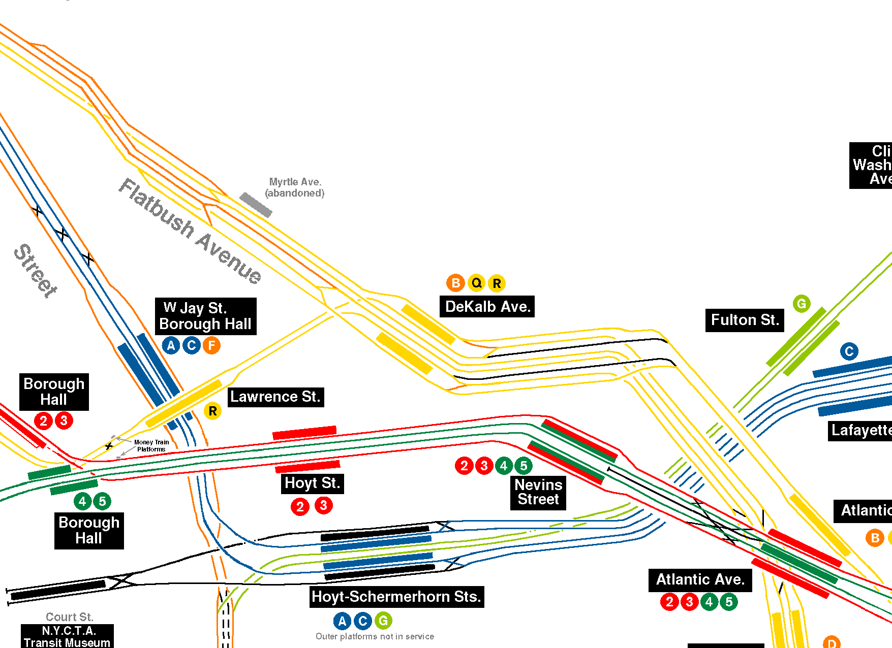
The DeKalb Avenue Junction is located to the north and south of the DeKalb Avenue station, and it is located at the juncture of the BMT Fourth Avenue Line and the BMT Brighton Line on the south and the four Manhattan Bridge tracks and Montague Tunnel tracks on the north. In 1927, platform extensions were built at DeKalb Avenue in order to allow for longer trains. The extensions were built into a curve south of the station–they were closed in 1960 when they were replaced by straight extensions to the north.[58][59] DeKalb Avenue received a new mezzanine with escalators at the north end of the station. From this mezzanine exits were built on both side of the Flatbush Avenue Extension between Fleet Street and Willoughby Street.[58]
Until the mid-1950s, though, the extreme outside tracks in each direction hosted the Fourth Avenue Line local tracks and the next pair hosted the Brighton Line. The middle tracks, which bypassed the station, hosted the Fourth Avenue express tracks. A group of level crossovers at the northern end of the station allowed all tracks access to both sides of the Manhattan Bridge and to the Montague Street Tunnel. The Fourth Avenue local tracks led straight onto the Manhattan Bridge west of the station, while the Brighton line tracks led straight to the Montague Street Tunnel, so the crossovers allowed trains from both lines to switch between the bridge and the tunnel.[59] This led to so many train delays on the Fourth Avenue and Brighton Lines that, in 1952, the junction was earmarked for "top priority" reconstruction.[58]
During the reconstruction of the junction that started in 1956 and was completed by April 1961, the Brighton Line tracks were connected to the DeKalb Avenue station's outermost tracks. A diamond crossover north of the station had caused frequent bottlenecks, but was removed during the realignment and replaced with two flying junctions.[60] All switches immediately north of the station were eliminated.[59] The junction towards the Manhattan Bridge was rebuilt. To make room for a new flying junction, the Myrtle Avenue station was closed on July 16, 1956.[61][62] That station's northbound platform remains visible from passing trains, but the southbound platform was demolished to accommodate the new flying junction that replaced the diamond crossover.[59] Between 1957 and 1958, extra tracks and new switches were added south of DeKalb Avenue.[30]:76 Platforms were also doubled in length to accommodate ten-car trains of 60-foot-long (18 m) cars.[63] It was estimated that the reconstruction of the junction increased the junction's train capacity by 25%.[58] The Chrystie Street Connection project was also tied to this improvement, as it resulted in more trains using the bridge, as well as connecting trains to the IND Sixth Avenue Line (and thus, to IND lines to the Bronx and Queens).[58][64]
Contemporary projects
Formerly, the Fourth Avenue Line served trains from the BMT Culver Line, which connected to the 36th Street station via the lower level of the Ninth Avenue station south of Green-Wood Cemetery from a now-demolished elevated structure.[6] Following the connection of the Culver Line to the South Brooklyn Line of the IND on October 30, 1954, this service turned at Ditmas Avenue instead.[30]:72, 74 Later on, service via the BMT Culver Line was cut back to being a shuttle that ran between Ditmas Avenue and Ninth Avenue. Shuttle service ended in 1975,[3][4] with homes and housing developments erected over the right-of-way of the two demolished stations in the 1980s and again in the 2010s.[65] The barest stub of the old elevated line is still visible at Ditmas Avenue.[66][67]
In January 2017, the MTA revealed plans to rehabilitate the structure of the tunnel above the express tracks between 36th and 59th Streets. The structure had become corroded because resurfacing of Fourth Avenue in the 2010s caused rainwater to seep into the structure rather into the sewage system. Work will also be done between Atlantic Avenue–Barclays Center and 36th Streets. Construction started in May 2017, and will end in March 2020.[68] Between May 2018 and May 2019, the express tracks will be closed to allow for work to be done.[69][70]
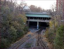
.jpg)
Under the 2015–2019 MTA Capital Plan's Enhanced Station Initiative, three stations on the line—Prospect Avenue, 53rd Street, and Bay Ridge Avenue—were selected to undergo a complete overhaul. All three stations would be entirely closed for up to 6 months in order to speed up renovations, unlike in previous station renovations conducted by the MTA, where parts of the stations would have been closed and renovated piece-by-piece.[71][72] Updates included cellular service, Wi-Fi, USB charging stations, interactive service advisories and maps, improved signage, and improved station lighting.[73][74] From January to May 2016, Grimshaw Architects worked on a design for the stations' renovation, with Arup Group acting as a consultant. The award for Package 1 of the renovations, which covers renovations at the three stations, was awarded on November 30, 2016.[75] The stations were closed on a staggered schedule from March to June 2017 for these renovations, with 53rd Street closing first, followed by Bay Ridge Avenue and Prospect Avenue. They were planned to reopen on a staggered schedule from September to December 2017.[71][72] 53rd Street reopened first on September 8,[76] followed by Bay Ridge Avenue a month later on October 13.[77] Prospect Avenue, the last of the three stations to be renovated, reopened a month ahead of schedule on November 2, 2017.[78]
Chaining information
Station listing
| Station service legend | |
|---|---|
| Stops all times | |
| Stops all times except late nights | |
| Stops late nights only | |
| Stops late nights and weekends only | |
| Stops weekdays only | |
| Stops rush hours only | |
| Time period details | |
| Station is compliant with the Americans with Disabilities Act | |
| Station is compliant with the Americans with Disabilities Act in the indicated direction only | |
| Elevator access to mezzanine only | |
| Neighborhood (approximate) |
Station | Tracks | Services | Opened | Transfers and notes | |
|---|---|---|---|---|---|---|
| Montague Street Tunnel branch (N | ||||||
| Downtown Brooklyn | Court Street | local | N |
August 1, 1920[31] | 2 4 | |
| Jay Street–MetroTech | local | N |
June 11, 1924[32] | formerly Lawrence Street A F | ||
| Manhattan Bridge branch (B | ||||||
| Myrtle Avenue | local | June 22, 1915[21] | Closed on July 16, 1956;[62] only Manhattan-bound platform remains | |||
| Tunnel and Bridge tracks merge | ||||||
| DeKalb Avenue | bridge, tunnel | B |
June 22, 1915[21] | 6 tracks; tunnel tracks and one set of bridge tracks stop at station; the other set of bridge tracks bypass through the middle | ||
| bridge & tunnel tracks stopping at DeKalb Avenue split to the BMT Brighton Line (B | ||||||
| Atlantic Avenue–Barclays Center | all | D |
June 22, 1915[21] | 2 B Connection to LIRR at Atlantic Terminal; Originally named "Pacific Street" | ||
| Park Slope | Union Street | local | D |
June 22, 1915[21] | ||
| Ninth Street | local | D |
June 22, 1915[21] | F | ||
| Prospect Avenue | local | D |
June 22, 1915[21] | |||
| Greenwood Heights | 25th Street | local | D |
June 22, 1915[21] | ||
| Sunset Park | 36th Street | all | D |
June 22, 1915[21] | ||
| split with BMT West End Line (D | ||||||
| 45th Street | local | N |
June 22, 1915[21] | |||
| 53rd Street | local | N |
June 22, 1915[21] | |||
| 59th Street | all | N |
June 22, 1915[21] | |||
| express tracks split off and become BMT Sea Beach Line (N | ||||||
| Bay Ridge | Bay Ridge Avenue | local | R |
January 15, 1916[24] | ||
| 77th Street | local | R |
January 15, 1916[24] | |||
| 86th Street | local | R |
January 15, 1916[24] | |||
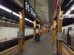
| Fort Hamilton | Bay Ridge–95th Street | local | R |
October 31, 1925[80][48] | ||
References
- ↑ "Bold Schemes". The Brooklyn Daily Eagle. June 4, 1892. p. 6. Retrieved May 5, 2017.
- 1 2 3 4 5 6 7 8 9 10 11 12 Fourth Avenue Subway, Brooklyn's New Transportation Line: A Part of the Dual System of Rapid Transit of the City of New York. Public Service Commission. June 19, 1915.
- 1 2 Matus, Paul (April–June 1975). "The Third Rail - BMT Culver Shuttle Closes". thethirdrail.net. Retrieved August 6, 2017.
- 1 2 Kelly, John (May 9, 1975). "End of Line for Culver Shuttle". The New York Daily News. Retrieved August 6, 2017.
- 1 2 Dougherty, Peter (2006) [2002]. Tracks of the New York City Subway 2006 (3rd ed.). Dougherty. OCLC 49777633 – via Google Books.
- 1 2 3 4 5 6 7 "Brooklyn Subway Extension Plan: Fourth Ave. Line to 86th St., Tunnel to Staten Island, and Eventually a Through Route to Coney Island" (PDF). nytimes.com. The New York Times. February 16, 1912. Retrieved June 28, 2015.
- ↑ "MTA Neighborhood Maps: Downtown Brooklyn and Borough Hall" (PDF). mta.info. Metropolitan Transportation Authority. 2018. Retrieved October 1, 2018.
- ↑
- "MTA Neighborhood Maps: Park Slope / Prospect Park" (PDF). mta.info. Metropolitan Transportation Authority. 2018. Retrieved October 1, 2018.
- "MTA Neighborhood Maps: Sunset Park" (PDF). mta.info. Metropolitan Transportation Authority. 2018. Retrieved October 1, 2018.
- ↑ "MTA Neighborhood Maps: Bay Ridge" (PDF). mta.info. Metropolitan Transportation Authority. 2018. Retrieved October 1, 2018.
- ↑ "Subway Service Guide" (PDF). Metropolitan Transportation Authority. June 25, 2017. Retrieved July 1, 2017.
- 1 2 3 4 "Future of South Brooklyn And Its Suburbs". The Brooklyn Daily Eagle. March 18, 1906. pp. 35–36. Retrieved May 5, 2017.
- 1 2 3 4 "Building of Fourth Ave. Subway Crowns Decade of Civic Struggle". The Brooklyn Daily Eagle. June 21, 1911. p. 10. Retrieved May 4, 2017.
- 1 2 3 4 "Fourth Avenue Subway Is Sent To A Committee". The Brooklyn Daily Eagle. March 20, 1908. pp. 1–2. Retrieved May 4, 2017.
- 1 2 3 4 5 6 7 Rogoff, David (May 1961). "New York Division ERA Bulletin May 1961". Google Docs. Retrieved May 8, 2017.
- ↑ "Fourth Avenue Subway To Be Political Issue". The Brooklyn Daily Eagle. December 11, 1908. p. 1. Retrieved May 4, 2017.
- ↑ "Crappy 100th Birthday, R Train! Love, Bay Ridge". www.heyridge.com. January 14, 2016. Retrieved May 4, 2017.
- ↑ "Fourth Ave. Subway Dirt Begins to Fly" (PDF). nytimes.com. The New York Times. November 14, 1909. Retrieved June 28, 2015.
- ↑ "Bay Ridge Turns Out For Start of Subway" (PDF). nytimes.com. The New York Times. October 27, 1912. Retrieved June 28, 2015.
- ↑ "Two Subway Branches Open Up New Era of Prosperity for Brooklyn and Queens" (PDF). nytimes.com. The New York Times. June 27, 1915. Retrieved June 28, 2015.
- 1 2 "STEINWAY TUNNEL TESTED BY SHONTS; After Inspection with Engineers He Says Tracks Are the Best He Has Ever Tried. PARTY RIDES THROUGH TUBE Interborough's Chief and Other Officials Are Hoisted from a Subway Shaft in a Dirt Bucket" (PDF). The New York Times. June 16, 1915. Retrieved May 4, 2017.
- 1 2 3 4 5 6 7 8 9 10 11 12 "QUEENSBORO TUNNEL OFFICIALLY OPENED; Subway, Started Twenty-three Years Ago, Links Grand Central and Long Island City. SPEECHES MADE IN STATION Belmont, Shonts, and Connolly Among Those Making Addresses -- $10,000,000 Outlay" (PDF). The New York Times. June 23, 1915. Retrieved May 4, 2017.
- ↑ "NEW SUBWAY OPENS; MAYOR NOT PRESENT; Refuses to Attend 4th Av. Line Ceremony Because He Feels He Was Slighted. BAY RIDGE CELEBRATES 10,000 School Children Give Pageant In Honor of the Event -- Traffic Starts Tuesday" (PDF). The New York Times. June 20, 1915. Retrieved May 4, 2017.
- ↑ "SUBWAY TO QUEENS WILL OPEN JUNE 15; Test Train to be Run on Tuesday and Regular Service Starts a Week Later. BEATS B. R. T. BY FOUR DAYS Fourth Avenue Subway Will Be Tested on June 19 and Opened to Traffic by July 4" (PDF). The New York Times. June 11, 1915. Retrieved May 4, 2017.
- 1 2 3 4 Senate, New York (State) Legislature (January 1, 1917). Documents of the Senate of the State of New York.
- ↑ Senate, New York (State) Legislature (January 1, 1917). Documents of the Senate of the State of New York.
- ↑ "Public Service Commission Promises To Complete Contract Awards This Year". Brooklyn Daily Eagle. January 16, 1916. Retrieved November 5, 2016 – via newspapers.com.
- ↑ "Subway Running To Eighty–Sixth Street Starts Building Boom In Bay Ridge". Brooklyn Daily Eagle. January 15, 1916. Retrieved November 5, 2016 – via Newspapers.com.
- ↑ "PROMISE JAY STREET SUBWAY STATION". The Daily Standard Union: Brooklyn, New York. March 17, 1916. Retrieved August 19, 2016 – via Fultonhistory.com.
- 1 2 3 "Two River Tunnels Opened 90 Years Ago". The Bulletin. New York Division, Electric Railroaders' Association. 53 (8). August 2010. Retrieved August 26, 2016 – via Issuu.
- 1 2 3 4 Cunningham, Joseph; DeHart, Leonard O. (1993). A History of the New York City Subway System. J. Schmidt, R. Giglio, and K. Lang.
- 1 2 District, New York (State) Public Service Commission First (January 1, 1921). Annual Report for the Year Ended ... The Commission.
- 1 2 "Announcing the Opening of the Lawrence Street (BMT) Subway Station". Brooklyn Daily Eagle. June 11, 1924. p. 8. Retrieved September 11, 2016.
- ↑ "TO EXTEND SUBWAY TO FORT HAMILTON; Transit Commission Orders Plans for Lengthening the Fourth Avenue Line. WOULD AID STATEN ISLAND Ferry Service May Be Established Until Tunnel Route is Selected" (PDF). The New York Times. August 26, 1922. Retrieved May 4, 2017.
- ↑ "SUBWAY HEARING TODAY.; Transit Board to Consider Pains for Line to Fort Hamilton" (PDF). The New York Times. September 12, 1922. Retrieved May 4, 2017.
- ↑ "LOCATES EXTENSION STATION; Transit Board Decides on 93d-95th St., Brooklyn, Site" (PDF). The New York Times. September 13, 2017. Retrieved May 4, 2017.
- ↑ The City Record: Official Journal. September 27, 1922. p. 6471.
- ↑ "Public Notices". The Brooklyn Daily Eagle. November 22, 1922. p. 18. Retrieved May 4, 2017.
- ↑ "One Way To Get Transit". The Brooklyn Daily Eagle. May 16, 1923. p. 6. Retrieved May 4, 2017.
- ↑ "SUBWAY DELAY LAID TO ESTIMATE BOARD; Transit Commission Blames It for Failure to Push Fort Hamil- ton Line". The New York Times. March 8, 1923. ISSN 0362-4331. Retrieved May 4, 2017.
- ↑ "$1,485,151 Bid Wins Contract To Build Ft. Hamilton Tube". The Brooklyn Daily Eagle. December 28, 1922. p. 19. Retrieved May 4, 2017.
- ↑ "THREE RAPID TRANSIT CONTRACTS ARE LET; They Cover Ft. Hamilton Extension, 14th St.-Eastern Workand 168th St. Elevators" (PDF). The New York Times. December 29, 1922. Retrieved May 4, 2017.
- ↑ "To Ask New Subway Bids". The New York Times. September 14, 1923. ISSN 0362-4331. Retrieved May 4, 2017.
- ↑ "TO RUSH SUBWAY WORK.; Contractor Ready to Begin Work on Fourth Avenue Extension". The New York Times. November 4, 1923. ISSN 0362-4331. Retrieved May 4, 2017.
- 1 2 "OPEN SUBWAY LINE TO FORT HAMILTON; Fourth Avenue Extension Put in Service After Wait of Four Years. HALF-MILE COST $2,000.000 Completion Gives Residents Through Trip Without Recourse to Trolley Cars". The New York Times. November 1, 1925. ISSN 0362-4331. Retrieved May 4, 2017.
- ↑ "12 B-M. T. STATIONS TO BE LENGTHEHED; Transportation Board Orders Engineers to Prepare Contracts for Brooklyn Work. COST PUT AT $633,000 Letter to Commission Urges That Company Be Compelled to Buy New Cars". The New York Times. February 17, 1925. ISSN 0362-4331. Retrieved May 4, 2017.
- ↑ "SUBWAY BIDS ANNOUNCED.; For 95th Street Terminal, Brooklyn, and Corona Yard". The New York Times. March 1, 1925. ISSN 0362-4331. Retrieved May 4, 2017.
- ↑ "$200,000 IS VOTED FOR 4TH AV. SUBWAY; B.M.T. Plans to Have New Extension in Operation Late This Year. CONTRACTS ARE PREPARED Statement Again Chides City for Its Failure to Construct Other Lines". The New York Times. April 23, 1925. ISSN 0362-4331. Retrieved May 4, 2017.
- 1 2 "95th St. Subway Extension Opened At 2 P. M. Today". Brooklyn Daily Eagle. October 31, 1925. Retrieved June 29, 2015 – via Newspapers.com.
- ↑ "To Extend Subway to Fort Hamilton" (PDF). nytimes.com. The New York Times. August 26, 1922. Retrieved June 27, 2015.
- ↑ "To Act This Year on the Richmond Tube: Route Approved in 1912 Still Alive-May Soon Be Adopted Anew or Amended" (PDF). nytimes.com. The New York Times. February 13, 1919. Retrieved June 27, 2015.
- ↑ Martin, Douglas (November 17, 1996). "Subway Planners' Lofty Ambitions Are Buried as Dead-End Curiosities". nytimes.com. The New York Times. Retrieved June 27, 2015.
- ↑ Staten Island Rapid Transit; The Essential History, by Irvin Leigh and Paul Matus; Page 9 (The Third Rail Online) Archived April 2, 2015, at the Wayback Machine.
- ↑ Levine, Richard (December 22, 1986). "S.I. TRAINS UNDERGOING RENOVATION". nytimes.com. The New York Times. Retrieved June 27, 2015.
- ↑ "Annual Report of the Brooklyn Rapid Transit Co. for The Year Ending June 30, 1912" (PDF). bmt-lines.com. Brooklyn Rapid Transit Company. June 30, 1912. Archived from the original (PDF) on October 11, 2016. Retrieved March 4, 2016.
- ↑ Leigh, Irvin; Matus, Paul (January 2002). "Staten Island Rapid Transit: The Essential History". thethirdrail.net. The Third Rail Online. Archived from the original on May 30, 2015. Retrieved June 27, 2015.
- ↑ Pitanza, Marc (2015). Staten Island Rapid Transit Images of Rail. Arcadia Publishing. ISBN 978-1-4671-2338-9.
- ↑ "Staten Island Is Not a Commuting Community". Brooklyn Daily Eagle. October 5, 1924. p. 67. Retrieved April 26, 2016 – via Newspapers.com.
- 1 2 3 4 5 "DEKALB REBUILDING GETS TOP PRIORITY; Board of Transportation Says Enlargement of B.M.T. Stop Will Eliminate Bottleneck". The New York Times. June 6, 2016. Retrieved July 8, 2016.
- 1 2 3 4 D'Adamo, R. Raleigh (1959). "DeKalb Avenue Station Reconstruction". nycsubway.org. Retrieved May 5, 2017.
- ↑ Detailed view of current track layout
- See also: Marrero, Robert (January 1, 2017). "472 Stations, 850 Miles" (PDF). B24 Blog, via Dropbox. Retrieved April 27, 2018.
- ↑ Joseph Brennan (2002). "Abandoned Stations : Myrtle Avenue". Retrieved September 9, 2010.
- 1 2 "Myrtle Avenue Closing Notice". Wikimedia Commons. New York City Transit Authority. July 1956. Retrieved August 6, 2017.
- ↑ "Dekalb Ave Escalators 1961". www.thejoekorner.com. New York City Transit Authority. April 27, 1961. Retrieved August 6, 2017.
- ↑ "Construction of New IND Tunnel for 6th Ave. Line Begins Today", New York Times April 19, 1961; page 41
- ↑ "Culver El Rezoning" (PDF). nyc.gov. October 27, 2010. Retrieved August 6, 2017.
- ↑ Klein, Helen (July 6, 2010). "Board backs housing on former Culver Shuttle land". nypost.com. New York Post. Retrieved June 28, 2015.
- ↑ Daley, Jessica (June 13, 2012). "The Culver Shuttle: Lost Beneath Borough Park for 40 Years". ny.curbed.com. Curbed. Retrieved June 28, 2015.
- ↑ "T6070316 Priority Structure Repairs on the 4th Av Line". web.mta.info. Metropolitan Transportation Authority. Retrieved September 3, 2017.
- ↑ "MTA Reveals Plans to Shut Down Part of N Subway Tunnel in Brooklyn Next Year". TWC News. January 21, 2017. Retrieved January 22, 2017.
- ↑ Spivack, Caroline (January 20, 2017). "Express N tunnel will shut for one year of emergency repairs". Brooklyn Paper. Retrieved January 22, 2017.
- 1 2 Spivack, Caroline (January 16, 2017). "Shuttle scuttle: Riders demand extra buses during three subway stations' closure". Brooklyn Paper. Retrieved January 27, 2017.
- 1 2 "MTA will close these Brooklyn subway stops to facilitate upgrades". Curbed NY. March 22, 2017. Retrieved March 24, 2017.
- ↑ Whitford, Emma (January 8, 2016). "MTA Will Completely Close 30 Subway Stations For Months-Long "Revamp"". Gothamist. Archived from the original on August 1, 2016. Retrieved July 18, 2016.
- ↑ "MTAStations" (PDF). governor.ny.gov. Government of the State of New York. Retrieved July 18, 2016.
- ↑ "Capital Program Oversight Committee Meeting" (PDF). mta.info. Metropolitan Transportation Authority. November 2016. Retrieved November 27, 2016.
- ↑ DeJesus, Jaime (September 8, 2017). "Sunset Park's renovated 53rd Street station is open for business". Brooklyn Reporter. Retrieved September 8, 2017.
- ↑ Mascali, Nikki M. (October 13, 2017). "MTA unveils new Bay Ridge Avenue R station". Metro US. Retrieved October 14, 2017.
- ↑ Barone, Vincent (November 2, 2017). "Prospect Avenue subway station reopens with modern amenities". am New York. Retrieved November 3, 2017.
- ↑ "Tracks of the New York City Subway". Tracks of the New York City Subway. Retrieved October 9, 2015.
- ↑ "Subway Bids Announced: For 95th Street Terminal, Brooklyn, and Corona Yard" (PDF). nytimes.com. The New York Times. March 1, 1925. Retrieved June 28, 2015.
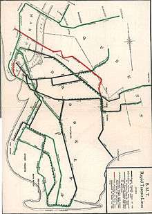
Route map:
| Current services |
| ||||||||||
|---|---|---|---|---|---|---|---|---|---|---|---|
| Defunct services |
| ||||||||||
| Unused labels | |||||||||||
| Stations |
| ||||||||||
| Divisions | |||||||||||
| Other lists | |||||||||||
| History |
| ||||||||||
| Infrastructure | |||||||||||
| Arts and culture | |||||||||||
| Miscellaneous | |||||||||||
| Other rapid transit in NYC |
| ||||||||||