| [3] |
Name on the Register |
Image |
Date listed[4] |
Location |
City or town |
Description |
|---|
| 1 |
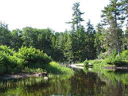
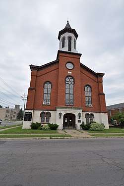
Adirondack Forest Preserve |
|
October 15, 1966
(#66000891) |
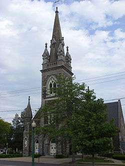
Northeast New York State
43°58′43″N 75°04′44″W / 43.978611°N 75.078889°W / 43.978611; -75.078889 (Adirondack Forest Preserve) |
|
The county contains 558,875 acres (2,261.69 km2) that are part of the six million acre (24,000 km²) Adirondack Park. |
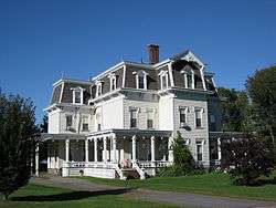
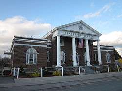
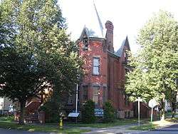
| 2 |
Balloon Farm |
|
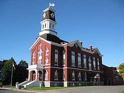
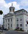
April 23, 1998
(#98000391) |
128 Cemetery Rd.
43°00′01″N 75°07′36″W / 43.000278°N 75.126667°W / 43.000278; -75.126667 (Balloon Farm) |
Frankfort |
|
| 3 |
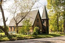
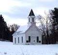
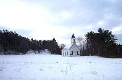
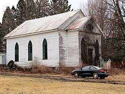
Big Moose Community Chapel |
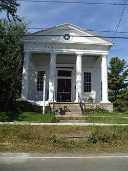
|
August 7, 2012
(#12000478) |
1544 Big Moose Rd.
43°49′03″N 74°52′43″W / 43.81763°N 74.87863°W / 43.81763; -74.87863 (Big Moose Community Chapel) |
Eagle Bay vicinity |
|
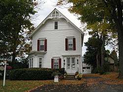
| 4 |
Blatchley House |
|
August 15, 2008
(#08000770) |
370 Blatchley Rd.
42°54′13″N 74°56′02″W / 42.903611°N 74.933889°W / 42.903611; -74.933889 (Blatchley House) |
Vicinity of Jordanville |
|
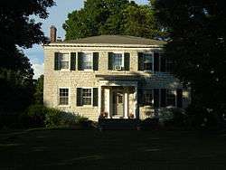
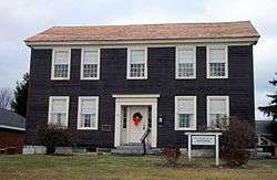
| 5 |
Bonfoy–Barstow House |
|
August 24, 2011
(#11000595) |
485 E. Main St.
42°54′10″N 75°11′13″W / 42.902778°N 75.186944°W / 42.902778; -75.186944 (Bonfoy–Barstow House) |
West Winfield |
|
| 6 |
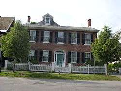
Benjamin Bowen House |
|
November 5, 1998
(#98001342) |
7482 Main St.
43°11′16″N 75°03′09″W / 43.187778°N 75.0525°W / 43.187778; -75.0525 (Benjamin Bowen House) |
Newport |
|
| 7 |
Brace Farm |
|
June 5, 2013
(#13000356) |
428 Brace Rd.
42°55′50″N 75°10′04″W / 42.93051208900886°N 75.16789184764662°W / 42.93051208900886; -75.16789184764662 (Brace Farm) |
Meetinghouse Green |
|
| 8 |
Breckwoldt-Ward House |
|
March 15, 2005
(#05000164) |
90 Van Buren St.
43°05′41″N 74°46′10″W / 43.094722°N 74.769444°W / 43.094722; -74.769444 (Breckwoldt-Ward House) |
Dolgeville |
Home of George Ward, who prosecuted Chester Gillette for the murder of Grace Brown in 1906, the case which served as the model for Theodore Dreiser's An American Tragedy. Now a bed and breakfast operated by Ward's great-grandson |
| 9 |
Church of the Good Shepherd |
|
August 21, 1997
(#97000943) |
NY 167, junction of NY 167 and Earl St.
42°52′57″N 74°57′48″W / 42.8825°N 74.963333°W / 42.8825; -74.963333 (Church of the Good Shepherd) |
Cullen |
|
| 10 |
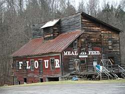
Cold Brook Feed Mill |
|
October 9, 1974
(#74001243) |
NY 8
43°14′23″N 75°02′29″W / 43.239722°N 75.041389°W / 43.239722; -75.041389 (Cold Brook Feed Mill) |
Cold Brook |
|
| 11 |
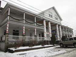
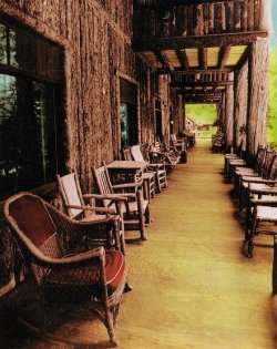
Covewood Lodge |
|
May 12, 2004
(#04000435) |
120 Covewood Lodge Rd.
43°49′00″N 74°51′08″W / 43.816667°N 74.852222°W / 43.816667; -74.852222 (Covewood Lodge) |
Big Moose |
|
| 12 |
Alfred Dolge Hose Co. No. 1 Building |
|
August 19, 1994
(#94001003) |
Junction of S. Main and Slawson Sts., southwest corner
43°06′00″N 74°46′28″W / 43.1°N 74.774444°W / 43.1; -74.774444 (Alfred Dolge Hose Co. No. 1 Building) |
Dolgeville |
|
| 13 |
Emmanuel Episcopal Church |
|
July 29, 2009
(#09000574) |
588 Albany St.
43°02′39″N 74°51′19″W / 43.044231°N 74.855392°W / 43.044231; -74.855392 (Emmanuel Episcopal Church) |
Little Falls |
|
| 14 |
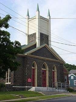
First United Methodist Church |
|
July 5, 2003
(#03000601) |
36 Second St.
43°00′49″N 75°02′21″W / 43.013611°N 75.039167°W / 43.013611; -75.039167 (First United Methodist Church) |
Ilion |
|
| 15 |
Fort Herkimer Church |
|
July 24, 1972
(#72000843) |
NY 5S
43°01′05″N 74°57′16″W / 43.018056°N 74.954444°W / 43.018056; -74.954444 (Fort Herkimer Church) |
East Herkimer |
|
| 16 |
Frankfort Hill District No. 10 School |
|
June 23, 2011
(#11000401) |
2235 Albany Rd.
43°02′04″N 75°11′05″W / 43.034444°N 75.184722°W / 43.034444; -75.184722 (Frankfort Hill District No. 10 School) |
Frankfort Hill vicinity |
|
| 17 |
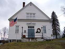
Frankfort Town Hall |
|
December 9, 1999
(#99001486) |
140 S. Litchfield St.
43°02′20″N 75°04′23″W / 43.038889°N 75.073056°W / 43.038889; -75.073056 (Frankfort Town Hall) |
Frankfort |
|
| 18 |
Augustus Frisbie House |
|
December 9, 1999
(#99001487) |
NY 29A
43°08′34″N 74°47′13″W / 43.142778°N 74.786944°W / 43.142778; -74.786944 (Augustus Frisbie House) |
Salisbury Center |
|
| 19 |
Goodsell House |
|
April 12, 2006
(#06000265) |
2993 Main St.
43°42′27″N 74°58′44″W / 43.7075°N 74.978889°W / 43.7075; -74.978889 (Goodsell House) |
Old Forge |
|
| 20 |
Herkimer County Courthouse |
|
January 14, 1972
(#72000844) |
320 N. Main St.
43°01′44″N 74°59′22″W / 43.028889°N 74.989444°W / 43.028889; -74.989444 (Herkimer County Courthouse) |
Herkimer |
|
| 21 |
Herkimer County Historical Society |
|
April 13, 1972
(#72000845) |
400 N. Main St.
43°01′45″N 74°59′22″W / 43.029167°N 74.989444°W / 43.029167; -74.989444 (Herkimer County Historical Society) |
Herkimer |
|
| 22 |
Herkimer County Jail |
|
January 14, 1972
(#72000846) |
327 N. Main St.
43°01′42″N 74°59′24″W / 43.028333°N 74.99°W / 43.028333; -74.99 (Herkimer County Jail) |
Herkimer |
|
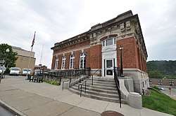
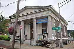
| 23 |
Herkimer County Trust Company Building |
|
March 5, 1970
(#70000421) |
Corner of Ann and Albany Sts.
43°02′34″N 74°51′33″W / 43.042778°N 74.859167°W / 43.042778; -74.859167 (Herkimer County Trust Company Building) |
Little Falls |
|
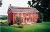
| 24 |
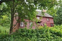
Herkimer House |
|
February 12, 1971
(#71000539) |
Near NY 5 S.
43°01′40″N 74°48′52″W / 43.027778°N 74.814444°W / 43.027778; -74.814444 (Herkimer House) |
Danube |
Built in the 1750s by Nicholas Herkimer, who died there in 1777. In 1834, the house was owned by Herkimer's nephew, John Herkimer. |
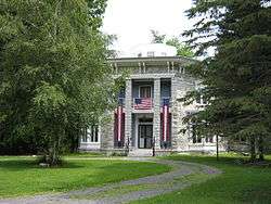
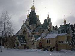
| 25 |
Holy Trinity Monastery |
|
June 23, 2011
(#09000286) |
1407 Robinson Road
42°55′39″N 74°56′02″W / 42.9275°N 74.933889°W / 42.9275; -74.933889 (Holy Trinity Monastery) |
Jordanville vicinity |
Russian Orthodox monastery established in 1928 is one of the largest in the country and home to only remaining pre-1918 Russian language printing press. |
| 26 |
Indian Castle Church |
|
February 18, 1971
(#71000540) |
NY 5S
43°00′10″N 74°46′40″W / 43.002778°N 74.777778°W / 43.002778; -74.777778 (Indian Castle Church) |
Indian Castle |
|
| 27 |
Italian Community Bake Oven |
|
November 8, 2006
(#06001003) |
NY 167
43°02′21″N 74°50′02″W / 43.039167°N 74.833889°W / 43.039167; -74.833889 (Italian Community Bake Oven) |
Little Falls |
|
| 28 |
Jordanville Public Library |
|
May 24, 1984
(#84002397) |
Main St.
42°54′56″N 74°56′51″W / 42.915556°N 74.9475°W / 42.915556; -74.9475 (Jordanville Public Library) |
Jordanville |
|
| 29 |
James Keith House and Brown–Morey–Davis Farm |
|
January 15, 2014
(#13001090) |
2615 & 2608 Newport Rd
43°10′11″N 75°01′08″W / 43.169738°N 75.018945°W / 43.169738; -75.018945 (James Keith House and Brown–Morey–Davis Farm) |
town of Newport |
|
| 30 |
Lalino Stone Arch Bridge |
|
December 28, 2001
(#01001397) |
319 NY 29
43°08′14″N 74°56′42″W / 43.137222°N 74.945°W / 43.137222; -74.945 (Lalino Stone Arch Bridge) |
Middleville |
|
| 31 |
Little Falls City Hall |
|
August 24, 2011
(#11000596) |
659 E. Main St.
43°02′40″N 74°51′20″W / 43.044444°N 74.855556°W / 43.044444; -74.855556 (Little Falls City Hall) |
Little Falls |
|
| 32 |
Little Falls Historic District |
|
February 8, 2012
(#12000013) |
Roughly bounded by W. Monroe, W. Gansevoort, Prospect, Garden, E. Main, N. William, & Loomis St.
43°02′36″N 74°51′35″W / 43.043403°N 74.859594°W / 43.043403; -74.859594 (Little Falls Historic District) |
Little Falls |
|
| 33 |
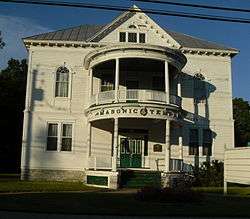
Masonic Temple — Newport Lodge No. 445 F. & A.M. |
|
January 13, 2010
(#09001228) |
7408 NY 28
43°10′51″N 75°00′38″W / 43.180833°N 75.010556°W / 43.180833; -75.010556 (Masonic Temple — Newport Lodge No. 445 F. & A.M.) |
Newport |
|
| 34 |
Meetinghouse Green Road Cemetery |
|
June 5, 2013
(#13000357) |
Cross and Meeting House Rds.
42°55′08″N 75°09′50″W / 42.91881106622769°N 75.1639270052745°W / 42.91881106622769; -75.1639270052745 (Meetinghouse Green Road Cemetery) |
Meetinghouse Green vicinity |
|
| 35 |
Menge House Complex |
|
December 16, 1996
(#96001425) |
98 Van Buren St.
43°05′38″N 74°46′12″W / 43.093889°N 74.77°W / 43.093889; -74.77 (Menge House Complex) |
Dolgeville |
|
| 36 |
Mohawk Upper Castle Historic District |
|
November 4, 1993
(#93001621) |
Address Restricted
|
Danube |
The district, declared a National Historic Landmark in 1993,[5] includes the Indian Castle Church as well as archaeological sites. Upper Castle was a fortified village. The Indian Castle Church, built in 1769, is the only colonial Indian missionary church surviving in New York State, and is the only Iroquois building surviving from its time.[6] |
| 37 |
Newport Stone Arch Bridge |
|
February 10, 1992
(#91002035) |
Bridge St. across West Canada Creek
43°11′06″N 75°01′04″W / 43.185°N 75.017778°W / 43.185; -75.017778 (Newport Stone Arch Bridge) |
Newport |
|
| 38 |
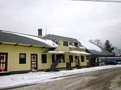
New York Central Railroad Adirondack Division Historic District |
|
December 23, 1993
(#93001451) |
NYCRR Right-of-Way
43°42′02″N 75°00′09″W / 43.700556°N 75.0025°W / 43.700556; -75.0025 (New York Central Railroad Adirondack Division Historic District) |
Thendara |
The New York Central passed through McKeever, Thendara, Big Moose Station, Beaver River, and Brandreth, and stations exist at Thendara and Big Moose. The Adirondack Scenic Railroad runs trains between Utica and Thendara. |
| 39 |
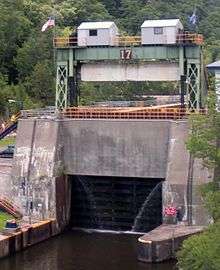
New York State Barge Canal |
|
October 15, 2014
(#14000860) |
Linear across county
43°00′56″N 74°59′39″W / 43.015598°N 74.994180°W / 43.015598; -74.994180 (New York State Barge Canal) |
Little Falls, Danube, Frankfort, German Flatts, Herkimer, Ilion, Mannheim, Mohawk, Ohio, Russia, Schuyler |
Successor to Erie Canal approved by state voters in early 20th century to compete with railroads; listing includes two of canal's reservoirs in Adirondacks. |
| 40 |
Norway Baptist Church (former) |
|
June 29, 2007
(#07000622) |
1067 Newport-Gray Rd.
43°12′25″N 74°57′11″W / 43.206944°N 74.953056°W / 43.206944; -74.953056 (Norway Baptist Church (former)) |
Norway |
|
| 41 |
Old City Road Stone Arch Bridge |
|
December 28, 2001
(#01001398) |
Old City Rd.
43°09′51″N 74°59′08″W / 43.164167°N 74.985556°W / 43.164167; -74.985556 (Old City Road Stone Arch Bridge) |
Welch Corners |
|
| 42 |
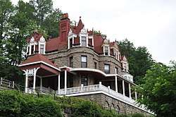
Overlook |
|
July 19, 2010
(#10000484) |
1 Overlook Drive
43°03′00″N 74°51′32″W / 43.05°N 74.858889°W / 43.05; -74.858889 (Overlook) |
Little Falls |
|
| 43 |
Palatine German Frame House |
|
April 15, 2004
(#04000282) |
4217 NY 5
43°01′42″N 75°02′35″W / 43.028333°N 75.043056°W / 43.028333; -75.043056 (Palatine German Frame House) |
Herkimer |
|
| 44 |
Stuart Perry and William Swezey Houses |
|
November 28, 2012
(#12000982) |
7541 & 7551 Main St.
43°11′27″N 75°01′09″W / 43.190769°N 75.019242°W / 43.190769; -75.019242 (Stuart Perry and William Swezey Houses) |
Newport |
|
| 45 |
The Reformed Church |
|
March 16, 1972
(#72000847) |
405 N. Main St.
43°01′44″N 74°59′25″W / 43.028889°N 74.990278°W / 43.028889; -74.990278 (The Reformed Church) |
Herkimer |
|
| 46 |
Remington House |
|
August 21, 1997
(#97000942) |
1279 Upper Barringer Rd.
42°59′27″N 75°05′12″W / 42.990833°N 75.086667°W / 42.990833; -75.086667 (Remington House) |
Kinne Corners |
|
| 47 |
Remington Stables |
|
October 29, 1976
(#76001222) |
1 Remington Ave.
43°00′44″N 75°02′07″W / 43.012222°N 75.035278°W / 43.012222; -75.035278 (Remington Stables) |
Ilion |
|
| 48 |
Rice–Dodge–Burgess Farm |
|
November 24, 2015
(#15000821) |
588 NY 51
42°54′47″N 75°07′11″W / 42.913164°N 75.1196167°W / 42.913164; -75.1196167 (Rice–Dodge–Burgess Farm) |
Cedarville |
Well-preserved 1820s farm complex |
| 49 |
Thomas Richardson House |
|
September 7, 1984
(#84002400) |
317 W. Main St.
43°01′11″N 75°02′52″W / 43.019722°N 75.047778°W / 43.019722; -75.047778 (Thomas Richardson House) |
Ilion |
|
| 50 |
Route 29 Stone Arch Bridge |
|
January 26, 2001
(#00001685) |
NY 29
43°08′15″N 74°56′59″W / 43.1375°N 74.949722°W / 43.1375; -74.949722 (Route 29 Stone Arch Bridge) |
Middleville |
|
| 51 |
Russia Corners Historic District |
|
July 25, 1996
(#96000815) |
Roughly, junction of Military and Beecher Rds.
43°15′27″N 75°04′48″W / 43.2575°N 75.08°W / 43.2575; -75.08 (Russia Corners Historic District) |
Russia |
|
| 52 |
Salisbury Center Covered Bridge |
|
June 19, 1972
(#72000848) |
Fairview Rd. over Spruce Creek
43°08′27″N 74°47′17″W / 43.140833°N 74.788056°W / 43.140833; -74.788056 (Salisbury Center Covered Bridge) |
Salisbury Center |
|
| 53 |
Salisbury Center Grange Hall |
|
February 12, 1999
(#99000056) |
2550 NY 29
43°08′32″N 74°47′18″W / 43.142222°N 74.788333°W / 43.142222; -74.788333 (Salisbury Center Grange Hall) |
Salisbury Center |
|
| 54 |
James Sanders House |
|
April 12, 2006
(#06000255) |
546 Garden St.
43°02′43″N 74°51′28″W / 43.045278°N 74.857778°W / 43.045278; -74.857778 (James Sanders House) |
Little Falls |
|
| 55 |
Snells Bush Church and Cemetery |
|
February 26, 2004
(#04000092) |
Snells Bush Rd.
43°02′18″N 74°46′26″W / 43.038333°N 74.773889°W / 43.038333; -74.773889 (Snells Bush Church and Cemetery) |
Manheim |
|
| 56 |
South Ann Street-Mill Street Historic District |
|
March 6, 2008
(#08000139) |
S. Ann & Mill Sts.
43°02′28″N 74°51′32″W / 43.041089°N 74.858803°W / 43.041089; -74.858803 (South Ann Street-Mill Street Historic District) |
Little Falls |
|
| 57 |
Stillwater Mountain Fire Observation Station |
|
September 18, 2017
(#100001624) |
1 mi. off Big Moose Rd.
43°51′43″N 75°02′01″W / 43.861823°N 75.033502°W / 43.861823; -75.033502 (Stillwater Mountain Fire Observation Station) |
Webb |
Rock at base of 1919 tower has bolts and guide holes from Verplanck Colvin's 1882 Adirondack survey |
| 58 |
Sunset Hill |
|
January 4, 2007
(#06001205) |
102 NY 167
42°51′28″N 74°58′50″W / 42.857706°N 74.980444°W / 42.857706; -74.980444 (Sunset Hill) |
Warren |
|
| 59 |
Thendara Historic District |
|
November 10, 2010
(#10000897) |
Roughly bounded by Birch St. and Forge St.
43°42′02″N 74°59′42″W / 43.700556°N 74.995°W / 43.700556; -74.995 (Thendara Historic District) |
Thendara |
|
| 60 |
Trinity Episcopal Church-Fairfield |
|
June 10, 1993
(#93000499) |
NY 29 (Salisbury St.)
43°08′09″N 74°54′41″W / 43.135833°N 74.911389°W / 43.135833; -74.911389 (Trinity Episcopal Church-Fairfield) |
Fairfield |
|
| 61 |
US Post Office-Dolgeville |
|
November 17, 1988
(#88002486) |
41 S. Main St.
43°06′01″N 74°46′22″W / 43.100278°N 74.772778°W / 43.100278; -74.772778 (US Post Office-Dolgeville) |
Dolgeville |
part of the US Post Offices in New York State, 1858-1943, Thematic Resource (TR) |
| 62 |
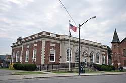
US Post Office-Frankfort |
|
May 11, 1989
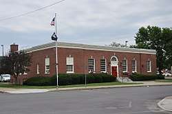
(#88002512) |
130 E. Main St.[7]
43°02′18″N 75°04′15″W / 43.038333°N 75.070833°W / 43.038333; -75.070833 (US Post Office-Frankfort) |
Frankfort |
part of the US Post Offices in New York State, 1858-1943, TR |
| 63 |
US Post Office-Herkimer |
|
May 11, 1989
(#88002501) |
135 Park Ave.
43°01′33″N 74°59′18″W / 43.025833°N 74.988333°W / 43.025833; -74.988333 (US Post Office-Herkimer) |
Herkimer |
part of the US Post Offices in New York State, 1858-1943, TR |
| 64 |
US Post Office-Ilion |
|
May 11, 1989
(#88002513) |
48 First St.
43°00′53″N 75°02′15″W / 43.014722°N 75.0375°W / 43.014722; -75.0375 (US Post Office-Ilion) |
Ilion |
part of the US Post Offices in New York State, 1858-1943, TR |
| 65 |
US Post Office-Little Falls |
|
May 11, 1989
(#88002343) |
25 W. Main St.
43°02′34″N 74°51′38″W / 43.042778°N 74.860556°W / 43.042778; -74.860556 (US Post Office-Little Falls) |
Little Falls |
part of the US Post Offices in New York State, 1858-1943, TR |
| 66 |
Yale-Cady Octagon House and Yale Lock Factory Site |
|
September 29, 2007
(#07001019) |
7550 N. Main St.
43°11′34″N 75°01′06″W / 43.192778°N 75.018333°W / 43.192778; -75.018333 (Yale-Cady Octagon House and Yale Lock Factory Site) |
Newport |
An octagonal house and the adjoining site of the lock factory of Linus Yale, Sr. and his son Linus Yale, Jr., the inventor of the cylinder lock. Linus Yale, Sr., built the house in 1849 as a gift for his daughter. |
| 67 |
Zoller-Frasier Round Barn |
|
September 29, 1984
(#84002401) |
Fords Bush Rd.
42°58′21″N 74°46′34″W / 42.9725°N 74.776111°W / 42.9725; -74.776111 (Zoller-Frasier Round Barn) |
Newville |
part of the Central Plan Dairy Barns of New York TR |
.jpg)
.jpg)
%2C_from_Robert_N._Dennis_collection_of_stereoscopic_views.png)
.jpg)