Fulton Street (New York City Subway)
Fulton Street | |||||||||||
|---|---|---|---|---|---|---|---|---|---|---|---|
|
| |||||||||||
.jpg) Turnstiles in the Fulton Center | |||||||||||
| Station statistics | |||||||||||
| Address |
Fulton Street between Broadway & Nassau Street New York, NY 10007 | ||||||||||
| Borough | Manhattan | ||||||||||
| Locale | Financial District | ||||||||||
| Coordinates | 40°42′36.74″N 74°0′27.88″W / 40.7102056°N 74.0077444°WCoordinates: 40°42′36.74″N 74°0′27.88″W / 40.7102056°N 74.0077444°W | ||||||||||
| Division | A (IRT), B (BMT, IND) | ||||||||||
| Line |
IND Eighth Avenue Line IRT Broadway–Seventh Avenue Line IRT Lexington Avenue Line BMT Nassau Street Line | ||||||||||
| Services |
2 3 4 5 A C J Z | ||||||||||
| Transit connections |
At Cortlandt Street via Fulton Center: N R W | ||||||||||
| Structure | Underground | ||||||||||
| Levels | 3 (Eighth Avenue Line platforms bisect the other 3 lines; Nassau Street platforms are on 2 levels) | ||||||||||
| Other information | |||||||||||
| Opened | July 1, 1948[1] | ||||||||||
| Station code | 628[2] | ||||||||||
| Accessible |
| ||||||||||
| Wireless service |
| ||||||||||
| Traffic | |||||||||||
| Passengers (2017) |
26,838,473 (station complex)[4] | ||||||||||
| Rank | 5 out of 425 | ||||||||||
| |||||||||||
| |||||||||||
| |||||||||||


Fulton Street is a New York City Subway station complex in Lower Manhattan. It consists of four linked stations on the IND Eighth Avenue Line, the IRT Lexington Avenue Line, the BMT Nassau Street Line and the IRT Broadway–Seventh Avenue Line. The last three cross Fulton Street at Broadway, Nassau Street, and William Street respectively; the Eighth Avenue Line station is underneath Fulton Street, between Broadway and Nassau Streets. The station is the seventh busiest in the system, as of 2017, with 26,838,473 passengers.[4]
The complex is served by the:
- 2, 4, A, and J trains at all times
- 3, 5, and C trains at all times except late nights
- Z train during rush hours in the peak direction
The Fulton Center is a renovation project that improves access throughout the station complex, introduces a new station building, and provides easier access to the World Trade Center site. It links the Fulton Street subway station with the nearby Cortlandt Street and Chambers Street/World Trade Center stations (the latter one stop north on the A, C, 2 and 3 trains) and the World Trade Center Transportation Hub through the out-of-fare control Dey Street Passageway. The Fulton Center opened on November 10, 2014.[5]
Station layout
| G | Street level | Exits/entrances
|
| B1 Platforms |
Mezzanine | Fare control, station agents, connections and retail at Fulton Center |
| Northbound Broadway–7th | ← ← | |
| Island platform, doors will open on the left | ||
| Southbound Broadway–7th | → → | |
| Side platform, doors will open on the left | ||
| Southbound Nassau | | |
| Side platform, doors will open on the right | ||
| Northbound Lexington | ← ← | |
| Southbound Lexington | → → | |
| Side platform, doors will open on the right | ||
| B2 Platforms |
Eastern mezzanine | Connections between services |
| Northbound Nassau | ← | |
| Side platform, doors will open on the left | ||
| Western mezzanine | Connections and Fulton Center retail | |
| B3 Platforms |
Northbound Eighth | ← ← |
| Island platform, doors will open on the left | ||
| Southbound Eighth | → → | |
| Fulton St to Cortlandt St subway cross-section | |||||||||
| Greenwich St | WTC Transportation Hub (Oculus) / Westfield Shops |
Church St | Broadway | Fulton Center / Westfield Shops |
Nassau St | William St | |||
| 1 | R / W | 4 / 5 | J / Z south | mezzanine | |||||
| underpass | underpass | Dey Street Passageway | underpass | mezzanine | J / Z north | mezzanine | 2 / 3 | ||
| mezzanine | ← A / C → | ||||||||
| PATH | |||||||||
IRT Lexington Avenue Line platforms
Fulton Street | |||||||||
|---|---|---|---|---|---|---|---|---|---|
|
| |||||||||
 Uptown platform | |||||||||
| Station statistics | |||||||||
| Division | A (IRT) | ||||||||
| Line | IRT Lexington Avenue Line | ||||||||
| Services |
4 5 | ||||||||
| Platforms | 2 side platforms | ||||||||
| Tracks | 2 | ||||||||
| Other information | |||||||||
| Opened | January 16, 1905 | ||||||||
| Station code | 412[2] | ||||||||
| Accessible |
| ||||||||
| Wireless service |
| ||||||||
| Station succession | |||||||||
| Next north |
Brooklyn Bridge–City Hall: 4 | ||||||||
| Next south |
Wall Street: 4 | ||||||||
|
| |||||||||
| Next |
Brooklyn Bridge–City Hall: 4 | ||||||||
| Next |
Bowling Green: 4 | ||||||||
| |||||||||

Fulton Street is a station on the IRT Lexington Avenue Line with two tracks and two side platforms.
History
This station opened on January 16, 1905 as part of a one-stop extension southbound from Brooklyn Bridge–City Hall. Only the northbound platform was in use when service started at this station.[6] The southbound platform opened for service on June 12, 1905, when the subway was extended one stop to the south at Wall Street.[7][8] This marked the first time that the subway had been extended further downtown and towards Brooklyn; the previous terminus, Brooklyn Bridge, was also the original subway's southern end.
Originally, only the southbound platform was ADA-accessible. In October 2012, a new entrance on Dey Street opened for the Dey Street underpass to Cortlandt Street, and an ADA-accessible elevator was installed for the southbound platform.[9] In November 2014, the northbound platform became accessible through an elevator to the underpass that connected to the southbound platform.
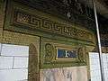
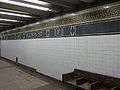
The station, which is now a registered New York City Landmark, features a mosaic of the steamboat built by Robert Fulton.[10] The southbound platform incorporates an ornate entrance to the building at 195 Broadway, which features fluted columns, engraved metal signs, ornate railings, and blacked out store windows.
Exits
Despite being on the Lexington Avenue Line, the station actually lies underneath Broadway between Cortlandt and Fulton Streets, as the line takes its name from its Upper East Side trunk avenue. A number of exits to street level are available at Dey, John, and Fulton Streets, while the connecting passage to the other stations within the Fulton Street complex lies underneath the latter.[11] Southbound exits are located at:
- Two stairs, NW corner of Fulton Street and Broadway[11]
- One stair, SW corner of Fulton Street and Broadway[11]
- One stair, NW corner of Dey Street and Broadway[11]

- One stair, NW corner of Cortlandt Street and Broadway[11]
Northbound exits are located at:
- One stair, NE corner of John Street and Broadway[11]
- One stair, SE corner of John Street and Broadway[11]
- One stair, NE corner of Cortlandt Street and Broadway[11]
Image gallery
 Column
 Name plaque
 33 Maiden Lane
.JPG) 140 West Street
140 West Street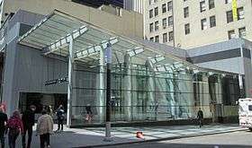 Dey Street stair
Further reading
- Lee Stokey. Subway Ceramics : A History and Iconography. 1994. ISBN 978-0-9635486-1-0
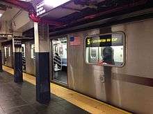
IRT Broadway–Seventh Avenue Line platform
Fulton Street | |||||||||||||
|---|---|---|---|---|---|---|---|---|---|---|---|---|---|
|
| |||||||||||||
 | |||||||||||||
| Station statistics | |||||||||||||
| Division | A (IRT) | ||||||||||||
| Line | IRT Broadway–Seventh Avenue Line | ||||||||||||
| Services |
2 3 | ||||||||||||
| Platforms | 1 island platform | ||||||||||||
| Tracks | 2 | ||||||||||||
| Other information | |||||||||||||
| Opened | July 1, 1918 | ||||||||||||
| Station code | 332[2] | ||||||||||||
| Accessible |
| ||||||||||||
| Wireless service |
| ||||||||||||
| Station succession | |||||||||||||
| Next north |
Park Place: 2 | ||||||||||||
| Next south |
Wall Street: 2 | ||||||||||||
|
| |||||||||||||
| Next |
Chambers Street: 2 | ||||||||||||
| Next |
Borough Hall: 2 | ||||||||||||
| |||||||||||||
The Fulton Street station on the IRT Broadway–Seventh Avenue Line was built on the portion of the line built as part of the Dual Contracts, which is the section south of Times Square–42nd Street. The line first opened as a shuttle to 34th Street–Penn Station on June 3, 1917,[12][13] and then south to South Ferry on July 1, 1918. On this same date, the Fulton Street station opened, with service to the station running as a shuttle between Chambers Street and Wall Street, on the line's Brooklyn Branch.[14] On August 1, 1918, the new "H" system was implemented on August 1, 1918, joining the two halves of the Broadway–Seventh Avenue Line and sending all West Side trains south from Times Square.[15] As a result, shuttle service to this station was replaced by through service.[16]
During the 1964–1965 fiscal year, the platforms at Fulton Street, along with those at four other stations on the Broadway–Seventh Avenue Line, were lengthened to 525 feet to accommodate a ten-car train of 51-foot IRT cars.[17]
Fulton Street station has a standard local configuration of two tracks and one island platform. Brooklyn-bound trains use track K2 while uptown trains use track K3. These designations come from track chaining which measures track distances and are not used in normal conversation. Based on this chaining, Fulton Street is about 19,700 ft (3.73 mi) from post zero at Broadway and 44th Street since this is where the West Side Line "merges" with the 42nd Street Shuttle. This is slightly non-standard signage because it is a local station using express track numbers as these tracks become the express tracks on the main line, providing a reasonable explanation.
There is an ADA-accessible elevator from platform level to the mezzanine at the platform's extreme south end, connecting to the mezzanine, which has elevators to the rest of the station via the IND Eighth Avenue Line platform. The Marine Grill Murals, salvaged from the restaurant of the same name in the Hotel McAlpin, reside near these elevators.
Exits
The station has two mezzanines, separated at Fulton Street. The full-time entrance is to the south mezzanine, at the southeast corner of Fulton and William Streets. There are also part-time entrances mid-block on William Street, and through an office building on John Street. The north mezzanine is open part-time, with an entrance through an office building on the northeast corner of Fulton and William Streets. Like Wall Street, the next station south, there is a narrow island platform and a number of comparatively narrow staircases up to the mezzanine level.[11]
Image gallery
 Former entrance in doorway of Royal Building. This stair is currently boarded up.
.JPG) Entrance at William Street and Fulton Street
Entrance at William Street and Fulton Street
BMT Nassau Street Line platforms
Fulton Street | |||||||||
|---|---|---|---|---|---|---|---|---|---|
|
| |||||||||
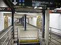
.JPG) Broad Street-bound platform | |||||||||
| Station statistics | |||||||||
| Division | B (BMT) | ||||||||
| Line | BMT Nassau Street Line | ||||||||
| Services |
J Z | ||||||||
| Levels | 2 | ||||||||
| Platforms | 2 side platforms (1 on each level) | ||||||||
| Tracks | 2 (1 on each level) | ||||||||
| Other information | |||||||||
| Opened | May 29, 1931[18] | ||||||||
| Station code | 106[2] | ||||||||
| Accessible |
| ||||||||
| Wireless service |
| ||||||||
| Station succession | |||||||||
| Next north |
Chambers Street: J | ||||||||
| Next south |
Broad Street: J | ||||||||
|
| |||||||||
| Next |
Marcy Avenue: J | ||||||||
| Next |
none: J Jay Street–MetroTech: no regular service | ||||||||
| |||||||||
Fulton Street on the BMT Nassau Street Line has two tracks and two side platforms, with downtown trains on the upper level and uptown trains on the lower level due to the narrowness of Nassau Street. The station has an unusual layout. The entrance for uptown trains is on the west side of Nassau Street, and the entrance for downtown trains is on the east side of Nassau Street (the reverse of what one would normally expect). It is possible to cross between the uptown and downtown sides via the IND platform, which passes underneath both levels of this station.[19] The station is ADA-accessible via the use of elevators to the IND platform, which then leads to the ADA-accessible Fulton Center main building.
Exits
Exit stairs rise to all four corners of Nassau Street and Fulton Street, with the eastern stairs for the southbound platform and the western stairs for the northbound platform. On the south end of the southbound platform, there are exits to either eastern corner of John and Nassau Streets that are open only during rush hours.[11]
There is a sealed north end exit to Ann Street and passageway to Beekman Street and Pace University to the far north. This passageway was out of system and more than one block long.[11][19]
Image gallery
IND Eighth Avenue Line platform
Fulton Street | |||||||||
|---|---|---|---|---|---|---|---|---|---|
|
| |||||||||
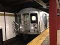
_03_-_IND_Platform.jpg) The IND Eighth Avenue Line platform | |||||||||
| Station statistics | |||||||||
| Division | B (IND) | ||||||||
| Line | IND Eighth Avenue Line | ||||||||
| Services |
A C | ||||||||
| Platforms | 1 island platform | ||||||||
| Tracks | 2 | ||||||||
| Other information | |||||||||
| Opened | February 1, 1933[20] | ||||||||
| Station code | 172[2] | ||||||||
| Accessible |
| ||||||||
| Wireless service |
| ||||||||
| Former/other names | Broadway – Nassau Street | ||||||||
| Station succession | |||||||||
| Next north |
Chambers Street: A | ||||||||
| Next south |
High Street: A | ||||||||
|
| |||||||||
| Next |
West Fourth Street–Washington Square (Eighth): A | ||||||||
| Next |
Jay Street–MetroTech (8th Ave express): A | ||||||||
| |||||||||
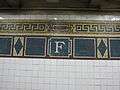
Fulton Street (formerly Broadway–Nassau Street) on the IND Eighth Avenue Line has two tracks and one island platform. The station is located approximately sixty feet (18m) below ground level. Similar to other stations near it, Fulton Street utilizes a tube station design because of its depth. The tile on this station is colored purple, with wall tiles reading "FULTON". An alternating pattern of "BWAY" and "NASSAU" was the original tiling. The station adopted the "Fulton Street" name in December 2010 to become unified with the other platforms in the station complex.[21] Overhead and column signage carry the new name.
An Arts for Transit piece, Nancy Holt's Astral Grating, was formerly located on the mezzanine but was removed during renovation.
Elevators lead from this line's platform to the mezzanines for the IRT Broadway–Seventh Avenue Line platform, both of the BMT Nassau Street Line's platforms, and both of the IRT Lexington Avenue Line's platforms. There is an elevator to street level at the southwestern corner of William and Fulton Streets.
Exits
The IND platform can be accessed via the entrances to any of the three other stations, but the BMT platforms' entrances provide the most direct access.[11]
Image gallery
 Mezzanine before reconstruction. Note the Marine Grill Murals on the walls
 Cliff Street Substation supplies power
Notable places nearby
References
- ↑ New York Times, Transfer Points Under Higher Fare, June 30, 1948, page 19
- 1 2 3 4 5 "Station Developers' Information". Metropolitan Transportation Authority. Retrieved June 13, 2017.
- 1 2 3 4 5 "NYC Subway Wireless – Active Stations". Transit Wireless Wifi. Retrieved May 18, 2016.
- 1 2 "Facts and Figures: Annual Subway Ridership 2012–2017". Metropolitan Transportation Authority. July 12, 2018. Retrieved July 12, 2018.
- ↑ "MTA | news | Welcome to the New Fulton Center". www.mta.info. Retrieved July 4, 2016.
- ↑ "Subway at Fulton Street Busy" (PDF). Retrieved September 4, 2016.
- ↑ "SUBWAY TRAINS RUN AGAIN THIS MORNING; Through Service Promised for the rush-Hour Crowds. TUNNEL PUMPED OUT AT LAST Big Water Main That Burst Was an Old One, Pressed Into Service Again After a Five-Hour Watch" (PDF). Retrieved September 18, 2016.
- ↑ "SUBWAY TO WALL ST. OPEN IN TEN DAYS; And All the Way to the Bronx by July 1. WHOLE ROAD READY IN AUGUST As to the Air Therein, William Barclay Parsons Says It Is Pure and Can't Be Bettered" (PDF). Retrieved September 18, 2016.
- ↑ "MTA | Press Release | MTA Headquarters | New Dey Street Entrance Opened". www.mta.info. Retrieved July 4, 2016.
- ↑ "The ships of the Fulton Street subway station". Ephemeral New York. December 6, 2012. Retrieved July 4, 2016.
- 1 2 3 4 5 6 7 8 9 10 11 12 13 14 15 16 17 "MTA Neighborhood Maps: Lower Manhattan" (PDF). mta.info. Metropolitan Transportation Authority. 2015. Retrieved August 16, 2016.
- ↑ "Three New Links of the Dual Subway System Opened, Including a Shuttle Service from Times Square to Thirty-Fourth Street — Service on the Jerome Avenue Branch From 149th Street North to About 225th Street Began Yesterday Afternoon — The Event Celebrated by Bronx Citizens and Property Owners — The Seventh Avenue Connection Opened This Morning" (PDF). The New York Times. June 3, 1917. p. 1. Retrieved November 6, 2016.
- ↑ "Annual report. 1916-1917". HathiTrust. Interborough Rapid Transit Company. December 12, 2013. p. 22. Retrieved September 5, 2016.
- ↑ "Open New Subway to Regular Traffic — First Train on Seventh Avenue Line Carries Mayor and Other Officials — To Serve Lower West Side — Whitney Predicts an Awakening of the District — New Extensions of Elevated Railroad Service" (PDF). The New York Times. July 2, 1918. p. 11. Retrieved November 6, 2016.
- ↑ "Open New Subway Lines to Traffic; Called a Triumph — Great H System Put in Operation Marks an Era in Railroad Construction — No Hitch in the Plans — But Public Gropes Blindly to Find the Way in Maze of New Stations — Thousands Go Astray — Leaders in City's Life Hail Accomplishment of Great Task at Meeting at the Astor" (PDF). The New York Times. August 2, 1918. p. 1. Retrieved November 6, 2016.
- ↑ Whitney, Travis H. (March 10, 1918). "The Seventh and Lexington Avenue Subways Will Revive Dormant Sections — Change in Operation That Will Transform Original Four-Tracked Subway Into Two Four-Tracked Systems and Double Present Capacity of the Interborough" (PDF). The New York Times. p. 12. Retrieved August 26, 2016.
- ↑ Annual Report 1964–1965. New York City Transit Authority. 1965.
- ↑ New York Times, Mayor Drives Train in New Subway Link, May 30, 1931, page 11
- 1 2 "Broadway Nassau Fulton Street Complex". April 27, 2005. Archived from the original on April 27, 2005. Retrieved July 4, 2016.
- ↑ New York Times, City Opens Subway to Brooklyn Today, February 1, 1933, page 19
- ↑ http://www.mta.info/nyct/service/FultonStreetStation.htm
External links
| Wikimedia Commons has media related to Fulton Street (New York City Subway). |
nycsubway.org:
- nycsubway.org – IRT East Side Line: Fulton Street
- nycsubway.org – IRT West Side Line: Fulton Street
- nycsubway.org – BMT Nassau St./Jamaica Line: Fulton Street
- nycsubway.org – IND 8th Avenue: Broadway/Nassau Street
- nycsubway.org — Marine Grill Murals, 1913 Artwork by Fred Dana Marsh (2000)
- nycsubway.org — Astral Grating Artwork by Nancy Holt (1987)
Station Reporter:
- Station Reporter — Broadway Nassau/Fulton Street Complex
MTA's Arts For Transit:
- MTA's Arts For Transit — Fulton Street/William Street
Google Street View:
- Broadway & Dey Street entrance (Dey Street Headhouse) from Google Maps Street View
- Broadway & Fulton Street entrance (street) from Google Maps Street View
- Broadway & Fulton Street entrance (Fulton Center building) from Google Maps Street View
- Broadway & John Street entrance from Google Maps Street View
- Broadway, Maiden Lane, and Cortlandt Street entrance from Google Maps Street View
- Nassau Street & Fulton Street entrance from Google Maps Street View
- Nassau Street & John Street entrance from Google Maps Street View
- William Street & Fulton Street entrance from Google Maps Street View
- IRT Lexington Avenue Line platforms from Google Maps Street View
- IND platform from Google Maps Street View
- BMT platform from Google Maps Street View
- IRT Broadway - Seventh Avenue Line platform from Google Maps Street View
| Broadway– Seventh Avenue Line |
| ||||
|---|---|---|---|---|---|
| Lexington Ave. Line |
| ||||
| Eighth Avenue Line |
| ||||
| Nassau St. Line | |||||
| |||||