New Haven, Kentucky
| New Haven, Kentucky | |
|---|---|
| City | |
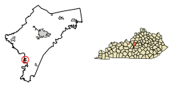 Location of New Haven in Nelson County, Kentucky. | |
| Coordinates: 37°39′33″N 85°35′21″W / 37.65917°N 85.58917°WCoordinates: 37°39′33″N 85°35′21″W / 37.65917°N 85.58917°W | |
| Country | United States |
| State | Kentucky |
| County | Nelson |
| Incorporated | 1839[1] |
| Named for | New Haven, Conn. |
| Area | |
| • Total | 0.6 sq mi (1.4 km2) |
| • Land | 0.6 sq mi (1.4 km2) |
| • Water | 0.0 sq mi (0.0 km2) |
| Elevation | 476 ft (145 m) |
| Population (2010) | |
| • Total | 855 |
| • Estimate (2016)[2] | 896 |
| • Density | 1,523.0/sq mi (588.0/km2) |
| Time zone | UTC-5 (Eastern (EST)) |
| • Summer (DST) | UTC-4 (EDT) |
| ZIP code | 40051 |
| Area code(s) | 502 |
| FIPS code | 21-55758 |
| GNIS feature ID | 0499330 |
New Haven is a home rule-class city in Nelson County, Kentucky, United States. The population was 849 at 2000 census.
History
New Haven was founded as "Pottenger's Landing" in 1781, but was renamed New Haven in 1819 by Samuel Pottenger Jr. for the Connecticut town. It was incorporated as a city in 1839,[1] with Silvester Johnson as the first elected city manager. In 1856, the Louisville and Nashville Railroad reached the town, virtually ending what had been a thriving flat-boating trade on the Rolling Fork River. The railroad purchased Pottenger's original landing, and it was demolished to make room for the roadbed and a bridge.
At the beginning of the Civil War, Kentucky declared its neutrality. Nevertheless, in late 1861 the Union Army occupied New Haven, and a training camp was established by the 15th Kentucky Infantry Regiment, later to be used by the 28th Kentucky Infantry Regiment. The New Haven railhead and post office were also used to support Camp Wickliffe, a Union infantry training camp in neighboring LaRue County. In mid-September 1862, General Braxton Bragg's Confederate troops marched through New Haven during its Kentucky Campaign, leaving the 3rd Georgia Cavalry Regiment to occupy the town, guarding the railroad bridge and the turnpike bridge over the Rolling Fork River. On September 26, a Union cavalry column, consisting the 2nd Indiana Cavalry, 1st Kentucky Cavalry, and 3rd Kentucky Cavalry, attacked the town, capturing almost the entire 3rd Georgia as well as the military patients being treated in a hospital set up at the Methodist Church. The 78th Illinois Infantry occupied the town in October, and were assigned the task of guarding the L&N railroad lines in the area. Blockhouses were built at all major bridges across the Rolling Fork River, including New Haven, which became the regiment's headquarters. During Morgan's Christmas Raid of 1862, the defenses at New Haven were attacked on the morning of December 30 by three companies of the Confederate 9th Kentucky Cavalry, aided by a single 12-punder Mountain Howitzer. After 90 minutes of contact, the Confederates broke off the attack, having inflicted no damage to the fort but suffering about 5 to 7 of their men wounded. However, the town suffered from several stray shells that damaged both of New Haven's taverns. The fortifications were occupied by different units until early 1864, but were burned to the ground by Henry C. Magruder's Confederate small band of guerillas in September 1864. From mid-1864 until the end of the war, New Haven acted as a base for a number of anti-guerilla units, the most famous being led by Major Cyrus J. Wilson.
After the Civil War, New Haven was well known as a center for the liquor trade, there being a large number of distilleries within a short distance. This bustling town had grown to a population of over 1200 by 1910, but the population fell quickly after the advent of Prohibition in 1919.
Geography
New Haven is located at 37°39′33″N 85°35′21″W / 37.65917°N 85.58917°W (37.659248, -85.589248).[3]
According to the United States Census Bureau, the city has a total area of 0.6 square miles (1.6 km2), all land.
Demographics
| Historical population | |||
|---|---|---|---|
| Census | Pop. | %± | |
| 1870 | 99 | — | |
| 1880 | 437 | 341.4% | |
| 1890 | 389 | −11.0% | |
| 1900 | 350 | −10.0% | |
| 1910 | 405 | 15.7% | |
| 1920 | 104 | −74.3% | |
| 1930 | 68 | −34.6% | |
| 1940 | 549 | 707.4% | |
| 1950 | 563 | 2.6% | |
| 1960 | 1,009 | 79.2% | |
| 1970 | 977 | −3.2% | |
| 1980 | 926 | −5.2% | |
| 1990 | 796 | −14.0% | |
| 2000 | 849 | 6.7% | |
| 2010 | 855 | 0.7% | |
| Est. 2016 | 896 | [2] | 4.8% |
| U.S. Decennial Census[4] | |||
As of the census[5] of 2000, there were 849 people, 341 households, and 243 families residing in the city. The population density was 1,523.0 people per square mile (585.4/km²). There were 355 housing units at an average density of 636.8 per square mile (244.8/km²). The racial makeup of the city was 97.53% White, 1.06% African American, 0.24% Asian, 0.47% from other races, and 0.71% from two or more races. Hispanic or Latino of any race were 1.18% of the population.
There were 341 households out of which 34.9% had children under the age of 18 living with them, 46.0% were married couples living together, 20.5% had a female householder with no husband present, and 28.7% were non-families. 26.1% of all households were made up of individuals and 12.6% had someone living alone who was 65 years of age or older. The average household size was 2.49 and the average family size was 2.95.
In the city the population was spread out with 27.1% under the age of 18, 8.7% from 18 to 24, 29.1% from 25 to 44, 19.3% from 45 to 64, and 15.8% who were 65 years of age or older. The median age was 35 years. For every 100 females, there were 92.5 males. For every 100 females age 18 and over, there were 82.6 males.
The median income for a household in the city was $29,886, and the median income for a family was $37,875. Males had a median income of $28,456 versus $20,809 for females. The per capita income for the city was $15,284. About 17.2% of families and 18.7% of the population were below the poverty line, including 25.7% of those under age 18 and 8.7% of those age 65 or over.
Sites of interest
- The Abbey of Our Lady of Gethsemani - Home of the monk Thomas Merton
- Kentucky Railway Museum - Houses "Old 152", the official steam locomotive of Kentucky[6]
References
- 1 2 Commonwealth of Kentucky. Office of the Secretary of State. Land Office. "New Haven, Kentucky". Accessed 15 September 2013.
- 1 2 "Population and Housing Unit Estimates". Retrieved June 9, 2017.
- ↑ "US Gazetteer files: 2010, 2000, and 1990". United States Census Bureau. 2011-02-12. Retrieved 2011-04-23.
- ↑ "Census of Population and Housing". Census.gov. Retrieved June 4, 2015.
- ↑ "American FactFinder". United States Census Bureau. Retrieved 2008-01-31.
- ↑ Kentucky State Symbols Archived 2008-12-22 at the Wayback Machine.
External links
| Wikimedia Commons has media related to New Haven, Kentucky. |
Municipalities and communities of Nelson County, Kentucky, United States | ||
|---|---|---|
| Cities | 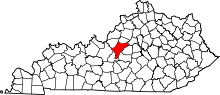 | |
| CDPs | ||
| Other unincorporated communities | ||