Rich Hill Township, Muskingum County, Ohio
| Rich Hill Township, Muskingum County, Ohio | |
|---|---|
| Township | |
 Cemetery on Zion Ridge Road | |
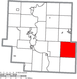 Location of Rich Hill Township in Muskingum County | |
| Coordinates: 39°53′7″N 81°44′32″W / 39.88528°N 81.74222°WCoordinates: 39°53′7″N 81°44′32″W / 39.88528°N 81.74222°W | |
| Country | United States |
| State | Ohio |
| County | Muskingum |
| Area | |
| • Total | 36.8 sq mi (95.2 km2) |
| • Land | 36.3 sq mi (93.9 km2) |
| • Water | 0.5 sq mi (1.3 km2) |
| Elevation[1] | 853 ft (260 m) |
| Population (2000) | |
| • Total | 385 |
| • Density | 10.6/sq mi (4.1/km2) |
| Time zone | UTC-5 (Eastern (EST)) |
| • Summer (DST) | UTC-4 (EDT) |
| FIPS code | 39-66600[2] |
| GNIS feature ID | 1086731[1] |
Rich Hill Township is one of the twenty-five townships of Muskingum County, Ohio, United States. The 2000 census found 385 people in the township.[3]
Geography
Located on the eastern edge of the county, it borders the following townships:
- Union Township - north
- Westland Township, Guernsey County - northeast
- Spencer Township, Guernsey County - east
- Brookfield Township, Noble County - southeast corner
- Meigs Township - south
- Blue Rock Township - southwest corner
- Salt Creek Township - west
No municipalities are located in Rich Hill Township.
Name and history
Rich Hill Township was established in 1815.[4] It is the only Rich Hill Township statewide.[5]
Government
The township is governed by a three-member board of trustees, who are elected in November of odd-numbered years to a four-year term beginning on the following January 1. Two are elected in the year after the presidential election and one is elected in the year before it. There is also an elected township fiscal officer,[6] who serves a four-year term beginning on April 1 of the year after the election, which is held in November of the year before the presidential election. Vacancies in the fiscal officership or on the board of trustees are filled by the remaining trustees.
References
- 1 2 "US Board on Geographic Names". United States Geological Survey. 2007-10-25. Retrieved 2008-01-31.
- ↑ "American FactFinder". United States Census Bureau. Archived from the original on September 11, 2013. Retrieved 2008-01-31.
- ↑ Muskingum County, Ohio — Population by Places Estimates Ohio State University, 2007. Accessed 15 May 2007.
- ↑ Everhart, F.J. (1882). 1794. History of Muskingum County, Ohio, with illustrations and biographical sketches of prominent men and pioneers. F.J. Everhart & Co. p. 441.
- ↑ "Detailed map of Ohio" (PDF). United States Census Bureau. 2000. Retrieved 2007-02-16.
- ↑ §503.24, §505.01, and §507.01 of the Ohio Revised Code. Accessed 4/30/2009.
External links
Municipalities and communities of Muskingum County, Ohio, United States | ||
|---|---|---|
| City | 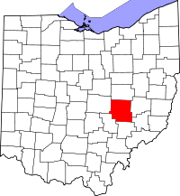 | |
| Villages | ||
| Townships | ||
| CDPs | ||
| Unincorporated communities |
| |
| Footnotes | ‡This populated place also has portions in an adjacent county or counties | |