Delaware
| State of Delaware | |||||
|---|---|---|---|---|---|
| |||||
| Nickname(s): The First State; The Small Wonder;[1] Blue Hen State; The Diamond State | |||||
| Motto(s): Liberty and Independence | |||||
| State song(s): "Our Delaware" | |||||
.svg.png) | |||||
| Demonym | Delawarean | ||||
| Capital | Dover | ||||
| Largest city | Wilmington | ||||
| Area | Ranked 49th | ||||
| • Total |
1,982[2] sq mi (5,130 km2) | ||||
| • Width | 30 miles (48 km) | ||||
| • Length | 96 miles (154 km) | ||||
| • % water | 21.7[3] | ||||
| • Latitude | 38° 27′ N to 39° 50′ N | ||||
| • Longitude | 75° 3′ W to 75° 47′ W | ||||
| Population | Ranked 45th | ||||
| • Total | 961,939 (2017 est.)[4] | ||||
| • Density |
469/sq mi (179/km2) Ranked 6th | ||||
| • Median household income | $57,756[5] (24th) | ||||
| Elevation | |||||
| • Highest point |
Near the Ebright Azimuth[6][7][8] 447.85 ft (136.50468 m) | ||||
| • Mean | 60 ft (20 m) | ||||
| • Lowest point |
Atlantic Ocean[6] Sea level | ||||
| Before statehood | Delaware Colony | ||||
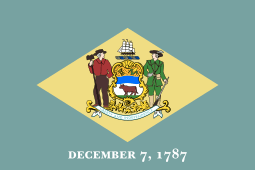
| Admission to Union | December 7, 1787 (1st) | ||||
| Governor | John Carney (D) | ||||
| Lieutenant Governor | Bethany Hall-Long (D) | ||||
| Legislature | General Assembly | ||||
| • Upper house | Senate | ||||
| • Lower house | House of Representatives | ||||
| U.S. Senators |
Tom Carper (D) Chris Coons (D) | ||||
| U.S. House delegation | Lisa Rochester (D) (list) | ||||
| Time zone | Eastern: UTC −5/−4 | ||||
| ISO 3166 | US-DE | ||||
| Abbreviations | DE, Del. | ||||
| Website |
delaware | ||||
| Delaware state symbols | |
|---|---|
 The Flag of Delaware | |
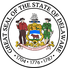 The Seal of Delaware | |
| Living insignia | |
| Bird | Delaware Blue Hen |
| Butterfly | Eastern tiger swallowtail |
| Wildlife animal | Grey fox |
| Fish | Weakfish |
| Flower | Peach blossom |
| Insect | 7-spotted ladybug |
| Tree | American holly |
| Inanimate insignia | |
| Beverage | Milk |
| Colors | Colonial blue, buff |
| Food | Strawberry, peach custard pie |
| Fossil | Belemnite |
| Mineral | Sillimanite |
| Slogan | Endless Discoveries [9] – Formerly: It's Good Being First |
| Soil | Greenwich |
| State route marker | |
 | |
| State quarter | |
 Released in 1999 | |
| Lists of United States state symbols | |
Delaware (/ˈdɛləwɛər/ (![]()
Delaware occupies the northeastern portion of the Delmarva Peninsula. It is the second smallest and sixth least populous state, but the sixth most densely populated. Delaware is divided into three counties, the lowest number of any state. From north to south, they are New Castle County, Kent County, and Sussex County. While the southern two counties have historically been predominantly agricultural, New Castle County is more industrialized.
Before its coastline was explored by Europeans in the 16th century, Delaware was inhabited by several groups of Native Americans, including the Lenape in the north and Nanticoke in the south. It was initially colonized by Dutch traders at Zwaanendael, near the present town of Lewes, in 1631.[12] Delaware was one of the 13 colonies participating in the American Revolution. On December 7, 1787, Delaware became the first state to ratify the Constitution of the United States, and has since been known as "The First State".[13]
Etymology
The state was named after the Delaware River, which in turn derived its name from Thomas West, 3rd Baron De La Warr (1577–1618) who was the ruling governor of the Colony of Virginia at the time Europeans first explored the river. The Delaware Indians, a name used by Europeans for Lenape people indigenous to the Delaware Valley, also derive their name from the same source.
The surname de La Warr comes from Sussex and is of Anglo-Norman origin.[14] It came probably from a Norman lieu-dit La Guerre. This toponymic could derive from the Latin word ager, from the Breton gwern or from the Late Latin varectum (fallow). The toponyms Gara, Gare, Gaire (the sound [ä] often mutated in [æ]) also appear in old texts cited by Lucien Musset, where the word ga(i)ra means gore. It could also be linked with a patronymic from the Old Norse verr.
Geography
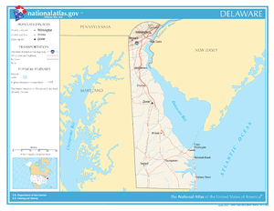


Delaware is 96 miles (154 km) long and ranges from 9 miles (14 km) to 35 miles (56 km) across, totaling 1,954 square miles (5,060 km2), making it the second-smallest state in the United States after Rhode Island. Delaware is bounded to the north by Pennsylvania; to the east by the Delaware River, Delaware Bay, New Jersey and the Atlantic Ocean; and to the west and south by Maryland. Small portions of Delaware are also situated on the eastern side of the Delaware River sharing land boundaries with New Jersey. The state of Delaware, together with the Eastern Shore counties of Maryland and two counties of Virginia, form the Delmarva Peninsula, which stretches down the Mid-Atlantic Coast.
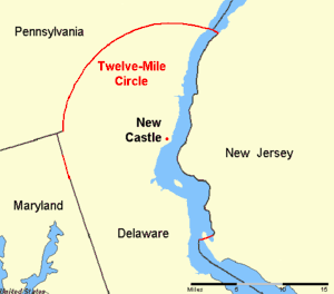
The definition of the northern boundary of the state is unusual. Most of the boundary between Delaware and Pennsylvania was originally defined by an arc extending 12 miles (19.3 km) from the cupola of the courthouse in the city of New Castle. This boundary is often referred to as the Twelve-Mile Circle.[lower-alpha 2] This is the only nominally circular state boundary in the United States.
This border extends all the way east to the low-tide mark on the New Jersey shore, then continues south along the shoreline until it again reaches the 12-mile (19 km) arc in the south; then the boundary continues in a more conventional way in the middle of the main channel (thalweg) of the Delaware River. To the west, a portion of the arc extends past the easternmost edge of Maryland. The remaining western border runs slightly east of due south from its intersection with the arc. The Wedge of land between the northwest part of the arc and the Maryland border was claimed by both Delaware and Pennsylvania until 1921, when Delaware's claim was confirmed.
Topography
Delaware is on a level plain, with the lowest mean elevation of any state in the nation.[15] Its highest elevation, located at Ebright Azimuth, near Concord High School, is less than 450 feet (140 m) above sea level.[15] The northernmost part of the state is part of the Piedmont Plateau with hills and rolling surfaces. The Atlantic Seaboard fall line approximately follows the Robert Kirkwood Highway between Newark and Wilmington; south of this road is the Atlantic Coastal Plain with flat, sandy, and, in some parts, swampy ground.[16] A ridge about 75 to 80 feet (23 to 24 m) in elevation extends along the western boundary of the state and separates the watersheds that feed Delaware River and Bay to the east and the Chesapeake Bay to the west.
Climate
Since almost all of Delaware is a part of the Atlantic coastal plain, the effects of the ocean moderate its climate. The state lies in the humid subtropical climate zone. Despite its small size (roughly 100 miles (160 km) from its northernmost to southernmost points), there is significant variation in mean temperature and amount of snowfall between Sussex County and New Castle County. Moderated by the Atlantic Ocean and Delaware Bay, the southern portion of the state has a milder climate and a longer growing season than the northern portion of the state. Delaware's all-time record high of 110 °F (43 °C) was recorded at Millsboro on July 21, 1930. The all-time record low of −17 °F (−27 °C) was also recorded at Millsboro on January 17, 1893.
Environment
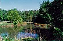
The transitional climate of Delaware supports a wide variety of vegetation. In the northern third of the state are found Northeastern coastal forests and mixed oak forests typical of the northeastern United States.[17] In the southern two-thirds of the state are found Middle Atlantic coastal forests.[17] Trap Pond State Park, along with areas in other parts of Sussex County, for example, support the northernmost stands of bald cypress trees in North America.
Environmental management
Delaware provides government subsidy support for the clean-up of property "lightly contaminated" by hazardous waste, the proceeds for which come from a tax on wholesale petroleum sales.[18]
Adjacent states
- Pennsylvania (north)
- New Jersey (east)
- Maryland (west and south)
History
Native Americans
Before Delaware was settled by European colonists, the area was home to the Eastern Algonquian tribes known as the Unami Lenape, or Delaware, who lived mostly along the coast, and the Nanticoke who occupied much of the southern Delmarva Peninsula. John Smith also shows two Iroquoian tribes, the Kuskarawock & Tockwogh, living north of the Nanticoke & they may have held small portions of land in the western part of the state before migrating across the Chesapeake Bay.[19] The Kuskarawocks were most likely the Tuscarora.
The Unami Lenape in the Delaware Valley were closely related to Munsee Lenape tribes along the Hudson River. They had a settled hunting and agricultural society, and they rapidly became middlemen in an increasingly frantic fur trade with their ancient enemy, the Minqua or Susquehannock. With the loss of their lands on the Delaware River and the destruction of the Minqua by the Iroquois of the Five Nations in the 1670s, the remnants of the Lenape who wished to remain identified as such left the region and moved over the Alleghany Mountains by the mid-18th century. Generally, those who did not relocate out of the state of Delaware were baptized, became Christian and were grouped together with other persons of color in official records and in the minds of their non-Native American neighbors.
Colonial Delaware
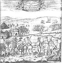
The Dutch were the first Europeans to settle in present-day Delaware in the middle region by establishing a trading post at Zwaanendael, near the site of Lewes in 1631. Within a year all the settlers were killed in a dispute with area Native American tribes. In 1638 New Sweden, a Swedish trading post and colony, was established at Fort Christina (now in Wilmington) by Peter Minuit at the head of a group of Swedes, Finns and Dutch. The colony of New Sweden lasted for 17 years. In 1651 the Dutch, reinvigorated by the leadership of Peter Stuyvesant, established a fort at present-day New Castle, and in 1655 they conquered the New Sweden colony, annexing it into the Dutch New Netherland.[20][21] Only nine years later, in 1664, the Dutch were conquered by a fleet of English ships by Sir Robert Carr under the direction of James, the Duke of York. Fighting off a prior claim by Cecil Calvert, 2nd Baron Baltimore, Proprietor of Maryland, the Duke passed his somewhat dubious ownership on to William Penn in 1682. Penn strongly desired access to the sea for his Pennsylvania province and leased what then came to be known as the "Lower Counties on the Delaware"[20] from the Duke.
Penn established representative government and briefly combined his two possessions under one General Assembly in 1682. However, by 1704 the Province of Pennsylvania had grown so large that their representatives wanted to make decisions without the assent of the Lower Counties and the two groups of representatives began meeting on their own, one at Philadelphia, and the other at New Castle. Penn and his heirs remained proprietors of both and always appointed the same person Governor for their Province of Pennsylvania and their territory of the Lower Counties. The fact that Delaware and Pennsylvania shared the same governor was not unique. From 1703 to 1738 New York and New Jersey shared a governor.[22] Massachusetts and New Hampshire also shared a governor for some time.[23]
Dependent in early years on indentured labor, Delaware imported more slaves as the number of English immigrants decreased with better economic conditions in England. The colony became a slave society and cultivated tobacco as a cash crop, although English immigrants continued to arrive.
American Revolution
Like the other middle colonies, the Lower Counties on the Delaware initially showed little enthusiasm for a break with Britain. The citizenry had a good relationship with the Proprietary government, and generally were allowed more independence of action in their Colonial Assembly than in other colonies. Merchants at the port of Wilmington had trading ties with the British.
So it was that New Castle lawyer Thomas McKean denounced the Stamp Act in the strongest terms, and Kent County native John Dickinson became the "Penman of the Revolution." Anticipating the Declaration of Independence, Patriot leaders Thomas McKean and Caesar Rodney convinced the Colonial Assembly to declare itself separated from British and Pennsylvania rule on June 15, 1776. The person best representing Delaware's majority, George Read, could not bring himself to vote for a Declaration of Independence. Only the dramatic overnight ride of Caesar Rodney gave the delegation the votes needed to cast Delaware's vote for independence.
Initially led by John Haslet, Delaware provided one of the premier regiments in the Continental Army, known as the "Delaware Blues" and nicknamed the "Blue Hen's Chicks." In August 1777 General Sir William Howe led a British army through Delaware on his way to a victory at the Battle of Brandywine and capture of the city of Philadelphia. The only real engagement on Delaware soil was the Battle of Cooch's Bridge, fought on September 3, 1777, at Cooch's Bridge in New Castle County, although there was a minor Loyalist rebellion in 1778.
Following the Battle of Brandywine, Wilmington was occupied by the British, and State President John McKinly was taken prisoner. The British remained in control of the Delaware River for much of the rest of the war, disrupting commerce and providing encouragement to an active Loyalist portion of the population, particularly in Sussex County. Because the British promised slaves of rebels freedom for fighting with them, escaped slaves flocked north to join their lines.[24]
Following the American Revolution, statesmen from Delaware were among the leading proponents of a strong central United States with equal representation for each state.
Slavery and race
Many colonial settlers came to Delaware from Maryland and Virginia, where the population had been increasing rapidly. The economies of these colonies were chiefly based on tobacco culture and were increasingly dependent on slave labor for its labor-intensive cultivation because of a decline in working class immigrants from England. Most of the English colonists had arrived as indentured servants, under contracts to work as laborers for a fixed period to pay for their passage. In the early years the line between indentured servants and African slaves or laborers was fluid, and the working classes often lived closely together.
Most of the free African-American families in Delaware before the Revolution had migrated from Maryland to find more affordable land. They were descendants chiefly of relationships or marriages between white servant women and enslaved, servant or free African or African-American men.[25] Under slavery law, children took the social status of their mothers, so children born to white women were free, regardless of their paternity, just as children born to enslaved women were born into slavery. As the flow of indentured laborers to the colony decreased with improving economic conditions in England, more slaves were imported for labor and the caste lines hardened.
By the end of the colonial period, the number of enslaved people in Delaware began to decline. Shifts in the agriculture economy from tobacco to mixed farming resulted in less need for slaves' labor. In addition local Methodists and Quakers encouraged slaveholders to free their slaves following the American Revolution, and many did so in a surge of individual manumissions for idealistic reasons. By 1810 three-quarters of all blacks in Delaware were free. When John Dickinson freed his slaves in 1777, he was Delaware's largest slave owner with 37 slaves. By 1860, the largest slaveholder owned 16 slaves.[26]
Although attempts to abolish slavery failed by narrow margins in the legislature, in practical terms, the state had mostly ended the practice. By the 1860 census on the verge of the Civil War, 91.7% of the black population were free;[27] 1,798 were slaves, as compared to 19,829 "free colored persons".[28]
An independent black denomination was chartered in 1813 by freed slave Peter Spencer as the "Union Church of Africans". This followed the 1793 establishment in Philadelphia of the African Methodist Episcopal Church by Richard Allen, which had ties to the Methodist Episcopal Church until 1816. Spencer built a church in Wilmington for the new denomination.[29] This was renamed as the African Union First Colored Methodist Protestant Church and Connection, more commonly known as the A.U.M.P. Church. In 1814, Spencer called for the first annual gathering, known as the Big August Quarterly, which continues to draw members of this denomination and their descendants together in a religious and cultural festival.
Delaware voted against secession on January 3, 1861, and so remained in the Union. While most Delaware citizens who fought in the war served in the regiments of the state, some served in companies on the Confederate side in Maryland and Virginia Regiments. Delaware is notable for being the only slave state from which no Confederate regiments or militia groups were assembled. Delaware essentially freed the few slaves that were still in bondage shortly after the Civil War, but rejected the 13th, 14th, and 15th Amendments to the Constitution; the 13th Amendment was rejected on February 8, 1865, the 14th Amendment was rejected on February 8, 1867, and the 15th Amendment was rejected on March 18, 1869. Delaware officially ratified the 13th, 14th, and 15th amendments on February 12, 1901.
Demographics
| Historical population | |||
|---|---|---|---|
| Census | Pop. | %± | |
| 1790 | 59,096 | — | |
| 1800 | 64,273 | 8.8% | |
| 1810 | 72,674 | 13.1% | |
| 1820 | 72,749 | 0.1% | |
| 1830 | 76,748 | 5.5% | |
| 1840 | 78,085 | 1.7% | |
| 1850 | 91,532 | 17.2% | |
| 1860 | 112,216 | 22.6% | |
| 1870 | 125,015 | 11.4% | |
| 1880 | 146,608 | 17.3% | |
| 1890 | 168,493 | 14.9% | |
| 1900 | 184,735 | 9.6% | |
| 1910 | 202,322 | 9.5% | |
| 1920 | 223,003 | 10.2% | |
| 1930 | 238,380 | 6.9% | |
| 1940 | 266,505 | 11.8% | |
| 1950 | 318,085 | 19.4% | |
| 1960 | 446,292 | 40.3% | |
| 1970 | 548,104 | 22.8% | |
| 1980 | 594,338 | 8.4% | |
| 1990 | 666,168 | 12.1% | |
| 2000 | 783,600 | 17.6% | |
| 2010 | 897,934 | 14.6% | |
| Est. 2017 | 961,939 | 7.1% | |
| Source: 1910–2010[30] 2015 estimate[31] | |||
The United States Census Bureau estimates that the population of Delaware was 952,065 people on July 1, 2016, a 6.0% increase since the 2010 United States Census.[31]
Ancestry
According to the 2010 United States Census, Delaware had a population of 897,934 people. The racial composition of the state was:
- 68.9% White American (65.3% Non-Hispanic White, 3.6% White Hispanic)
- 21.4% Black or African American
- 0.5% American Indian and Alaska Native
- 3.2% Asian American
- 0.0% Native Hawaiian and other Pacific Islander
- 3.4% some other race
- 2.7% Multiracial American
Ethnically, Hispanics and Latinos of any race made up 8.2% of the population.[32]
| Racial composition | 1990[33] | 2000[34] | 2010[35] |
|---|---|---|---|
| White | 80.3% | 74.6% | 68.9% |
| Black | 16.9% | 19.2% | 21.4% |
| Asian | 1.4% | 2.1% | 3.2% |
| Native | 0.3% | 0.4% | 0.5% |
| Native Hawaiian and other Pacific Islander | – | – | – |
| Other race | 1.1% | 2.0% | 3.4% |
| Two or more races | – | 1.7% | 2.7% |
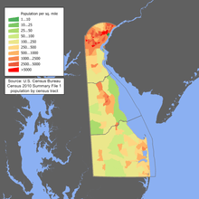
Delaware is the sixth most densely populated state, with a population density of 442.6 people per square mile, 356.4 per square mile more than the national average, and ranking 45th in population. Delaware is one of five states that do not have a single city with a population over 100,000 as of the 2010 census, the other four being West Virginia, Vermont, Maine and Wyoming.[36] The center of population of Delaware is in New Castle County, in the town of Townsend.[37]
As of 2011, 49.7% of Delaware's population younger than one year of age belonged to minority groups (i.e., did not have two parents of non-Hispanic white ancestry).[38] In 2000 approximately 19% of the population were African-American and 5% of the population is Hispanic (mostly of Puerto Rican or Mexican ancestry).[39]
Birth data
Note: Births in table don't add up because Hispanics are counted both by their ethnicity and by their race, giving a higher overall number.
| Race | 2013[40] | 2014[41] | 2015[42] | 2016[43] |
|---|---|---|---|---|
| White: | 7,204 (66.5%) | 7,314 (66.7%) | 7,341 (65.7%) | ... |
| > Non-Hispanic White | 5,942 (54.8%) | 5,904 (53.8%) | 5,959 (53.4%) | 5,827 (53.0%) |
| Black | 3,061 (28.3%) | 2,988 (27.2%) | 3,134 (28.1%) | 2,832 (25.7%) |
| Asian | 541 (5.0%) | 644 (5.9%) | 675 (6.1%) | 627 (5.7%) |
| American Indian | 25 (0.2%) | 26 (0.2%) | 16 (0.1%) | 13 (0.1%) |
| Hispanic (of any race) | 1,348 (12.4%) | 1,541 (14.0%) | 1,532 (13.7%) | 1,432 (13.0%) |
| Total Delaware | 10,831 (100%) | 10,972 (100%) | 11,166 (100%) | 10,992 (100%) |
- Since 2016, data for births of White Hispanic origin are not collected, but included in one Hispanic group; persons of Hispanic origin may be of any race.
Languages
As of 2000 91% of Delaware residents age 5 and older speak only English at home; 5% speak Spanish. French is the third most spoken language at 0.7%, followed by Chinese at 0.5% and German at 0.5%.
Legislation had been proposed in both the House and the Senate in Delaware to designate English as the official language.[44][45] Neither bill was passed in the legislature.
Religion
As of 2014, Delaware is mostly Christian. Although Protestants account for almost half of the population,[46] the Catholic Church is the largest single denomination in the state. The Association of Religion Data Archives[47] reported in 2010 that the three largest denominational groups in Delaware by number of adherents are the Catholic Church at 182,532 adherents, the United Methodist Church with 53,656 members reported, and non-denominational Evangelical Protestant with 22,973 adherents reported. The religious body with the largest number of congregations is the United Methodist Church (with 158 congregations) followed by non-denominational Evangelical Protestant (with 106 congregations), then the Catholic Church (with 45 congregations).
The Roman Catholic Diocese of Wilmington and the Episcopal Diocese of Delaware oversee the parishes within their denominations. The A.U.M.P. Church, the oldest African-American denomination in the nation, was founded in Wilmington. It still has a substantial presence in the state. Reflecting new immigrant populations, an Islamic mosque has been built in the Ogletown area, and a Hindu temple in Hockessin.
Delaware is home to an Amish community that resides to the west of Dover in Kent County, consisting of 9 church districts and between 1,200 and 1,500 people. The Amish first settled in Kent County in 1915. In recent years, increasing development has led to the decline in the number of Amish living in the community.[48][49]
A 2012 survey of religious attitudes in the United States found that 34% of Delaware residents considered themselves "moderately religious," 33% "very religious," and 33% as "non-religious."[50]
Sexual orientation
A 2012 Gallup poll found that Delaware's proportion of lesbian, gay, bisexual, and transgender adults stood at 3.4 percent of the population. This constitutes a total LGBT adult population estimate of 23,698 people. The number of same-sex couple households in 2010 stood at 2,646. This grew by 41.65% from a decade earlier.[51][52] On July 1, 2013, same-sex marriage was legalized, and all civil unions would be converted into marriages.[53]
Economy
Affluence
| DE County | March 2010 | March 2011 |
|---|---|---|
| New Castle | 229,000 | 216,000 |
| Sussex | 323,000 | 296,000 |
| Kent | 186,000 | 178,000 |
According to a 2013 study by Phoenix Marketing International, Delaware had the ninth-largest number of millionaires per capita in the United States, with a ratio of 6.20 percent.[55]
Agriculture

Delaware's agricultural output consists of poultry, nursery stock, soybeans, dairy products and corn.
Industries
As of October 2015, the state's unemployment rate was 5.1%.[56]
The state's largest employers are:
- government (State of Delaware, New Castle County)
- education (University of Delaware, Delaware Technical & Community College)
- banking (Bank of America, M&T Bank, JPMorgan Chase, Citigroup, Deutsche Bank)
- chemical, pharmaceutical, technology (E.I. du Pont de Nemours & Co., AstraZeneca, Syngenta, Agilent Technologies)
- healthcare (Christiana Care Health System, Bayhealth Medical Center, Alfred I. duPont Hospital for Children)
- farming, specifically chicken farming in Sussex County (Perdue Farms, Mountaire Farms, Allen Family Foods)
- retail (Walmart, Walgreens, Acme Markets)
Dover Air Force Base, located next to the state capital of Dover, is one of the largest Air Force bases in the country and is a major employer in Delaware. In addition to its other responsibilities in the United States Air Force Air Mobility Command, this air base serves as the entry point and mortuary for American military personnel and some U.S. government civilians who die overseas.
Industrial decline
Since the mid-2000s, Delaware has seen the departure of the state's automotive manufacturing industry (General Motors Wilmington Assembly and Chrysler Newark Assembly), the corporate buyout of a major bank holding company (MBNA), the departure of the state's steel industry (Evraz Claymont Steel), the bankruptcy of a fiber mill (National Vulcanized Fibre),[57] and the diminishing presence of Astra Zeneca in Wilmington.[58][59]
In late 2015, DuPont announced that 1,700 employees, nearly a third of its footprint in Delaware, would be laid off in early 2016.[60] The merger of E.I. du Pont de Nemours & Co. and Dow Chemical Company into DowDuPont took place on September 1, 2017.[61][62][63][64]
Incorporation in Delaware
More than 50% of all U.S. publicly traded companies and 63% of the Fortune 500 are incorporated in Delaware.[65] The state's attractiveness as a corporate haven is largely because of its business-friendly corporation law. Franchise taxes on Delaware corporations supply about one-fifth of its state revenue.[66] Although "USA (Delaware)" ranked as the world's most opaque jurisdiction on the Tax Justice Network's 2009 Financial Secrecy Index,[67] the same group's 2011 Index ranks the USA fifth and does not specify Delaware.[68] In Delaware, there are more than a million registered corporations,[69] meaning there are more corporations than people.
Food and drink
Title 4, chapter 7 of the Delaware Code stipulates that alcoholic liquor only be sold in specifically licensed establishments, and only between 9:00 am and 1:00 am.[70] Until 2003, Delaware was among the several states enforcing blue laws and banned the sale of liquor on Sunday.[71]
Transportation

The transportation system in Delaware is under the governance and supervision of the Delaware Department of Transportation, also known as "DelDOT".[73][74] Funding for DelDOT projects is drawn, in part, from the Delaware Transportation Trust Fund, established in 1987 to help stabilize transportation funding; the availability of the Trust led to a gradual separation of DelDOT operations from other Delaware state operations.[75] DelDOT manages programs such as a Delaware Adopt-a-Highway program, major road route snow removal, traffic control infrastructure (signs and signals), toll road management, Delaware Division of Motor Vehicles, the Delaware Transit Corporation (branded as "DART First State", the state government public transportation organization), among others. In 2009, DelDOT maintained 13,507 lane miles of roads, totaling 89 percent of the state's public roadway system; the remaining public road miles are under the supervision of individual municipalities. This far exceeds the United States national average of 20 percent for state department of transportation maintenance responsibility.[76]
Roads
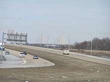
One major branch of the U.S. Interstate Highway System, Interstate 95 (I-95), crosses Delaware southwest-to-northeast across New Castle County. In addition to I-95, there are six U.S. highways that serve Delaware: U.S. Route 9 (US 9), US 13, US 40, US 113, US 202, and US 301. There are also several state highways that cross the state of Delaware; a few of them include Delaware Route 1 (DE 1), DE 9, and DE 404. US 13 and DE 1 are primary north-south highways connecting Wilmington and Pennsylvania with Maryland, with DE 1 serving as the main route between Wilmington and the Delaware beaches. DE 9 is a north-south highway connecting Dover and Wilmington via a scenic route along the Delaware Bay. US 40, is a primary east-west route, connecting Maryland with New Jersey. DE 404 is another primary east-west highway connecting the Chesapeake Bay Bridge in Maryland with the Delaware beaches. The state also operates two toll highways, the Delaware Turnpike, which is I-95, between Maryland and New Castle and the Korean War Veterans Memorial Highway, which is DE 1, between Wilmington and Dover.
A bicycle route, Delaware Bicycle Route 1, spans the north-south length of the state from the Maryland border in Fenwick Island to the Pennsylvania border north of Montchanin. It is the first of several signed bike routes planned in Delaware.[77]
Delaware has around 1,450 bridges, 95 percent of which are under the supervision of DelDOT. About 30 percent of all Delaware bridges were built before 1950, and about 60 percent of the number are included in the National Bridge Inventory. Some bridges not under DelDOT supervision includes the four bridges on the Chesapeake and Delaware Canal, which are under the jurisdiction of the U.S. Army Corps of Engineers, and the Delaware Memorial Bridge, which is under the bi-state Delaware River and Bay Authority.
It has been noted that the tar and chip composition of secondary roads in Sussex County make them more prone to deterioration than asphalt roadways found in almost the rest of the state.[78] Among these roads, Sussex (county road) 236 is among the most problematic.[78]
Ferries
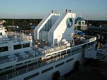
There are three ferries that operate in the state of Delaware:
- Cape May–Lewes Ferry crosses the mouth of the Delaware Bay between Lewes, Delaware and Cape May, New Jersey.
- Woodland Ferry is a cable ferry that crosses the Nanticoke River southwest of Seaford.
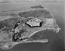
- Forts Ferry Crossing connects Delaware City with Fort Delaware and Fort Mott, New Jersey
Rail and bus
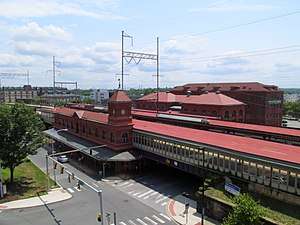
Amtrak has two stations in Delaware along the Northeast Corridor; the relatively quiet Newark Rail Station in Newark, and the busier Wilmington Rail Station in Wilmington. The Northeast Corridor is also served by SEPTA's Wilmington/Newark Line of Regional Rail, which serves Claymont, Wilmington, Churchmans Crossing, and Newark.
Two Class I railroads, Norfolk Southern and CSX, provide freight rail service in northern New Castle County. Norfolk Southern provides freight service along the Northeast Corridor and to industrial areas in Edgemoor, New Castle, and Delaware City. CSX's Philadelphia Subdivision passes through northern New Castle County parallel to the Amtrak Northeast Corridor. Multiple short-line railroads provide freight service in Delaware. The Delmarva Central Railroad operates the most trackage of the short-line railroads, running from an interchange with Norfolk Southern in Porter south through Dover, Harrington, and Seaford to Delmar, with another line running from Harrington to Frankford. The Delmarva Central Railroad connects with two shortline railroads, the Delaware Coast Line Railroad and the Maryland and Delaware Railroad, which serve local customers in Sussex County.[79] CSX connects with the freight/heritage operation, the Wilmington and Western Railroad, based in Wilmington and the East Penn Railroad, which operates a line from Wilmington to Coatesville, Pennsylvania.
The last north-south passenger train through the main part of Delaware was the Pennsylvania Railroad's The Cavalier, which ended service from Philadelphia through the state's interior in 1951.[80]
The DART First State public transportation system was named "Most Outstanding Public Transportation System" in 2003 by the American Public Transportation Association. Coverage of the system is broad within northern New Castle County with close association to major highways in Kent and Sussex counties. The system includes bus, subsidized passenger rail operated by Philadelphia transit agency SEPTA, and subsidized taxi and paratransit modes. The paratransit system, consisting of a statewide door-to-door bus service for the elderly and disabled, has been described by a Delaware state report as "the most generous paratransit system in the United States."[75] As of 2012, fees for the paratransit service have not changed since 1988.[75]
Air
As of 2016, there is no scheduled air service from any Delaware airport, as has been the case in various years since 1991. Various airlines had served Wilmington Airport, with the latest departure being Frontier Airlines in April 2015.[81]
Delaware is centrally situated in the Northeast megalopolis region of cities along I-95. Therefore, Delaware commercial airline passengers most frequently use Philadelphia International Airport (PHL), Baltimore-Washington International Thurgood Marshall Airport (BWI) and Washington Dulles International Airport (IAD) for domestic and international transit. Residents of Sussex County will also use Wicomico Regional Airport (SBY), as it is located less than 10 miles (16 km) from the Delaware border. Atlantic City International Airport (ACY), Newark Liberty International Airport (EWR), and Ronald Reagan Washington National Airport (DCA) are also within a 100-mile (160 km) radius of New Castle County.
The Dover Air Force Base of the Air Mobility Command is in the central part of the state, and it is the home of the 436th Airlift Wing and the 512th Airlift Wing.
Other general aviation airports in Delaware include Summit Airport near Middletown, Delaware Airpark near Cheswold, and Delaware Coastal Airport near Georgetown.
Law and government
Delaware's fourth and current constitution, adopted in 1897, provides for executive, judicial and legislative branches.[82]
Legislative branch
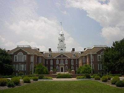
The Delaware General Assembly consists of a House of Representatives with 41 members and a Senate with 21 members. It sits in Dover, the state capital. Representatives are elected to two-year terms, while senators are elected to four-year terms. The Senate confirms judicial and other nominees appointed by the governor.
Delaware's U.S. Senators are Tom Carper (Democrat) and Chris Coons (Democrat). Delaware's single U.S. Representative is Lisa Blunt Rochester (Democrat).
Judicial branch
The Delaware Constitution establishes a number of courts:
- The Delaware Supreme Court is the state's highest court.
- The Delaware Superior Court is the state's trial court of general jurisdiction.
- The Delaware Court of Chancery deals primarily in corporate disputes.
- The Family Court handles domestic and custody matters.
- The Delaware Court of Common Pleas has jurisdiction over a limited class of civil and criminal matters.
Minor non-constitutional courts include the Justice of the Peace Courts and Aldermen's Courts.
Significantly, Delaware has one of the few remaining Courts of Chancery in the nation, which has jurisdiction over equity cases, the vast majority of which are corporate disputes, many relating to mergers and acquisitions. The Court of Chancery and the Delaware Supreme Court have developed a worldwide reputation for rendering concise opinions concerning corporate law which generally (but not always) grant broad discretion to corporate boards of directors and officers. In addition, the Delaware General Corporation Law, which forms the basis of the Courts' opinions, is widely regarded as giving great flexibility to corporations to manage their affairs. For these reasons, Delaware is considered to have the most business-friendly legal system in the United States; therefore a great number of companies are incorporated in Delaware, including 60% of the companies listed on the New York Stock Exchange.[83] Delaware was the last U.S. state to use judicial corporal punishment, in 1952.[84]
Executive branch
The executive branch is headed by the Governor of Delaware. The present governor is John Carney (Democrat), who took office January 17, 2017. The lieutenant governor is Bethany Hall-Long. The governor presents a "State of the State" speech to a joint session of the Delaware legislature annually.[85]
Counties
Delaware is subdivided into three counties; from north to south they are New Castle, Kent and Sussex. This is the fewest among all states. Each county elects its own legislative body (known in New Castle and Sussex counties as County Council, and in Kent County as Levy Court), which deal primarily in zoning and development issues. Most functions which are handled on a county-by-county basis in other states – such as court and law enforcement – have been centralized in Delaware, leading to a significant concentration of power in the Delaware state government. The counties were historically divided into hundreds, which were used as tax reporting and voting districts until the 1960s, but now serve no administrative role, their only current official legal use being in real-estate title descriptions.[86]
Politics
| Year | Democratic | Republican |
|---|---|---|
| 1952 | 47.9% 81,772 | 52.1% 88,977 |
| 1956 | 48.1% 85,047 | 52.0% 91,965 |
| 1960 | 51.7% 100,792 | 48.3% 94,043 |
| 1964 | 51.4% 102,797 | 48.7% 97,374 |
| 1968 | 49.5% 102,360 | 50.5% 104,474 |
| 1972 | 51.3% 117,274 | 47.9% 109,583 |
| 1976 | 42.5% 97,480 | 56.9% 130,531 |
| 1980 | 28.5% 64,217 | 70.7% 159,004 |
| 1984 | 44.5% 108,315 | 55.5% 135,250 |
| 1988 | 29.3% 70,236 | 70.7% 169,733 |
| 1992 | 64.7% 179,365 | 32.8% 90,725 |
| 1996 | 69.5% 188,300 | 30.5% 82,564 |
| 2000 | 59.2% 191,695 | 39.8% 128,603 |
| 2004 | 50.9% 185,548 | 45.8% 167,008 |
| 2008 | 67.5% 266,861 | 32.0% 126,662 |
| 2012 | 69.3% 275,993 | 28.6% 113,793 |
| 2016 | 58.3% 248,404 | 39.2% 166,852 |
| Year | Democratic | Republican |
|---|---|---|
| 1952 | 47.9% 83,315 | 51.8% 90,059 |
| 1956 | 44.6% 79,421 | 55.1% 98,057 |
| 1960 | 50.6% 99,590 | 49.0% 96,373 |
| 1964 | 61.0% 122,704 | 38.8% 78,078 |
| 1968 | 41.6% 89,194 | 45.1% 96,714 |
| 1972 | 39.2% 92,283 | 59.6% 140,357 |
| 1976 | 52.0% 122,596 | 46.6% 109,831 |
| 1980 | 44.9% 105,754 | 47.2% 111,252 |
| 1984 | 39.9% 101,656 | 59.8% 152,190 |
| 1988 | 43.5% 108,647 | 55.9% 139,639 |
| 1992 | 43.5% 126,054 | 35.3% 102,313 |
| 1996 | 51.8% 140,355 | 36.6% 99,062 |
| 2000 | 55.0% 180,068 | 41.9% 137,288 |
| 2004 | 53.4% 200,152 | 45.8% 171,660 |
| 2008 | 61.9% 255,459 | 36.9% 152,374 |
| 2012 | 58.6% 242,584 | 40.0% 165,484 |
| 2016 | 53.1% 235,603 | 41.7% 185,127 |
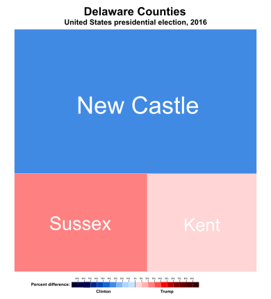
The Democratic Party holds a plurality of registrations in Delaware. Until the 2000 presidential election, the state tended to be a Presidential bellwether, sending its three electoral votes to the winning candidate since 1952. This trend ended in 2000 when Delaware's electoral votes went to Al Gore by 20-percentage points. In 2004, John Kerry won Delaware by eight-percentage points. In 2008, Democrat Barack Obama defeated Republican John McCain in Delaware by 25-percentage points. Obama's running mate was Joe Biden, who had represented Delaware in the United States Senate since 1973. Obama carried Delaware by 19-percentage points in 2012. In 2016, Delaware's electoral votes went to Hillary Clinton by 11-percentage points.
Delaware's swing to the Democrats is in part due to a strong Democratic trend in New Castle County, home to 55 percent of Delaware's population (the two smaller counties have only 359,000 people between them to New Castle's 535,000). New Castle has not voted Republican in a presidential election since 1988. In 1992, 2000, 2004, and 2016, the Republican presidential candidate carried both Kent and Sussex but lost by double-digits each time in New Castle, which was a large enough margin to swing the state to the Democrats. New Castle also elects a substantial majority of the legislature; 27 of the 41 state house districts and 14 of the 21 state senate districts are based in New Castle.
The Democrats have held the governorship since 1993, having won the last seven gubernatorial elections in a row. Democrats presently hold seven of the nine statewide elected offices, while the Republicans hold only two statewide offices, State Auditor and State Treasurer.
Freedom of information
Each of the 50 states of the United States has passed some form of freedom of information legislation, which provides a mechanism for the general public to request information of the government. In 2011 Delaware passed legislation placing a 15 business day time limit on addressing freedom-of-information requests, to either produce information or an explanation of why such information would take longer than this time to produce.[88]
Government revenue
Delaware has six different income tax brackets, ranging from 2.2% to 5.95%. The state does not assess sales tax on consumers. The state does, however, impose a tax on the gross receipts of most businesses. Business and occupational license tax rates range from 0.096% to 1.92%, depending on the category of business activity.
Delaware does not assess a state-level tax on real or personal property. Real estate is subject to county property taxes, school district property taxes, vocational school district taxes, and, if located within an incorporated area, municipal property taxes.
Gambling provides significant revenue to the state. For instance, the casino at Delaware Park Racetrack provided more than $100 million USD to the state in 2010.[89]
In June 2018, Delaware became the first US state to legalize sports betting following the Supreme Court ruling to repeal The Professional and Amateur Sports Protection Act (PASPA).[90]
Voter registration
| Party | Number of voters | Percentage | |
|---|---|---|---|
| Democratic | 330,631 | 47.38% | |
| Republican | 194,920 | 27.93% | |
| Unaffiliated | 159,625 | 22.88% | |
| Independent Party of Delaware | 5,597 | 0.80% | |
| Libertarian | 1,612 | 0.23% | |
| Green | 857 | 0.12% | |
| Non-partisan | 797 | 0.11% | |
| American Delta Party | 794 | 0.11% | |
| Others | 530 | 0.08% | |
| Conservative | 444 | 0.06% | |
| American Independent Party | 441 | 0.06% | |
| Working Families Party | 420 | 0.06% | |
| Liberal | 369 | 0.05% | |
| Constitution | 310 | 0.04% | |
| Blue Enigma Party | 145 | 0.04% | |
| Socialist Workers Party | 126 | 0.02% | |
| Natural Law Party | 85 | 0.01% | |
| Constitution | 66 | 0.01% | |
| Total | 697,769 | 100% | |
Municipalities
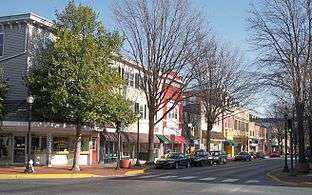
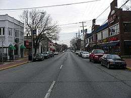
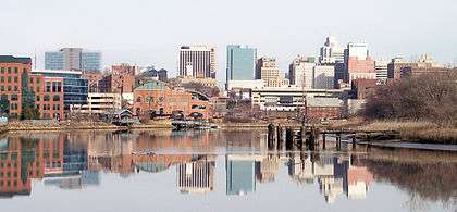
Wilmington is the state's largest city and its economic hub. It is located within commuting distance of both Philadelphia and Baltimore. All regions of Delaware are enjoying phenomenal growth, with Dover and the beach resorts expanding at a rapid rate.
.jpg)
Education
Delaware was the origin of Belton v. Gebhart, one of the four cases which were combined into Brown v. Board of Education, the Supreme Court of the United States decision that led to the end of officially segregated public schools. Significantly, Belton was the only case in which the state court found for the plaintiffs, thereby ruling that segregation was unconstitutional.
Unlike many states, Delaware's educational system is centralized in a state Superintendent of Education, with local school boards retaining control over taxation and some curriculum decisions.
As of 2011, the Delaware Department of Education had authorized the founding of 25 charter schools in the state, one of them being all-girls.[92]
All teachers in the State's public school districts are unionized.[93] As of January 2012, none of the State's charter schools are members of a teachers union.[93] One of the State's teachers' unions is Delaware State Education Association (DSEA), whose President as of January 2012 is Frederika Jenner.[93]
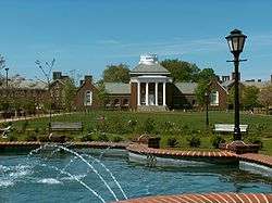
Colleges and Universities
- Delaware College of Art and Design
- Delaware State University
- Delaware Technical & Community College
- Drexel University at Wilmington
- Goldey-Beacom College
- University of Delaware — Ranked 63rd in USA and in top 201–250 in the world (Times Higher Education World University Rankings 2018)
- Wesley College
- Widener University School of Law
- Wilmington University
Sister cities and states
Delaware's sister state in Japan is Miyagi Prefecture.[94]
Media
Television
The northern part of the state is served by network stations in Philadelphia and the southern part by network stations in Baltimore and Salisbury, Maryland. Philadelphia's ABC affiliate, WPVI-TV, maintains a news bureau in downtown Wilmington. Salisbury's ABC affiliate, WMDT covers Sussex and lower Kent County; while CBS affiliate, WBOC-TV, maintains bureaus in Dover and Milton.
Few television stations are based solely in Delaware; the local PBS station from Philadelphia (but licensed to Wilmington), WHYY-TV, maintains a studio and broadcasting facility in Wilmington and Dover, Ion Television affiliate WPPX is licensed to Wilmington but maintains their offices in Philadelphia and their digital transmitter outside of that city and an analog tower in New Jersey, and MeTV affiliate WDPN-TV is licensed to Wilmington but maintains their offices in New Jersey and their transmitter is located at the antenna farm in Philadelphia.
In April 2014, it was revealed that Rehoboth Beach's WRDE-LD would affiliate with NBC, becoming the first major network-affiliated station in Delaware.[95]
Tourism
In addition to First State National Historical Park, Delaware has several museums, wildlife refuges, parks, houses, lighthouses, and other historic places.
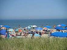
Rehoboth Beach, together with the towns of Lewes, Dewey Beach, Bethany Beach, South Bethany, and Fenwick Island, comprise Delaware's beach resorts. Rehoboth Beach often bills itself as "The Nation's Summer Capital" because it is a frequent summer vacation destination for Washington, D.C. residents as well as visitors from Maryland, Virginia, and in lesser numbers, Pennsylvania. Vacationers are drawn for many reasons, including the town's charm, artistic appeal, nightlife, and tax free shopping. According to SeaGrant Delaware, the Delaware Beaches generate $6.9 billion annually and over $711 million in tax revenue.[96]
Delaware is home to several festivals, fairs, and events. Some of the more notable festivals are the Riverfest held in Seaford, the World Championship Punkin Chunkin formerly held at various locations throughout the state since 1986, the Rehoboth Beach Chocolate Festival, the Bethany Beach Jazz Funeral to mark the end of summer, the Apple Scrapple Festival held in Bridgeville, the Clifford Brown Jazz Festival in Wilmington, the Rehoboth Beach Jazz Festival, the Sea Witch Halloween Festival and Parade in Rehoboth Beach, the Rehoboth Beach Independent Film Festival, the Nanticoke Indian Pow Wow in Oak Orchard, Firefly Music Festival, and the Return Day Parade held after every election in Georgetown.
In 2015, tourism in Delaware generated $3.1 billion, which makes up of 5 percent of the state's GDP. Delaware saw 8.5 million visitors in 2015, with the tourism industry employing 41,730 people, making it the 4th largest private employer in the state. Major origin markets for Delaware tourists include Philadelphia, Baltimore, New York City, Washington, D.C., and Harrisburg, with 97% of tourists arriving to the state by car and 75% of tourists coming from 200 miles (320 km) or less.[97]
Culture and entertainment
Festivals
Sports
- Professional Teams
As Delaware has no franchises in the major American professional sports leagues, many Delawareans follow either Philadelphia or Baltimore teams. In the WNBA, the Washington Mystics enjoy a major following due to the presence of Wilmington native and University of Delaware product Elena Delle Donne. The University of Delaware's football team has a large following throughout the state with the Delaware State University and Wesley College teams also enjoying a smaller degree of support.
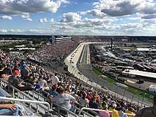
Delaware is home to Dover International Speedway and Dover Downs. DIS, also known as the Monster Mile, hosts two NASCAR race weekends each year, one in the late spring and one in the early fall. Dover Downs is a popular harness racing facility. It is the only co-located horse and car-racing facility in the nation, with the Dover Downs track inside the DIS track.
Delaware is represented in USA Rugby League by 2015 expansion club, the Delaware Black Foxes.
Delaware has been home to professional wrestling outfit Combat Zone Wrestling (CZW). CZW has been affiliated with the annual Tournament of Death and ECWA with its annual Super 8 Tournament.
Delaware Native Americans
Delaware is also the name of a Native American group (called in their own language Lenni Lenape) that was influential in the colonial period of the United States and is today headquartered in Cheswold, Kent County, Delaware. A band of the Nanticoke tribe of American Indians today resides in Sussex County and is headquartered in Millsboro, Sussex County, Delaware.
Namesakes
- Several ships have been named USS Delaware in honor of this state.
Delawareans
See also
Notes
- ↑ While the U.S. Census Bureau designates Delaware as one of the South Atlantic States, it is usually grouped with the Mid-Atlantic States or the Northeastern United States.
- ↑ Because of surveying errors, the actual line is several compound arcs with centers at different points in New Castle.
References
- ↑ Melissa Nann Burke (January 5, 2015). "Delaware a Small Wonder no more?". Delaware Online. Retrieved March 10, 2015.
- ↑ The State of Delaware. "State of Delaware". delaware.gov. Retrieved September 27, 2015.
- ↑ USGS, Howard Perlman,. "Area of each state that is water". water.usgs.gov.
- ↑ "Delaware: Population estimates". U.S. Census Bureau. July 1, 2017. Retrieved May 6, 2017.
- ↑ "Median Annual Household Income". The Henry J. Kaiser Family Foundation. Retrieved December 9, 2016.
- 1 2 "Elevations and Distances in the United States". United States Geological Survey. 2001. Archived from the original on October 15, 2011. Retrieved October 21, 2011.
- ↑ Elevation adjusted to North American Vertical Datum of 1988.
- ↑ Schenck, William S. "Highest Point in Delaware". Delaware Geological Survey. Archived from the original on October 20, 2008. Retrieved July 23, 2008.
- ↑ Molly Murray (January 6, 2015). "Delaware's new tourism brand: Endless Discoveries". Delaware Online. Retrieved March 10, 2015.
- ↑ Random House Dictionary
- ↑ "Delaware". Online Etymology Dictionary. Retrieved February 24, 2007.
- ↑ Myers, Albert Cook (1912). Narratives of Early Pennsylvania, West New Jersey and Delaware, 1630–1707, Volume 13. C. Scribner's Sons. p. 8.
- ↑ "The First to Ratify" would be more accurate, as the beginnings of the states themselves date back to the Declaration of Independence, celebrated July 4, 1776, when what was to become the State of Delaware was still the three lower counties of Pennsylvania with the governor in Philadelphia, and not establishing independence from that body until September 20, 1776. According to Delaware's own website, "Delaware became a state in 1776, just two months after the signing of the Declaration of Independence." (ref-pdf) Therefore Delaware was actually the last of the thirteen colonies to establish itself as a state. Additionally, the Delaware State Quarter is minted with this nickname, yet shows Caesar Rodney on horseback in commemoration of how he was the last delegate to show up to the Continental Congress for the historic vote for independence. And with regard to the original Articles of Confederation, Delaware was the 12th of the 13 states to ratify.
- ↑ Ware DeGidio, Wanda (2011). Ware DeGidio, Wanda, ed. Ware Family History: Descendants from Ancient, Medieval, and Modern Kings and Queens, and Presidents of the United States. p. 10. ISBN 978-1-4010-9930-5.
- 1 2 "Extreme and Mean Elevations by State and Other Area" (PDF). Statistical Abstract of the United States: 2004–2005. United States Census Bureau. p. 216. Retrieved March 16, 2011.
- ↑ "A Summary of the Geologic History of Delaware". The Delaware Geological Survey.
- 1 2 Olson; D. M; E. Dinerstein; et al. (2001). "Terrestrial Ecoregions of the World: A New Map of Life on Earth". BioScience. 51 (11): 933–938. doi:10.1641/0006-3568(2001)051[0933:TEOTWA]2.0.CO;2. ISSN 0006-3568. Archived from the original on October 14, 2011.
- ↑ Montgomery, Jeff (May 14, 2011). "Cleaning up contamination". The News Journal. New Castle, Delaware: Gannett. DelawareOnline. Archived from the original on May 14, 2011. Retrieved May 14, 2011. The first online page is archived; the page containing information related here is not in the archived version.
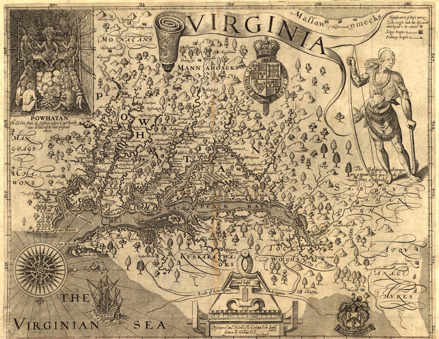
- ↑ http://www.sonofthesouth.net/revolutionary-war/maps/captain-smith-virginia-map.jpg
- 1 2 Munroe, John A (2006). "3. The Lower Counties on The Delaware". History of Delaware (5th, illustrated ed.). University of Delaware Press. p. 45. ISBN 978-0-87413-947-1.
- ↑ Scheltema, Gajus; Westerhuijs, Heleen, eds. (2011), Exploring Historic Dutch New York, New York: Museum of the City of New York/Dover, ISBN 978-0-486-48637-6
- ↑ Lurie, Mappen M (2004), Encyclopedia of New Jersey, Rutgers University Press, p. 327, ISBN 978-0-8135-3325-4
- ↑ Mayo, LS (1921), John Wentworth, Governor of New Hampshire: 1767–1775, Harvard University Press, p. 5
- ↑ Schama, Simon (2006), Rough Crossings: Britain, the Slaves, and the American Revolution, New York: Harper Collins
- ↑ Heinegg, Paul, Free African Americans in Virginia, North Carolina, South Carolina, Maryland and Delaware, retrieved February 15, 2008
- ↑ Kolchin 1994, pp. 78, 81–82.
- ↑ Kolchin 1994, pp. 81–82.
- ↑ "1860 Federal Census", Historical Census Browser, University of Virginia Library, archived from the original on October 11, 2014, retrieved November 30, 2012
- ↑ Dalleo, Peter T. (June 27, 1997). "The Growth of Delaware's Antebellum Free African Community". University of Delaware.
- ↑ "Resident Population Data". Census. 2010. Archived from the original on October 19, 2013. Retrieved August 17, 2011.
- 1 2 "Table 1. Annual Estimates of the Population for the United States, Regions, States, and Puerto Rico: April 1, 2010 to July 1, 2016". 2015 Population Estimates. United States Census Bureau, Population Division. December 20, 2016. Archived from the original (CSV) on December 23, 2015. Retrieved December 20, 2016.
- ↑ "American FactFinder". Factfinder2.census.gov. October 5, 2010. Archived from the original on May 20, 2011. Retrieved August 17, 2011.
- ↑ Historical Census Statistics on Population Totals By Race, 1790 to 1990, and By Hispanic Origin, 1970 to 1990, For The United States, Regions, Divisions, and States Archived copy at WebCite (June 22, 2013).
- ↑ "censusviewer.com/city/ID". January 7, 2014. Archived from the original on January 7, 2014.
- ↑ Center for New Media and Promotions(C2PO). "2010 Census Data". census.gov. Retrieved September 27, 2015.
- ↑ Voting (press release), US: Census, archived from the original on February 4, 2008
- ↑ "Population and Population Centers by State". United States Census Bureau. 2000. Archived from the original (plain text) on June 22, 2013. Retrieved March 9, 2007.
- ↑ Exner, Rich (June 3, 2012). "Americans under age 1 now mostly minorities, but not in Ohio: Statistical Snapshot". The Plain Dealer.
- ↑ "Demographic, Social and Economic Profile for Delaware" (PDF). Retrieved 2016-06-26.
- ↑ https://www.cdc.gov/nchs/data/nvsr/nvsr64/nvsr64_01.pdf
- ↑ https://www.cdc.gov/nchs/data/nvsr/nvsr64/nvsr64_12.pdf
- ↑ https://www.cdc.gov/nchs/data/nvsr/nvsr66/nvsr66_01.pdf
- ↑ https://www.cdc.gov/nchs/data/nvsr/nvsr67/nvsr67_01.pdf
- ↑ SB 129, State of Delaware , assigned June 13, 2007 to Senate Education Committee.
- ↑ HB 436, State of Delaware , stricken June 15, 2006
- 1 2 "Religious Landscape Study". Pew Forum. May 11, 2015.
- ↑ "The Association of Religion Data Archives | State Membership Report". www.thearda.com. Retrieved November 7, 2013.
- ↑ "Amish Countryside". Kent County & Greater Dover, Delaware Convention and Visitors Bureau. Archived from the original on November 23, 2016. Retrieved November 22, 2016.
- ↑ "Delaware Amish". Amish America. Retrieved October 6, 2017.
- ↑ Catholic News Agency (April 3, 2012). "In 'very religious' USA, Gallup sees Delaware residents as 'moderately' so – by 1 percent". The Dialog. Retrieved April 16, 2012.
- ↑ "LGBT Percentage Highest in D.C., Lowest in North Dakota". State of the States. Gallup Politics. February 15, 2013
- ↑ Williams Inst. Census Snapshot http://williamsinstitute.law.ucla.edu/category/research/census-lbgt-demographics-studies/
- ↑ Chase, Randall (May 7, 2013). "Delaware to Become 11th State With Gay Marriage". ABC News. Retrieved May 7, 2011
- ↑ Ruth, Eric (April 15, 2010). "Delaware housing: Home prices slide in all three counties; sales in NCCo, Kent down from year ago". The News Journal. Delaware. Delaware Online. Retrieved March 31, 2014. (subscription required)
- ↑ Frank, Robert (January 15, 2014). "Top states for millionaires per capita". CNBC. CNBC.com. Retrieved October 28, 2016.
- ↑ "Delaware Economy at a Glance" (database report). United States Department of Labor, Bureau of Labor Statistics.
- ↑ "National Vulcanized Fibre Corp. site in Yorklyn". Retrieved 12 December 2015.
- ↑ "AstraZeneca lays off workers at Delaware headquarters".
- ↑ "Delaware officials concerned about AstraZeneca, DuPont threats".
- ↑ "DuPont to cut 1,700 jobs in Delaware in January". Retrieved 29 December 2015.
- ↑ "DuPont merger called 'catastrophic' for Delaware". Archived from the original on December 17, 2015. Retrieved December 12, 2015.
- ↑ "DuPont merger: A 'sad day' for Delaware". Retrieved 12 December 2015.
- ↑ "DuPont-Dow merger 'catastrophic' for Delaware". Retrieved 12 December 2015.
- ↑ "Chemours will lay off 400, including some in Delaware". Retrieved 12 December 2015.
- ↑ "Delaware Division of Corporations". Government of DE. Retrieved June 10, 2012.
- ↑ "Delaware 2007 Fiscal Notebook – State General Fund Revenues by Category (F.Y. 2002 – F.Y. 2005)" (PDF). Archived from the original (PDF) on August 16, 2011. Retrieved August 17, 2011.
- ↑ "Financial Secrecy Index" (PDF). Tax Justice Network. November 1, 2009.
- ↑ "Financial Secrecy Index" (PDF). Tax Justice Network. October 4, 2011.
- ↑ "State of Delaware – Division of Corporations".
- ↑ "Chapter 7. Regulatory Provisions". Online Delaware Code. Delaware General Assembly. Archived from the original on June 26, 2013. Retrieved September 13, 2011.
- ↑ Aaron, Nathans (July 9, 2011). "Del. package stores hope to benefit from Md. tax". The News Journal. New Castle, Delaware. Archived from the original on July 11, 2011. Retrieved July 10, 2011.
- ↑ Harlow, Summer (January 20, 2008). "Auto tag No. 6 likely to sell for $1 million". The News Journal. Archived from the original on September 23, 2015.
- ↑ "State of Delaware Department of Transportation". State of Delaware. Retrieved June 30, 2006.
- ↑ Staff (Delaware Department of Transportation Public Relations) (2005). Delaware Transportation Facts 2005 (PDF). DelDOT Division of Planning. Archived from the original (PDF) on September 9, 2008.
- 1 2 3 Montgomery, Jeff (January 29, 2011). "Crisis ahead on Delaware roads". The News Journal. delawareonline. Retrieved January 29, 2012
- ↑ Delaware Transportation Facts (PDF). Delaware Department of Transportation. 2009. Archived from the original (PDF) on May 11, 2012. Retrieved April 16, 2012.
- ↑ "Projects: Delaware Bicycle Facility Master Plan". Delaware Department of Transportation. Retrieved September 28, 2010.
- 1 2 Justin Williams (April 17, 2011). "Anything Once: On the road, taking plenty of pot shots". News Journal. Wilmington, Delaware: Gannett. DelawareOnline. Retrieved April 17, 2011.
- ↑ "Delmarva Central Railroad". Carload Express. Retrieved March 27, 2017.
- ↑ Baer, Christopher T (2009), Named Trains of The PRR Including Through Services (PDF), PRRTHS
- ↑ See Wilmington Airport for history and details.
- ↑ "The Delaware Constitution of 1897 as amended". State of Delaware. Retrieved 22 August 2016.
- ↑ "About Agency". Delaware Division of Corporations. Archived from the original on February 28, 2007. Retrieved July 23, 2008.
- ↑ Pleck, Elizabeth Hefkin (2004). Domestic tyranny: the making of American social policy against family. University of Illinois Press. p. 120. ISBN 978-0-252-07175-1.
- ↑ "Delaware House of Representatives Minority Caucus". 2010. Archived from the original on January 24, 2010. Retrieved January 24, 2001.
- ↑ "The Hundreds of Delaware". Department of State: Division of Historical and Cultural Affairs. Delaware State Archives. Archived from the original on June 17, 2010. Retrieved September 28, 2010.
- 1 2 Leip, David. "General Election Results – Delaware". Dave Leip's Atlas of U.S. Presidential Elections. Retrieved August 4, 2018.
- ↑ Bennett, Rep.; Peterson, Sen.; Katz, Sen. (January 6, 2011), "An Act to Amend Title 29 of the Delaware Code Relating to the Freedom of Information Act", Delaware Code, 78 (online ed.) (published April 15, 2011), 10, House Bill # 5, retrieved April 22, 2011
- ↑ Barrish, Chris (April 23, 2011). "Delaware crime: Wave of brazen attacks sounds alarm at casino". Delaware Online. Wilmington, DE: Gannett. 1st page of online article archived via link provided. Archived from the original on May 14, 2011. Retrieved April 23, 2011.
- ↑ "Delaware becomes the first state to legalise sports betting". Retrieved 22 June 2018.
- ↑ http://elections.delaware.gov/reports/pdfs/e70r2001_20170301.pdf
- ↑ Dobo, Nichole (June 12, 2011). "Delaware schools: Checkered past goes unchecked". The News Journal. Archived from the original on June 13, 2011. Retrieved June 13, 2011.
- 1 2 3 Dobo, Nichole (2012). "Charter votes to join union". The News Journal (published Jan 19, 2012). delawareonline. Retrieved January 19, 2012
- ↑ McDowell; Sen. McBride; Rep. George (March 22, 2011). "Mourning Those Lost in the Recent Earthquake and Related Disasters that have Befallen Japan, and Expressing the Thoughts and Prayers of All Delawareans for the Citizens of Our Sister State of Miyagi Prefecture During These Difficult Times" (published March 23, 2011). Senate Joint Resolution # 3. Retrieved April 22, 2011.
- ↑ "Meet Delaware's New NBC Affiliate". Multichannel News. Retrieved April 24, 2014.
- ↑ "The Contribution of The Coastal Economy To The State of Delaware". SeaGrant Delaware. Archived from the original on April 2, 2017. Retrieved April 1, 2017.
- ↑ "The Value of Tourism 2015" (PDF). Visit Delaware. Archived from the original (PDF) on February 7, 2018. Retrieved February 6, 2018.
- ↑ "AN ACT TO AMEND TITLE 29 OF THE DELAWARE CODE RELATING TO THE DESIGNATION OF A STATE SPORT". Retrieved 7 July 2016.
Bibliography
- Kolchin, Peter (1994), American Slavery: 1619–1877, New York: Hill & Wang .
External links
History
- Delaware State Guide, Library of Congress .
General
- State of Delaware (official website) .

- Delaware Tourism homepage
- Delaware Map Data
- Energy & Environmental Data for Delaware
- USGS real-time, geographic, and other scientific resources of Delaware
- U.S. Census Bureau
- Delaware State Facts from USDA
- 2000 Census of Population and Housing for Delaware, U.S. Census Bureau
- Delaware at Ballotpedia
- Delaware at Curlie (based on DMOZ)
- Delaware State Databases – Annotated list of searchable databases produced by Delaware state agencies and compiled by the Government Documents Roundtable of the American Library Association.
| First | List of U.S. states by date of admission to the Union Ratified Constitution on December 7, 1787 (1st) |
Succeeded by Pennsylvania |
Dover (capital) | ||
| Topics |
| |
| Society |
| |
| Cities | ||
| Towns |
| |
| Counties | ||