Excelsior, Minnesota
| Excelsior, Minnesota | |
|---|---|
| City | |
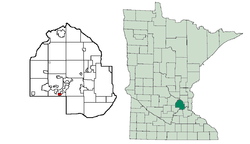 Location of Excelsior within Hennepin County and the state of Minnesota | |
| Country | United States |
| State | Minnesota |
| County | Hennepin |
| Government | |
| • Type | City |
| • Mayor | Mark Gaylord[1] |
| Area[2] | |
| • Total | 0.69 sq mi (1.79 km2) |
| • Land | 0.63 sq mi (1.63 km2) |
| • Water | 0.06 sq mi (0.16 km2) |
| Elevation | 950 ft (290 m) |
| Population (2010)[3] | |
| • Total | 2,188 |
| • Estimate (2016)[4] | 2,316 |
| • Density | 3,695/sq mi (1,426.8/km2) |
| Time zone | UTC-6 (Central (CST)) |
| • Summer (DST) | UTC-5 (CDT) |
| ZIP Code | 55331 |
| Area code(s) | 952 |
| FIPS code | 27-20078 |
| GNIS feature ID | 643477 |
| Website |
www |
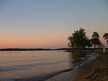
Excelsior is a city on Lake Minnetonka in Hennepin County, Minnesota, United States. As of the 2010 census the population was 2,188,[5] and in 2016 the estimated population was 2,316.[4] The suburb is located 18 miles (29 km) west of downtown Minneapolis.
Geography
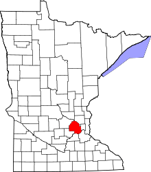
Excelsior is in southwestern Hennepin County on the south shore of Lake Minnetonka. It is nearly surrounded by the city of Shorewood, and a small portion of the northeast border is shared with the city of Greenwood. According to the United States Census Bureau, Excelsior has a total area of 0.69 square miles (1.79 km2), of which 0.63 square miles (1.63 km2) is land and 0.06 square miles (0.16 km2) is water.[2] Minnesota State Highway 7 serves as a main route through the city, leading east-northeast 11 miles (18 km) to Highway 100 in St. Louis Park and west 41 miles (66 km) to Hutchinson.
History
Excelsior was founded in 1853 by George Bertram and the Excelsior Pioneer Association. It was the first community established on Lake Minnetonka. Many of the original settlers in Excelsior came from the New England area, particularly upstate New York and Massachusetts. Some eastern-like features can be found in the layout of the town, which is organized as a grid with a public common along the lake shore.
Throughout the years, Excelsior's Water Street has been the home to many businesses including hotels, restaurants, and merchants. Excelsior works hard to maintain its historical identity while renewing various elements of the downtown area; the community is known for its abundance of Victorian housing stock and masonry-clad commercial district.
.jpg)

Excelsior was home to the Excelsior Amusement Park, which operated from 1925 to 1973. Today the site is occupied by a condominium complex and two restaurants.
Ray Colihan owned a ballroom called "Big Reggie's Danceland" in Excelsior during the 1950s and 1960s. Colihan is speculated as the only man to lose money on both The Beatles, who he booked at Met Stadium in 1965, and The Rolling Stones, who played Danceland in 1964 for an audience of approximately 300.[6] Legend has it, since debunked online,[6] that an Excelsior resident named Jimmy Hutmaker was the inspiration behind the Rolling Stones song You Can't Always Get What You Want after an encounter with singer Mick Jagger at the local drug store prior to the 1964 concert.[7] "Mr. Jimmy", as he was known, died on October 3, 2007.[8]
President Gerald Ford's golden retriever, Liberty, was purchased in 1974 from Avis Friberg, a resident of Excelsior.[9]
The streetcar steamboat Minnehaha, used for passenger travel on Lake Minnetonka during the turn of the twentieth century, was raised from the bottom of Lake Minnetonka in 1980, restored, and put back into passenger service in 1996. Now operated by the Museum of Lake Minnetonka, it again carries passengers between the communities of Excelsior and Wayzata as it did over a century ago.[10]

The Minnesota Streetcar Museum, a local transportation museum, operates threeheritage streetcar lines in Minneapolis and Excelsior. threestreetcars are currently operated on the Excelsior line: Twin City Lines No. 1239, Winona Power & Light Co. #10 and Duluth Street Railway No. 78.
Demographics
| Historical population | |||
|---|---|---|---|
| Census | Pop. | %± | |
| 1880 | 417 | — | |
| 1890 | 619 | 48.4% | |
| 1900 | 717 | 15.8% | |
| 1910 | 1,015 | 41.6% | |
| 1920 | 790 | −22.2% | |
| 1930 | 1,072 | 35.7% | |
| 1940 | 1,422 | 32.6% | |
| 1950 | 1,763 | 24.0% | |
| 1960 | 2,020 | 14.6% | |
| 1970 | 2,563 | 26.9% | |
| 1980 | 2,523 | −1.6% | |
| 1990 | 2,367 | −6.2% | |
| 2000 | 2,393 | 1.1% | |
| 2010 | 2,188 | −8.6% | |
| Est. 2016 | 2,316 | [4] | 5.9% |
| U.S. Decennial Census[11] | |||
2010 census

As of the census[3] of 2010, there were 2,188 people, 1,115 households, and 494 families residing in the city. The population density was 3,473.0 inhabitants per square mile (1,340.9/km2). There were 1,254 housing units at an average density of 1,990.5 per square mile (768.5/km2). The racial makeup of the city was 90.4% White, 2.7% African American, 0.6% Native American, 1.5% Asian, 0.1% Pacific Islander, 2.2% from other races, and 2.5% from two or more races. Hispanic or Latino of any race were 5.9% of the population.
There were 1,115 households of which 21.0% had children under the age of 18 living with them, 31.7% were married couples living together, 9.1% had a female householder with no husband present, 3.6% had a male householder with no wife present, and 55.7% were non-families. 48.3% of all households were made up of individuals and 12.2% had someone living alone who was 65 years of age or older. The average household size was 1.92 and the average family size was 2.82.
The median age in the city was 42 years. 19.1% of residents were under the age of 18; 8.1% were between the ages of 18 and 24; 27.4% were from 25 to 44; 30.3% were from 45 to 64; and 15.4% were 65 years of age or older. The gender makeup of the city was 48.4% male and 51.6% female.
2000 census
As of the census[12] of 2000, there were 2,393 people, 1,199 households, and 547 families residing in the city. The population density was 3,822.9 people per square mile (1,466.6/km²). There were 1,254 housing units at an average density of 2,003.3 per square mile (768.5/km²). The racial makeup of the city was 94.07% White, 0.75% African American, 0.33% Native American, 2.21% Asian, 1.55% from other races, and 1.09% from two or more races. Hispanic or Latino of any race were 3.13% of the population.
There were 1,199 households out of which 22.1% had children under the age of 18 living with them, 32.2% were married couples living together, 9.9% had a female householder with no husband present, and 54.3% were non-families. 45.2% of all households were made up of individuals and 14.1% had someone living alone who was 65 years of age or older. The average household size was 1.95 and the average family size was 2.80.
In the city, the population was spread out with 19.5% under the age of 18, 10.0% from 18 to 24, 33.3% from 25 to 44, 21.8% from 45 to 64, and 15.3% who were 65 years of age or older. The median age was 37 years. For every 100 females, there were 88.1 males. For every 100 females age 18 and over, there were 85.7 males.
The median income for a household in the city was $43,598, and the median income for a family was $61,406. Males had a median income of $40,845 versus $28,717 for females. The per capita income for the city was $29,127. About 3.6% of families and 5.7% of the population were below the poverty line, including 4.0% of those under age 18 and 5.6% of those age 65 or over.
Parks

The Excelsior Commons, a large park situated along the shore of Lake Minnetonka, is a publicly owned parcel of land used for various activities year-round. A large public beach is located at the northern end of the Commons.
Three Rivers Park District also maintains a bike and pedestrian trail that runs through Excelsior.
Events
Excelsior hosts several annual events including Apple Day, Art on the Lake, Crazy Days, Girls Night Out, Christkindlmarkt, the Excelsior Farmers Market, and Independence Day festivities.
Notable residents
- Sydney Rossman (born 1995), professional ice hockey player with the Connecticut Whale of the National Women's Hockey League[13]
- Sarah Punch (born 1976), inventor of microwave brownies.
- John Berkey (born 1932), professional artist best known for a wide variety of science fiction works.
References
- ↑ Excelsior, MN - Official Website - City Council
- 1 2 "US Gazetteer files 2010". United States Census Bureau. Archived from the original on 2012-01-24. Retrieved 2012-11-13.
- 1 2 "American FactFinder". United States Census Bureau. Retrieved 2012-11-13.
- 1 2 3 "Population and Housing Unit Estimates". Retrieved June 9, 2017.
- ↑ "Geographic Identifiers: 2010 Census Summary File 1 (G001): Excelsior city, Minnesota". American Factfinder. U.S. Census Bureau. Retrieved August 14, 2017.
- 1 2 Keller, Martin (2007). Music Legends: A Rewind on the Minnesota Music Scene. D Media. p. 10. ISBN 978-0-9787956-1-0.
- ↑ Kaufmann, Bill (2009-04-20) The Republic Strikes Back, The American Conservative
- ↑ Thiede, Dana (2007). "Excelsior loses tie to rock and roll history". KARE 11. Multimedia Holdings. Retrieved January 2, 2010.
- ↑ Honor's Foxfire Liberty Hume - Golden Retriever Weekly Archived 2007-09-28 at the Wayback Machine.
- ↑ "Streetcars and steamboats: the Excelsior of yore", by Alissa Antilla, Lakeshore Weekly News
- ↑ "Census of Population and Housing". Census.gov. Archived from the original on May 12, 2015. Retrieved June 4, 2015.
- ↑ "American FactFinder". United States Census Bureau. Archived from the original on 2013-09-11. Retrieved 2008-01-31.
- ↑
External links
![]()
Municipalities and communities of Hennepin County, Minnesota, United States | ||
|---|---|---|
| Cities |
|  |
| Unorganized territory | ||
| Footnotes | ‡This populated place also has portions in an adjacent county or counties | |
Coordinates: 44°54′12″N 93°33′59″W / 44.90333°N 93.56639°W