Kanabec County, Minnesota
| Kanabec County, Minnesota | |
|---|---|
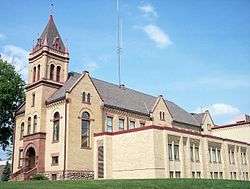 The Kanabec County Courthouse in Mora in 2007 | |
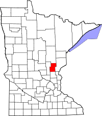 Location in the U.S. state of Minnesota | |
 Minnesota's location in the U.S. | |
| Founded |
March 13, 1858 (created) 1882 (organized)[1] |
| Named for | The Ojibwe word for "snake," after the Snake River |
| Seat | Mora |
| Largest city | Mora |
| Area | |
| • Total | 534 sq mi (1,383 km2) |
| • Land | 522 sq mi (1,352 km2) |
| • Water | 12 sq mi (31 km2), 2.3% |
| Population (est.) | |
| • (2016) | 15,830 |
| • Density | 31/sq mi (12/km2) |
| Congressional district | 8th |
| Time zone | Central: UTC−6/−5 |
| Website |
www |
Kanabec County (/kəˈneɪbɪk/ kə-NAY-bik) is a county located in the U.S. state of Minnesota. As of the 2010 census, the population was 16,239.[2] Its county seat is Mora,[3] although the original county seat was Brunswick. The county was founded on March 13, 1858 from Pine County and organized in 1882.[4] It is named after the Ojibwe Ginebig, meaning "Snake," after the Snake River — Kanabecosippi (Ginebigo-ziibi in the modern spelling) — which flows through this East Central Minnesota county.[5]
Geography
According to the U.S. Census Bureau, the county has a total area of 534 square miles (1,380 km2), of which 522 square miles (1,350 km2) is land and 12 square miles (31 km2) (2.3%) is water.[6]
Major highways
Adjacent counties
- Aitkin County (north)
- Pine County (east)
- Chisago County (southeast)
- Isanti County (south)
- Mille Lacs County (west)
Demographics
| Historical population | |||
|---|---|---|---|
| Census | Pop. | %± | |
| 1860 | 30 | — | |
| 1870 | 93 | 210.0% | |
| 1880 | 505 | 443.0% | |
| 1890 | 1,579 | 212.7% | |
| 1900 | 4,614 | 192.2% | |
| 1910 | 6,461 | 40.0% | |
| 1920 | 9,086 | 40.6% | |
| 1930 | 8,558 | −5.8% | |
| 1940 | 9,651 | 12.8% | |
| 1950 | 9,192 | −4.8% | |
| 1960 | 9,007 | −2.0% | |
| 1970 | 9,775 | 8.5% | |
| 1980 | 12,161 | 24.4% | |
| 1990 | 12,802 | 5.3% | |
| 2000 | 14,996 | 17.1% | |
| 2010 | 16,239 | 8.3% | |
| Est. 2016 | 15,830 | [7] | −2.5% |
| U.S. Decennial Census[8] 1790-1960[9] 1900-1990[10] 1990-2000[11] 2010-2016[2] | |||
As of the 2010 census,[12] there were 16,239 people and 6,277 households in the county. The population density was 31.1 people per square mile (11/km²). There were 7,808 housing units (2014 estimate). The racial makeup of the county was 96.6% White, 0.6% Black or African American, 0.8% Native American or Alaska Native, 0.4% Asian, <0.1% Pacific Islander or Native Hawaiian, and 1.6% from other races or two or more races. 1.7% of the population were Hispanic or Latino of any race. As of the 2000 census, 30.2% were of German, 18.1% Swedish, 13.1% Norwegian, 5.5% American and 5.4% Irish ancestry.
In the census of 2000, there were 5,759 households out of which 34.10% had children under the age of 18 living with them, 58.80% were married couples living together, 8.40% had a female householder with no husband present, and 28.00% were non-families. 23.80% of all households were made up of individuals and 10.30% had someone living alone who was 65 years of age or older. The average household size was 2.58 and the average family size was 3.03.
In the county, the population was spread out with 24.0% under the age of 18 and 16.4% who were 65 years of age or older. For every 100 females there were 101.2 males.
The median income for a household in the county was $47,068. The per capita income for the county was $22,291. About 14.2% of the population were below the poverty line.
Communities
Cities
Townships
Unincorporated communities
Politics
| Year | Republican | Democratic | Third parties |
|---|---|---|---|
| 2016 | 64.0% 5,230 | 28.5% 2,327 | 7.6% 620 |
| 2012 | 53.1% 4,328 | 44.1% 3,593 | 2.8% 229 |
| 2008 | 52.7% 4,479 | 44.0% 3,743 | 3.3% 277 |
| 2004 | 54.9% 4,527 | 43.6% 3,592 | 1.6% 129 |
| 2000 | 51.1% 3,480 | 41.6% 2,831 | 7.3% 500 |
| 1996 | 32.4% 1,924 | 49.2% 2,927 | 18.5% 1,097 |
| 1992 | 29.8% 1,876 | 40.3% 2,532 | 29.9% 1,880 |
| 1988 | 45.9% 2,571 | 53.1% 2,970 | 1.0% 57 |
| 1984 | 52.9% 3,027 | 46.5% 2,660 | 0.7% 37 |
| 1980 | 45.4% 2,500 | 48.2% 2,654 | 6.4% 354 |
| 1976 | 36.6% 1,943 | 60.0% 3,188 | 3.4% 180 |
| 1972 | 51.7% 2,395 | 42.5% 1,969 | 5.8% 268 |
| 1968 | 43.5% 1,847 | 50.7% 2,154 | 5.8% 247 |
| 1964 | 33.5% 1,348 | 66.3% 2,666 | 0.3% 10 |
| 1960 | 54.3% 2,278 | 45.1% 1,890 | 0.6% 25 |
| 1956 | 52.8% 1,950 | 47.0% 1,736 | 0.2% 7 |
| 1952 | 55.9% 2,205 | 43.4% 1,714 | 0.7% 29 |
| 1948 | 38.6% 1,531 | 58.1% 2,305 | 3.4% 134 |
| 1944 | 51.5% 1,913 | 47.8% 1,776 | 0.7% 24 |
| 1940 | 50.9% 2,311 | 48.1% 2,185 | 1.1% 49 |
| 1936 | 33.0% 1,350 | 63.1% 2,579 | 3.9% 159 |
| 1932 | 35.2% 1,268 | 58.4% 2,106 | 6.4% 231 |
| 1928 | 68.4% 2,380 | 29.9% 1,040 | 1.8% 62 |
| 1924 | 47.6% 1,507 | 4.0% 128 | 48.4% 1,533 |
| 1920 | 75.7% 2,436 | 10.3% 332 | 14.0% 451 |
| 1916 | 49.0% 776 | 38.4% 608 | 12.6% 199 |
| 1912 | 17.0% 218 | 21.0% 270 | 62.0% 795 |
| 1908 | 69.5% 803 | 21.0% 242 | 9.5% 110 |
| 1904 | 86.1% 872 | 10.5% 106 | 3.5% 35 |
| 1900 | 73.4% 658 | 23.4% 210 | 3.1% 28 |
| 1896 | 64.1% 484 | 33.9% 256 | 2.0% 15 |
| 1892 | 53.5% 182 | 11.2% 38 | 35.3% 120 |
See also
References
- ↑ "Minnesota Place Names". Minnesota Historical Society. Retrieved March 18, 2014.
- 1 2 "State & County QuickFacts". United States Census Bureau. Archived from the original on July 12, 2011. Retrieved September 1, 2013.
- ↑ "Find a County". National Association of Counties. Archived from the original on 2011-05-31. Retrieved 2011-06-07.
- ↑ Minnesota State Government Series - State Counties
- ↑ Gannett, Henry (1905). The Origin of Certain Place Names in the United States. Govt. Print. Off. p. 172.
- ↑ "2010 Census Gazetteer Files". United States Census Bureau. August 22, 2012. Archived from the original on September 21, 2013. Retrieved October 18, 2014.
- ↑ "Population and Housing Unit Estimates". Retrieved June 9, 2017.
- ↑ "U.S. Decennial Census". United States Census Bureau. Archived from the original on May 12, 2015. Retrieved October 18, 2014.
- ↑ "Historical Census Browser". University of Virginia Library. Retrieved October 18, 2014.
- ↑ "Population of Counties by Decennial Census: 1900 to 1990". United States Census Bureau. Retrieved October 18, 2014.
- ↑ "Census 2000 PHC-T-4. Ranking Tables for Counties: 1990 and 2000" (PDF). United States Census Bureau. Retrieved October 18, 2014.
- ↑ "State & County QuickFacts". United States Census Bureau. Archived from the original on 2011-07-12. Retrieved 2015-11-12.
- ↑ Leip, David. "Dave Leip's Atlas of U.S. Presidential Elections". uselectionatlas.org. Retrieved 2018-09-19.
Further reading
External links
Places adjacent to Kanabec County, Minnesota | ||||||||||
|---|---|---|---|---|---|---|---|---|---|---|
| ||||||||||
Municipalities and communities of Kanabec County, Minnesota, United States | ||
|---|---|---|
| Cities | | |
| Townships | ||
| Unincorporated communities | ||
| Indian reservation | ||
| Footnotes | ‡This populated place also has portions in an adjacent county or counties | |