Lynchburg, Ohio
| Lynchburg, Ohio | |
|---|---|
| Village | |
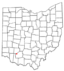 Location of Lynchburg, Ohio | |
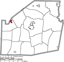 Location of Lynchburg in Highland County | |
| Coordinates: 39°14′32″N 83°47′26″W / 39.24222°N 83.79056°WCoordinates: 39°14′32″N 83°47′26″W / 39.24222°N 83.79056°W | |
| Country | United States |
| State | Ohio |
| Counties | Highland, Clinton |
| Area[1] | |
| • Total | 0.95 sq mi (12.56 km2) |
| • Land | 0.94 sq mi (2.43 km2) |
| • Water | 0.01 sq mi (0.03 km2) |
| Elevation[2] | 1,007 ft (307 m) |
| Population (2010)[3] | |
| • Total | 1,499 |
| • Estimate (2012[4]) | 1,479 |
| • Density | 1,594.7/sq mi (615.7/km2) |
| Time zone | UTC-5 (Eastern (EST)) |
| • Summer (DST) | UTC-4 (EDT) |
| ZIP code | 45142 |
| Area code(s) | 937 |
| FIPS code | 39-45542[5] |
| GNIS feature ID | 1085472[2] |
Lynchburg is a village in Clinton and Highland counties in the U.S. state of Ohio. The population was 1,499 at the 2010 census.
History
Lynchburg was platted in 1830, and named after Lynchburg, Virginia, the birthplace of a first settler.[6]
Lynchburg Covered Bridge was added in 1976 to the National Register of Historic Places.[7]
Geography
Lynchburg is located at 39°14′32″N 83°47′26″W / 39.24222°N 83.79056°W (39.242207, -83.790428).[8]
According to the United States Census Bureau, the village has a total area of 0.95 square miles (2.46 km2), of which 0.94 square miles (2.43 km2) is land and 0.01 square miles (0.03 km2) is water.[1]
Demographics
| Historical population | |||
|---|---|---|---|
| Census | Pop. | %± | |
| 1870 | 476 | — | |
| 1880 | 664 | 39.5% | |
| 1890 | 763 | 14.9% | |
| 1900 | 907 | 18.9% | |
| 1910 | 923 | 1.8% | |
| 1920 | 898 | −2.7% | |
| 1930 | 792 | −11.8% | |
| 1940 | 833 | 5.2% | |
| 1950 | 972 | 16.7% | |
| 1960 | 1,022 | 5.1% | |
| 1970 | 1,186 | 16.0% | |
| 1980 | 1,205 | 1.6% | |
| 1990 | 1,212 | 0.6% | |
| 2000 | 1,350 | 11.4% | |
| 2010 | 1,499 | 11.0% | |
| Est. 2017 | 1,473 | [9] | −1.7% |
| U.S. Decennial Census[10] | |||
2010 census
As of the census[3] of 2010, there were 1,499 people, 575 households, and 397 families residing in the village. The population density was 1,594.7 inhabitants per square mile (615.7/km2). There were 654 housing units at an average density of 695.7 per square mile (268.6/km2). The racial makeup of the village was 98.8% White, 0.3% from other races, and 0.9% from two or more races. Hispanic or Latino of any race were 0.8% of the population.
There were 575 households of which 38.8% had children under the age of 18 living with them, 48.3% were married couples living together, 15.1% had a female householder with no husband present, 5.6% had a male householder with no wife present, and 31.0% were non-families. 24.9% of all households were made up of individuals and 13.6% had someone living alone who was 65 years of age or older. The average household size was 2.61 and the average family size was 3.12.
The median age in the village was 35.5 years. 27.4% of residents were under the age of 18; 7.8% were between the ages of 18 and 24; 28% were from 25 to 44; 22.6% were from 45 to 64; and 14% were 65 years of age or older. The gender makeup of the village was 47.4% male and 52.6% female.
2000 census
As of the census[5] of 2000, there were 1,350 people, 518 households, and 365 families residing in the village. The population density was 1,538.4 people per square mile (592.3/km²). There were 557 housing units at an average density of 634.7 per square mile (244.4/km²). The racial makeup of the village was 98.67% White, 0.30% African American, 0.22% Native American, 0.15% Asian, and 0.67% from two or more races. Hispanic or Latino of any race were 0.07% of the population.
There were 518 households out of which 36.9% had children under the age of 18 living with them, 55.4% were married couples living together, 11.6% had a female householder with no husband present, and 29.5% were non-families. 26.3% of all households were made up of individuals and 12.5% had someone living alone who was 65 years of age or older. The average household size was 2.61 and the average family size was 3.14.
In the village, the population was spread out with 29.9% under the age of 18, 7.2% from 18 to 24, 31.9% from 25 to 44, 18.5% from 45 to 64, and 12.5% who were 65 years of age or older. The median age was 33 years. For every 100 females there were 90.4 males. For every 100 females age 18 and over, there were 88.6 males.
The median income for a household in the village was $34,792, and the median income for a family was $41,375. Males had a median income of $30,337 versus $22,422 for females. The per capita income for the village was $16,315. About 6.0% of families and 9.1% of the population were below the poverty line, including 10.4% of those under age 18 and 12.3% of those age 65 or over.
Education
Lynchburg-Clay Local School District operates one elementary school, one middle school, and Lynchburg-Clay High School.[11]
Lynchburg has a public library, a branch of the Highland County District Library.[12]
Gallery
 Corporation limit sign
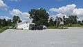 The Family Diner
 The last remaining building of the Freiberg & Workhum Distillery
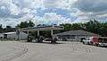 First Stop gas station
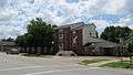 Lynchburg Commons apartments
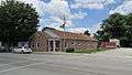 Lynchburg Post Office
 Main Street
 Main Street
 Main Street
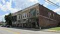 Main Street
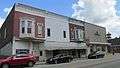 Main Street
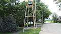 Original bell from the old Lynchburg High School
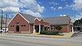 Lynchburg Library
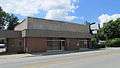 Main Street
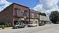 Main Street
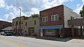 Main Street
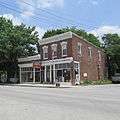 Main Street
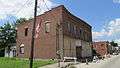 Main Street
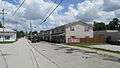 Old Mill Townhouses
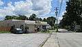 Main Street
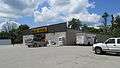 Dollar General
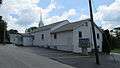 Faith Baptist Church
 Pearl Street Church of Christ
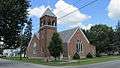 St. Paul Lutheran Church
 Lynchburg United Methodist Church
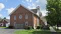 First Church of Christ
 Ruth Cramton Memorial Community Park
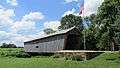 Lynchburg Covered Bridge
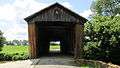 Lynchburg Covered Bridge
 Lynchburg Covered Bridge
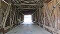 Lynchburg Covered Bridge
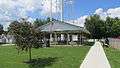 Old School Park
 Old School Park
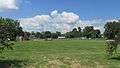 Old School Park
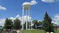 Lynchburg water tower
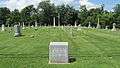 Lynchburg Masonic Cemetery - June 1854
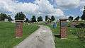 Lynchburg F.& A.M. Cemetery
References
- 1 2 "US Gazetteer files 2010". United States Census Bureau. Archived from the original on 2012-01-24. Retrieved 2013-01-06.
- 1 2 "US Board on Geographic Names". United States Geological Survey. 2007-10-25. Retrieved 2008-01-31.
- 1 2 "American FactFinder". United States Census Bureau. Retrieved 2013-01-06.
- ↑ "Population Estimates". United States Census Bureau. Archived from the original on 2013-06-02. Retrieved 2013-06-17.
- 1 2 "American FactFinder". United States Census Bureau. Retrieved 2008-01-31.
- ↑ Overman, William Daniel (1958). Ohio Town Names. Akron, OH: Atlantic Press. p. 79.
- ↑ "OHIO - Highland County". nationalregisterofhistoricplaces.com. Retrieved 25 February 2018.
- ↑ "US Gazetteer files: 2010, 2000, and 1990". United States Census Bureau. 2011-02-12. Retrieved 2011-04-23.
- ↑ "Population and Housing Unit Estimates". Retrieved May 26, 2018.
- ↑ "Census of Population and Housing". Census.gov. Retrieved June 4, 2015.
- ↑ "Homepage". Lynchburg-Clay Local School District. Retrieved 25 February 2018.
- ↑ "Hours & Locations". Highland County District Library. Retrieved 25 February 2018.
Municipalities and communities of Clinton County, Ohio, United States | ||
|---|---|---|
| City | 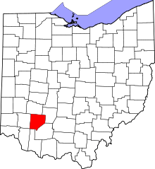 | |
| Villages | ||
| Townships | ||
| Unincorporated communities | ||
| Ghost town | ||
| Footnotes | ‡This populated place also has portions in an adjacent county or counties | |
Municipalities and communities of Highland County, Ohio, United States | ||
|---|---|---|
| City |  | |
| Villages | ||
| Townships | ||
| CDPs | ||
| Unincorporated communities | ||
| Footnotes | ‡This populated place also has portions in an adjacent county or counties | |