Union Township, Highland County, Ohio
| Union Township, Highland County, Ohio | |
|---|---|
| Township | |
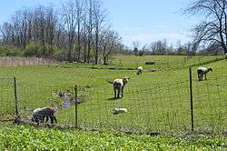 Sheep pasture on Fisher Road | |
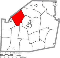 Location of Union Township in Highland County | |
| Coordinates: 39°14′59″N 83°43′15″W / 39.24972°N 83.72083°WCoordinates: 39°14′59″N 83°43′15″W / 39.24972°N 83.72083°W | |
| Country | United States |
| State | Ohio |
| County | Highland |
| Area | |
| • Total | 30.10 sq mi (77.95 km2) |
| • Land | 30.04 sq mi (77.80 km2) |
| • Water | 0.05 sq mi (0.14 km2) |
| Elevation[1] | 1,053 ft (321 m) |
| Population (2010) | |
| • Total | 2,065 |
| • Density | 70/sq mi (26.9/km2) |
| Time zone | UTC-5 (Eastern (EST)) |
| • Summer (DST) | UTC-4 (EDT) |
| FIPS code | 39-78344[2] |
| GNIS feature ID | 1086313[1] |
Union Township is one of the seventeen townships of Highland County, Ohio, United States. As of the 2010 census the population was 2,065,[3] up from 1,710 at the 2000 census.
Geography
Located in the northwestern part of the county, it borders the following townships:
- Green Township, Clinton County - north
- Penn Township - northeast
- Liberty Township - southeast
- New Market Township - south, east of Hamer Township
- Hamer Township - south, west of New Market Township
- Dodson Township - southwest
- Clark Township, Clinton County - northwest
No municipalities are located in Union Township.
Name and history
It is one of twenty-seven Union Townships statewide.[4]
Government
The township is governed by a three-member board of trustees, who are elected in November of odd-numbered years to a four-year term beginning on the following January 1. Two are elected in the year after the presidential election and one is elected in the year before it. There is also an elected township fiscal officer,[5] who serves a four-year term beginning on April 1 of the year after the election, which is held in November of the year before the presidential election. Vacancies in the fiscal officership or on the board of trustees are filled by the remaining trustees.
References
- 1 2 "US Board on Geographic Names". United States Geological Survey. 2007-10-25. Retrieved 2008-01-31.
- ↑ "American FactFinder". United States Census Bureau. Archived from the original on September 11, 2013. Retrieved 2008-01-31.
- ↑ "Geographic Identifiers: 2010 Census Summary File 1 (G001): Union township, Highland County, Ohio". American Factfinder. U.S. Census Bureau. Retrieved January 3, 2018.
- ↑ "Detailed map of Ohio" (PDF). United States Census Bureau. 2000. Retrieved 2007-02-16.
- ↑ §503.24, §505.01, and §507.01 of the Ohio Revised Code. Accessed 4/30/2009.
External links
Municipalities and communities of Highland County, Ohio, United States | ||
|---|---|---|
| City | 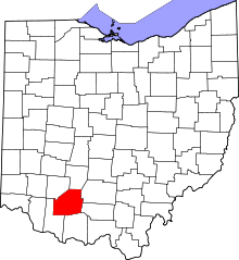 | |
| Villages | ||
| Townships | ||
| CDPs | ||
| Unincorporated communities | ||
| Footnotes | ‡This populated place also has portions in an adjacent county or counties | |