Grand Marais, Minnesota
| Grand Marais, Minnesota | |
|---|---|
| City | |
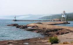 Lake Superior harbor in downtown Grand Marais | |
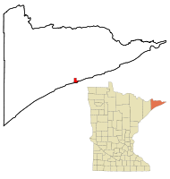 Location of the city of Grand Marais within Cook County, Minnesota | |
| Coordinates: 47°45′14″N 90°20′7″W / 47.75389°N 90.33528°WCoordinates: 47°45′14″N 90°20′7″W / 47.75389°N 90.33528°W | |
| Country | United States |
| State | Minnesota |
| County | Cook |
| Area[1] | |
| • Total | 2.90 sq mi (7.51 km2) |
| • Land | 2.90 sq mi (7.51 km2) |
| • Water | 0 sq mi (0 km2) |
| Elevation | 617 ft (188 m) |
| Population (2010)[2] | |
| • Total | 1,351 |
| • Estimate (2016)[3] | 1,339 |
| • Density | 470/sq mi (180/km2) |
| Time zone | UTC-6 (Central (CST)) |
| • Summer (DST) | UTC-5 (CDT) |
| ZIP code | 55604 |
| Area code(s) | 218 |
| FIPS code | 27-24992[4] |
| GNIS feature ID | 0656425[5] |
| Website | www.ci.grand-marais.mn.us |
Grand Marais (/ˌɡrænd
The area was a bustling fur trading station since the 1700s, and the French Voyageurs termed the settled village ‘Grand Marais’ which is French for "Great Marsh", referring to a marsh that, in early fur-trading times, was 20 acres (8.1 ha) or less in area, nearly at the level of Lake Superior, and situated at the head of the little bay and harbor that led to the settlement of the village there. Another small bay on the east, less protected from storms, is separated from the harbor by a slight projecting point and a short beach. Also, ‘Grand Marais’ also may mean "sheltered water area," as the harbor has natural breakwall rock outcroppings, providing for a natural safe harbor for early Lake Superior explorers.
Located on the east side of Grand Marais is Chippewa City. Chippewa City thrived in the 1890s, with about 100 families living in the village. The historic Francis Xavier church still stands slightly north of town, just off Highway 61. The church began as a Jesuit mission from Fort William, Ontario in 1855 to minister to the Ojibwe residents of the area. The permanent structure was built in 1895 and was used until declining attendance forced it to close in 1936. The Cook County Historical society restored the site between 1970 and 1974 and it was added to the National Register in 1986.
Grand Marais is a gateway to the Boundary Waters Canoe Area Wilderness, with the Gunflint Trail, historically a footpath for travelers and fur traders from inland lakes to Lake Superior. It is now County Road 12, a paved National Scenic Byway that begins in Grand Marais and ends at Saganaga Lake in the Boundary Waters Canoe Area Wilderness (BWCAW), near the U.S. border with Ontario. It provides access to many of the entry points in the BWCAW.
Many are attracted to the natural beauty of the area, making it a regional arts, music, and crafts hub, as the home of nonprofit educational institutions, such as the Grand Marais Art Colony and the North House Folk School, and art galleries featuring the work of local and regional artists. Grand Marais is also the hometown of 300 Entertainment recording artist Cobi.[10]
Geography
According to the United States Census Bureau, the city has a total area of 2.90 square miles (7.51 km2), all of it land.[1] Grand Marais is located on the northwestern shore of Lake Superior in northeastern Minnesota. It is an entry point for the Boundary Waters Canoe Area Wilderness, situated at the beginning of the Gunflint Trail. The Superior Hiking Trail passes near Grand Marais, and Judge C. R. Magney State Park is nearby, with its unusual Devil's Kettle waterfalls.
The land surrounding Grand Marais slopes up to form the Sawtooth Bluff, a dramatic rock face visible from nearly any vantage point in the city. Adjacent to the bluff is Pincushion Mountain, a large bald monolith with dramatic views of Lake Superior and the inland wilderness.
Grand Marais Harbor is protected by Artist's Point, a barrier island formed by lava that was connected to the mainland by gravel deposited by lake currents, forming a tombolo. An Arctic–alpine disjunct community survives there.[6][7]
Road access to Grand Marais is by Minnesota Highway 61, which heads northeast, following the shore of Lake Superior, and is known as the North Shore Scenic Drive. The Gunflint Trail (Cook County Road 12) begins in Grand Marais and heads northwest, away from the lake and into the Boundary Waters region.
Grand Marais is located 110 miles northeast of Duluth and 38 miles southwest of the Canada–US border.
Climate
Grand Marais has a warm-summer humid continental climate (Köppen Dfb), like the rest of northern Minnesota. Because of the moderating influence of Lake Superior, summer temperatures are cooler, winter temperatures warmer, and the seasonal temperature difference is smaller than locations farther inland. With average highs of a little over 70 °F (21 °C) in July and August, Grand Marais has the coolest summer temperatures of any weather station in Minnesota. The difference between the temperature of the warmest and coldest months is only 47.6 °F (26.4 °C), significantly smaller than 58.9 °F (32.7 °C), the seasonal temperature difference in Tower, Minnesota, about 90 miles (140 km) to the west.[8] Despite being significantly farther north, Grand Marais lies in USDA hardiness zone 4b like Duluth and Minneapolis,[9] with an average yearly minimum temperature of −23 °F (−31 °C).[10]
| Climate data for Grand Marais, Minnesota (1981–2010 normals, extremes 1897-present) | |||||||||||||
|---|---|---|---|---|---|---|---|---|---|---|---|---|---|
| Month | Jan | Feb | Mar | Apr | May | Jun | Jul | Aug | Sep | Oct | Nov | Dec | Year |
| Record high °F (°C) | 52 (11) |
58 (14) |
67 (19) |
83 (28) |
88 (31) |
93 (34) |
99 (37) |
100 (38) |
90 (32) |
77 (25) |
67 (19) |
55 (13) |
100 (38) |
| Average high °F (°C) | 24.7 (−4.1) |
28.4 (−2) |
36.3 (2.4) |
47.4 (8.6) |
56 (13) |
63.6 (17.6) |
71.2 (21.8) |
72.1 (22.3) |
64.3 (17.9) |
52.1 (11.2) |
39.3 (4.1) |
28 (−2) |
48.7 (9.3) |
| Daily mean °F (°C) | 15.6 (−9.1) |
19.1 (−7.2) |
27.7 (−2.4) |
38.8 (3.8) |
47.0 (8.3) |
53.8 (12.1) |
61.5 (16.4) |
63.2 (17.3) |
55.8 (13.2) |
44.2 (6.8) |
32.3 (0.2) |
20.0 (−6.7) |
40.0 (4.4) |
| Average low °F (°C) | 6.5 (−14.2) |
9.9 (−12.3) |
19 (−7) |
30.1 (−1.1) |
37.9 (3.3) |
44 (7) |
51.7 (10.9) |
54.3 (12.4) |
47.4 (8.6) |
36.4 (2.4) |
25.2 (−3.8) |
12 (−11) |
31.3 (−0.4) |
| Record low °F (°C) | −34 (−37) |
−34 (−37) |
−24 (−31) |
−8 (−22) |
17 (−8) |
25 (−4) |
28 (−2) |
33 (1) |
23 (−5) |
6 (−14) |
−14 (−26) |
−27 (−33) |
−34 (−37) |
| Average precipitation inches (mm) | 0.81 (20.6) |
0.5 (13) |
0.87 (22.1) |
1.67 (42.4) |
2.53 (64.3) |
3.61 (91.7) |
3.12 (79.2) |
2.71 (68.8) |
3 (80) |
3.1 (79) |
1.7 (43) |
0.98 (24.9) |
24.6 (625) |
| Average snowfall inches (cm) | 14.2 (36.1) |
6.2 (15.7) |
6.4 (16.3) |
1.8 (4.6) |
0 (0) |
0 (0) |
0 (0) |
0 (0) |
0 (0) |
0.1 (0.3) |
3.1 (7.9) |
13.2 (33.5) |
45.7 (116.1) |
| Source: NOAA[11][12][13] | |||||||||||||
Demographics
| Historical population | |||
|---|---|---|---|
| Census | Pop. | %± | |
| 1910 | 355 | — | |
| 1920 | 443 | 24.8% | |
| 1930 | 618 | 39.5% | |
| 1940 | 855 | 38.3% | |
| 1950 | 1,078 | 26.1% | |
| 1960 | 1,301 | 20.7% | |
| 1970 | 1,301 | 0.0% | |
| 1980 | 1,289 | −0.9% | |
| 1990 | 1,171 | −9.2% | |
| 2000 | 1,353 | 15.5% | |
| 2010 | 1,351 | −0.1% | |
| Est. 2016 | 1,339 | [3] | −0.9% |
| U.S. Decennial Census | |||
2010 census
As of the census[2] of 2010, there were 1,351 people, 673 households, and 331 families residing in the city. The population density was 465.9 inhabitants per square mile (179.9/km2). There were 863 housing units, with an average density of 297.6 per square mile (114.9/km2). The racial makeup of the city was 93.4% white, 0.4% African American, 2.4% Native American, 0.5% Asian, 0.1% Pacific Islander, 0.6% from other races, and 2.5% from two or more races. Hispanic and Latino residents of any race were 1.6% of the population.
There were 673 households, of which 21.5% had children under the age of 18 living with them, 37.1% were married couples living together, 9.4% had a female householder with no husband present, 2.7% had a male householder with no wife present, and 50.8% were non-families; 43.7% of all households were made up of individuals and 18.6% had someone living alone who was 65 years of age or older. The average household size was 1.94 persons, and the average family size was 2.67.
The median age in the city was 48.4 years; 18.1% of residents were under the age of 18; 5.1% were between the ages of 18 and 24; 23.2% were from 25 to 44; 30.8% were from 45 to 64; and 23% were 65 years of age or older. The gender makeup of the city was 45.9% male and 54.1% female.
2000 census
As of the census[4] of 2000, there were 1,353 people, 645 households, and 341 families residing in the city. The population density was 506.7 people per square mile (195.7/km²). There were 722 housing units, with an average density of 270.4 per square mile (104.4/km²). The racial makeup of the city was 94.97% white, 2.81% Native American, 0.15% Asian, 0.15% Pacific Islander, 0.07% from other races, and 1.85% from two or more races. Hispanic and Latino residents of any race were 0.74% of the population. According to the census, 23.3% were of Norwegian, 20.2% German, 11.8% Swedish, 7.0% Irish and 6.1% English ancestry.
There were 645 households, of which 23.3% had children under the age of 18 living with them, 42.9% were married couples living together, 8.1% had a female householder with no husband present, and 47.1% were non-families; 42.0% of all households were made up of individuals, and 21.6% had someone living alone who was 65 years of age or older. The average household size was 2.01 and the average family size was 2.73.
In the city 18.8% of the population were under the age of 18; 6.1% were from 18 to 24; 25.9% were from 25 to 44; 22.8% were from 45 to 64; and 26.3% were 65 years of age or older. The median age was 45 years. For every 100 females, there were 83.1 males. For every 100 females age 18 and over, there were 80.8 males.
The median income for a household in the city was $33,493, and the median income for a family was $46,563. Males had a median income of $31,500. The median income for females was $23,393. The per capita income for the city was $21,863. About 7.4% of families and 10.0% of the population were below the poverty line, including 11.9% of those under age 18 and 12.0% of those age 65 or over.
Festivals
Due to the pleasant summer climate with Lake Superior’s cooling and temperature moderating effect, and due to the lake-effect snows in winter, tourism is a large component of the town’s economy. Grand Marais is host to numerous festivals throughout the year. These festivals celebrate the unique history and culture of the North Shore and of the picturesque city itself.
- Fisherman's Picnic is held in Grand Marais during the first weekend in August.[14] It originated in the days when the area's economy was based on logging and commercial fishing, and the community would gather for a shoreline potluck picnic featuring a fish fry of fresh Lake Superior herring. The tradition continues with the Lions Club's Famous Fishburger Stand. Herring, still provided by local commercial fishermen, is dipped in coating, fried golden brown and served piping hot on a hot dog bun.[15]
- Moose Madness is held the third weekend in October. It celebrates the area's moose populations, and is a family themed event with games, prizes, and activities.
- The Grand Marais Arts Festival. A popular, longstanding event held in early July along Lake Superior's North Shore, directly in town. There are over 70 local and regional artists, live music, and art demonstrations, and is hosted by the Grand Marais Art Colony.
- Summer and Winter Solstice Festivals, hosted by the North House Folk School.
- Le Grand Du Nord. This race takes place on Memorial Day weekend, and is a gravel course which starts in the village's harbor area. The route than climbs to a view of the US/Canadian border, with almost 6000 feet of climbing.
- Lake Superior Storm Fest, sponsored by Visit Cook County, celebrated the gales of November and stormy season of Lake Superior.
Historic lodges and resorts
- Naniboujou Lodge
- Lutsen Resort on Lake Superior
- Elsies Lakeview Cabins
Media
Newspapers
- Cook County News-Herald
- Northern Wilds
Radio
Outdoor recreation
- Boundary Waters Canoe Area
- Isle Royale National Park
- Superior Hiking Trail Association
- Cascade River State Park
- Eagle Mountain
- Judge C. R. Magney State Park
- Border Route Trail
- Gunflint Trail
- Kekekabic Hiking Trail
- Pincushion Mountain Cross Country Ski Trail
- Grand Marais Recreation Area
- Devil's Kettle
- Lutsen Mountains
- Temperance River State Park
- Grand Portage State Park
Culture
- Grand Marais Art Colony
- Grand Marais Playhouse
- North Shore Music Association
- Grand Portage National Monument
- North House Folk School
- Cook County Historical Society
See also
References
- 1 2 "US Gazetteer files 2010". United States Census Bureau. Archived from the original on 2012-01-24. Retrieved 2012-11-13.
- 1 2 "American FactFinder". United States Census Bureau. Retrieved 2012-11-13.
- 1 2 "Population and Housing Unit Estimates". Retrieved June 9, 2017.
- 1 2 "American FactFinder". United States Census Bureau. Archived from the original on 2013-09-11. Retrieved 2008-01-31.
- ↑ "US Board on Geographic Names". United States Geological Survey. 2007-10-25. Retrieved 2008-01-31.
- ↑ "Planning Framework: North Shore Scenic Drive: All-American Road" (PDF). Center for Changing Landscapes. University of Minnesota.
- ↑ "Appendix: North Shore Scenic Drive: All-American Road" (PDF). Center for Changing Landscapes. University of Minnesota.
- ↑ "Temperature Summary for Station USC00218311 - TOWER 2S, MN". Midwest Regional Climate Center. Retrieved 14 August 2016.
- ↑ "USDA Plant Hardiness Zone Map". Agricultural Research Service, U.S. Department of Agriculture. 2012. Retrieved 14 August 2016.
- ↑ "GRAND MARAIS, MINNESOTA (213282): Monthly Minimum of Minimum Daily Temperature (Degrees Fahrenheit)". Western Regional Climate Center. Retrieved 14 August 2016.
- ↑ "GRAND MARAIS, MINNESOTA (213282): 1981-2010 Monthly Climate Summary". Western Regional Climate Center. Retrieved 14 August 2016.
- ↑ "Temperature Summary for Station USC00213282 - GRAND MARAIS, MN". Midwest Regional Climate Center. Retrieved 14 August 2016.
- ↑ "Grand Marais mean of monthly snowfall sums 1981-2010". NOWData. National Weather Service Forecast Office, Duluth, MN. Missing or empty
|url=(help) - ↑ Accessed 06/27/11."Grand Marais Fisherman's Picnic August 4–7, 2011"
- ↑ http://www.eastbaysuites.com/activities-and-events/events/fishermans-picnic.php East Bay Suites Website
External links
| Wikimedia Commons has media related to Grand Marais, Minnesota. |

- City of Grand Marais
- Grand Marais Chamber of Commerce
- Grand Marais Area Tourism Association
Municipalities and communities of Cook County, Minnesota, United States | ||
|---|---|---|
| City | 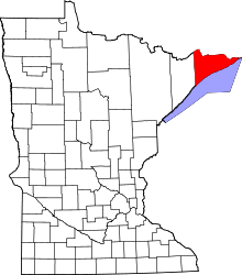 | |
| Townships | ||
| Unorganized territories | ||
| CDP | ||
| Unincorporated communities | ||
| Indian reservation | ||
| Ghost towns | ||