Fairfield, Ohio
| Fairfield, Ohio | |||
|---|---|---|---|
| City | |||
| |||
| Nickname(s): City of Opportunity | |||
 Location in Ohio | |||
 Location of Fairfield in Butler County | |||
| Coordinates: 39°19′52″N 84°32′34″W / 39.33111°N 84.54278°W | |||
| Country | United States | ||
| State | Ohio | ||
| Counties | Butler, Hamilton | ||
| Founded | 1787 | ||
| Incorporated | 1955 | ||
| Government | |||
| • Mayor | Steve Miller | ||
| Area[1] | |||
| • Total | 21.06 sq mi (54.55 km2) | ||
| • Land | 20.94 sq mi (54.23 km2) | ||
| • Water | 0.12 sq mi (0.31 km2) | ||
| Elevation | 591 ft (180 m) | ||
| Population (2010)[2] | |||
| • Total | 42,510 | ||
| • Estimate (2012[3]) | 42,647 | ||
| • Density | 2,030.1/sq mi (783.8/km2) | ||
| Time zone | UTC-5 (EST) | ||
| • Summer (DST) | UTC-4 (Eastern Daylight Saving Time) | ||
| ZIP code(s) | 45014 (with small portions 45011 & 45069) | ||
| Area code(s) | 513 | ||
| FIPS code | 39-25970[4] | ||
| GNIS feature ID | 1048720[5] | ||
| Website |
www | ||


Fairfield is a city in Butler and Hamilton counties in the U.S. state of Ohio, and a residential suburb of nearby Cincinnati. Fairfield was incorporated in 1955. The population was 42,510 at the 2010 census. It includes the former hamlet of Symmes Corner, named after Celadon Symmes.[6] The city school district is one of the largest in Ohio, with Fairfield High School graduating 842 students in June 2009.
History
An evolution of Fairfield:[7]
- 1877 — The Groh family settles in what would become the city of Fairfield. Patriarch Fred Groh purchased 50 acres (200,000 m2) in Fairfield Twp.
- 1953 — On August 6, 1953, the Hamilton Journal and Daily News reported a master plan to annex half of Fairfield Twp., taking half the schools and the township's major industries.
- 1954 — In April, voters said 'no' to incorporating the entire township 1,219 to 831. On July 10, township residents said 'yes' to incorporating 738 for to 216 against.
- 1955 — Attempts to detach the village and annex into Hamilton continued. The council pursued to annex a 10-square-mile (26 km2) area known as Stockton. Results of a special census were announced on September 20 there were 6,202 residents.
- 1965 — The third, and current, Fairfield Municipal Building was dedicated.
- 1972 — The 11th annual Homearama is held in Fairfield, the first one outside Hamilton County. Homearama's annual showcase returned two more times in Fairfield.
- 1974 — Jim Boniminio purchases land at 5440 Dixie Highway and after a reluctant planning commission approves his request to open a permanent fruit and vegetable market on the industrial zoned land. Today Jungle Jim's International Market has 50,000 weekly shoppers and annual sales of nearly $100 million.
- 1979 — The Fairfield Golf team wins a state championship, the first team or individual state title for the school.
- 1985 - Fairfield wins State HS Baseball Championships.
- 1986 — Fairfield HS wins state football championship versus Lakewood St. Edwards.
- 1989 — Forest Fair Mall opens with three anchors and 37 specialty stores. The $200 million mall with 1,700,000 square feet (160,000 m2) straddles the Fairfield and Forest Park border. Redevelopment of the mall in 2004 leads to renaming the mall Cincinnati Mills.
- 1991 — The Fairfield High School baseball team is named USA Today National Champions
- 2001 — In September, Village Green Park debuted. It was developed to give Fairfield a downtown.
- 2005 — In May, the Community Arts Center debuted, completing the city's "crown jewel". The Community Arts Center serves as a "bookend" to the Fairfield Lane Library, which opened in Village Green.
- 2012 — On July 28, the Joe Nuxhall Miracle League Fields, the region's first multi-field complex for tournament play by the disabled, celebrated opening day.
Geography
According to the United States Census Bureau, the city has a total area of 21.06 square miles (54.55 km2), of which 20.94 square miles (54.23 km2) is land and 0.12 square miles (0.31 km2) is water.[1]
Demographics
| Historical population | |||
|---|---|---|---|
| Census | Pop. | %± | |
| 1960 | 9,734 | — | |
| 1970 | 14,680 | 50.8% | |
| 1980 | 30,777 | 109.7% | |
| 1990 | 39,729 | 29.1% | |
| 2000 | 42,097 | 6.0% | |
| 2010 | 42,510 | 1.0% | |
| Est. 2017 | 42,566 | [8] | 0.1% |
| Sources:[4][9][10][11] | |||
2010 census
As of the census[2] of 2010, there were 42,510 people, 17,415 households, and 11,372 families residing in the city. The population density was 2,030.1 inhabitants per square mile (783.8/km2). There were 18,803 housing units at an average density of 897.9 per square mile (346.7/km2). The racial makeup of the city was 79.0% White, 12.8% African American, 0.3% Native American, 2.4% Asian, 0.1% Pacific Islander, 3.0% from other races, and 2.4% from two or more races. Hispanic or Latino of any race were 5.5% of the population.
There were 17,415 households of which 32.1% had children under the age of 18 living with them, 47.2% were married couples living together, 13.1% had a female householder with no husband present, 4.9% had a male householder with no wife present, and 34.7% were non-families. 28.7% of all households were made up of individuals and 9.3% had someone living alone who was 65 years of age or older. The average household size was 2.41 and the average family size was 2.97.
The median age in the city was 38.3 years. 23.2% of residents were under the age of 18; 8.6% were between the ages of 18 and 24; 27.4% were from 25 to 44; 28% were from 45 to 64; and 13% were 65 years of age or older. The gender makeup of the city was 48.2% male and 51.8% female.
Economy
Insurance company Cincinnati Financial is based in Fairfield.[12]
Top Employers
As of March, 2017 Fairfield's largest employers:[12]
| Rank | Employer | Number of Employees |
|---|---|---|
| 1 | Cincinnati Financial | 2,800 |
| 2 | Liberty Mutual | 1,400 |
| 3 | Mercy Health — Fairfield Hospital | 1,250 |
| 4 | Koch Foods | 1,000 |
| 5 | Fairfield City Schools | 900 |
| 6 | Pacific Manufacturing | 650 |
| 7 | Express Scripts | 600 |
| 8 | Takumi Stamping | 500 |
| 9 | Veritiv | 450 |
| 10 | Tri-County Extended Care | 400 |
Education
Fairfield City School District operates Fairfield High School.[13] Fairfield has a public library, a branch of the Lane Libraries.[14]
Sports
Fairfield is home to Cincinnati Gymnastics Academy, one of the nation's top elite gymnastics program, which has coached various Olympians.[15] The facility is owned by renowned coach, Mary Lee Tracy
Gallery
 Fairfield Community Arts Center, 2005
 City Library, 2008
.jpg) Fairfield Senior High School, 2008
Fairfield Senior High School, 2008
References
- 1 2 "US Gazetteer files 2010". United States Census Bureau. Archived from the original on 2012-01-24. Retrieved 2013-01-06.
- 1 2 "American FactFinder". United States Census Bureau. Retrieved 2013-01-06.
- ↑ "Population Estimates". United States Census Bureau. Archived from the original on 2013-06-17. Retrieved 2013-06-17.
- 1 2 "American FactFinder". United States Census Bureau. Archived from the original on 2013-09-11. Retrieved 2008-01-31.
- ↑ "US Board on Geographic Names". United States Geological Survey. 2007-10-25. Retrieved 2008-01-31.
- ↑ "Butler County Towns and How They Obtained Their Names". The Journal News. January 27, 1923. p. 11. Retrieved August 23, 2014 – via Newspapers.com.

- ↑ From the October 20, 2005, edition of the Fairfield Echo and ‘Fairfeild, Ohio: From the Pioneers to our Golden Years' published in 2005
- ↑ "Population and Housing Unit Estimates". Retrieved May 26, 2018.
- ↑ "Number of Inhabitants: Ohio" (PDF). 18th Census of the United States. U.S. Census Bureau. Retrieved 22 November 2013.
- ↑ "Ohio: Population and Housing Unit Counts" (PDF). U.S. Census Bureau. Retrieved 22 November 2013.
- ↑ "Incorporated Places and Minor Civil Divisions Datasets: Subcounty Population Estimates: April 1, 2010 to July 1, 2012". U.S. Census Bureau. Archived from the original on 17 June 2013. Retrieved 25 November 2013.
- 1 2 "Archived copy". Archived from the original on 2017-03-04. Retrieved 2017-03-03.
- ↑ "Schools". Fairfield City School District. Retrieved 25 February 2018.
- ↑ "Hours & Locations". Lane Libraries. Retrieved 25 February 2018.
- ↑ http://cincinnatigymnastics.com/
Further reading

- Bert S. Barlow, W.H. Todhunter, Stephen D. Cone, Joseph J. Pater, and Frederick Schneider, eds. Centennial History of Butler County, Ohio. Hamilton, Ohio: B.F. Bowen, 1905.
- Jim Blount. The 1900s: 100 Years In the History of Butler County, Ohio. Hamilton, Ohio: Past Present Press, 2000.
- Butler County Engineer's Office. Butler County Official Transportation Map, 2003. Fairfield Township, Butler County, Ohio: The Office, 2003.
- A History and Biographical Cyclopaedia of Butler County, Ohio with Illustrations and Sketches of Its Representative Men and Pioneers. Cincinnati, Ohio: Western Biographical Publishing Company, 1882.
- Ohio. Secretary of State. The Ohio municipal and township roster, 2002-2003. Columbus, Ohio: The Secretary, 2003.
- History of Fairfield. City of Fairfield Website, 2010.
- The Joe Nuxhall Miracle League Fields at Hatton Park. City of Fairfield Website, 2012.
- Life, Well Run Fairfield. The City of Fairfield has produced a video that is to assist the city in its residential retention and economic development initiatives. City of Fairfield Website, 2013.
External links
| Wikimedia Commons has media related to Fairfield, Ohio. |

- City of Fairfield Official Website
- Fairfield City Schools
- Journal News—Most local daily newspaper
- Fairfield Echo—Local weekly newspaper
Municipalities and communities of Butler County, Ohio, United States | ||
|---|---|---|
| Cities | 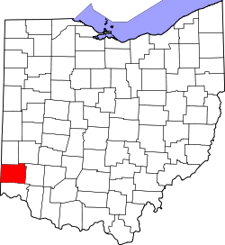 | |
| Villages | ||
| Townships | ||
| CDPs | ||
| Unincorporated communities | ||
| Footnotes | ‡This populated place also has portions in an adjacent county or counties | |
Municipalities and communities of Hamilton County, Ohio, United States | ||
|---|---|---|
| Cities | 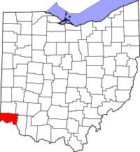 | |
| Villages | ||
| Townships | ||
| CDPs |
| |
| Other unincorporated communities | ||
| Footnotes | ‡This populated place also has portions in an adjacent county or counties | |
Coordinates: 39°19′52″N 84°32′34″W / 39.331156°N 84.542842°W