Breathitt County, Kentucky
| Breathitt County, Kentucky | |
|---|---|
 Breathitt County Courthouse in Jackson | |
 Location in the U.S. state of Kentucky | |
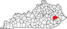
 Kentucky's location in the U.S. | |
| Founded | 1839 |
| Named for | John Breathitt |
| Seat | Jackson |
| Largest city | Jackson |
| Area | |
| • Total | 495 sq mi (1,282 km2) |
| • Land | 492 sq mi (1,274 km2) |
| • Water | 2.9 sq mi (8 km2), 0.6% |
| Population | |
| • (2010) | 13,878 |
| • Density | 28/sq mi (11/km2) |
| Congressional district | 5th |
| Time zone | Eastern: UTC−5/−4 |
| Website |
breathittcounty |
Breathitt County is a county located in the eastern Appalachian portion of the U.S. state of Kentucky. As of the 2010 census, the population was 13,878.[1] Its county seat is Jackson, Kentucky.[2] The county was formed in 1839 and was named for John Breathitt, who was Governor of Kentucky from 1832 to 1834. Breathitt County was a prohibition or dry county, until a public vote in July 2016 that allowed alcohol sales.[3]
History
The area now encompassed by Kentucky's Breathitt County was first bounded in 1772, when all of what is now the state of Kentucky was in the frontier county of Fincastle County, Virginia. Fincastle was divided in 1776, with the western portion named Kentucky County, Virginia. In 1780, Virginia set aside all land in Kentucky County for soldiers who had served in the Revolutionary War. In 1780, Kentucky County was divided into 3 counties, Jefferson, Fayette, and Lincoln. Lincoln County was divided in 1799, with part becoming Knox County. In 1807, the Legislature partitioned the upper part of Knox to create Clay County. On 6 February 1839, a portion of Clay (along with portions of Estill and Perry Counties) was partitioned off to create Breathitt County. It was named after Governor John Breathitt.[4]
Geography
According to the U.S. Census Bureau, the county has a total area of 495 square miles (1,280 km2), of which 492 square miles (1,270 km2) is land and 2.9 square miles (7.5 km2) (0.6%) is water.[5]
The North and Middle Forks of the Kentucky River pass through the county as the main water sources.
Adjacent counties
- Wolfe County (northwest)
- Magoffin County (northeast)
- Knott County (east)
- Perry County (southeast)
- Owsley County (southwest)
- Lee County (west)
Demographics
| Historical population | |||
|---|---|---|---|
| Census | Pop. | %± | |
| 1840 | 2,195 | — | |
| 1850 | 3,785 | 72.4% | |
| 1860 | 4,980 | 31.6% | |
| 1870 | 5,672 | 13.9% | |
| 1880 | 7,742 | 36.5% | |
| 1890 | 8,705 | 12.4% | |
| 1900 | 14,322 | 64.5% | |
| 1910 | 17,540 | 22.5% | |
| 1920 | 20,614 | 17.5% | |
| 1930 | 21,143 | 2.6% | |
| 1940 | 23,946 | 13.3% | |
| 1950 | 19,964 | −16.6% | |
| 1960 | 15,490 | −22.4% | |
| 1970 | 14,221 | −8.2% | |
| 1980 | 17,004 | 19.6% | |
| 1990 | 15,703 | −7.7% | |
| 2000 | 16,100 | 2.5% | |
| 2010 | 13,878 | −13.8% | |
| Est. 2016 | 13,284 | [6] | −4.3% |
| U.S. Decennial Census[7] 1790–1960[8] 1900–1990[9] 1990–2000[10] 2010–2013[1] | |||
As of the 2000 United States Census, there were 16,100 people, 6,170 households, and 4,541 families residing in the county. The population density was 32 per square mile (12/km2). There were 6,812 housing units at an average density of 14 per square mile (5.4/km2). The racial makeup of the county was 98.69% White, 0.39% Black or African American, 0.09% Native American, 0.29% Asian, 0.02% Pacific Islander, 0.08% from other races, and 0.43% from two or more races. 0.66% of the population were Hispanic or Latino of any race.
There were 6,170 households, out of which 34.10% had children under the age of 18 living with them, 55.00% were married couples living together, 14.20% had a female householder with no husband present, and 26.40% were non-families. 23.80% of all households were made up of individuals, and 9.00% had someone living alone who was 65 years of age or older. The average household size was 2.54 and the average family size was 3.00.
Throughout the county the population was spread out, with 25.50% under the age of 18, 10.00% from 18 to 24, 28.90% from 25 to 44, 24.00% from 45 to 64, and 11.50% who were 65 years of age or older. The median age was 36 years. For every 100 females there were 97.40 males. For every 100 females age 18 and over, there were 92.70 males.
The median income for a household in the county was $19,155, and the median income for a family was $23,721. Males had a median income of $26,208 versus $20,613 for females. The per capita income for the county was $11,044. About 28.10% of families and 33.20% of the population were below the poverty line, including 42.90% of those under age 18 and 26.80% of those age 65 or over.
Politics
| Year | Republican | Democratic | Third parties |
|---|---|---|---|
| 2016 | 69.6% 3,991 | 26.8% 1,537 | 3.7% 210 |
| 2012 | 66.3% 3,318 | 31.2% 1,562 | 2.6% 128 |
| 2008 | 53.1% 2,671 | 43.8% 2,205 | 3.1% 154 |
| 2004 | 42.8% 2,542 | 56.0% 3,327 | 1.3% 75 |
| 2000 | 41.1% 2,084 | 57.2% 2,902 | 1.7% 87 |
| 1996 | 23.1% 1,058 | 67.9% 3,106 | 9.0% 414 |
| 1992 | 24.4% 1,303 | 65.5% 3,496 | 10.1% 537 |
| 1988 | 38.5% 2,149 | 60.7% 3,387 | 0.8% 44 |
| 1984 | 45.3% 2,855 | 54.5% 3,435 | 0.3% 19 |
| 1980 | 27.7% 1,532 | 70.8% 3,916 | 1.5% 84 |
| 1976 | 22.2% 1,014 | 77.5% 3,544 | 0.4% 18 |
| 1972 | 40.7% 1,846 | 59.0% 2,677 | 0.4% 18 |
| 1968 | 29.1% 1,361 | 63.2% 2,954 | 7.8% 363 |
| 1964 | 12.4% 669 | 87.6% 4,714 | 0.0% 0 |
| 1960 | 37.6% 1,996 | 62.4% 3,307 | 0.0% 0 |
| 1956 | 42.7% 2,423 | 57.2% 3,246 | 0.1% 4 |
| 1952 | 29.0% 1,381 | 71.0% 3,383 | 0.0% 0 |
| 1948 | 22.4% 957 | 77.1% 3,295 | 0.6% 24 |
| 1944 | 29.4% 1,230 | 69.9% 2,922 | 0.7% 31 |
| 1940 | 28.7% 1,602 | 71.1% 3,977 | 0.2% 11 |
| 1936 | 31.0% 1,790 | 68.9% 3,980 | 0.2% 11 |
| 1932 | 23.2% 1,371 | 76.7% 4,524 | 0.1% 7 |
| 1928 | 43.4% 2,309 | 56.7% 3,017 | 0.0% 0 |
| 1924 | 37.6% 1,708 | 62.2% 2,826 | 0.2% 10 |
| 1920 | 47.1% 2,464 | 52.3% 2,737 | 0.6% 31 |
| 1916 | 43.1% 1,584 | 56.2% 2,067 | 0.7% 25 |
| 1912 | 30.3% 910 | 56.1% 1,682 | 13.6% 407 |
Economy
Coal companies
Education
Jackson Independent Schools
Jackson Independent Schools is a school district that educates students inside and outside the city limits of Jackson, Kentucky.
- Jackson City School – a single K-12 facility.
Breathitt County Schools
Breathitt County Schools is another school district with an array of schools within the city limits of Jackson, Kentucky and throughout the county.
- L.B.J. Elementary School – Jackson, Kentucky (Opened 1970)
- Highland-Turner Elementary School – Canoe, Kentucky (Opened 1992)
- Rousseau Elementary School (Closed 2013) – Rousseau, Kentucky
- Marie Roberts-Caney Elementary School – Lost Creek, Kentucky (Expanded School Opened 1996)
- Sebastian Middle School – Jackson, Kentucky (Opened 1975)
- Breathitt County High School – Jackson, Kentucky (New School Opened 1982)
Private schools
- Mount Carmel School – Vancleve, Kentucky
- Oakdale Christian Academy – Jackson, Kentucky
- Riverside Christian School – Lost Creek, Kentucky
Higher education
- Lees College Campus of Hazard Community and Technical College (part of the Kentucky Community and Technical College System) – Jackson, Kentucky
- Kentucky Mountain Bible College – Vancleve, Kentucky
Breathitt Area Technology Center
The Breathitt Area Technology Center serves both the Jackson Independent and the Breathitt County school districts. The school is located in Jackson, Kentucky on the campus of Breathitt County High School. The school is operated by the state of Kentucky. While most of the funding comes from the state, much of the equipment is purchased with federal Carl D. Perkins Vocational and Technical Education Act funds, which are aimed at advancing technical education.
The school is focused on technical education. The Breathitt ATC offers the following technical programs:
- Automotive Technology
- Construction Technology
- Electrical Technology
- Health Sciences
- Office Technology
UK Robinson Station
The community of Quicksand is the location for the University of Kentucky Robinson Station. This agriculture research facility is a pivotal asset in Breathitt County, furthering the scientific studies in the areas of agriculture and forestry.
Health care
- Breathitt County Family Health Center, Jackson, Kentucky
Breathitt County health care providers were featured in a 23 November 2013 Washington Post article: "In Rural Kentucky, Health-Care Takes Back Seat as the Long-Uninsured Line Up".[14] As of 2014 the county had the highest morbidity rate in the state of Kentucky.
Communities
- Altro
- Bays
- Caney
Cane Creek
- Canoe
- Chenowee
- Clayhole
- Cockrell Fork (on line between Breathitt and Perry Counties)
- Crockettsville
- Elkatawa
- Evanston
- Fishtrap
- Flintville
- Frozen/Frozen Creek
- Fugates Fork
- Gauge
- Haddix
- Hardshell Caney
- Hayes Branch
- Jackson (county seat)
- Leatherwood
- Lost Creek
- Morris Fork
- Ned
- Nix Branch
- Noble
- Noctor
- Oakdale
- Quicksand
- River Caney
- Riverside
- Rose Branch
- Rousseau
- Rowdy
- Saldee
- Sebastians Branch
- Shoulder Blade/Shoulderblade
- Smith Branch
- South Fork
- Troublesome Creek
- Turners Creek
- Vancleve
- War Creek
- Watts
- Whick
- Wilstacy
WolfCoal
Notable people
- Kim Davis, the Rowan County clerk known for her refusal to comply with a federal court order directing her to issue marriage licenses to same-sex couples, was born in Breathitt County.[15]
- J. D. Vance, author of Hillbilly Elegy (2016) spent much of his childhood in Breathitt County before his family moved to Ohio for work. His family roots are deep in Jackson, Kentucky.
See also
References
- 1 2 "State & County QuickFacts". United States Census Bureau. Retrieved 5 March 2014.
- ↑ "Find a County". National Association of Counties. Archived from the original on 15 June 2011. Retrieved 7 June 2011.
- ↑ "Breathitt County voters choose to allow alcohol sales". wymt.com. WYMT-TV. 12 July 2016. Retrieved 14 July 2016.
- ↑ The Register of the Kentucky State Historical Society, Vol. 1. Kentucky State Historical Society. 1903. p. 34.
- ↑ "2010 Census Gazetteer Files". United States Census Bureau. 22 August 2012. Archived from the original on 12 August 2014. Retrieved 12 August 2014.
- ↑ "Population and Housing Unit Estimates". Retrieved 9 June 2017.
- ↑ "U.S. Decennial Census". United States Census Bureau. Archived from the original on 12 May 2015. Retrieved 12 August 2014.
- ↑ "Historical Census Browser". University of Virginia Library. Retrieved 12 August 2014.
- ↑ "Population of Counties by Decennial Census: 1900 to 1990". United States Census Bureau. Retrieved 12 August 2014.
- ↑ "Census 2000 PHC-T-4. Ranking Tables for Counties: 1990 and 2000" (PDF). United States Census Bureau. Retrieved 12 August 2014.
- ↑ Leip, David. "Dave Leip's Atlas of U.S. Presidential Elections". uselectionatlas.org. Retrieved 29 June 2018.
- ↑ Arch Coal – Hazard Complex Archived 10 September 2013 at the Wayback Machine.
- ↑ US Coal Corporation :: OperationsArchived 2 January 2016 at the Wayback Machine.
- ↑ McCrummen, Stephanie (13 November 2013). "In Rural Kentucky Health-Care Debate Takes Back Seat as the Long-Uninsured Line Up". Washington Post. Retrieved 23 November 2014.
- ↑ "Kentucky clerk who refused same-sex marriage licenses starts new appeal". Reuters. 6 September 2015. Retrieved 8 May 2016.
Further reading
- T.R.C. Hutton, Bloody Breathitt: Politics and Violence in the Appalachian South. Lexington, KY: University Press of Kentucky, 2013.
External links
- The Kentucky Highlands Project
- The Breathitt County Museum – Provides a wealth of information on the rich history of Breathitt County.
- UK Robinson Station
- http://www.breathittcounty.com – hundreds of photos and articles about Breathitt County
- Breathitt County Public Schools
- Breathitt Area Technology Center
- Breathitt County History & Ancestry
Municipalities and communities of Breathitt County, Kentucky, United States | ||
|---|---|---|
| City | | |
| Unincorporated communities | ||
