List of counties in North Dakota
This is a list of counties in North Dakota. There are 53 counties in the U.S. state of North Dakota.
| Counties of North Dakota | |
|---|---|
| Location | State of North Dakota |
| Number | 53 |
| Populations | 727 (Slope) – 149,778 (Cass) |
| Areas | 632 square miles (1,640 km2) (Eddy) – 2,742 square miles (7,100 km2) (McKenzie) |
| Government | County government |
| Subdivisions | cities, towns, townships, unincorporated communities, indian reservations, census designated place |

The Federal Information Processing Standard (FIPS) code, which is used by the United States government to uniquely identify states and counties, is provided with each entry.[1] North Dakota's code is 38, which when combined with any county code would be written as 38XXX. The FIPS code for each county links to census data for that county.[2]
List
| County |
FIPS code[2] | County seat[3] | Est.[3] | Etymology[4] | Population[3][5] | Area[3][5] | Map |
|---|---|---|---|---|---|---|---|
| Adams County | 001 | Hettinger | 1885 | John Quincy Adams, a railroad agent and cousin of the former president who was instrumental in having the Chicago, Milwaukee and St. Paul Railway built through North Dakota | 2,343 | 988 sq mi (2,559 km2) | 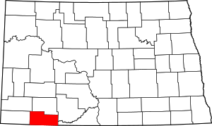 |
| Barnes County | 003 | Valley City | 1875 | Dakota Territory judge Alanson H. Barnes | 11,066 | 1,492 sq mi (3,864 km2) | 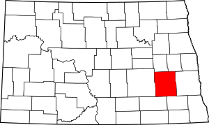 |
| Benson County | 005 | Minnewaukan | 1883 | Dakota territorial legislator Bertil W. Benson | 6,660 | 1,389 sq mi (3,597 km2) | 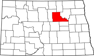 |
| Billings County | 007 | Medora | 1879 | Frederick H. Billings (1823–1890), who was president of the Northern Pacific Railroad | 783 | 1,152 sq mi (2,984 km2) | 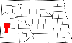 |
| Bottineau County | 009 | Bottineau | 1873 | Named for frontiersman Pierre Bottineau | 6,429 | 1,669 sq mi (4,323 km2) | 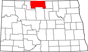 |
| Bowman County | 011 | Bowman | 1883 | Dakota territorial legislator Edward M. Bowman | 3,151 | 1,162 sq mi (3,010 km2) | 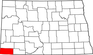 |
| Burke County | 013 | Bowbells | 1910 | John Burke, tenth Governor of North Dakota | 1,968 | 1,104 sq mi (2,859 km2) | 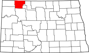 |
| Burleigh County | 015 | Bismarck | 1873 | Walter A. Burleigh (1820–1896), territorial delegate to Congress | 81,308 | 1,633 sq mi (4,229 km2) | 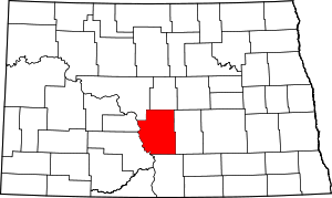 |
| Cass County | 017 | Fargo | 1873 | George Washington Cass (1810–1888), who was the president of the Northern Pacific Railroad | 149,778 | 1,766 sq mi (4,574 km2) |  |
| Cavalier County | 019 | Langdon | 1873 | Charles Cavalier, French fur trapper and one of the area's original settlers | 3,993 | 1,489 sq mi (3,856 km2) | 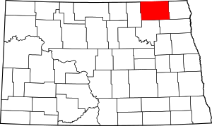 |
| Dickey County | 021 | Ellendale | 1881 | Dakota territorial legislator George H. Dickey | 5,289 | 1,131 sq mi (2,929 km2) | 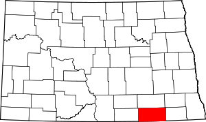 |
| Divide County | 023 | Crosby | 1910 | Named because it was created upon the division of Williams County | 2,071 | 1,259 sq mi (3,261 km2) | 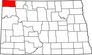 |
| Dunn County | 025 | Manning | 1883 | John P. Dunn, an early civic leader of Bismarck, who opened the first drugstore in North Dakota | 3,536 | 2,010 sq mi (5,206 km2) | 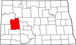 |
| Eddy County | 027 | New Rockford | 1885 | Ezra B. Eddy, a Fargo banker and one of the territory's wealthiest citizens | 2,385 | 632 sq mi (1,637 km2) | 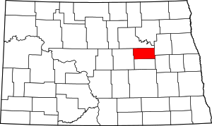 |
| Emmons County | 029 | Linton | 1879 | James Emmons, an early entrepreneur and businessman who operated the first steamboat across the Missouri River in Bismarck | 3,550 | 1,510 sq mi (3,911 km2) | 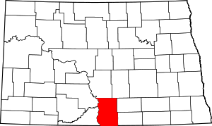 |
| Foster County | 031 | Carrington | 1873 | Either James S. Foster and George I. Foster, brother, and prominent farmers during the territorial days | 3,343 | 635 sq mi (1,645 km2) | 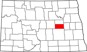 |
| Golden Valley County | 033 | Beach | 1912 | Named for either promotional reasons or for the Golden Valley Land and Cattle Company | 1,680 | 1,002 sq mi (2,595 km2) | 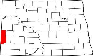 |
| Grand Forks County | 035 | Grand Forks | 1873 | Named for Grand Forks, North Dakota, which in turn was named for its location at the intersection of the Red Lake River and the Red River of the North | 66,861 | 1,438 sq mi (3,724 km2) |  |
| Grant County | 037 | Carson | 1916 | Ulysses S. Grant (1822–1885), eighteenth U.S. President | 2,394 | 1,660 sq mi (4,299 km2) | 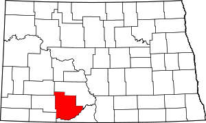 |
| Griggs County | 039 | Cooperstown | 1881 | Alexander Griggs, a steamboat captain and founder of Grand Forks, North Dakota | 2,420 | 708 sq mi (1,834 km2) | 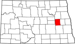 |
| Hettinger County | 041 | Mott | 1883 | Mathias K. Hettinger, the father-in-law of Erastus A. Williams, the North Dakota Speaker of the House during that session | 2,477 | 1,132 sq mi (2,932 km2) | 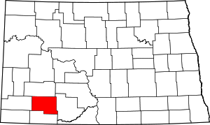 |
| Kidder County | 043 | Steele | 1873 | Jefferson Parrish Kidder, territorial delegate to the 44th Congress and 45th Congresses | 2,435 | 1,352 sq mi (3,502 km2) |  |
| LaMoure County | 045 | LaMoure | 1873 | Dakota territorial legislator and North Dakota state legislator Judson LaMoure | 4,139 | 1,147 sq mi (2,971 km2) |  |
| Logan County | 047 | Napoleon | 1873 | Illinois U.S. Senator John A. Logan (1826–1886) | 1,990 | 993 sq mi (2,572 km2) | 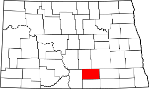 |
| McHenry County | 049 | Towner | 1873 | James McHenry, one of the area's original settlers | 5,395 | 1,874 sq mi (4,854 km2) | 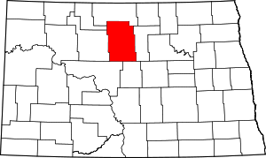 |
| McIntosh County | 051 | Ashley | 1883 | Edward H. McIntosh, a member of the Territorial Legislature | 2,809 | 975 sq mi (2,525 km2) | 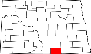 |
| McKenzie County | 053 | Watford City | 1905 | Alexander McKenzie, party boss known in the state as "the senator-maker" | 6,360 | 2,742 sq mi (7,102 km2) |  |
| McLean County | 055 | Washburn | 1883 | John A. McLean, first mayor of Bismarck, North Dakota | 8,962 | 2,110 sq mi (5,465 km2) |  |
| Mercer County | 057 | Stanton | 1875 | William Henry Harrison Mercer, an early settler | 8,424 | 1,045 sq mi (2,707 km2) |  |
| Morton County | 059 | Mandan | 1873 | Governor of Indiana Oliver Hazard Perry Throck Morton | 27,471 | 1,926 sq mi (4,988 km2) | 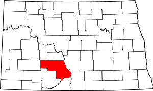 |
| Mountrail County | 061 | Stanley | 1873 | Joseph Mountraille, Metis voyageur and early explorer | 7,673 | 1,824 sq mi (4,724 km2) | 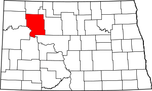 |
| Nelson County | 063 | Lakota | 1883 | Dakota territorial legislator Nelson E. Nelson | 3,126 | 982 sq mi (2,543 km2) | 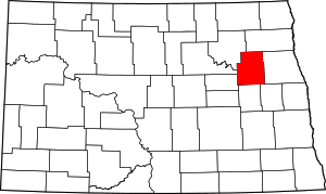 |
| Oliver County | 065 | Center | 1885 | Dakota territorial legislator Harry S. Oliver | 1,846 | 724 sq mi (1,875 km2) | 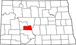 |
| Pembina County | 067 | Cavalier | 1867 | Named for the high-bush cranberries which grew wild in the area. Pembina may be from an Ojibwa phrase, anepeminan sipi, referring to the berries, as they grew in abundance around the Redberry River; it may also be from an Ojibwa word meaning meeting place. The name originally applied to the old Pembina Territory | 7,413 | 1,119 sq mi (2,898 km2) |  |
| Pierce County | 069 | Rugby | 1887 | Gilbert Ashville Pierce, a Governor of Dakota Territory and later a U.S. Senator from North Dakota | 4,357 | 1,018 sq mi (2,637 km2) | 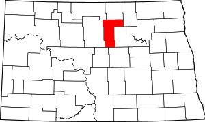 |
| Ramsey County | 071 | Devils Lake | 1873 | Minnesota U.S. Senator Alexander Ramsey | 11,451 | 1,186 sq mi (3,072 km2) |  |
| Ransom County | 073 | Lisbon | 1873 | Named for locally situated Fort Ransom | 5,457 | 863 sq mi (2,235 km2) |  |
| Renville County | 075 | Mohall | 1873 | Joseph Renville, missionary and interpreter for Dakota Native Americans | 2,470 | 875 sq mi (2,266 km2) | 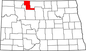 |
| Richland County | 077 | Wahpeton | 1873 | Morgan T. Rich, early settler | 16,321 | 1,437 sq mi (3,722 km2) |  |
| Rolette County | 079 | Rolla | 1873 | Joseph Rolette, Jr. (1820–1871), a prominent fur trapper and local political organizer | 13,937 | 902 sq mi (2,336 km2) |  |
| Sargent County | 081 | Forman | 1883 | Homer E. Sargent, a general manager of the Northern Pacific Railroad | 3,829 | 859 sq mi (2,225 km2) | 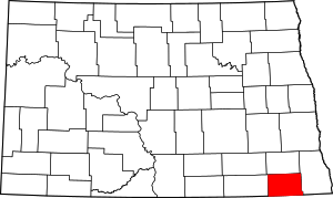 |
| Sheridan County | 083 | McClusky | 1873 | American Civil War officer Philip Henry Sheridan (1831–1888) | 1,321 | 972 sq mi (2,517 km2) | 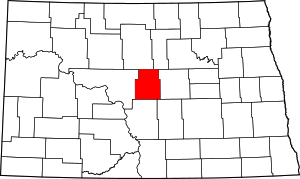 |
| Sioux County | 085 | Fort Yates | 1915 | The Native American Sioux people | 4,153 | 1,094 sq mi (2,833 km2) | 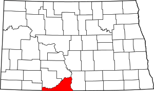 |
| Slope County | 087 | Amidon | 1915 | Topographical feature within the county known as the Missouri Slope | 727 | 1,218 sq mi (3,155 km2) | 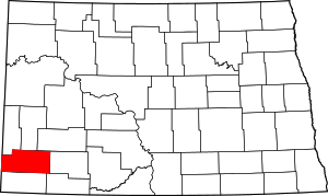 |
| Stark County | 089 | Dickinson | 1879 | George Stark, a vice president of the Northern Pacific Railroad | 24,199 | 1,338 sq mi (3,465 km2) | 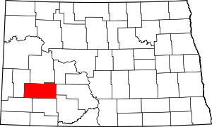 |
| Steele County | 091 | Finley | 1883 | Edward H. Steele, secretary-treasurer of the Red River Land Company | 1,975 | 712 sq mi (1,844 km2) | 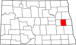 |
| Stutsman County | 093 | Jamestown | 1873 | Dakota Territorial Legislator Enos Stutsman | 21,100 | 2,222 sq mi (5,755 km2) | 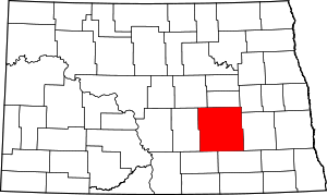 |
| Towner County | 095 | Cando | 1883 | Dakota territorial legislator Oscar M. Towner | 2,246 | 1,025 sq mi (2,655 km2) |  |
| Traill County | 097 | Hillsboro | 1875 | Walter John Strickland Traill, early settler | 8,121 | 862 sq mi (2,233 km2) | 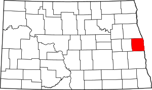 |
| Walsh County | 099 | Grafton | 1881 | George H. Walsh, early settler and one of the founders of the University of North Dakota | 11,119 | 1,282 sq mi (3,320 km2) | 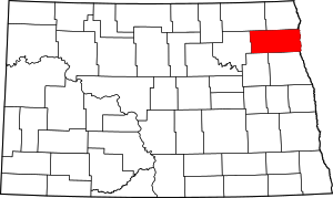 |
| Ward County | 101 | Minot | 1888 | Dakota territorial legislator Mark Ward (1844–1902) | 61,675 | 2,013 sq mi (5,214 km2) | 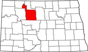 |
| Wells County | 103 | Fessenden | 1873 | Dakota territorial legislator Edward Payson Wells | 4,207 | 1,271 sq mi (3,292 km2) | 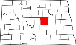 |
| Williams County | 105 | Williston | 1890 | Dakota territorial legislator Erastus Appelman Williams | 22,398 | 2,071 sq mi (5,364 km2) | 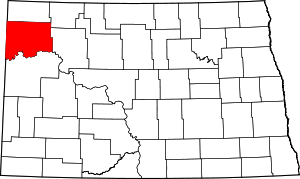 |

ND counties, shaded by population
References
- "FIPS Publish 6-4". National Institute of Standards and Technology. Archived from the original on 2013-09-29. Retrieved 2008-02-03.
- "EPA County FIPS Code Listing". US Environmental Protection Agency. Retrieved 2008-02-03.
- "NACo – Find a county". National Association of Counties. Archived from the original on 25 October 2007. Retrieved 24 February 2012.
- "County History". Official Portal for North Dakota State Government. Archived from the original on 2 February 2015. Retrieved 24 February 2012.
- "North Dakota QuickFacts". U.S. Census Bureau. Archived from the original on 22 February 2012. Retrieved 24 February 2012. (2010 Census)

This article is issued from Wikipedia. The text is licensed under Creative Commons - Attribution - Sharealike. Additional terms may apply for the media files.