New Rockford, North Dakota
New Rockford is a city in Eddy County, North Dakota, United States. It is the county seat of Eddy County.[5] The population was 1,391 at the 2010 census.[6] New Rockford was founded in 1883.
New Rockford, North Dakota | |
|---|---|
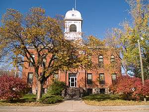 Eddy County Courthouse in New Rockford | |
 Location of New Rockford, North Dakota | |
| Coordinates: 47°40′50″N 99°8′10″W | |
| Country | United States |
| State | North Dakota |
| County | Eddy |
| Area | |
| • Total | 1.54 sq mi (3.99 km2) |
| • Land | 1.51 sq mi (3.91 km2) |
| • Water | 0.03 sq mi (0.08 km2) |
| Elevation | 1,532 ft (467 m) |
| Population | |
| • Total | 1,391 |
| • Estimate (2018)[3] | 1,352 |
| • Density | 900/sq mi (350/km2) |
| Time zone | UTC−6 (Central (CST)) |
| • Summer (DST) | UTC−5 (CDT) |
| ZIP code | 58356 |
| Area code(s) | 701 |
| FIPS code | 38-56620 |
| GNIS feature ID | 1030398[4] |
| Highways | US 281, ND 15 |
| Website | CityofNewRockford.com |
History
New Rockford was founded in 1883 at the time of the arrival of the Great Northern Railway into the area.[7]
In 1915, residents mounted a challenge to have the state capital relocated from Bismarck, North Dakota to New Rockford. This was not passed and defeated, leaving Bismarck the state capital of North Dakota.
Geography
New Rockford is located at 47°40′50″N 99°8′10″W (47.680579, -99.136177).[8]
According to the United States Census Bureau, the city has a total area of 1.54 square miles (3.99 km2), of which, 1.51 square miles (3.91 km2) is land and 0.03 square miles (0.08 km2) is water.[1] New Rockford's zip code is 58356.
Demographics
| Historical population | |||
|---|---|---|---|
| Census | Pop. | %± | |
| 1920 | 2,111 | — | |
| 1930 | 2,195 | 4.0% | |
| 1940 | 2,017 | −8.1% | |
| 1950 | 2,185 | 8.3% | |
| 1960 | 2,177 | −0.4% | |
| 1970 | 1,969 | −9.6% | |
| 1980 | 1,791 | −9.0% | |
| 1990 | 1,604 | −10.4% | |
| 2000 | 1,463 | −8.8% | |
| 2010 | 1,391 | −4.9% | |
| Est. 2018 | 1,352 | [3] | −2.8% |
| U.S. Decennial Census[9] 2018 Estimate[10] | |||
2010 census
At the 2010 census there were 1,391 people, 628 households, and 363 families living in the city. The population density was 921.2 inhabitants per square mile (355.7/km2). There were 750 housing units at an average density of 496.7 per square mile (191.8/km2). The racial makeup of the city was 95.7% White, 0.1% African American, 1.7% Native American, 0.4% Asian, 0.1% Pacific Islander, 0.9% from other races, and 1.2% from two or more races. Hispanic or Latino of any race were 2.9%.[2]
Of the 628 households 24.7% had children under the age of 18 living with them, 44.9% were married couples living together, 9.4% had a female householder with no husband present, 3.5% had a male householder with no wife present, and 42.2% were non-families. 38.4% of households were one person and 22% were one person aged 65 or older. The average household size was 2.08 and the average family size was 2.74.
The median age was 50.2 years. 20.8% of residents were under the age of 18; 4.8% were between the ages of 18 and 24; 18.3% were from 25 to 44; 28.8% were from 45 to 64; and 27.2% were 65 or older. The gender makeup of the city was 46.2% male and 53.8% female.
2000 census
At the 2000 census, there were 1,463 people, 651 households, and 378 families living in the city. The population density was 970.7 people per square mile (374.1/km²). There were 778 housing units at an average density of 516.2 per square mile (198.9/km²). The racial makeup of the city was 98.02% White, 0.14% African American, 1.50% Native American, 0.14% from other races, and 0.21% from two or more races. Hispanic or Latino of any race were 0.55% of the population.
Of the 651 households 24.7% had children under the age of 18 living with them, 49.8% were married couples living together, 6.1% had a female householder with no husband present, and 41.8% were non-families. 39.3% of households were one person and 24.7% were one person aged 65 or older. The average household size was 2.13 and the average family size was 2.84.
The age distribution was 20.8% under the age of 18, 6.4% from 18 to 24, 21.3% from 25 to 44, 21.9% from 45 to 64, and 29.7% 65 or older. The median age was 46 years. For every 100 females, there were 84.5 males. For every 100 females age 18 and over, there were 80.0 males.
The median household income was $28,042 and the median family income was $43,438. Males had a median income of $26,080 versus $19,219 for females. The per capita income for the city was $16,444. About 6.2% of families and 9.0% of the population were below the poverty line, including 8.3% of those under age 18 and 15.3% of those age 65 or over.
Events
- The annual Central North Dakota Steam Thresher's Reunion is one of New Rockford's main annual events. It is held the third weekend of September.
- The Opera House hosts theatre productions year round.
Notable people
- James Buchli, U.S. Marine, former NASA astronaut
- Ole H. Olson, 18th Governor of North Dakota
- Larry Steinbach, American football player
Education
The city of New Rockford is served by New Rockford-Sheyenne Public School.
Climate
This climatic region is typified by large seasonal temperature differences, with warm to hot (and often humid) summers and cold (sometimes severely cold) winters. According to the Köppen Climate Classification system, New Rockford has a humid continental climate, abbreviated "Dfb" on climate maps.[11]
References
- "US Gazetteer files 2010". United States Census Bureau. Archived from the original on 2012-01-25. Retrieved 2012-06-14.
- "U.S. Census website". United States Census Bureau. Retrieved June 14, 2012.
- "Population and Housing Unit Estimates". Retrieved June 8, 2019.
- "US Board on Geographic Names". United States Geological Survey. October 25, 2007. Retrieved January 31, 2008.
- "Find a County". National Association of Counties. Retrieved June 7, 2011.
- "2010 Census Redistricting Data (Public Law 94-171) Summary File". American FactFinder. United States Census Bureau. Retrieved May 2, 2011.
- Hellmann, Paul T. (May 13, 2013). Historical Gazetteer of the United States. Routledge. p. 840. Retrieved November 30, 2013.
- "US Gazetteer files: 2010, 2000, and 1990". United States Census Bureau. 2011-02-12. Retrieved 2011-04-23.
- United States Census Bureau. "Census of Population and Housing". Retrieved February 12, 2014.
- "Population Estimates". United States Census Bureau. Retrieved June 8, 2019.
- Climate Summary for New Rockford, North Dakota
External links
| Wikivoyage has a travel guide for New Rockford. |
- New Rockford Community Site
- City of New Rockford official website
- A century of sowers, a harvest of heritage (1983) from the Digital Horizons website
Municipalities and communities of Eddy County, North Dakota, United States | ||
|---|---|---|
| Cities | 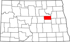 Map of North Dakota highlighting Eddy County | |
| Townships |
| |
| Unincorporated communities |
| |
