Cando, North Dakota
Cando (/ˈkænduː/ KAN-doo) is a city in Towner County, North Dakota, United States. It is the county seat of Towner County.[5] The population was 1,115 at the 2010 census.[6] Cando was founded in 1884.
Cando, North Dakota | |
|---|---|
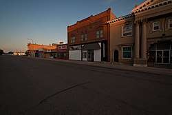 Business district in Cando | |
| Motto(s): "Duck Hunting Capital Of North Dakota" | |
 Location of Cando, North Dakota | |
| Coordinates: 48°29′19″N 99°12′16″W | |
| Country | United States |
| State | North Dakota |
| County | Towner |
| Area | |
| • Total | 0.63 sq mi (1.63 km2) |
| • Land | 0.63 sq mi (1.63 km2) |
| • Water | 0 sq mi (0 km2) |
| Elevation | 1,476 ft (450 m) |
| Population | |
| • Total | 1,115 |
| • Estimate (2018)[3] | 1,064 |
| • Density | 1,800/sq mi (680/km2) |
| Time zone | UTC−6 (Central (CST)) |
| • Summer (DST) | UTC−5 (CDT) |
| ZIP code | 58324 |
| Area code(s) | 701 |
| FIPS code | 38-11860 |
| GNIS feature ID | 1028267[4] |
| Highways | US 281, ND 17 |
| Website | http://www.candond.com/ |
History
Cando was founded in 1884 as the seat of the newly formed Towner County.[7] It was named from the pioneers' "can do" spirit.[8] The Great Northern Railway was extended to Cando in 1888.[7]
Geography
Cando is located at 48°29′19″N 99°12′16″W.[9]
According to the United States Census Bureau, the city has a total area of 0.63 square miles (1.63 km2), all of it land.[1]
Demographics
| Historical population | |||
|---|---|---|---|
| Census | Pop. | %± | |
| 1890 | 200 | — | |
| 1900 | 1,061 | 430.5% | |
| 1910 | 1,332 | 25.5% | |
| 1920 | 1,111 | −16.6% | |
| 1930 | 1,164 | 4.8% | |
| 1940 | 1,282 | 10.1% | |
| 1950 | 1,530 | 19.3% | |
| 1960 | 1,566 | 2.4% | |
| 1970 | 1,512 | −3.4% | |
| 1980 | 1,496 | −1.1% | |
| 1990 | 1,564 | 4.5% | |
| 2000 | 1,342 | −14.2% | |
| 2010 | 1,115 | −16.9% | |
| Est. 2018 | 1,064 | [3] | −4.6% |
| U.S. Decennial Census[10] 2018 Estimate[11] | |||
2010 census
As of the census[2] of 2010, there were 1,115 people, 518 households, and 309 families living in the city. The population density was 1,769.8 inhabitants per square mile (683.3/km2). There were 701 housing units at an average density of 1,112.7 per square mile (429.6/km2). The racial makeup of the city was 96.1% White, 0.2% African American, 2.3% Native American, 0.2% from other races, and 1.3% from two or more races. Hispanic or Latino of any race were 0.5% of the population.
There were 518 households, of which 24.5% had children under the age of 18 living with them, 46.3% were married couples living together, 9.7% had a female householder with no husband present, 3.7% had a male householder with no wife present, and 40.3% were non-families. 38.0% of all households were made up of individuals, and 22.2% had someone living alone who was 65 years of age or older. The average household size was 2.08 and the average family size was 2.69.
The median age in the city was 49.3 years. 20.3% of residents were under the age of 18; 6% were between the ages of 18 and 24; 16.7% were from 25 to 44; 31.1% were from 45 to 64; and 25.7% were 65 years of age or older. The gender makeup of the city was 48.0% male and 52.0% female.
2000 census
As of the census of 2000, there were 1,342 people, 595 households, and 345 families living in the city. The population density was 2,178.3 people per square mile (835.7/km2). There were 707 housing units at an average density of 1,147.6 per square mile (440.3/km2). The racial makeup of the city was 97.24% White, 0.07% African American, 2.16% Native American, 0.15% Asian, and 0.37% from two or more races. Hispanic or Latino of any race were 0.15% of the population.
There were 595 households, out of which 25.9% had children under the age of 18 living with them, 49.7% were married couples living together, 5.4% had a female householder with no husband present, and 42.0% were non-families. 40.2% of all households were made up of individuals, and 24.4% had someone living alone who was 65 years of age or older. The average household size was 2.15 and the average family size was 2.88.
In the city, the population was spread out, with 23.7% under the age of 18, 2.5% from 18 to 24, 23.8% from 25 to 44, 23.3% from 45 to 64, and 26.8% who were 65 years of age or older. The median age was 45 years. For every 100 females, there were 88.5 males. For every 100 females age 18 and over, there were 82.9 males.
The median income for a household in the city was $31,989, and the median income for a family was $43,571. Males had a median income of $28,421 versus $17,308 for females. The per capita income for the city was $19,128. About 6.5% of families and 9.7% of the population were below the poverty line, including 9.5% of those under age 18 and 14.3% of those age 65 or over.
Notable people
- Dave Osborn, running back for the Minnesota Vikings[12]
- Dick Armey, U.S. Congressman; House Majority Leader
- Fountain L. Thompson, U.S. Senator, lived in Cando
Climate
This climatic region is typified by large seasonal temperature differences, with warm to hot (and often humid) summers and cold (sometimes severely cold) winters. According to the Köppen Climate Classification system, Cando has a humid continental climate, abbreviated "Dfb" on climate maps.[13]
References
- "US Gazetteer files 2010". United States Census Bureau. Archived from the original on 2012-07-02. Retrieved 2012-06-14.
- "U.S. Census website". United States Census Bureau. Retrieved June 14, 2012.
- "Population and Housing Unit Estimates". Retrieved June 2, 2019.
- "US Board on Geographic Names". United States Geological Survey. 2007-10-25. Retrieved January 31, 2008.
- "Find a County". National Association of Counties. Archived from the original on 2011-05-31. Retrieved June 7, 2011.
- "2010 Census Redistricting Data (Public Law 94-171) Summary File". American FactFinder. United States Census Bureau. Retrieved 2 May 2011.
- Hellmann, Paul T. (May 13, 2013). Historical Gazetteer of the United States. Routledge. p. 833. Retrieved 30 November 2013.
- "Homepage". City of Cando, North Dakota. Retrieved 19 June 2014.
- "US Gazetteer files: 2010, 2000, and 1990". United States Census Bureau. 2011-02-12. Retrieved 2011-04-23.
- United States Census Bureau. "Census of Population and Housing". Retrieved August 30, 2013.
- "Population Estimates". United States Census Bureau. Retrieved June 2, 2019.
- "Archived copy". Archived from the original on 2013-07-28. Retrieved 2013-11-07.CS1 maint: archived copy as title (link)
- Climate Summary for Cando, North Dakota
External links
- City of Cando official website
- Cando, North Dakota : a history of its people and events (1984) from the Digital Horizons website
Municipalities and communities of Towner County, North Dakota, United States | ||
|---|---|---|
| Cities |  Map of North Dakota highlighting Towner County | |
| Townships |
| |
| Unincorporated communities | ||
| Footnotes | ‡This populated place also has portions in an adjacent county or counties | |

| Authority control |
|
|---|