Center, North Dakota
Center is a city in Oliver County, North Dakota, United States. It is the county seat of, and the only incorporated place in, Oliver County.[4] The population was 571 at the 2010 census.[5]
Center, North Dakota | |
|---|---|
| Nickname(s): Center of North America | |
 Location of Center, North Dakota | |
| Coordinates: 47°6′59″N 101°17′59″W[1] | |
| Country | United States |
| State | North Dakota |
| County | Oliver |
| Area | |
| • Total | 0.46 sq mi (1.19 km2) |
| • Land | 0.46 sq mi (1.19 km2) |
| • Water | 0 sq mi (0 km2) |
| Elevation | 1,975 ft (602 m) |
| Population | |
| • Total | 571 |
| • Estimate (2018) | 588 |
| • Density | 1,200/sq mi (480/km2) |
| Time zone | UTC-6 (Central (CST)) |
| • Summer (DST) | UTC-5 (CDT) |
| ZIP Code | 58530 |
| Area code(s) | 701 |
| FIPS code | 38-13180 |
| GNIS feature ID | 1028320[1] |
| Website | CenterND.net |
History
Center was founded in 1902.[6] The city was named from its location near the geographical center of Oliver County.[7] Coincidentally, it has also been calculated to be the geographical center of North America.[8]
The town is somewhat notable for the blizzard-related death of Hazel Miner, who would go on to be the subject of a song and memorials.
Geography
According to the United States Census Bureau, the city has a total area of 0.46 square miles (1.19 km2), all of it land.[2]
Southwest of Center, there is a large open air coal mine. Southeast of Center, at Nelson Lake there is a large power plant. West of Nelson Lake is situated the Square Butte high-voltage direct current transmission line's static inverter.
Peter Rogerson, a professor of geography at the University at Buffalo in New York, used new scientific methods and the azimuthal equidistant projection to calculate the "geographic center" of the North American continent. By some extraordinary coincidence, he found that Center, North Dakota, is the continent's geographical center.[9]
Demographics
| Historical population | |||
|---|---|---|---|
| Census | Pop. | %± | |
| 1930 | 293 | — | |
| 1940 | 509 | 73.7% | |
| 1950 | 492 | −3.3% | |
| 1960 | 476 | −3.3% | |
| 1970 | 619 | 30.0% | |
| 1980 | 900 | 45.4% | |
| 1990 | 826 | −8.2% | |
| 2000 | 678 | −17.9% | |
| 2010 | 571 | −15.8% | |
| Est. 2018 | 588 | [10] | 3.0% |
| U.S. Decennial Census[11] 2018 Estimate[12] | |||
2010 census
As of the census[3] of 2010, there were 571 people, 252 households, and 169 families living in the city. The population density was 1,241.3 inhabitants per square mile (479.3/km2). There were 310 housing units at an average density of 673.9 per square mile (260.2/km2). The racial makeup of the city was 96.0% White, 0.5% African American, 3.2% Native American, and 0.4% from two or more races. Hispanic or Latino of any race were 1.9% of the population.
There were 252 households, of which 20.6% had children under the age of 18 living with them, 57.5% were married couples living together, 7.5% had a female householder with no husband present, 2.0% had a male householder with no wife present, and 32.9% were non-families. 27.8% of all households were made up of individuals, and 13.1% had someone living alone who was 65 years of age or older. The average household size was 2.26 and the average family size was 2.71.
The median age in the city was 49.3 years. 19.1% of residents were under the age of 18; 5.7% were between the ages of 18 and 24; 18.4% were from 25 to 44; 40% were from 45 to 64; and 17% were 65 years of age or older. The gender makeup of the city was 51.3% male and 48.7% female.
2000 census
As of the census of 2000, there were 678 people, 279 households, and 196 families living in the city. The population density was 1,743.8 people per square mile (671.2/km2). There were 310 housing units at an average density of 797.3 per square mile (306.9/km2). The racial makeup of the city was 93.81% White, 0.44% African American, 3.39% Native American, and 2.36% from two or more races. Hispanic or Latino of any race were 0.59% of the population.
There were 279 households, out of which 33.3% had children under the age of 18 living with them, 62.0% were married couples living together, 5.7% had a female householder with no husband present, and 29.4% were non-families. 26.2% of all households were made up of individuals, and 16.5% had someone living alone who was 65 years of age or older. The average household size was 2.43 and the average family size was 2.93.
In the city, the population was spread out, with 24.6% under the age of 18, 5.8% from 18 to 24, 22.6% from 25 to 44, 33.0% from 45 to 64, and 14.0% who were 65 years of age or older. The median age was 44 years. For every 100 females, there were 96.0 males. For every 100 females age 18 and over, there were 92.8 males.
The median income for a household in the city was $41,406, and the median income for a family was $57,045. Males had a median income of $54,750 versus $18,393 for females. The per capita income for the city was $20,043. About 2.1% of families and 7.6% of the population were below the poverty line, including 9.9% of those under age 18 and 17.8% of those age 65 or over.
Climate
This climatic region is typified by large seasonal temperature differences, with warm to hot (and often humid) summers and cold (sometimes severely cold) winters. According to the Köppen Climate Classification system, Center has a humid continental climate, abbreviated "Dfb" on climate maps.[13]
References
- Notes
- U.S. Geological Survey Geographic Names Information System: Center, North Dakota
- "US Gazetteer files 2010". United States Census Bureau. Archived from the original on 2012-01-25. Retrieved 2012-06-14.
- "U.S. Census website". United States Census Bureau. Retrieved 2012-06-14.
- "Find a County". National Association of Counties. Archived from the original on May 31, 2011. Retrieved June 7, 2011.
- "2010 Census Redistricting Data (Public Law 94-171) Summary File". American FactFinder. United States Census Bureau. Retrieved May 2, 2011.
- Hellmann, Paul T. (May 13, 2013). Historical Gazetteer of the United States. Routledge. p. 834. Retrieved 30 November 2013.
- Federal Writers' Project (1938). North Dakota, a Guide to the Northern Prairie State,. WPA. p. 318. ISBN 978-1-62376-033-5.
- Hsu, Charlotte. "Where's the center of North America? Geographer's new method finds a new answer". Science Daily. Science Daily. Retrieved January 12, 2017.
- Yin, Steph (January 25, 2017). "North America's Geographical Center May Be in a North Dakota Town Called Center". The New York Times.
- "Population and Housing Unit Estimates". Retrieved June 9, 2017.
- United States Census Bureau. "Census of Population and Housing". Retrieved June 16, 2014.
- "Population Estimates". United States Census Bureau. Retrieved June 16, 2019.
- Climate Summary for Center, North Dakota
| Counties |  | |
|---|---|---|
| Core cities | ||
| Surrounding areas |
| |
Municipalities and communities of Oliver County, North Dakota, United States | ||
|---|---|---|
| City | 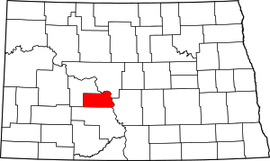 Map of North Dakota highlighting Oliver County | |
| Unorganized territories |
| |
| Unincorporated communities | ||
| Authority control |
|
|---|