Bowman, North Dakota
Bowman is a city and county seat of Bowman County, North Dakota, United States. Its population was 1,650 at the 2010 census.[5]
Bowman, North Dakota | |
|---|---|
 Dakota Western Bank, Bowman, North Dakota | |
 Location of Bowman, North Dakota | |
| Coordinates: 46°10′54″N 103°24′1″W | |
| Country | United States |
| State | North Dakota |
| County | Bowman |
| Founded | 1907 |
| Area | |
| • Total | 1.53 sq mi (3.96 km2) |
| • Land | 1.53 sq mi (3.96 km2) |
| • Water | 0 sq mi (0 km2) |
| Elevation | 2,963 ft (903 m) |
| Population | |
| • Total | 1,650 |
| • Estimate (2018)[3] | 1,608 |
| • Density | 1,100/sq mi (420/km2) |
| Time zone | UTC−7 (Mountain (MST)) |
| • Summer (DST) | UTC−6 (MDT) |
| ZIP code | 58623 |
| Area code(s) | 701 |
| FIPS code | 38-08700 |
| GNIS feature ID | 1028099[4] |
| Highways | US 12, US 85 |
| Website | BowmanND.com |
History
Bowman was founded in 1907 at about the same time the railroad was extended to that point.[6] The city took its name from Bowman County.[7] A post office has been in operation at Bowman since 1907.[8]
Geography
Bowman is located at 46°10′54″N 103°24′1″W (46.181791, -103.400211).[9] According to the United States Census Bureau, the city has a total area of 1.53 square miles (3.96 km2), all land.[1]
Climate
According to the Köppen Climate Classification system, Bowman has a semi-arid climate, abbreviated "BSk" on climate maps.[10]
| Climate data for Bowman, North Dakota (1981–2010) | |||||||||||||
|---|---|---|---|---|---|---|---|---|---|---|---|---|---|
| Month | Jan | Feb | Mar | Apr | May | Jun | Jul | Aug | Sep | Oct | Nov | Dec | Year |
| Average high °F (°C) | 28.1 (−2.2) |
32.2 (0.1) |
41.8 (5.4) |
55.1 (12.8) |
65.6 (18.7) |
75.0 (23.9) |
83.8 (28.8) |
83.6 (28.7) |
72.0 (22.2) |
56.3 (13.5) |
41.2 (5.1) |
29.6 (−1.3) |
55.4 (13.0) |
| Average low °F (°C) | 7.0 (−13.9) |
10.4 (−12.0) |
19.1 (−7.2) |
29.6 (−1.3) |
40.6 (4.8) |
50.1 (10.1) |
56.2 (13.4) |
54.3 (12.4) |
42.9 (6.1) |
30.6 (−0.8) |
18.8 (−7.3) |
8.2 (−13.2) |
30.7 (−0.7) |
| Average precipitation inches (mm) | 0.51 (13) |
0.48 (12) |
0.87 (22) |
1.23 (31) |
2.47 (63) |
3.08 (78) |
2.14 (54) |
1.09 (28) |
1.21 (31) |
1.38 (35) |
0.59 (15) |
0.47 (12) |
15.51 (394) |
| Average snowfall inches (cm) | 9.7 (25) |
8.3 (21) |
10.1 (26) |
7.8 (20) |
1.9 (4.8) |
0.0 (0.0) |
0.0 (0.0) |
0.0 (0.0) |
0.5 (1.3) |
3.3 (8.4) |
7.7 (20) |
8.1 (21) |
57.4 (146) |
| Source: NOAA[11] | |||||||||||||
Demographics
| Historical population | |||
|---|---|---|---|
| Census | Pop. | %± | |
| 1910 | 481 | — | |
| 1920 | 767 | 59.5% | |
| 1930 | 888 | 15.8% | |
| 1940 | 967 | 8.9% | |
| 1950 | 1,382 | 42.9% | |
| 1960 | 1,730 | 25.2% | |
| 1970 | 1,762 | 1.8% | |
| 1980 | 2,071 | 17.5% | |
| 1990 | 1,741 | −15.9% | |
| 2000 | 1,600 | −8.1% | |
| 2010 | 1,650 | 3.1% | |
| Est. 2018 | 1,608 | [3] | −2.5% |
| U.S. Decennial Census[12] 2018 Estimate[13] | |||
2010 census
As of the census[2] of 2010, there were 1,650 people, 760 households, and 422 families living in the city. The population density was 1,078.4 inhabitants per square mile (416.4/km2). There were 867 housing units at an average density of 566.7 per square mile (218.8/km2). The racial makeup of the city was 97.7% White, 0.2% Native American, 0.1% Asian, 1.5% from other races, and 0.5% from two or more races. Hispanic or Latino of any race were 3.9% of the population.
There were 760 households of which 22.9% had children under the age of 18 living with them, 46.4% were married couples living together, 5.4% had a female householder with no husband present, 3.7% had a male householder with no wife present, and 44.5% were non-families. 39.3% of all households were made up of individuals and 19.9% had someone living alone who was 65 years of age or older. The average household size was 2.06 and the average family size was 2.77.
The median age in the city was 48.4 years. 19.1% of residents were under the age of 18; 6.8% were between the ages of 18 and 24; 19.9% were from 25 to 44; 27.5% were from 45 to 64; and 26.7% were 65 years of age or older. The gender makeup of the city was 48.5% male and 51.5% female.
2000 census
As of the census of 2000, there were 1,600 people, 702 households, and 419 families living in the city. The population density was 1,227.8 people per square mile (475.2/km²). There were 799 housing units at an average density of 613.2 per square mile (237.3/km²). The racial makeup of the city was 99.12% White, 0.12% Native American, 0.12% from other races, and 0.62% from two or more races. Hispanic or Latino of any race were 0.75% of the population.
There were 702 households out of which 25.9% had children under the age of 18 living with them, 51.3% were married couples living together, 6.1% had a female householder with no husband present, and 40.3% were non-families. 37.5% of all households were made up of individuals and 21.1% had someone living alone who was 65 years of age or older. The average household size was 2.15 and the average family size was 2.84.
In the city, the population was spread out with 21.7% under the age of 18, 5.2% from 18 to 24, 23.8% from 25 to 44, 22.5% from 45 to 64, and 26.9% who were 65 years of age or older. The median age was 45 years. For every 100 females, there were 91.2 males. For every 100 females age 18 and over, there were 89.6 males.
The median income for a household in the city was $31,645, and the median income for a family was $41,131. Males had a median income of $28,824 versus $19,688 for females. The per capita income for the city was $18,851. About 5.4% of families and 7.5% of the population were below the poverty line, including 8.2% of those under age 18 and 9.6% of those age 65 or over.
Education
The city is home to Bowman County High School.
Radio
- KPOK (1340 AM)
Notable people
- Chris Tuchscherer, mixed martial arts and UFC Fighter
Miss Rodeo North Dakota: 1975: Karen Paulson, 1978: Deb Stearns, 2006: Ashley Andrews, crowned Miss Rodeo America 2007, (reference to Pioneer Regional Trails Museum, Bowman, N.D.) 2014: See Slope County, N.D. for Codi Miller Source: Miss Rodeo North Dakota website
References
- "US Gazetteer files 2010". United States Census Bureau. Archived from the original on January 12, 2012. Retrieved 2012-06-14.
- "U.S. Census website". United States Census Bureau. Retrieved June 14, 2012.
- "Population and Housing Unit Estimates". Retrieved June 4, 2019.
- "US Board on Geographic Names". United States Geological Survey. October 25, 2007. Retrieved January 31, 2008.
- "2010 Census Redistricting Data (Public Law 94-171) Summary File". American FactFinder. United States Census Bureau. Retrieved May 2, 2011.
- North Dakota: Counties - Towns & People, Part III. Watchmaker Publishing, Ltd. 2008. pp. 58–59. ISBN 978-1-60386-342-1.
- Federal Writers' Project (1938). North Dakota, a Guide to the Northern Prairie State,. WPA. p. 225. ISBN 978-1-62376-033-5.
- "Bowman County". Jim Forte Postal History. Retrieved October 25, 2015.
- "US Gazetteer files: 2010, 2000, and 1990". United States Census Bureau. 2011-02-12. Retrieved 2011-04-23.
- Climate Summary for Bowman, North Dakota
- "NOWData - NOAA Online Weather Data". National Oceanic and Atmospheric Administration. Retrieved May 4, 2013.
- United States Census Bureau. "Census of Population and Housing". Retrieved June 2, 2014.
- "Population Estimates". United States Census Bureau. Retrieved June 4, 2019.
External links

- City of Bowman
Municipalities and communities of Bowman County, North Dakota, United States | ||
|---|---|---|
| Cities | 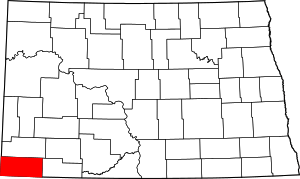 Map of North Dakota highlighting Bowman County | |
| Townships | ||
| Unorganized territories | ||
| Unincorporated communities |
| |
