Mandan, North Dakota
Mandan is a city on the eastern border of Morton County and is the seventh-largest city in North Dakota. Founded in 1879 on the west side of the upper Missouri River, it was designated in 1881 as the county seat of Morton County.[6] The U.S. Census Bureau estimated the 2019 population at 22,752.[7] Located across the Missouri River from the state capital of Bismarck,[8] Mandan is a core city of the Bismarck-Mandan Metropolitan Statistical Area.
Mandan, North Dakota | |
|---|---|
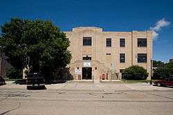 City Hall in Mandan | |
| Motto(s): "Where the West Begins" | |
 Location of Mandan, North Dakota | |
| Coordinates: 46°49′44″N 100°53′28″W[1] | |
| Country | United States |
| State | North Dakota |
| County | Morton |
| Founded | 1881 |
| Government | |
| • Mayor | Tim Helbling |
| Area | |
| • Total | 11.13 sq mi (28.83 km2) |
| • Land | 11.03 sq mi (28.57 km2) |
| • Water | 0.10 sq mi (0.26 km2) |
| Elevation | 1,647 ft (502 m) |
| Population | |
| • Total | 18,331 |
| • Estimate (2019)[4] | 22,752 |
| • Density | 1,600/sq mi (640/km2) |
| Time zone | UTC−6 (Central (CST)) |
| • Summer (DST) | UTC−5 (CDT) |
| ZIP code | 58554 |
| Area code(s) | 701 |
| FIPS code | 38-49900 |
| GNIS feature ID | 1030076[5] |
| Highways | I-94 / I-94 Bus. / I-194 / ND 6 / ND 1806 |
| Website | cityofmandan.com |
Naming
The city was named after the historic indigenous Mandan of the area.[9] The Mandan are now part of the Three Affiliated Tribes of the Fort Berthold Reservation, spanning the upper Missouri River in the western part of the state. Their people also live in cities of the state and other areas. In the 2010 census, nearly five percent of the people in the city of Mandan identified as Native American.[3]
The Mandan Indian village located at the southern base of Crying Hill prominent in east Mandan today was recorded as early as 1738 and referred to as the village of Good Fur Robe, named after their chief. This settlement would also be recorded as the village of the Crying Hill as well the village of the Two Face Stone, after their corresponding geographic features. The village was one of six Mandan villages on the west river bank between today's Knife River and Cannonball River.[10]
The credit for the city's incorporated name is a point of debate. John Andrew Rea originally arrived across the river in Bismarck in 1876 to serve as temporary editor of its newspaper during one of its founder's extended absences. Rea subsequently served as the register in the governmental land office in the territorial capital of Bismarck for eight years starting in June 1880. Rea claimed he and Northern Pacific Railroad engineer Thomas L. Rosser created the name. Rea would write to the St. Paul Pioneer Press which published and popularized the name which remains in use today.[11] However, the more generally accepted version of the truth gives credit for the city's name to Frederic Gerard. Gerard had married Helena Catherine, an Arikara/Ree woman when he ran the Fort Berthold trading post. Gerard was appointed by the Dakota Territorial governor as Morton County's first assessor when it was established in March 1878. He was one of the first three men elected as a Morton County Commissioner in November 1878.[12]
History
Early history
While Native Americans had long established settlements in the area along the river, the first white explorer was Frenchman Sieure de la Verendyre and his expedition in 1738. Not until the early 1800s did Euro-American frontiersmen come to the area with any regularity; the Lewis and Clark Expedition in 1804 and 1806, George Catlin in 1832 and Prince Maximilian and Karl Bodmer in 1834 being the most notable. The Fort Clark Trading Post was established in 1830 by the American Fur Company 40 miles upstream on the Missouri River to support trappers. To provide protection for the approaching rail line from the east and the homesteaders who would surely follow, the US Army established two outposts in the area in 1872 and 1873. Fort Greeley (later renamed Fort Hancock) was founded first on the east side of the river. On the west side, an infantry post named Fort McKeen was constructed on bluffs above the confluence of Heart and Missouri Rivers. In 1873 Congress authorized the addition of a cavalry post and changed its designation to Fort Abraham Lincoln when foot soldiers were deemed ineffective against their mounted adversaries. A permanent civilian settlement known as "Lincoln" was adjacent to the north side of the fort.
When the Northern Pacific Railroad announced a pending river crossing in 1872, land speculators rushed to establish claims at probable locations for the inevitable city to be established on the west side of the crossing. But due to the national financial crisis in 1873, Northern Pacific would postpone the river bridge project. Once its final location was announced approximately five miles north of Fort Abraham Lincoln, a work camp appeared on the west river bank in December 1878 complete with its own post office. The settlement would also serve as the base for the westward survey of the rail line.
On March 3, 1879, the post office was moved from the west bank of the Missouri River to the railroad's city site within blocks of Mandan's first railroad depot and freight building at Main Street and Stark Avenue (today's Collin's Avenue.) Four city names coincided exactly with four postmasters. The original railroad work camp's post office in 1878 was known as "Morton." The name "Mandan" stuck for only eight days in March 1879 before being renamed "Cushman" by a postmaster with an identical surname. Eventually in September 1879, the post office returned to its current designation of "Mandan."[13]
The City of Mandan was formally incorporated on February 24, 1881 and was named for the Mantani Indians, or "people of the bank." Mandan became the county seat for the replatted Morton County after the North Dakota legislature restored the prior county boundaries 1881 after the land grab in 1879 by Burleigh County. The city of Lincoln had been county seat from 1878 through 1879.
Upon completion of the railroad to Montana in 1881, Fort Abraham Lincoln had fulfilled its primary purpose and gradually declined until formally abandoned in 1891. The City of Lincoln eventually dwindled into obscurity.
Transportation development
In the earliest days of Euro-American settlement, the main commercial transportation route was the Missouri River. Even after the rail arrived in the 1870s, the river remained the main north/south route until the mid-1930s with the development of the national highway system. Steamboats used coal for fuel and the mine at Sims seven miles west of Mandan was a major source of lignite coal. If unavailable, steamboat crews bought wood from farmers along the river. Bellows Landing, the site of today's R M Hesket Power Station, was a refueling station with an icehouse. Historical records indicate it served steamboat traffic as early as 1832 when the riverboat Yellowstone reached Fort Union. Regular steamboat service on the Missouri began in 1860. Bellows Landing was renamed "Rock Haven" when the US government took over the operation in the late 1870s. The Army Corps of Engineers made extensive riverside improvements, including adding dry-dock and boat repair facilities. It supported the supply ships for the US Army's frontier forts and was considered the best landing on the river. Unlike most river harbors, the area was permanent and safe even during spring river ice breakup. It would cease operations in 1934.[14]
Recent history
In 2013, Mandan was selected a finalist in the Rand McNally "Most Patriotic City" competition.[15]
As part of the Bismarck-Mandan MSA, the area has repeatedly been ranked in the top 5 on both the Forbes list of "Best Small Places for Business and Careers" and the Milken Institutes' "Best Small Cities" list. Additionally, the sister cities has been included in CNN Money's list of top 100 places to live.[16]
Geography
According to the United States Census Bureau, the city has a total area of 11.13 square miles (28.83 km2), of which 11.03 square miles (28.57 km2) is land and 0.10 square miles (0.26 km2) is water.[2]
Climate
This climatic region is typified by large seasonal temperature differences, with warm (and often humid) summers and cold (sometimes severely cold) winters. According to the Köppen Climate Classification system, Mandan has a humid continental climate, abbreviated "Dfb" on climate maps.[17]
| Climate data for Mandan | |||||||||||||
|---|---|---|---|---|---|---|---|---|---|---|---|---|---|
| Month | Jan | Feb | Mar | Apr | May | Jun | Jul | Aug | Sep | Oct | Nov | Dec | Year |
| Record high °C (°F) | 17 (63) |
21 (70) |
27 (81) |
34 (93) |
36 (97) |
44 (111) |
44 (111) |
42 (108) |
41 (106) |
35 (95) |
24 (75) |
18 (64) |
44 (111) |
| Average high °C (°F) | −7 (19) |
−3 (27) |
3 (37) |
13 (55) |
20 (68) |
25 (77) |
29 (84) |
29 (84) |
22 (72) |
15 (59) |
4 (39) |
−3 (27) |
12 (54) |
| Daily mean °C (°F) | −13 (9) |
−9 (16) |
−2 (28) |
6 (43) |
13 (55) |
18 (64) |
22 (72) |
21 (70) |
14 (57) |
8 (46) |
−2 (28) |
−9 (16) |
6 (42) |
| Average low °C (°F) | −19 (−2) |
−15 (5) |
−8 (18) |
−1 (30) |
6 (43) |
11 (52) |
14 (57) |
13 (55) |
7 (45) |
0 (32) |
−8 (18) |
−15 (5) |
−1 (30) |
| Record low °C (°F) | −42 (−44) |
−42 (−44) |
−33 (−27) |
−24 (−11) |
−9 (16) |
−1 (30) |
2 (36) |
1 (34) |
−12 (10) |
−23 (−9) |
−34 (−29) |
−31 (−24) |
−42 (−44) |
| Source: [18] | |||||||||||||
Demographics
| Historical population | |||
|---|---|---|---|
| Census | Pop. | %± | |
| 1880 | 239 | — | |
| 1890 | 1,328 | 455.6% | |
| 1900 | 1,658 | 24.8% | |
| 1910 | 3,873 | 133.6% | |
| 1920 | 4,336 | 12.0% | |
| 1930 | 5,037 | 16.2% | |
| 1940 | 6,685 | 32.7% | |
| 1950 | 7,298 | 9.2% | |
| 1960 | 10,525 | 44.2% | |
| 1970 | 11,093 | 5.4% | |
| 1980 | 15,513 | 39.8% | |
| 1990 | 15,177 | −2.2% | |
| 2000 | 16,718 | 10.2% | |
| 2010 | 18,331 | 9.6% | |
| Est. 2019 | 22,752 | [4] | 24.1% |
| U.S. Decennial Census[19] 2018 Estimate[20] | |||
2010 census
As of the census[3] of 2010, there were 18,331 people, 7,632 households, and 4,921 families residing in the city. The population density was 1,661.9 inhabitants per square mile (641.7/km2). There were 7,950 housing units at an average density of 720.8 per square mile (278.3/km2). The racial makeup of the city was 91.7% White, 0.6% African American, 4.9% Native American, 0.2% Asian, 0.1% Pacific Islander, 0.5% from other races, and 2.0% from two or more races. Hispanic or Latino of any race were 1.8% of the population.
There were 7,632 households of which 31.6% had children under the age of 18 living with them, 48.4% were married couples living together, 11.5% had a female householder with no husband present, 4.6% had a male householder with no wife present, and 35.5% were non-families. 28.9% of all households were made up of individuals and 10.5% had someone living alone who was 65 years of age or older. The average household size was 2.35 and the average family size was 2.89.
The median age in the city was 37.2 years. 23.9% of residents were under the age of 18; 8.2% were between the ages of 18 and 24; 27.3% were from 25 to 44; 27.2% were from 45 to 64; and 13.2% were 65 years of age or older. The gender makeup of the city was 49.2% male and 50.8% female.
2000 census
As of the census of 2000, there were 16,718 people, 6,647 households, and 4,553 families residing in the city. The population density was 1,642.8 per square mile (634.3/km2). There were 6,958 housing units at an average density of 683.7 per square mile (264.0/km2). The racial makeup of the city was 94.98% White, 0.20% African American, 3.02% Native American, 0.33% Asian, 0.01% Pacific Islander, 0.15% from other races, and 1.30% from two or more races. Hispanic or Latino of any race were 0.78% of the population.
The top 6 ancestry groups in the city were German (61.3%), Norwegian (15.4%), Russian (13.1%), Irish (7.9%), English (4.2%), and Native American (3.02%).
There were 6,647 households out of which 35.7% had children under the age of 18 living with them, 54.1% were married couples living together, 10.6% had a female householder with no husband present, and 31.5% were non-families. 26.4% of all households were made up of individuals and 10.1% had someone living alone who was 65 years of age or older. The average household size was 2.48 and the average family size was 3.01.
In the city, the population was spread out with 27.0% under the age of 18, 9.0% from 18 to 24, 29.7% from 25 to 44, 21.6% from 45 to 64, and 12.7% who were 65 years of age or older. The median age was 36 years. For every 100 females, there were 97.0 males. For every 100 females age 18 and over, there were 93.6 males.
The median income for a household in the city was $38,182, and the median income for a family was $46,210. Males had a median income of $31,653 versus $21,400 for females. The per capita income for the city was $17,509. About 7.0% of families and 10.0% of the population were below the poverty line, including 12.2% of those under age 18 and 13.6% of those age 65 or over.
Economy
The economy of the surrounding area is largely agriculture-based. Mandan at one time had five grain elevators and a flour mill, but none of these facilities remain today. However, the city continues to support the agricultural industry with livestock sale ring, farm implement dealers and suppliers and finance/lending institutions. But its original purpose was support for the railroad. Subsequent access to rail transportation allowed the agricultural, commercial and industrial sectors to flourish.
In recent decades, Mandan has diversified its economy to include food processing, petroleum refining, electrical power generation, software development, manufacturing and retail trade as well as all manner of professional services for its residents. One federal institution as well as one state institution border the city.
Transportation
The origin for the city was to support the operation of the Northern Pacific Railroad. First platting documents were filed in 1873. A rail division headquarters and major maintenance facility was established in Mandan in 1881 to support operation from the Missouri River west to the Yellowstone River near Glendive, Montana. The Northern Pacific became part of the 1970 merger into the Burlington Northern Railroad; in 1995 part of the new Burlington Northern Santa Fe Railway. Known since 2005 as BNSF Railway, it operates the railroad facilities in Mandan and the surrounding communities today. Over 320 BNSF employees are based in Mandan.
Information services
National Information Systems Cooperative (NISC) develops and supports software and hardware for utility cooperatives and telecommunications companies. Of the 1,200 software developers, engineers, customer support specialists and other individuals employed by the company, approximately 450 are located in Mandan which makes it the second largest employer in the city.[21]
Laducer & Associates, Inc. specializes in large-scale information processing, with emphasis on data entry and data capture, for clients including the federal government. It is one of the largest private employers in the city.[22]
Energy industry

A Marathon Petroleum oil refinery north of Mandan began operations in 1954 as a unit of the American Oil Company with a 29,000 barrels per day (BPD) capacity. Today, the Mandan Refinery's nameplate capacity of 73,800 BPD processes primarily North Dakota sweet (low sulfur) crude oil into a full range of refined petroleum products.[23] The refinery became part of the British Petroleum (BP) system as part of the BP-Amoco merger in January 2001. BP sold the site to Tesoro Corporation in September 2001; Tesoro became Andeavor in August 2017; and Andeavor was purchased by Marathon Petroleum in October 2018.[24] In total 250 employees are based at the site including the Andeavor Logistics LP group which support trucking and crude pipeline and natural gas transportation and processing operations.[25]
R.M. Heskett Station is an electric generating station operated by Montana-Dakota Utilities Co. located approximately four miles northeast of downtown Mandan along the Missouri River. It hosts two lignite coal-fired boilers – the smaller is a spreader stoker with and the larger is a fluidizedibed design. The smaller of the two units went on line in 1954 and has a capacity of 25 megawatts. The second unit went online in 1963 and is rated at 75 megawatts.[26] A 88MW Simple Cycle Combustion Turbine i.e. "peaking unit" was added to the Station in July 2014.[27] The plant is named for R.M. Heskett, the founder of Montana-Dakota Utilities Co.
Governmental institutions
As the seat of Morton County, all the major governmental service offices are located in the city including the courthouse. Morton County employs approximately 170 people with the majority residing in Mandan. The offices for the City of Mandan include facilities to house approximately 140 people.[28]
In August 1912, a bill to establish the Northern Great Plains Research Station was passed by the US Congress. Ground was broke in September 1913. This Station today maintains the honor of being the second-largest federal dry land experimental station in the nation. Dry land farming in all of its phases is carried on at the Station as well as the development of new grains and fruits. The station employs approximately 20 people including doctorate level professionals.[29]
The North Dakota Youth Correctional Center maintains custody of up to 107 youth committed to its care by the Juvenile Courts. Operated by the State of North Dakota, the campus includes four cottages, administration and education facilities, a gymnasium with an indoor swimming pool, a chapel and a cafeteria. Until 1947 the facility, then referred to as the State Training School, also served as an orphanage, especially for the children of criminals who were incarcerated. However other children orphaned typically through accidents or other mishaps were also assigned there.[30]
Education
Mandan Public Schools operates Roosevelt Elementary School, Mary Stark Elementary School, Lewis & Clark Elementary School, Ft. Lincoln Elementary School, Custer Elementary School, Red Trail Elementary School, Mandan Middle School, and Mandan High School, as well as the Brave Center Academy night school. In 2016, the Mandan Public School District was the largest employer in Morton County with approximately 700 employees.[28]
The city's Catholic parishes operate two private K–6 schools: Christ the King School and St. Joseph School.
Bismarck State College operates two campuses in Mandan focusing on post-secondary vocational education. Its a Mechanical Maintenance Technology program is based out of its east-Mandan campus. The Electrical Lineworker School is housed at a facility in northwest Mandan.[31]
Hospitals
Triumph Hospital Central Dakotas is a 41-bed critical care hospital in Mandan.[32]
Local media
Mandan shares a print, radio, and television media market with nearby Bismarck.
Notable people
- Frank L. Anders, Congressional Medal of Honor recipient, engineer, businessman, amateur military historian and politician
- Henry Waldo Coe, resident of Mandan and among the first physicians in Dakota Territory, elected to state office, close friend of Theodore Roosevelt
- Tony Dean, television broadcaster, columnist and conservationist. Dean's real name was Anthony DeChandt
- Ivan Dmitri, AKA Levon West; artist, photographer and printmaker; gained international recognition as an artist for his etching “The Spirit of St. Louis”
- Ron Erhardt, born and grew up in Mandan, he became head coach of the New England Patriots
- Heidi Heitkamp, Former US Senator who resides in rural Mandan[33]
- Tom Huff, Washington State Representative
- Richard Longfellow, Congressional Medal of Honor recipient
- Arthur Peterson, Jr., actor born and raised in Mandan
- A. R. Shaw, educator and politician[34]
- Era Bell Thompson, author and editor of Ebony magazine
- Marlo Anderson, founder of National Day Calendar
See also
References
- "US Gazetteer files: 2010, 2000, and 1990". United States Census Bureau. February 12, 2011. Retrieved April 23, 2011.
- "US Gazetteer files 2010". United States Census Bureau. Archived from the original on 2012-01-25. Retrieved 2012-06-14.
- "U.S. Census website". United States Census Bureau. Retrieved June 14, 2014.
- "Population and Housing Unit Estimates". Retrieved May 21, 2020.
- "US Board on Geographic Names". United States Geological Survey. October 25, 2007. Retrieved January 31, 2008.
- "Find a County". National Association of Counties. Retrieved 2011-06-07.
- "2017 Pop Estimate". Retrieved July 7, 2018.
- "City of Mandan", official website
- Gannett, Henry (1905). The Origin of Certain Place Names in the United States. U.S. Government Printing Office. p. 197.
- Ahler, Stanley (2002). Prehistory on ... Scattered Village in Mandan, North Dakota (PDF) (Report). N.D. Department of Transportation. p. 8.
- "John Rea Bares Inside Story of Mandan". Mandan Daily Pioneer. Pioneer Publishing Company. August 27, 1931. p. 1.
- Patera, Alan H. (1982). North Dakota Post Offices 1850–1982. The Depot, Burtonsville, Maryland. p. 56.
- "Rockhaven Harbor". Mandan Historical Society. Mandan Historical Society. Retrieved July 14, 2018.
- Eckroth, LeAnn (September 4, 2013). "Mandan garners the most patriotic votes online". The Bismarck Tribune. Lee Enterprises. Retrieved 25 October 2015.
- "About Bismarck-Mandan". Bismarck-Mandan Developmental Association. Bismarck-Mandan Developmental Association. Retrieved July 25, 2018.
- Climate Summary for Mandan, North Dakota
- "Mandan, North Dakota, Temperature Averages". Weatherbase. Retrieved 6 February 2015.
- United States Census Bureau. "Census of Population and Housing". Retrieved July 19, 2013.
- "Population Estimates". United States Census Bureau. Retrieved May 23, 2019.
- "About Us". National Information Systems Cooperative. National Information Systems Cooperative. Retrieved July 25, 2018.
- "Laducer Information Management". Laducer & Associates, Inc. Laducer & Associates, Inc. Retrieved July 25, 2018.
- http://www.andeavor.com/refining/mandan/, Andeavor website
- "Tesoro officially becomes Andeavor". Oil & Gas Journal. Retrieved July 7, 2018.
- "Marathon to become top US refiner". Reuters News Service. April 29, 2018. Retrieved August 4, 2018.
- "R.M. Heskett Station". North Dakota Lignite Council. Retrieved July 7, 2018.
- "MDU 88MW ... Post-Construction Inspection Report" (PDF). Wenck Associates. January 2015. pp. 1–3.
- "Major Employers". Bismarck-Mandan Developmental Association. Bismarck-Mandan Developmental Association. Retrieved July 25, 2018.
- "Northern Great Plains Research Laboratory: Mandan, ND". Northern Great Plains Research Laboratory. US Department of Agriculture. Retrieved July 4, 2018.
- "Youth Correctional Center". Mandanhistory.org. Mandan Historical Society. Retrieved July 4, 2018.
- "Lineworker (Electrical)". Retrieved July 14, 2018.
- "Triumph Hospital Central Dakotas". Hospitals Worldwide. MediLexicon International Ltd. Retrieved July 9, 2013.
- "How Heidi Works for North Dakotans". Heidi for North Dakota. Archived from the original on October 5, 2013. Retrieved July 9, 2013.
- "Biographical Sketch of Arch Shaw," North Dakota Centennial Blue Book 1889–1989, Ben Meier (editor), North Dakota Legislative Assembly, p. 411
External links
| Wikivoyage has a travel guide for Mandan. |
Municipalities and communities of Morton County, North Dakota, United States | ||
|---|---|---|
| Cities | 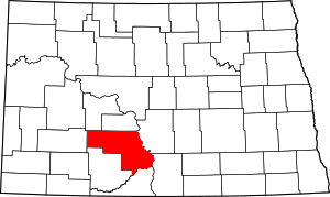 Map of North Dakota highlighting Morton County | |
| Township | ||
| CDP | ||
| Unincorporated communities | ||

| Counties |  | |
|---|---|---|
| Core cities | ||
| Surrounding areas |
| |
| Authority control |
|
|---|