Dickinson, North Dakota
Dickinson is a city in Stark County, North Dakota, United States. It is the county seat of Stark County.[6] The population was 17,787 at the 2010 census.[7] The U.S. Census Bureau estimated that the 2019 population is 23,133.[8]
Dickinson, North Dakota | |
|---|---|
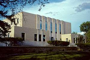 Stark County Courthouse in Dickinson | |
| Nickname(s): Queen City[1] | |
 Location of Dickinson, North Dakota | |
| Coordinates: 46°53′1″N 102°47′20″W | |
| Country | United States |
| State | North Dakota |
| County | Stark |
| Government | |
| • Type | City Commission |
| • President | Scott Decker |
| • City Administrator | tba |
| Area | |
| • Total | 10.03 sq mi (25.98 km2) |
| • Land | 9.96 sq mi (25.80 km2) |
| • Water | 0.07 sq mi (0.18 km2) |
| Elevation | 2,411 ft (735 m) |
| Population | |
| • Total | 17,787 |
| • Estimate (2019)[4] | 23,133 |
| • Density | 1,800/sq mi (680/km2) |
| Time zone | UTC−7 (Mountain (MST)) |
| • Summer (DST) | UTC−6 (MDT) |
| ZIP codes | 58601-58602 |
| Area code(s) | 701 Exchange: 225 |
| FIPS code | 38-19620 |
| GNIS feature ID | 1028683[5] |
| Highways | I-94, I-94 Bus., ND 22 |
| Website | www.dickinsongov.com |
Since the North Dakota oil boom the city has become one of the fastest growing cities in the United States. According to the 2015 census, the city is estimated to have a population of 23,765, however, other sources have estimates of the population at 30,372 or possibly exceeding 35,000.[9] The rapid growth of the city led to an increase in crime and homelessness within the city limits.[10][11] Also, the city has seen an increase in diversity, with increases in the Latino, Asian and African American populations.
Dickinson is the principal city of the Dickinson Micropolitan Statistical Area, a micropolitan area that covers Billings and Stark counties and had a combined population of 24,982 at the 2010 census.
History
Dickinson was founded in 1881.[12] Dickinson was named for its founder, W. S. Dickinson, a native of Malone, New York.[13]
Geography
Dickinson is located at 46°53′01″N 102°47′20″W (46.883575, −102.788811).[14]
According to the United States Census Bureau, the city has a total area of 10.03 square miles (25.98 km2), of which, 9.96 square miles (25.80 km2) is land and 0.07 square miles (0.18 km2) is water.[2] Dickinson's municipal water supplies come from Southwest Water Authority which, in turn, gets their water from Lake Sakakawea through a transmission pipeline.
Climate
Nearly all of Stark County has a humid continental climate of warm summer (Köppen: Dfb), but due to low precipitation and marginality between climate with dry season defined (Dwb) and semi-arid climate (BSk), Dickinson can be said to be prone to periods of drought, even though it is defined as wet all year round. Its climate is similar to Bismarck's, though a bit less extreme.[15] The monthly daily average temperature ranges from 16.3 °F (−8.7 °C) in January to 69.2 °F (20.7 °C) in July; on average, temperatures reach 100 °F (38 °C) on 2.2 days, 90 °F (32 °C) on 22 days, and 0 °F (−18 °C) on 32 days annually. The average window for freezing temperatures is September 22 thru May 16 and for measurable (≥0.1 inches or 0.25 centimetres) snow, October 26 thru April 19. Due to the relative aridity, there are only 2.8 days where 24-hour snowfall exceeds 3 inches (7.6 cm). With a period of record dating only to 1938 (for lows) and 1948 (for highs), extreme temperatures range from −35 °F (−37 °C) as recently as January 29, 1966 to 109 °F (43 °C) on July 7, 1981.
| Climate data for Dickinson Theodore Roosevelt Regional Airport (1981–2010) | |||||||||||||
|---|---|---|---|---|---|---|---|---|---|---|---|---|---|
| Month | Jan | Feb | Mar | Apr | May | Jun | Jul | Aug | Sep | Oct | Nov | Dec | Year |
| Record high °F (°C) | 57.0 (13.9) |
66.0 (18.9) |
79.0 (26.1) |
89.1 (31.7) |
93.9 (34.4) |
100.0 (37.8) |
105.1 (40.6) |
108.0 (42.2) |
102.0 (38.9) |
93.9 (34.4) |
70.0 (21.1) |
60.1 (15.6) |
108.0 (42.2) |
| Average high °F (°C) | 26.4 (−3.1) |
30.8 (−0.7) |
41.1 (5.1) |
55.4 (13.0) |
66.1 (18.9) |
75.4 (24.1) |
83.6 (28.7) |
83.2 (28.4) |
71.2 (21.8) |
56.5 (13.6) |
40.0 (4.4) |
28.1 (−2.2) |
54.8 (12.7) |
| Daily mean °F (°C) | 16.3 (−8.7) |
20.5 (−6.4) |
30.0 (−1.1) |
42.3 (5.7) |
53.1 (11.7) |
62.2 (16.8) |
69.2 (20.7) |
68.4 (20.2) |
57.2 (14.0) |
43.8 (6.6) |
29.5 (−1.4) |
17.9 (−7.8) |
42.5 (5.8) |
| Average low °F (°C) | 6.2 (−14.3) |
10.1 (−12.2) |
18.8 (−7.3) |
29.2 (−1.6) |
40.1 (4.5) |
49.1 (9.5) |
54.9 (12.7) |
53.6 (12.0) |
43.1 (6.2) |
31.2 (−0.4) |
18.9 (−7.3) |
7.7 (−13.5) |
30.2 (−1.0) |
| Record low °F (°C) | −36.9 (−38.3) |
−27.0 (−32.8) |
−27.9 (−33.3) |
−4.0 (−20.0) |
16.0 (−8.9) |
32.0 (0.0) |
39.0 (3.9) |
32.0 (0.0) |
17.1 (−8.3) |
3.0 (−16.1) |
−22.0 (−30.0) |
−27.9 (−33.3) |
−36.9 (−38.3) |
| Average precipitation inches (mm) | 0.29 (7.4) |
0.33 (8.4) |
0.69 (18) |
1.47 (37) |
2.32 (59) |
3.20 (81) |
2.44 (62) |
1.53 (39) |
1.47 (37) |
1.23 (31) |
0.54 (14) |
0.24 (6.1) |
15.73 (400) |
| Average snowfall inches (cm) | 5.3 (13) |
5.2 (13) |
5.6 (14) |
5.4 (14) |
0.5 (1.3) |
0 (0) |
0 (0) |
0 (0) |
0.5 (1.3) |
1.6 (4.1) |
5.5 (14) |
4.1 (10) |
33.8 (86) |
| Average precipitation days (≥ 0.01 in) | 5.2 | 4.3 | 6.4 | 7.8 | 10.9 | 12.2 | 9.5 | 6.8 | 6.6 | 6.2 | 5.7 | 4.9 | 86.5 |
| Average snowy days (≥ 0.1 in) | 5.2 | 4.8 | 4.7 | 2.7 | .3 | 0 | 0 | 0 | .2 | 1.0 | 4.9 | 5.1 | 28.8 |
| Source 1: NOAA[16] | |||||||||||||
| Source 2: Climatebase.ru (extremes)[17] | |||||||||||||
Demographics
| Historical population | |||
|---|---|---|---|
| Census | Pop. | %± | |
| 1890 | 897 | — | |
| 1900 | 2,076 | 131.4% | |
| 1910 | 3,678 | 77.2% | |
| 1920 | 4,122 | 12.1% | |
| 1930 | 5,025 | 21.9% | |
| 1940 | 5,839 | 16.2% | |
| 1950 | 7,469 | 27.9% | |
| 1960 | 9,971 | 33.5% | |
| 1970 | 12,405 | 24.4% | |
| 1980 | 15,974 | 28.8% | |
| 1990 | 16,097 | 0.8% | |
| 2000 | 16,010 | −0.5% | |
| 2010 | 17,787 | 11.1% | |
| Est. 2019 | 23,133 | [4] | 30.1% |
| U.S. Decennial Census[18] 2018 Estimate[8] | |||
2010 census
As of the census[3] of 2010, there were 17,787 people, 7,521 households, and 4,308 families residing in the city. The population density was 1,785.8 inhabitants per square mile (689.5/km2). There were 7,865 housing units at an average density of 789.7 per square mile (304.9/km2). The racial makeup of the city was 94.2% White, 1.0% African American, 1.2% Native American, 1.5% Asian, 0.1% Pacific Islander, 0.6% from other races, and 1.5% from two or more races. Hispanic or Latino of any race were 2.1% of the population. It is estimated Dickinson has currently grown to close to 35,000 people, due to the boom of the Bakken Oil Shale[9]
There were 7,521 households, of which 26.6% had children under the age of 18 living with them, 45.4% were married couples living together, 8.1% had a female householder with no husband present, 3.9% had a male householder with no wife present, and 42.7% were non-families. 33.6% of all households were made up of individuals, and 12.8% had someone living alone who was 65 years of age or older. The average household size was 2.25 and the average family size was 2.89.
The median age in the city was 35.6 years. 21% of residents were under the age of 18; 14.1% were between the ages of 18 and 24; 24.6% were from 25 to 44; 24.3% were from 45 to 64; and 16.1% were 65 years of age or older. The gender makeup of the city was 49.3% male and 50.7% female.
2000 census
As of the census of 2000, there were 16,010 people, 6,517 households, and 4,020 families residing in the city. The population density was 1,690.7 inhabitants per square mile (652.7/km2). There were 7,033 housing units at an average density of 742.7 per square mile (286.7/km2). The racial makeup of the city was 97.16% White, 0.27% African American, 1.20% Native American, 0.24% Asian, 0.03% Pacific Islander, 0.32% from other races, and 0.77% from two or more races. Hispanic or Latino of any race were 1.05% of the population.
The top 6 ancestry groups in the city are German (54.1%), Norwegian (14.2%), Czech (7.5%), Russian (7.2%), Irish (5.5%), English (3.7%).
There were 6,517 households, out of which 30.9% had children under the age of 18 living with them, 49.7% were married couples living together, 9.1% had a female householder with no husband present, and 38.3% were non-families. 32.4% of all households were made up of individuals, and 13.3% had someone living alone who was 65 years of age or older. The average household size was 2.33 and the average family size was 2.99.
In the city, the population was spread out, with 24.5% under the age of 18, 13.8% from 18 to 24, 25.9% from 25 to 44, 19.8% from 45 to 64, and 16.1% who were 65 years of age or older. The median age was 36 years. For every 100 females, there were 93.5 males. For every 100 females age 18 and over, there were 88.7 males.
The median income for a household in the city was $31,542, and the median income for a family was $41,566. Males had a median income of $30,613 versus $19,951 for females. The per capita income for the city was $15,975. About 7.1% of families and 12.0% of the population were below the poverty line, including 10.2% of those under age 18 and 16.9% of those age 65 or over.
Education
K-12
The Dickinson Public Schools system includes six elementary schools, a junior high school, Dickinson High School and an alternative high school. There are also several parochial schools in Dickinson. Trinity East and Trinity West serve as the parochial elementary schools and Dickinson Trinity has both a junior high school and a high school. Hope Christian Academy is also located in Dickinson. HCA is part of the Evangelical Bible Church. The current principal is Shane Bradley.
Higher education
- Dickinson State University, A public University that offers 51 bachelor's degrees, 4 associate degrees, and 2 certificate programs.[19]
Transportation
Dickinson is served by Dickinson Theodore Roosevelt Regional Airport. United Express provides commercial airline service to Denver. Delta Connection discontinued service to Minneapolis on December 1, 2015
FedEx Express has daily cargo flight service between Theodore Roosevelt Regional Airport (DIK) and Hector International Airport (FAR) in Fargo, ND. The flights operate Monday through Saturday using Cessna 208B Caravans with Cargomaster cargo pods.
Jefferson Lines offers regional bus service throughout the Midwest and stops at the Paragon Lanes Bowling Alley in Dickinson almost daily throughout the week.
The former Northern Pacific Railway line now owned by Burlington Northern Santa Fe Railway provides only freight service to Dickinson.
Interstate 94 has interchanges in Dickinson at Exits 59, 61, and 64. It also has a I-94 Business Loop between exits 59 and 64. The state route within Dickinson is North Dakota Highway 22 which runs north and south along Main Avenue and Third Avenue. ND 22 has a truck route along Southwest Eighth Street, State Avenue and West Villard Street due to the low bridge for the former Northern Pacific Railway line.
Media
Print
Television
Digital
Radio
FM band
- 88.1 K201FN – rebroadcasts CSN (Christian)
- 89.9 KDPR – North Dakota Public Radio/NPR network (Public radio)
- 90.9 K296DT – rebroadcasts KSLT "K-Salt" (Cont. Christian music)
- 92.1 KZRX "Z92" (Mainstream Rock)
- 93.9 KXDI "I94" (Country)
- 99.1 KCAD "Roughrider Country" (Country)
- 103.3 KPAR-LP – low power broadcaster carrying LifeTalk Radio network (Christian Talk)
- 105.7 KDXN "The Mix" (Adult Contemporary)
AM band
Sites of interest
- Dickinson Dinosaur Museum
- Dickinson Museum Center
- West River Community Center
- West River Ice Center
- Biesiot Activities Center
- Ukrainian Cultural Institute
- Dickinson Area Public Library (originally a Carnegie Library)
Sports
- The Dickinson Packers played independent minor league baseball in the Mandak League from 1955 to 1956
- Dickinson Roughriders of North Dakota American Legion Baseball
- Dickinson State University Blue Hawks
- Dickinson High School Midgets
- Trinity High School Titans
- Badlands Big Sticks, summer collegiate baseball team in the Expedition League[20]
Notable People
- LaRoy Baird, lived in Dickinson, former member of North Dakota Senate
- Doug Beaudoin, born in Dickinson, former American football safety in the NFL
- Bob Bergloff, born in Dickinson, former ice hockey defenseman
- Byron Dorgan, born in Dickinson, former United States Senator
- Edward Doro, born in Dickinson, poet
- Clay S. Jenkinson, born in Dickinson, scholar, author, and educator
- Bennie Joppru, born in Dickinson, former tight end in the National Football League
- Douglas Kary, born in Dickinson, member of the Montana Legislature
- Aaron Krauter, born in Dickinson, member of North Dakota Senate
- John S. Lesmeister, born in Dickinson, 30th North Dakota State Treasurer
- Kellan Lutz, born in Dickinson, actor, played Emmett Cullen in Twilight
- Mitch Malloy, born in Dickinson, singer and songwriter
- Ted Nace, raised in Dickinson, writer, publisher, and environmentalist
- Herb Parker (1921–2007), lived in Dickinson, teacher and American football coach at Minot State University
- Malachi Ritscher (1954–2006), born in Dickinson, musician and human rights activist
- George Scherger (1920–2011), born in Dickinson, MLB coach, infielder, and manager
- Dorothy Stickney (1896–1998), born in Dickinson, stage and film actress
- Bill Swain, born in Dickinson, former linebacker for the New York Giants
References
- "City of Dickinson, North Dakota". Retrieved 2010-04-20.
- "US Gazetteer files 2010". United States Census Bureau. Archived from the original on July 2, 2012. Retrieved June 14, 2012.
- "U.S. Census website". United States Census Bureau. Retrieved June 14, 2012.
- "Population and Housing Unit Estimates". Retrieved May 21, 2020.
- "US Board on Geographic Names". United States Geological Survey. 2007-10-25. Retrieved 2008-01-31.
- "Find a County". National Association of Counties. Archived from the original on May 31, 2011. Retrieved June 7, 2011.
- "2010 Census Redistricting Data (Public Law 94-171) Summary File". American FactFinder. United States Census Bureau. Retrieved 2 May 2011.
- "Population Estimates". United States Census Bureau. Retrieved October 3, 2018.
- Christie, Les (Mar 19, 2013). "Fastest growing boomtowns". CNNMoney. Retrieved Dec 23, 2019.
- Healy, Jack (30 Nov 2013). "As Oil Floods Plains Towns, Crime Pours In". The New York Times.
- Faulx, Nadia (April 4, 2015). "Bakken a new market for organized drug crime, officials say". The Forum.
- Wick, Douglas A. "Dickinson (Stark County)". North Dakota Place Names. Retrieved 8 May 2011.
- Gannett, Henry (1905). The Origin of Certain Place Names in the United States. Govt. Print. Off. pp. 106.
- "US Gazetteer files: 2010, 2000, and 1990". United States Census Bureau. February 12, 2011. Retrieved April 23, 2011.
- "Updated Köppen-Geiger climate map of the world". people.eng.unimelb.edu.au. Retrieved 2018-12-21.
- "NOWData – NOAA Online Weather Data". National Oceanic and Atmospheric Administration. Retrieved May 4, 2013.
- "Dickinson, USA". Climatebase.ru. Retrieved December 21, 2018.
- "U.S. Decennial Census". Census.gov. Retrieved May 26, 2013.
- "Archived copy". Archived from the original on 2015-03-10. Retrieved 2015-03-04.CS1 maint: archived copy as title (link)
- "Home Page | Badlands Big Sticks - Pointstreak Sites". badlandsbigsticks.pointstreaksites.com. Retrieved Dec 23, 2019.
External links
| Wikivoyage has a travel guide for Dickinson. |
Municipalities and communities of Stark County, North Dakota, United States | ||
|---|---|---|
| Cities | 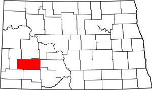 Map of North Dakota highlighting Stark County | |
| Unincorporated communities | ||

| Authority control |
|
|---|