Salem Township, Shelby County, Ohio
| Salem Township, Shelby County, Ohio | |
|---|---|
| Township | |
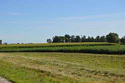 Farm fields east of Port Jefferson | |
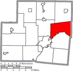 Location of Salem Township in Shelby County | |
| Coordinates: 40°20′25″N 84°4′24″W / 40.34028°N 84.07333°WCoordinates: 40°20′25″N 84°4′24″W / 40.34028°N 84.07333°W | |
| Country | United States |
| State | Ohio |
| County | Shelby |
| Area | |
| • Total | 26.7 sq mi (69.2 km2) |
| • Land | 26.7 sq mi (69.1 km2) |
| • Water | 0.0 sq mi (0.0 km2) |
| Elevation[1] | 1,050 ft (320 m) |
| Population (2000) | |
| • Total | 2,231 |
| • Density | 83.6/sq mi (32.3/km2) |
| Time zone | UTC-5 (Eastern (EST)) |
| • Summer (DST) | UTC-4 (EDT) |
| FIPS code | 39-69960[2] |
| GNIS feature ID | 1086968[1] |
Salem Township is one of the fourteen townships of Shelby County, Ohio, United States. The 2000 census found 2,231 people in the township, 1,910 of whom lived in the unincorporated portions of the township.[3]
Geography
Located in the eastern part of the county, it borders the following townships:
- Jackson Township - north
- Bloomfield Township, Logan County - northeast
- Pleasant Township, Logan County - east
- Miami Township, Logan County - southeast
- Perry Township - south
- Clinton Township - southwest
- Franklin Township - northwest
The village of Port Jefferson is located in southern Salem Township, and the unincorporated community of Maplewood lies in the northern part of the township.
Name and history
Salem Township was established in 1826.[4] It is one of fourteen Salem Townships statewide.[5]
Government
The township is governed by a three-member board of trustees, who are elected in November of odd-numbered years to a four-year term beginning on the following January 1. Two are elected in the year after the presidential election and one is elected in the year before it. There is also an elected township fiscal officer,[6] who serves a four-year term beginning on April 1 of the year after the election, which is held in November of the year before the presidential election. Vacancies in the fiscal officership or on the board of trustees are filled by the remaining trustees.
References
- 1 2 "US Board on Geographic Names". United States Geological Survey. 2007-10-25. Retrieved 2008-01-31.
- ↑ "American FactFinder". United States Census Bureau. Retrieved 2008-01-31.
- ↑ Shelby County, Ohio — Population by Places Estimates Ohio State University, 2007. Accessed 15 May 2007.
- ↑ Hitchcock, Almon Baldwin Carrington (1913). History of Shelby County, Ohio, and representative citizens. p. 83.
- ↑ "Detailed map of Ohio" (PDF). United States Census Bureau. 2000. Retrieved 2007-02-16.
- ↑ §503.24, §505.01, and §507.01 of the Ohio Revised Code. Accessed 4/30/2009.
External links
Municipalities and communities of Shelby County, Ohio, United States | ||
|---|---|---|
| City |  | |
| Villages | ||
| Townships | ||
| CDP | ||
| Unincorporated communities | ||
| Footnotes | ‡This populated place also has portions in an adjacent county or counties | |