Oktibbeha County, Mississippi
| Oktibbeha County, Mississippi | |
|---|---|
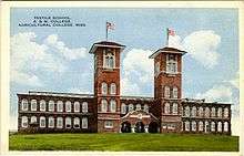 Postcard. Textile Building in Starkville, Mississippi | |
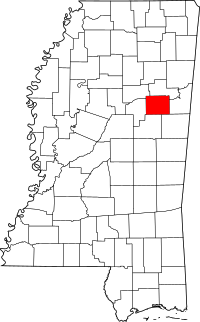 Location in the U.S. state of Mississippi | |
 Mississippi's location in the U.S. | |
| Founded | 1833 |
| Seat | Starkville |
| Largest city | Starkville |
| Area | |
| • Total | 462 sq mi (1,197 km2) |
| • Land | 458 sq mi (1,186 km2) |
| • Water | 3.7 sq mi (10 km2), 0.8% |
| Population | |
| • (2010) | 47,671 |
| • Density | 104/sq mi (40/km2) |
| Congressional districts | 1st, 3rd |
| Time zone | Central: UTC−6/−5 |
| Website |
www |
Oktibbeha County is a county located in the east central portion of the U.S. state of Mississippi. As of the 2010 census the population was 47,671. The county seat is Starkville. The county's name is derived from a local Native American word meaning either "bloody water" or "icy creek".[1]
Mississippi State University, a public research university and land-grand institution, is located in Oktibbeha County.
Oktibbeha County is conterminous with the Starkville, MS Micropolitian Statistical Area. The county is part of the Golden Triangle region of Mississippi.
History
The name Oktibbeha is a Native American word meaning either "bloody water" (because of a battle fought on the banks) or possibly "icy creek". Indian artifacts more than 2000 years old have been found near ancient earthwork mounds just east of Starkville, showing the area has been inhabited at least this long. These have been used to date the construction of the mounds to the Woodland period, ending about 1000 A.D. The Choctaw people, one of the Five Civilized Tribes of the Southeast, occupied extensive territory in this area for centuries prior to European encounter. The Indian Mound Campground nearby was named for the earthwork monuments.
Artifacts in the form of clay pot fragments and artwork dating from that period have been found east of Starkville at the Herman Mound and Village site, which is listed on the National Register of Historic Places and can be accessed from the Indian Mound Campground. Shortly before the American Revolutionary War period, the area was inhabited by the Choccuma (or Chakchiuma) tribe, who were annihilated at a settlement known as Lyon's Bluff by a rare alliance between the Choctaw and Chickasaw, who were traditional rivals.[2] The modern early settlement of the area was started during the period of Indian Removal, after the Choctaw of Oktibbeha County ceded their claims to land to the United States in the area in the Treaty of Dancing Rabbit Creek in 1830. They were removed to other lands west of the Mississippi River, in Indian Territory, what is now the state of Oklahoma.
Like the indigenous peoples before them, white settlers were drawn to the Starkville area because of two large natural springs. The Choctaw Agency was set up near what is now Sturgis, first to deal with the Choctaw and later to organize the selling of their lands to the new inhabitants.[3] What was originally a trading post was located on Robinson Road, about 1.5 mi (2.4 km) east of the Noxubee River.[4]
A lumber mill southwest of town produced clapboards, from which the settlement took its original name of Boardtown. In 1835, Boardtown was established as the county seat of Oktibbeha County, and its name was changed to Starkville in honor of Revolutionary War hero General John Stark.[5]
In 1876, in a largely successful attempt by whites to suppress the black vote in the Reconstruction era, a group of eighteen white men known as White-Liners, led by Dorsey Outlaw, surrounded the Republican Club in the community of Chapel Hill near Choctaw Agency. They fired upon the black members from ambush, shooting them in the back. One man, Charles Curry, was killed instantly, and 36 were wounded, four of them possibly mortally wounded. Jeff Gregory died the following day. The same group of White-Liners continued to Artesia the next day to intimidate black voters in that area, and on to Columbus the next day.[6][7]
The state legislature founded Mississippi State University near Starkville in 1878 as a land-grant university. It has become a major research university. Since the late 20th century, Oktibbeha, along with Clay and Lowndes counties, have been designated along with their respective counties as the Golden Triangle in Mississippi. They share a goal of collaborative economic development among the three counties and their major jurisdictions. Following the decline of manufacturing in the late 20th century, the growth of Mississippi State University has resulted in Starkville's becoming the largest city in the region.[8]
In 1912 Mann Hamilton, a black man, was accused of assaulting a white woman, June Bell, at Bell's school house near Maben. Although Sheriff Nickles attempted to gain custody of the accused, he was directed to the wrong location and Hamilton was lynched, hanged by a white mob.[9] This was one of six lynchings of African Americans committed by whites in the county in the post-Reconstruction period and extending into the early 20th century.[10]
Geography
According to the U.S. Census Bureau, the county has a total area of 462 square miles (1,200 km2), of which 458 square miles (1,190 km2) is land and 3.7 square miles (9.6 km2) (0.8%) is water.[11] The majority of the county lies within the Black Belt region while portions of the county are in the Flatwoods region.
Major highways
Adjacent counties
- Noxubee County (southeast)
- Winston County (south)
- Choctaw County (west)
- Webster County (northwest)
- Clay County (north)
- Lowndes County (east)
National protected areas
- Noxubee National Wildlife Refuge (part)
- Tombigbee National Forest (part)
Demographics
As can be seen on the population table, there was a marked decline from 1910 to 1920, a period when the Great Migration (African American) of African Americans out of the rural South began. Before 1940 a total of 1.5 million African Americans went to northern and Midwestern industrial cities to find work.
| Historical population | |||
|---|---|---|---|
| Census | Pop. | %± | |
| 1840 | 4,276 | — | |
| 1850 | 9,171 | 114.5% | |
| 1860 | 12,977 | 41.5% | |
| 1870 | 14,891 | 14.7% | |
| 1880 | 15,978 | 7.3% | |
| 1890 | 17,694 | 10.7% | |
| 1900 | 20,183 | 14.1% | |
| 1910 | 19,676 | −2.5% | |
| 1920 | 16,872 | −14.3% | |
| 1930 | 19,119 | 13.3% | |
| 1940 | 22,151 | 15.9% | |
| 1950 | 24,569 | 10.9% | |
| 1960 | 26,175 | 6.5% | |
| 1970 | 28,752 | 9.8% | |
| 1980 | 36,018 | 25.3% | |
| 1990 | 38,375 | 6.5% | |
| 2000 | 42,902 | 11.8% | |
| 2010 | 47,671 | 11.1% | |
| Est. 2016 | 49,833 | [12] | 4.5% |
| U.S. Decennial Census[13] 1790-1960[14] 1900-1990[15] 1990-2000[16] 2010-2013[17] | |||
As of the 2010 United States Census, there were 47,671 people residing in the county. 59.2% were White, 36.6% Black or African American, 2.4% Asian, 0.2% Native American, 0.4% of some other race and 1.2% of two or more races. 1.4% were Hispanic or Latino (of any race).
As of the census[18] of 2000, there were 42,902 people, 15,945 households, and 9,264 families residing in the county. The population density was 94 people per square mile (36/km²). There were 17,344 housing units at an average density of 38 per square mile (15/km²). The racial makeup of the county was 58.66% White, 37.43% Black or African American, 0.16% Native American, 2.53% Asian, 0.03% Pacific Islander, 0.47% from other races, and 0.71% from two or more races. 1.07% of the population were Hispanic or Latino of any race.
There were 15,945 households out of which 28.20% had children under the age of 18 living with them, 39.90% were married couples living together, 14.80% had a female householder with no husband present, and 41.90% were non-families. 27.70% of all households were made up of individuals and 6.70% had someone living alone who was 65 years of age or older. The average household size was 2.42 and the average family size was 3.03.
In the county, the population was spread out with 21.00% under the age of 18, 29.60% from 18 to 24, 24.80% from 25 to 44, 16.00% from 45 to 64, and 8.60% who were 65 years of age or older. The median age was 25 years. For every 100 females there were 99.90 males. For every 100 females age 18 and over, there were 99.20 males.
The median income for a household in the county was $24,899, and the median income for a family was $36,914. Males had a median income of $32,162 versus $20,622 for females. The per capita income for the county was $14,998. About 18.00% of families and 28.20% of the population were below the poverty line, including 30.30% of those under age 18 and 17.80% of those age 65 or over.
Government and politics
In 2004 Republican George Bush won Oktibbeha County over Democrat John Kerry 55% to 43%, as most of the majority whites support Republican national candidates. In 2008 Democrat Barack Obama defeated Republican John McCain by 6 votes, becoming the first Democrat to win the county since 1956. Obama carried the county again with an increased margin in 2012. Oktibbeha whites had started voting Republican in the presidential election prior to the major realignment of parties in the South that has taken place since the mid-20th century.
Two small portions of the county are included within the 1st congressional district. Most of the county, including the city of Starkville and the campus of Mississippi State University, are included in the 3rd district.
| Year | Republican | Democratic | Third parties |
|---|---|---|---|
| 2016 | 47.3% 8,576 | 48.9% 8,859 | 3.8% 689 |
| 2012 | 48.4% 8,761 | 50.2% 9,095 | 1.4% 261 |
| 2008 | 49.6% 9,320 | 49.6% 9,326 | 0.8% 146 |
| 2004 | 55.7% 9,068 | 43.1% 7,015 | 1.3% 207 |
| 2000 | 53.8% 7,959 | 43.5% 6,443 | 2.7% 402 |
| 1996 | 49.0% 6,142 | 47.3% 5,923 | 3.7% 459 |
| 1992 | 48.5% 6,381 | 43.5% 5,726 | 8.0% 1,049 |
| 1988 | 58.0% 7,126 | 41.5% 5,100 | 0.5% 63 |
| 1984 | 59.7% 7,574 | 40.1% 5,097 | 0.2% 26 |
| 1980 | 49.7% 6,300 | 47.6% 6,039 | 2.7% 336 |
| 1976 | 53.4% 5,194 | 44.6% 4,339 | 2.0% 192 |
| 1972 | 75.6% 6,160 | 23.1% 1,880 | 1.4% 113 |
| 1968 | 17.7% 1,276 | 25.3% 1,826 | 57.1% 4,127 |
| 1964 | 90.7% 3,795 | 9.3% 390 | |
| 1960 | 24.3% 829 | 26.8% 915 | 49.0% 1,672 |
| 1956 | 26.6% 702 | 58.8% 1,552 | 14.6% 386 |
| 1952 | 46.3% 1,435 | 53.7% 1,666 | |
| 1948 | 2.9% 58 | 7.9% 158 | 89.2% 1,788 |
| 1944 | 5.3% 110 | 94.7% 1,948 | |
| 1940 | 3.9% 79 | 95.5% 1,951 | 0.7% 14 |
| 1936 | 1.1% 19 | 98.9% 1,714 | 0.1% 1 |
| 1932 | 1.6% 26 | 98.4% 1,574 | |
| 1928 | 6.6% 111 | 93.4% 1,577 | |
| 1924 | 2.1% 30 | 95.0% 1,370 | 2.9% 42 |
| 1920 | 8.2% 70 | 91.6% 778 | 0.1% 1 |
| 1916 | 5.0% 48 | 94.9% 911 | 0.1% 1 |
| 1912 | 3.3% 30 | 93.3% 851 | 3.4% 31 |
Education
At one time, the county was served by a number of single-teacher schools. Gradually these were consolidated into larger schools, including Starkville High School, Longview High School,[20] the Self Creek Consolidated School district, and many others.[21]
Until 1970, African-American children were not permitted to attend the same public schools as white students. By 1922, there were about twenty small schools for African-American children across the county. In that year, Rosenwald funds became available to build schools for these children, and the first two were erected in Trim Cane and in Turnpike. A total of eight Rosenwald Schools were built in the county between 1922 and 1927. The largest of these, Oktibbeha County Training School was opened in 1926 at a cost of $127,000. Other schools included a three-teacher school in Longview, Maben Colored School with two teachers, Pleasant Grove, which had four teachers, True Vine school (3 teachers), and Rock Hill School, which also had four teachers.[22]
Until 2013, Oktibbeha County was served by both the Oktibbeha County School District and the Starkville Public School District. Until 1970, a dual system was maintained, one for white students, and another for blacks. From 1923 until 1970, African Americans attended schools on what is now known as Dr. Martin Luther King, Jr. Boulevard. These schools, originally built with Rosenwald funds, were variously known as the Oktibbeha County Training School,[23] Rosenwald School, and Henderson High School. In 1970 the schools were integrated and Henderson became the junior high school, while the Rosenwald School was burned to the ground.[24] In 2013, the Mississippi Legislature passed a bill requiring that all Oktibbeha County schools be merged into the Starkville School District, as part of the consolidation of administration.[25]
The county has two private schools, Starkville Academy, founded as a segregation academy[26] in 1969[27] and Starkville Christian School, founded in 1995.[28]
Oktibbeha County is within the service area of the East Mississippi Community College system.[29]
The campus of Mississippi State University is located in Oktibbeha County, partially in Starkville and partially in an unincorporated area.[30][31] Its growth has led the Starkville to become the largest city by population in the Golden Triangle.
The county also runs the Starkville-Oktibbeha County Public Library System.
Communities
City
- Starkville (county seat)
Towns
- Maben (partly in Webster County)
- Sturgis
Census-designated places
Other unincorporated communities
- Adaton
- Blackjack
- Bradley
- Clayton Village
- Hickory Grove
- Hickory Grove Estates
- Josey Creek
- Longview
- Morgantown[32]
- Oktoc
- Osborn
- Self Creek
- Sessums
Historical/ghost towns
- Agency
- Bell's Mill
- Chapel
- Cedar Grove
- Collier's Tanyard
- Double Springs
- Ebenezer
- Folsom
- Grab All
- Hassie
- Kemper
- Lincecum's Mill
- Muldrow Station
- Prospect
- Red Acre
- Steelville
- Trimcane
- Whitefield
- Yanaby
See also
References
- ↑ "The Origin Of Certain Place Names In The State Of Mississippi". Mississippi Genealogy. 2011-08-10. Retrieved 2018-06-17.
- ↑ Galloway, Patricia. "Chakchiuma". In Sturtevant, William C. Handbook of North American Indians, V. 14, Southeast. SmithsonianInstitution. pp. 496–98. ISBN 0-16-072300-0.
- ↑ Jacobson, Judy (1999). Alabama and Mississippi Connections: Historical and Biographical Sketches of Families who Settled on Both Sides of the Tombigbee River. Genealogical Publishing Company. pp. 25, 38–39.
- ↑ Halbert, H.S. (1901). "The Last Indian Council on Noxubee River". Mississippi Historical Society. Archived from the original on 2014-04-24.
- ↑ "Starkville's History". Archived from the original on 2006-05-24. Retrieved 2006-08-24.
- ↑ "A Night of Horrors". New Orleans Republican. October 6, 1876. Retrieved December 17, 2017.
- ↑ "Full text of "Mississippi: Testimony as to denial of elective franchise in Mississippi at the elections of 1875 and 1876, taken under the resolution of the Senate of December 5, 1876"". December 5, 1876. Retrieved December 18, 2017.
- ↑ Team, ITS Web Development. "History". Mississippi State University. Retrieved 2018-03-17.
- ↑ "A Quiet Lynching". The Starkville News. February 16, 1912. Retrieved December 18, 2017.
- ↑ "Supplement: Lynchings by County/ Mississippi: Oktihebba", 3rd edition, p. 7, from Lynching in America: Confronting the Legacy of Racial Terror, 2015, Equal Justice Institute, Montgomery, Alabama
- ↑ "2010 Census Gazetteer Files". United States Census Bureau. August 22, 2012. Archived from the original on September 28, 2013. Retrieved November 6, 2014.
- ↑ "Population and Housing Unit Estimates". Retrieved June 9, 2017.
- ↑ "U.S. Decennial Census". United States Census Bureau. Retrieved November 6, 2014.
- ↑ "Historical Census Browser". University of Virginia Library. Retrieved November 6, 2014.
- ↑ "Population of Counties by Decennial Census: 1900 to 1990". United States Census Bureau. Retrieved November 6, 2014.
- ↑ "Census 2000 PHC-T-4. Ranking Tables for Counties: 1990 and 2000" (PDF). United States Census Bureau. Retrieved November 6, 2014.
- ↑ "State & County QuickFacts". United States Census Bureau. Archived from the original on July 15, 2011. Retrieved September 4, 2013.
- ↑ "American FactFinder". United States Census Bureau. Retrieved 2008-01-31.
- ↑ Leip, David. "Dave Leip's Atlas of U.S. Presidential Elections". Uselectionatlas.org. Retrieved 3 December 2017.
- ↑ "Second Berry Camp at Longview Next Week". Starkville News. 18 June 1920. Retrieved 18 December 2017.
- ↑ "A & M Men Add Big Sum to Fund Rebuild at Self Creek School". Starkville News. 18 June 1920. Retrieved 18 December 2017.
- ↑ Morgan, Ruth (11 December 11). "Early African American schools in Oktibbeha County - FROM DAYS PAST". Retrieved 20 September 2018. Check date values in:
|date=(help) - ↑ "ABOUT O.C.T.S". Retrieved 10 November 2017.
- ↑ "Segregated Education". Retrieved 10 November 2017.
- ↑ "COMMISSION RELEASES PROPOSED PLAN FOR CONSOLIDATION STRUCTURE". Starkville, MS. Archived from the original on February 4, 2014. Retrieved February 5, 2014.
- ↑ Spencer, Mack (17 May 2004). "Public domain, private options". Djournal.com. Retrieved 25 September 2015.
- ↑ "History". Starkvilleacademy.org. Retrieved 3 December 2017.
- ↑ "Oktibbeha County, MS Private Schools". Privateschoolreview.com. Retrieved 3 December 2017.
- ↑ "CATALOG 2007-2009" Archived 2010-12-18 at the Wayback Machine., East Mississippi Community College website (pg. 3); retrieved March 1, 2011.
- ↑ "Zoning Map" Archived 2010-12-24 at the Wayback Machine., Town of Starkville; retrieved March 1, 2011.
- ↑ "Campus Map", Mississippi State University; retrieved March 1, 2011.
- ↑ "The History of Morgantown, Oktibbeha County, MS". Sturgisms.homestead.com. Retrieved 3 December 2017.
External links
Places adjacent to Oktibbeha County, Mississippi | ||||||||||
|---|---|---|---|---|---|---|---|---|---|---|
| ||||||||||
Municipalities and communities of Oktibbeha County, Mississippi, United States | ||
|---|---|---|
| City | | |
| Towns | ||
| CDP | ||
| Unincorporated communities | ||
| Ghost town | ||
| Footnotes | ‡This populated place also has portions in an adjacent county or counties | |
.svg.png)