Winston County, Mississippi
| Winston County, Mississippi | |
|---|---|
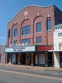 The historic Strand Theatre in Louisville, Mississippi. | |
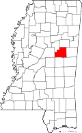 Location in the U.S. state of Mississippi | |
 Mississippi's location in the U.S. | |
| Founded | 1833 |
| Seat | Louisville |
| Largest city | Louisville |
| Area | |
| • Total | 610 sq mi (1,580 km2) |
| • Land | 607 sq mi (1,572 km2) |
| • Water | 2.8 sq mi (7 km2), 0.5% |
| Population | |
| • (2010) | 19,198 |
| • Density | 32/sq mi (12/km2) |
| Congressional district | 1st |
| Time zone | Central: UTC−6/−5 |
| Website |
Winston County, Mississippi Winston County Economic Development District Partnership |
Winston County is a county located in the U.S. state of Mississippi. In the 2010 census, the population was 19,198.[1] Its county seat is Louisville.[2] The county is named for Louis Winston (1784–1824), a colonel in the militia, a prominent lawyer, and a judge of the Mississippi Supreme Court.[3]
The county is the site of Nanih Waiya, an ancient mound built in the Woodland period, about 1 CE-300 CE. Since the 17th century, it has been venerated by the Choctaw people who later occupied the area.[4] As of 2008, the mound is owned by the Mississippi Band of Choctaw Indians, a Federally-recognized tribe.
Geography
According to the U.S. Census Bureau, the county has a total area of 610 square miles (1,600 km2), of which 607 square miles (1,570 km2) is land and 2.8 square miles (7.3 km2) (0.5%) is water.[5]
Major highways
Adjacent counties
- Oktibbeha County (north)
- Noxubee County (east)
- Kemper County (southeast)
- Neshoba County (south)
- Attala County (west)
- Choctaw County (northwest)
National protected area
- Tombigbee National Forest (part)
Demographics
| Historical population | |||
|---|---|---|---|
| Census | Pop. | %± | |
| 1840 | 4,650 | — | |
| 1850 | 7,956 | 71.1% | |
| 1860 | 9,811 | 23.3% | |
| 1870 | 8,984 | −8.4% | |
| 1880 | 10,087 | 12.3% | |
| 1890 | 12,089 | 19.8% | |
| 1900 | 14,124 | 16.8% | |
| 1910 | 17,139 | 21.3% | |
| 1920 | 18,139 | 5.8% | |
| 1930 | 21,239 | 17.1% | |
| 1940 | 22,751 | 7.1% | |
| 1950 | 22,231 | −2.3% | |
| 1960 | 19,246 | −13.4% | |
| 1970 | 18,406 | −4.4% | |
| 1980 | 19,474 | 5.8% | |
| 1990 | 19,433 | −0.2% | |
| 2000 | 20,160 | 3.7% | |
| 2010 | 19,198 | −4.8% | |
| Est. 2016 | 18,160 | [6] | −5.4% |
| U.S. Decennial Census[7] 1790-1960[8] 1900-1990[9] 1990-2000[10] 2010-2013[1] | |||
As of the 2010 United States Census, there were 19,198 people residing in the county. 51.9% were White, 45.6% Black or African American, 1.1% Native American, 0.2% Asian, 0.2% of some other race and 0.9% of two or more races. 1.0% were Hispanic or Latino (of any race).
At the 2000 census,[12] there were 20,160 people, 7,578 households and 5,471 families residing in the county. The population density was 33 per square mile (13/km²). There were 8,472 housing units at an average density of 14 per square mile (5/km²). The racial makeup of the county was 55.26% White, 43.25% Black or African American, 0.66% Native American, 0.08% Asian, 0.28% from other races, and 0.46% from two or more races. 1.21% of the population were Hispanic or Latino of any race.
There were 7,578 households of which 33.50% had children under the age of 18 living with them, 49.90% were married couples living together, 18.10% had a female householder with no husband present, and 27.80% were non-families. 25.20% of all households were made up of individuals and 12.50% had someone living alone who was 65 years of age or older. The average household size was 2.59 and the average family size was 3.09.
26.80% of the population were under the age of 18, 9.20% from 18 to 24, 26.10% from 25 to 44, 22.50% from 45 to 64, and 15.50% who were 65 years of age or older. The median age was 36 years. For every 100 females there were 93.70 males. For every 100 females age 18 and over, there were 88.30 males.
The median household income was $28,256, and the median family income was $33,602. Males had a median income of $28,665 versus $18,210 for females. The per capita income for the county was $14,548 About 19.40% of families and 23.70% of the population were below the poverty line, including 32.90% of those under age 18 and 18.90% of those age 65 or over.
Communities
Cities
- Louisville (county seat)
Town
Unincorporated communities
Ghost towns
Education
There are two public high schools in Winston County, Louisville High School and Nanih Waiya Attendance Center. In addition, Winston Academy was established in 1969 as an alternative for white students who wished to experience a segregated education. It has since adopted a non-discrimination policy.[13][14]
Politics
| Year | Republican | Democratic | Third parties |
|---|---|---|---|
| 2016 | 55.3% 4,910 | 43.4% 3,850 | 1.4% 121 |
| 2012 | 52.6% 5,168 | 46.9% 4,607 | 0.6% 54 |
| 2008 | 53.8% 5,497 | 45.5% 4,653 | 0.7% 71 |
| 2004 | 57.2% 5,386 | 42.3% 3,978 | 0.5% 51 |
| 2000 | 55.5% 4,645 | 43.9% 3,672 | 0.6% 51 |
| 1996 | 47.0% 3,498 | 46.9% 3,488 | 6.1% 452 |
| 1992 | 48.1% 4,311 | 44.1% 3,953 | 7.9% 704 |
| 1988 | 57.6% 5,317 | 41.7% 3,851 | 0.7% 61 |
| 1984 | 59.4% 5,192 | 40.5% 3,543 | 0.1% 11 |
| 1980 | 46.8% 3,998 | 51.7% 4,416 | 1.5% 131 |
| 1976 | 47.0% 3,659 | 50.8% 3,956 | 2.3% 177 |
| 1972 | 78.6% 5,155 | 20.7% 1,354 | 0.7% 46 |
| 1968 | 8.4% 508 | 15.1% 911 | 76.6% 4,635 |
| 1964 | 94.3% 3,922 | 5.7% 237 | |
| 1960 | 13.7% 405 | 35.6% 1,056 | 50.7% 1,505 |
| 1956 | 13.4% 361 | 78.8% 2,132 | 7.8% 212 |
| 1952 | 23.2% 771 | 76.9% 2,559 | |
| 1948 | 1.6% 33 | 11.4% 240 | 87.0% 1,832 |
| 1944 | 2.7% 51 | 97.3% 1,822 | |
| 1940 | 1.3% 26 | 98.7% 1,979 | |
| 1936 | 0.9% 21 | 99.1% 2,418 | 0.0% 1 |
| 1932 | 0.7% 12 | 99.1% 1,720 | 0.2% 4 |
| 1928 | 5.7% 97 | 94.4% 1,620 | |
| 1924 | 3.8% 53 | 96.2% 1,344 | |
| 1920 | 10.6% 113 | 87.8% 932 | 1.6% 17 |
| 1916 | 3.8% 47 | 94.0% 1,152 | 2.2% 27 |
| 1912 | 1.1% 9 | 90.4% 743 | 8.5% 70 |
Notable people
Andy Kennedy - basketball player and coach[16]
See also
References
- 1 2 "State & County QuickFacts". United States Census Bureau. Retrieved September 7, 2013.
- ↑ "Find a County". National Association of Counties. Retrieved 2011-06-07.
- ↑ History of Winston County, Mississippi Archived 2010-07-24 at the Wayback Machine.
- ↑ Ken Carleton, "Nanih Waiya: Mother Mound of the Choctaw", The Delta Endangered, Spring 1996, Vol.1 (1), NPS Archeology Program, accessed 16 Nov 2009
- ↑ "2010 Census Gazetteer Files". United States Census Bureau. August 22, 2012. Archived from the original on September 28, 2013. Retrieved November 8, 2014.
- ↑ "Population and Housing Unit Estimates". Retrieved June 9, 2017.
- ↑ "U.S. Decennial Census". United States Census Bureau. Retrieved November 8, 2014.
- ↑ "Historical Census Browser". University of Virginia Library. Retrieved November 8, 2014.
- ↑ "Population of Counties by Decennial Census: 1900 to 1990". United States Census Bureau. Retrieved November 8, 2014.
- ↑ "Census 2000 PHC-T-4. Ranking Tables for Counties: 1990 and 2000" (PDF). United States Census Bureau. Retrieved November 8, 2014.
- ↑ Based on 2000 census data
- ↑ "American FactFinder". United States Census Bureau. Retrieved 2008-01-31.
- ↑ Spencer, Mack (17 May 2004). "Public domain, private options". Retrieved 11 November 2017. Web Archive
- ↑ Bolton, Charles C. (2005). The Hardest Deal of All. Jackson: University Press of Mississippi. ISBN 9781578067176.
- ↑ Leip, David. "Dave Leip's Atlas of U.S. Presidential Elections". uselectionatlas.org. Retrieved 2018-03-04.
- ↑ "Ole Miss Bio". Retrieved 12 March 2018.
Places adjacent to Winston County, Mississippi | ||||||||||
|---|---|---|---|---|---|---|---|---|---|---|
| ||||||||||
Municipalities and communities of Winston County, Mississippi, United States | ||
|---|---|---|
| Cities | | |
| Towns | ||
| Unincorporated communities | ||
| Ghost towns | ||
| Indian reservation | ||
| Footnotes | ‡This populated place also has portions in an adjacent county or counties | |
.svg.png)