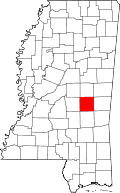
Newton County, Mississippi
| Newton County, Mississippi | |
|---|---|
 | |
 Location in the U.S. state of Mississippi | |
 Mississippi's location in the U.S. | |
| Founded | 1836 |
| Seat | Decatur |
| Largest town | Union |
| Area | |
| • Total | 580 sq mi (1,502 km2) |
| • Land | 578 sq mi (1,497 km2) |
| • Water | 1.5 sq mi (4 km2), 0.3% |
| Population | |
| • (2010) | 21,720 |
| • Density | 38/sq mi (15/km2) |
| Congressional district | 3rd |
| Time zone | Central: UTC−6/−5 |
| Website |
www |
Newton County is a county located in the U.S. state of Mississippi. As of the 2010 census, the population was 21,720.[1] Its county seat is Decatur.[2]
History
Newton County was formed in 1836, and was named for Sir Isaac Newton.[3] Newton County is adjacent to Jasper County, which was named for Sgt. William Jasper, a Revolutionary War hero of the Siege of Savannah in 1779. Sgt. John Newton had a very similar history. Early in the 1800s, many places were named for these men. At least four other states, Georgia, Indiana, Missouri and Texas, have adjacent Jasper and Newton Counties. At least two states, Illinois and Iowa, have Newton as the county seat of Jasper County. In Arkansas, Jasper is the county seat of Newton County. The frequency of occurrence of these names in juxtaposition shows that the stories of Sgts. Jasper and Newton were widely known, and associated with each other at the time these counties were named.
Geography
According to the U.S. Census Bureau, the county has a total area of 580 square miles (1,500 km2), of which 578 square miles (1,500 km2) is land and 1.5 square miles (3.9 km2) (0.3%) is water.[4]
Major highways
Adjacent counties
- Neshoba County (north)
- Lauderdale County (east)
- Jasper County (south)
- Scott County (west)
National protected area
- Bienville National Forest (part)
Demographics
| Historical population | |||
|---|---|---|---|
| Census | Pop. | %± | |
| 1840 | 2,527 | — | |
| 1850 | 4,465 | 76.7% | |
| 1860 | 9,661 | 116.4% | |
| 1870 | 10,067 | 4.2% | |
| 1880 | 13,436 | 33.5% | |
| 1890 | 16,625 | 23.7% | |
| 1900 | 19,708 | 18.5% | |
| 1910 | 23,085 | 17.1% | |
| 1920 | 20,727 | −10.2% | |
| 1930 | 22,910 | 10.5% | |
| 1940 | 24,249 | 5.8% | |
| 1950 | 22,681 | −6.5% | |
| 1960 | 19,517 | −14.0% | |
| 1970 | 18,983 | −2.7% | |
| 1980 | 19,944 | 5.1% | |
| 1990 | 20,291 | 1.7% | |
| 2000 | 21,838 | 7.6% | |
| 2010 | 21,720 | −0.5% | |
| Est. 2016 | 21,558 | [5] | −0.7% |
| U.S. Decennial Census[6] 1790-1960[7] 1900-1990[8] 1990-2000[9] 2010-2013[1] | |||
As of the census[10] of 2000, there were 21,838 people, 8,221 households, and 6,001 families residing in the county. The population density was 38 people per square mile (15/km²). There were 9,259 housing units at an average density of 16 per square mile (6/km²). The racial makeup of the county was 65.01% White, 30.37% Black or African American, 3.68% Native American, 0.18% Asian, 0.33% from other races, and 0.44% from two or more races. 0.91% of the population were Hispanic or Latino of any race.
There were 8,221 households out of which 33.50% had children under the age of 18 living with them, 53.00% were married couples living together, 16.00% had a female householder with no husband present, and 27.00% were non-families. 24.60% of all households were made up of individuals and 11.60% had someone living alone who was 65 years of age or older. The average household size was 2.57 and the average family size was 3.04.
In the county, the population was spread out with 26.20% under the age of 18, 11.20% from 18 to 24, 26.00% from 25 to 44, 21.70% from 45 to 64, and 14.90% who were 65 years of age or older. The median age was 35 years. For every 100 females there were 92.40 males. For every 100 females age 18 and over, there were 88.70 males.
The median income for a household in the county was $28,735, and the median income for a family was $34,606. Males had a median income of $27,820 versus $20,757 for females. The per capita income for the county was $14,008. About 16.40% of families and 19.90% of the population were below the poverty line, including 26.30% of those under age 18 and 21.70% of those age 65 or over.
Communities
City
Towns
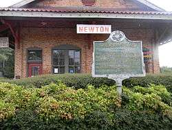
- Chunky
- Decatur (county seat)
- Hickory
- Lake (mostly in Scott County)
- Union (partly in Neshoba County)
Census-designated place
Unincorporated communities
- Cedar Grove
- Duffee
- Lawrence
- Little Rock
- Stratton
Politics
| Year | Republican | Democratic | Third parties |
|---|---|---|---|
| 2016 | 69.4% 6,548 | 29.2% 2,756 | 1.4% 134 |
| 2012 | 65.4% 6,394 | 34.0% 3,319 | 0.7% 64 |
| 2008 | 66.8% 6,579 | 32.7% 3,218 | 0.6% 58 |
| 2004 | 72.6% 6,165 | 26.9% 2,280 | 0.5% 43 |
| 2000 | 71.6% 5,540 | 27.8% 2,147 | 0.7% 51 |
| 1996 | 61.3% 4,223 | 31.4% 2,163 | 7.3% 503 |
| 1992 | 65.7% 5,128 | 27.5% 2,146 | 6.8% 532 |
| 1988 | 70.7% 5,658 | 29.1% 2,332 | 0.2% 13 |
| 1984 | 73.2% 5,911 | 26.4% 2,127 | 0.4% 34 |
| 1980 | 54.4% 4,317 | 43.5% 3,455 | 2.1% 169 |
| 1976 | 57.0% 3,813 | 41.0% 2,741 | 2.0% 136 |
| 1972 | 88.1% 5,585 | 9.4% 597 | 2.5% 161 |
| 1968 | 7.9% 542 | 11.6% 799 | 80.6% 5,561 |
| 1964 | 95.2% 4,735 | 4.8% 238 | |
| 1960 | 15.1% 508 | 27.0% 912 | 57.9% 1,956 |
| 1956 | 11.5% 360 | 75.5% 2,359 | 13.0% 407 |
| 1952 | 25.7% 851 | 74.3% 2,460 | |
| 1948 | 1.5% 39 | 6.4% 169 | 92.2% 2,442 |
| 1944 | 2.2% 56 | 97.8% 2,516 | |
| 1940 | 1.6% 41 | 98.3% 2,495 | 0.1% 3 |
| 1936 | 1.5% 39 | 98.4% 2,624 | 0.1% 3 |
| 1932 | 2.4% 56 | 97.1% 2,253 | 0.5% 11 |
| 1928 | 15.1% 368 | 84.9% 2,074 | |
| 1924 | 4.0% 72 | 90.9% 1,657 | 5.1% 93 |
| 1920 | 7.7% 108 | 86.4% 1,208 | 5.9% 82 |
| 1916 | 1.3% 19 | 94.7% 1,341 | 4.0% 56 |
| 1912 | 0.5% 6 | 94.6% 1,197 | 4.9% 62 |
See also
References
- 1 2 "State & County QuickFacts". United States Census Bureau. Archived from the original on March 9, 2013. Retrieved September 4, 2013.
- ↑ "Find a County". National Association of Counties. Retrieved 2011-06-07.
- ↑ Rowland, Dunbar (1907). Mississippi: Comprising Sketches of Counties, Towns, Events, Institutions, and Persons, Arranged in Cyclopedic Form. 2. Southern Historical Publishing Association. p. 339.
- ↑ "2010 Census Gazetteer Files". United States Census Bureau. August 22, 2012. Archived from the original on September 28, 2013. Retrieved November 6, 2014.
- ↑ "Population and Housing Unit Estimates". Retrieved June 9, 2017.
- ↑ "U.S. Decennial Census". United States Census Bureau. Retrieved November 6, 2014.
- ↑ "Historical Census Browser". University of Virginia Library. Retrieved November 6, 2014.
- ↑ "Population of Counties by Decennial Census: 1900 to 1990". United States Census Bureau. Retrieved November 6, 2014.
- ↑ "Census 2000 PHC-T-4. Ranking Tables for Counties: 1990 and 2000" (PDF). United States Census Bureau. Retrieved November 6, 2014.
- ↑ "American FactFinder". United States Census Bureau. Retrieved 2008-01-31.
- ↑ Leip, David. "Dave Leip's Atlas of U.S. Presidential Elections". uselectionatlas.org. Retrieved 2018-03-04.
| Wikimedia Commons has media related to Newton County, Mississippi. |
Further reading
- A.J. Brown, History of Newton County, Mississippi from 1834 to 1894. Jackson, MS: Clarion-Ledger Co., 1894. • HTML version
- Nicholas Russell Murray, Newton County, Mississippi, 1872-1900. Hammond, LA: Hunting for Bears, 1981.
- Newton County Pictorial History Committee, Newton County, Mississippi: A Pictorial History. Humboldt, TN: Rose Publishing Co., 2000.
Places adjacent to Newton County, Mississippi | ||||||||||
|---|---|---|---|---|---|---|---|---|---|---|
| ||||||||||
Municipalities and communities of Newton County, Mississippi, United States | ||
|---|---|---|
| Cities | | |
| Towns | ||
| CDPs | ||
| Other unincorporated communities | ||
| Indian reservation | ||
| Footnotes | ‡This populated place also has portions in an adjacent county or counties | |
.svg.png)