Webster County, Mississippi
| Webster County, Mississippi | |
|---|---|
.jpg) Cemetery of Greensboro Baptist Church in Webster County. The large white marble tombstone marks the grave of William F. Brantley, General, C.S.A. | |
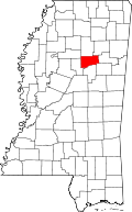 Location in the U.S. state of Mississippi | |
 Mississippi's location in the U.S. | |
| Founded | 1874 |
| Named for | Daniel Webster |
| Seat | Walthall |
| Largest city | Eupora |
| Area | |
| • Total | 423 sq mi (1,096 km2) |
| • Land | 421 sq mi (1,090 km2) |
| • Water | 2.3 sq mi (6 km2), 0.5% |
| Population | |
| • (2010) | 10,253 |
| • Density | 24/sq mi (9/km2) |
| Congressional district | 1st |
| Time zone | Central: UTC−6/−5 |
Webster County is a county located in the U.S. state of Mississippi. As of the 2010 census, the population was 10,253.[1] Its county seat is Walthall.[2] The county is named after statesman Daniel Webster.
History
Old Greensboro was known for the old Webster County Seat and is still known for the Old Greensboro Cemetery. In 1872 the county seat was moved from Greensboro to LaGrange. In 1874 Sumner County was formed and Greensboro again became a county seat, but this only lasted until 1876 when it was moved to Walthall. Greensboro, which had already begun to deteriorate, rapidly declined. Today the only sign left of its existence is the old Greensboro cemetery. Greensboro was originally the county seat of Choctaw County. Choctaw County was formed from territory acquired in the Treaty of Dancing Rabbit Creek in 1833. At that time it was a much larger county taking in what is now all of Webster County, and the eastern part of Montgomery County and a small portion of Grenada County.
The town of Greensboro, which was centrally located and Choctaw County was inhabited by settlers primarily from Alabama, Georgia and South Carolina. The temporary courthouse and log jail were replaced in 1839 by a brick courthouse and jail. This courthouse was destroyed by fire in 1865 supposedly by an arsonist. Almost all of the early records were destroyed in the fire.
Greensboro at one time consisted of several types of stores and shops, saloons, a livery stable, a brick yard, and a newspaper. Greensboro had a Methodist church as early as 1839 and a Baptist church was begun in 1846. The Greensboro Lodge No. 49 of Free and Accepted Masons was chartered in 1842.
Greensboro had the reputation of a rough and lawless town, many notorious criminals and murders were located there. John A. Murell, a famed outlaw of the Natchez trace was tried and convicted of horse stealing but on being transported to Columbus MS for incarceration he killed his guard and escaped. The Edwards-Gray feud, which grew out of the settlement of the estate of Edward Dewitt Edwards Jr., exploded in 1861. Three of the brothers (William, James, and Robert) of Mrs. Mary "Molly" Gray Edwards, widow of the deceased, shot and killed judge Edward D. Edwards Sr. and his son Luther Edwards. The Gray brothers were jailed, however a mob stormed the jail shooting two and hanging the third.
Two brothers W.F. Brantley and Arnold Brantley were both killed in the vicinity. Arnold Brantley was killed in Winona in 1880. his murderers escaped. Gen. W.f. Brantley was ambushed riding from Winona to Greensboro, by a group believed to have been the killers of an older Brantley brother in Texas. Political candidates frequently campaigned at Greensboro, including, in 1851 Jefferson Davis who was seeking the office of governor. Seven young men of Greensboro and Choctaw County rushed to enlist at the outbreak of the American Civil War. The first company organized was the Wig Fall Rifles, company D 15th MS infantry C.S.A. This unit was formed in Greensboro in April 1861 and the Captain was William F. Brantley of Greensboro later to be one of the youngest confederate generals. In December 1864 federals raided the town and burned much of it. is an external link.
The county had the youngest birth mother recorded in the United States. Dr. V. I. Pittman of Cadaretta, Mississippi reported to have delivered a boy weighing 7 lb (3.2 kg) to nine-year-old Estelle P. on March 16, 1908.[3] [4]
The Mathiston Police Department frequently conducts roadblocks on the highways running through the town in the part located in Webster County to search for and seize any and all alcohol being transported through the county. While the legality of such roadblocks are not in dispute, the ability for the police to seize alcohol from persons over 21, provided containers are unopened, will be prohibited after July 1, 2018, following the passage of Mississippi House Bill 192, which legalizes transport of all alcohol through dry counties within the state.[5]
Geography
According to the U.S. Census Bureau, the county has a total area of 423 square miles (1,100 km2), of which 421 square miles (1,090 km2) is land and 2.3 square miles (6.0 km2) (0.5%) is water.[6]
Major highways


- Natchez Trace Parkway
Adjacent counties
- Calhoun County (north)
- Chickasaw County (northeast)
- Clay County (east)
- Oktibbeha County (southeast)
- Choctaw County (south)
- Montgomery County (west)
- Grenada County (northwest)
National protected area
- Natchez Trace Parkway (part)
Demographics
| Historical population | |||
|---|---|---|---|
| Census | Pop. | %± | |
| 1880 | 9,534 | — | |
| 1890 | 12,060 | 26.5% | |
| 1900 | 13,619 | 12.9% | |
| 1910 | 14,853 | 9.1% | |
| 1920 | 12,644 | −14.9% | |
| 1930 | 12,128 | −4.1% | |
| 1940 | 14,160 | 16.8% | |
| 1950 | 11,607 | −18.0% | |
| 1960 | 10,580 | −8.8% | |
| 1970 | 10,047 | −5.0% | |
| 1980 | 10,300 | 2.5% | |
| 1990 | 10,222 | −0.8% | |
| 2000 | 10,294 | 0.7% | |
| 2010 | 10,253 | −0.4% | |
| Est. 2016 | 9,767 | [7] | −4.7% |
| U.S. Decennial Census[8] 1790-1960[9] 1900-1990[10] 1990-2000[11] 2010-2013[1] | |||
As of the census[12] of 2000, there were 10,294 people, 3,905 households, and 2,877 families residing in the county. The population density was 24 people per square mile (9/km²). There were 4,344 housing units at an average density of 10 per square mile (4/km²). The racial makeup of the county was 77.55% White, 20.93% Black or African American, 0.11% Native American, 0.17% Asian, 0.01% Pacific Islander, 0.84% from other races, and 0.39% from two or more races. 1.69% of the population were Hispanic or Latino of any race.
There were 3,905 households out of which 33.90% had children under the age of 18 living with them, 56.20% were married couples living together, 13.10% had a female householder with no husband present, and 26.30% were non-families. 24.00% of all households were made up of individuals and 12.20% had someone living alone who was 65 years of age or older. The average household size was 2.59 and the average family size was 3.07.
In the county, the population was spread out with 26.10% under the age of 18, 9.00% from 18 to 24, 26.60% from 25 to 44, 21.80% from 45 to 64, and 16.40% who were 65 years of age or older. The median age was 37 years. For every 100 females there were 93.50 males. For every 100 females age 18 and over, there were 89.40 males.
The median income for a household in the county was $28,834, and the median income for a family was $34,969. Males had a median income of $27,297 versus $19,627 for females. The per capita income for the county was $14,109. About 14.80% of families and 18.70% of the population were below the poverty line, including 24.60% of those under age 18 and 18.30% of those age 65 or over.
Communities
City
Towns
- Maben (mostly in Oktibbeha County)
- Mathiston (partly in Choctaw County)
Villages
Unincorporated communities
- Alva
- Bellefontaine
- Cumberland
- Dancy
- Fame
- Hohenlinden
- Old Greensboro
- Pellez
- Sapa
- Spring Valley
- Ticky Bend
- Tomnolen
- Clarkson
Politics
| Year | Republican | Democratic | Third parties |
|---|---|---|---|
| 2016 | 78.4% 3,976 | 20.1% 1,019 | 1.5% 74 |
| 2012 | 76.3% 3,992 | 22.7% 1,190 | 1.0% 52 |
| 2008 | 74.6% 4,072 | 24.7% 1,349 | 0.7% 36 |
| 2004 | 73.2% 3,708 | 26.5% 1,341 | 0.4% 19 |
| 2000 | 67.5% 3,069 | 31.4% 1,426 | 1.1% 50 |
| 1996 | 57.9% 2,254 | 35.4% 1,379 | 6.8% 263 |
| 1992 | 56.0% 2,791 | 35.0% 1,746 | 9.0% 451 |
| 1988 | 66.1% 3,061 | 33.5% 1,550 | 0.5% 21 |
| 1984 | 70.7% 3,390 | 29.1% 1,397 | 0.2% 7 |
| 1980 | 50.6% 2,386 | 46.2% 2,178 | 3.1% 148 |
| 1976 | 45.4% 1,943 | 51.8% 2,218 | 2.8% 120 |
| 1972 | 89.2% 3,624 | 9.9% 403 | 0.9% 38 |
| 1968 | 8.2% 330 | 7.3% 295 | 84.5% 3,398 |
| 1964 | 92.4% 2,884 | 7.6% 237 | |
| 1960 | 14.8% 299 | 27.3% 553 | 58.0% 1,174 |
| 1956 | 10.8% 188 | 80.9% 1,412 | 8.3% 145 |
| 1952 | 20.4% 453 | 79.6% 1,765 | |
| 1948 | 3.4% 47 | 19.7% 277 | 76.9% 1,080 |
| 1944 | 7.8% 127 | 92.2% 1,504 | |
| 1940 | 5.2% 87 | 94.6% 1,595 | 0.3% 5 |
| 1936 | 3.7% 56 | 95.5% 1,439 | 0.8% 12 |
| 1932 | 3.1% 35 | 96.4% 1,092 | 0.5% 6 |
| 1928 | 23.5% 338 | 76.5% 1,102 | |
| 1924 | 10.2% 115 | 81.2% 918 | 8.6% 97 |
| 1920 | 32.5% 299 | 62.5% 576 | 5.0% 46 |
| 1916 | 12.6% 143 | 83.3% 944 | 4.1% 46 |
| 1912 | 3.8% 32 | 77.6% 655 | 18.6% 157 |
See also
References
- 1 2 "State & County QuickFacts". United States Census Bureau. Retrieved September 7, 2013.
- ↑ "Find a County". National Association of Counties. Retrieved 2011-06-07.
- ↑ Pittman, V. I. (1908). "Pregnancy at Nine Years of Age". Memphis Medical Monthly. University of Michigan. 28 (6): 315. Retrieved 11 December 2011.
- ↑ List of youngest birth mothers
- ↑ http://billstatus.ls.state.ms.us/2018/pdf/history/HB/HB0192.xml
- ↑ "2010 Census Gazetteer Files". United States Census Bureau. August 22, 2012. Archived from the original on September 28, 2013. Retrieved November 8, 2014.
- ↑ "Population and Housing Unit Estimates". Retrieved June 9, 2017.
- ↑ "U.S. Decennial Census". United States Census Bureau. Retrieved November 8, 2014.
- ↑ "Historical Census Browser". University of Virginia Library. Retrieved November 8, 2014.
- ↑ "Population of Counties by Decennial Census: 1900 to 1990". United States Census Bureau. Retrieved November 8, 2014.
- ↑ "Census 2000 PHC-T-4. Ranking Tables for Counties: 1990 and 2000" (PDF). United States Census Bureau. Retrieved November 8, 2014.
- ↑ "American FactFinder". United States Census Bureau. Retrieved 2008-01-31.
- ↑ Leip, David. "Dave Leip's Atlas of U.S. Presidential Elections". uselectionatlas.org. Retrieved 2018-03-04.
Places adjacent to Webster County, Mississippi | ||||||||||
|---|---|---|---|---|---|---|---|---|---|---|
| ||||||||||
Municipalities and communities of Webster County, Mississippi, United States | ||
|---|---|---|
| City | | |
| Towns | ||
| Villages | ||
| Communities | ||
| Footnotes | ‡This populated place also has portions in an adjacent county or counties | |
.svg.png)