Jones County, Mississippi
| Jones County, Mississippi | |
|---|---|
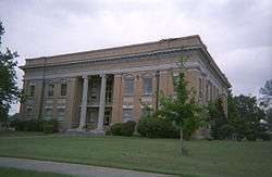 Jones County courthouse in Ellisville | |
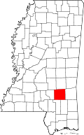 Location in the U.S. state of Mississippi | |
 Mississippi's location in the U.S. | |
| Founded | 1826 |
| Named for | John Paul Jones |
| Seat | Laurel and Ellisville |
| Largest city | Laurel |
| Area | |
| • Total | 700 sq mi (1,813 km2) |
| • Land | 695 sq mi (1,800 km2) |
| • Water | 4.9 sq mi (13 km2), 0.7% |
| Population (est.) | |
| • (2015) | 68,215 |
| • Density | 98/sq mi (38/km2) |
| Congressional district | 4th |
| Time zone | Central: UTC−6/−5 |
| Website |
jonescounty |
Jones County is a county located in the southeast portion of the U.S. state of Mississippi. As of the 2010 census, the population was 67,761.[1] Its county seats are Laurel and Ellisville.[2]
Jones County is part of the Laurel, MS Micropolitan Statistical Area.
History
Less than a decade after Mississippi became the country's 20th state, settlers organized this area of 700 sq mi (1,800 km2) of pine forests and swamps for a new county in 1826. They named it Jones County after John Paul Jones, the early American Naval hero who rose from humble Scottish origin to military success during the American Revolution.[3]
Ellisville, the county seat, was named for Powhatan Ellis, a member of the Mississippi Legislature who claimed to be a direct descendant of Pocahontas. During the economic hard times in the 1830s and 1840s, there was an exodus of population from Southeast Mississippi, both to western Mississippi and Louisiana in regions opened to white settlement after Indian Removal, and to Texas. The slogan "GTT" ("Gone to Texas") became widely used.
Jones County was in an area of mostly yeomen farmers and lumbermen, as the pine forests, swamp and soil were not easily cultivated for cotton. In 1860, the majority of white residents were not slaveholders. Slaves made up only 12% of the total population in Jones County in 1860, the smallest percentage of any county in the state.[4]
Civil War years
Soon after the election of Abraham Lincoln as United States president in November 1860, slave-owning planters led Mississippi to join South Carolina and secede from the Union in January 1861. These were the two states with the largest holdings of slaves. Other Southern states would follow suit.
As Mississippi debated the secession question, the inhabitants of Jones County voted overwhelmingly for the anti-secessionist John Hathorne Powell, Jr. In comparison to the pro-secessionist J.M. Bayliss, who received 24 votes, Powell received 374.[5] But, at the Secession Convention, Powell voted for secession. Legend has it that, for his vote, he was burned in effigy in Ellisville, the county seat.[5]
The reality is more complicated. The only choices possible at the Secession Convention were voting for immediate secession on the one hand, or for a more cautious, co-operative approach to secession among several Southern states on the other. Powell almost certainly voted for the more conservative approach to secession—the only position available to him that was consistent with the anti-secessionist views of his constituency.[5]
Mississippi's Declaration of Secession reflected planters' interests in its first sentence: "Our position is thoroughly identified with the institution of slavery…" Jones County had mostly yeoman farmers and cattle herders, who were not slaveholders. They had little use for a war over a "state's right" to maintain the institution of slavery.[4]
During the American Civil War, Jones County and neighboring counties, especially Covington County to its west, became a haven for Confederate deserters.[4] A number of factors prompted desertions. The lack of food and supplies was demoralizing, while reports of poor conditions back home made the men fear for their families' survival. Small farms deteriorated from neglect as women and children struggled to keep them up. Their limited stores and livestock were often taken by the Confederate tax-in-kind agents, who took excessive amounts of yeoman farmers' goods. Many residents and soldiers were also outraged over the Confederate government's passing of the Twenty Negro Law, allowing wealthy plantation owners to avoid military service if they owned twenty slaves or more.[4] The Confederate government figured such planters were needed at home to keep the slaves in line and keep up cotton production, which still produced revenue for the government.
Free State of Jones
On October 13, 1863, a band of deserters from Jones County and adjacent counties organized to protect the area from Confederate authorities and the crippling tax collections.[6] The company, led by Newton Knight, formed a separate government, with Unionist leanings, known as the "Free State of Jones",[7] fought a recorded 14 skirmishes with Confederate forces. They also raided Paulding, capturing five wagonloads of corn that had been collected for tax from area farms, which they distributed back among the local population.[8] The company harassed Confederate officials. Deaths believed to be at their hands were reported in 1864 among numerous tax collectors, conscript officers, and other officials.[4]
The governor was informed by the Jones County court clerk that deserters had made tax collections in the county impossible.[9] By the spring of 1864, the Knight company had taken effective control from the Confederate government in the county.[4] The followers of Knight raised an American flag over the courthouse in Ellisville, and sent a letter to Union General William T. Sherman declaring Jones County's independence from the Confederacy.[4] In July 1864, the Natchez Courier reported that Jones County had seceded from the Confederacy.[10]
Scholars have disputed whether the county truly seceded, with some concluding it did not. While there have been numerous attempts to study Knight and his followers, the lack of documentation during and after the war has made him an elusive figure. The rebellion in Jones County has been variously characterized as consisting of local skirmishes to being a full-fledged war of independence. It assumed legendary status among some county residents and Civil War historians, culminating in the release of a 2016 feature film, Free State of Jones.[11][12][13] The film is credited as "based on the books The Free State of Jones by Victoria E. Bynum and The State of Jones by Sally Jenkins and John Stauffer".[12]
Economy
The economy of Jones County is still primarily rural and based on resources – timber and agriculture.
Geography
According to the U.S. Census Bureau, the county has a total area of 700 square miles (1,800 km2), of which 695 square miles (1,800 km2) is land and 4.9 square miles (13 km2) (0.7%) is water.[14]
Adjacent counties
- Jasper County (north)
- Wayne County (east)
- Perry County (southeast)
- Forrest County (southwest)
- Covington County (west)
- Smith County (northwest)
National protected area
- De Soto National Forest (part)
Demographics
| Historical population | |||
|---|---|---|---|
| Census | Pop. | %± | |
| 1830 | 1,471 | — | |
| 1840 | 1,258 | −14.5% | |
| 1850 | 2,164 | 72.0% | |
| 1860 | 3,323 | 53.6% | |
| 1870 | 3,313 | −0.3% | |
| 1880 | 3,828 | 15.5% | |
| 1890 | 8,333 | 117.7% | |
| 1900 | 17,846 | 114.2% | |
| 1910 | 29,885 | 67.5% | |
| 1920 | 32,919 | 10.2% | |
| 1930 | 41,492 | 26.0% | |
| 1940 | 49,227 | 18.6% | |
| 1950 | 57,235 | 16.3% | |
| 1960 | 59,542 | 4.0% | |
| 1970 | 56,357 | −5.3% | |
| 1980 | 61,912 | 9.9% | |
| 1990 | 62,031 | 0.2% | |
| 2000 | 64,958 | 4.7% | |
| 2010 | 67,761 | 4.3% | |
| Est. 2016 | 67,953 | [15] | 0.3% |
| U.S. Decennial Census[16] 1790-1960[17] 1900-1990[18] 1990-2000[19] 2010-2013[1] | |||
As of the census[20] of 2000, there were 64,958 people, 24,275 households, and 17,550 families residing in the county. The population density was 94 people per square mile (36/km²). There were 26,921 housing units at an average density of 39 per square mile (15/km²). The racial makeup of the county was 71.11% White, 26.34% Black or African American, 0.39% Native American, 0.27% Asian, 0.01% Pacific Islander, 1.41% from other races, and 0.48% from two or more races. 1.96% of the population were Hispanic or Latino of any race.
There were 24,275 households out of which 32.60% had children under the age of 18 living with them, 53.00% were married couples living together, 15.10% had a female householder with no husband present, and 27.70% were non-families. 24.40% of all households were made up of individuals and 11.00% had someone living alone who was 65 years of age or older. The average household size was 2.61 and the average family size was 3.08.
In the county, the population was spread out with 25.80% under the age of 18, 10.50% from 18 to 24, 27.30% from 25 to 44, 22.20% from 45 to 64, and 14.20% who were 65 years of age or older. The median age was 36 years. For every 100 females, there were 93.70 males. For every 100 females age 18 and over, there were 90.10 males.
The median income for a household in the county was $28,786, and the median income for a family was $34,465. Males had a median income of $28,273 versus $19,405 for females. The per capita income for the county was $14,820. About 14.30% of families and 19.80% of the population were below the poverty line, including 25.00% of those under age 18 and 16.80% of those age 65 or over.
Economy
According to the Economic Development Authority of Jones County,[21] the top employers in the county are:
| # | Employer | # of Employees |
|---|---|---|
| 1 | Howard Industries | 3,700 |
| 2 | South Central Regional Medical Center | 1,837 |
| 3 | Ellisville State School | 1,459 |
| 4 | Jones County School District | 1,162 |
| 5 | Sanderson Farms | 889 |
| 6 | Wayne Farms | 715 |
| 7 | Laurel School District | 600 |
| 8 | Walmart | 585 |
| 9 | Masonite | 556 |
| 10 | Jones County | 510 |
| 11 | Sawmill Square Mall | 450 |
| 12 | Jones County Junior College | 427 |
| 13 | MS Industries for Individuals with Disabilities | 415 |
| 14 | Southern Hens | 390 |
| 15 | City of Laurel | 317 |
| 16 | Tanner Construction | 185 |
| 17 | Hudson's Salvage Center | 153 |
| 18 | Dunn Roadbuilders | 145 |
| 19 | Morgan Brothers Millwork | 137 |
| 20 | West Quality Food Service | 135 |
| 21 | Thermo-Kool | 135 |
| 22 | Laurel Machine & Foundry | 131 |
| 23 | The Essmueller Company | 115 |
| 24 | Howse Implement | 113 |
| 25 | Care Center of Laurel | 107 |
Government and infrastructure
The Mississippi Department of Mental Health South Mississippi State Hospital Crisis Intervention Center is in Laurel and in Jones County.[22]
Transportation
Major highways
Airport
Hattiesburg-Laurel Regional Airport is located in an unincorporated area in the county, near Moselle.[23][24]
Politics
| Year | Republican | Democratic | Third parties |
|---|---|---|---|
| 2016 | 71.0% 20,133 | 27.5% 7,791 | 1.5% 428 |
| 2012 | 68.6% 20,687 | 30.5% 9,211 | 0.9% 261 |
| 2008 | 68.9% 20,157 | 30.2% 8,846 | 0.9% 270 |
| 2004 | 71.7% 19,125 | 27.7% 7,398 | 0.5% 143 |
| 2000 | 67.1% 16,341 | 31.7% 7,713 | 1.2% 286 |
| 1996 | 59.6% 13,020 | 33.7% 7,360 | 6.7% 1,457 |
| 1992 | 56.6% 13,824 | 32.9% 8,035 | 10.5% 2,571 |
| 1988 | 69.1% 16,764 | 30.4% 7,383 | 0.5% 125 |
| 1984 | 70.5% 17,586 | 29.3% 7,298 | 0.3% 70 |
| 1980 | 53.1% 12,900 | 45.8% 11,117 | 1.1% 272 |
| 1976 | 51.5% 11,098 | 47.0% 10,139 | 1.5% 315 |
| 1972 | 83.8% 16,489 | 14.2% 2,790 | 2.0% 400 |
| 1968 | 18.0% 3,242 | 13.8% 2,476 | 68.2% 12,276 |
| 1964 | 86.0% 12,123 | 14.1% 1,981 | |
| 1960 | 25.9% 2,729 | 46.3% 4,871 | 27.8% 2,928 |
| 1956 | 29.8% 2,463 | 62.2% 5,137 | 8.0% 663 |
| 1952 | 40.7% 4,039 | 59.3% 5,884 | |
| 1948 | 3.0% 193 | 9.2% 599 | 87.9% 5,736 |
| 1944 | 6.6% 337 | 93.4% 4,782 | |
| 1940 | 5.1% 242 | 94.9% 4,517 | |
| 1936 | 3.9% 185 | 95.0% 4,461 | 1.0% 49 |
| 1932 | 4.2% 173 | 91.5% 3,816 | 4.4% 183 |
| 1928 | 44.1% 1,804 | 55.9% 2,284 | |
| 1924 | 10.1% 318 | 75.2% 2,373 | 14.7% 464 |
| 1920 | 30.1% 419 | 52.7% 734 | 17.2% 240 |
| 1916 | 9.4% 196 | 80.0% 1,664 | 10.6% 220 |
| 1912 | 2.4% 34 | 73.9% 1,058 | 23.8% 340 |
Communities
Cities
Towns
Census-designated place
Unincorporated communities
Notable people
- Lance Bass, singer with NSYNC
- Ralph Boston, Olympic track and field medalist
- Jason Campbell, retired National Football League quarterback
- Mary Elizabeth Ellis-Day, actress
- Carroll Gartin, lieutenant governor of Mississippi
- Newton Knight, farmer and opponent of secession and slavery, a Confederate deserter who led a guerrilla rebellion against local Confederate officials as the leader of the Knight Company and Jones County Scouts; he was a US Marshal and a leading Republican figure in the Reconstruction of Mississippi
- Tom Lester, actor played Eb on Green Acres
- Amos McLemore, schoolteacher, Methodist pastor, businessman, and one-time opponent of Southern secession from the Union; commissioned as a Confederate officer at the rank of major; he was reputedly assassinated by Newton Knight
- Charles W. Pickering, retired Federal Circuit Judge who served on the United States Court of Appeals for the Fifth Circuit
- Parker Posey, actress
- Leontyne Price, operatic soprano
- James Street, author
- Ray Walston, actor My Favorite Martian
See also
References
- 1 2 "State & County QuickFacts". United States Census Bureau. Archived from the original on July 12, 2011. Retrieved September 3, 2013.
- ↑ "Find a County". National Association of Counties. Archived from the original on 2011-05-31. Retrieved 2011-06-07.
- ↑ Jones County Mississippi Official Site
- 1 2 3 4 5 6 7 Kelly Jr., James R. "Newton Knight and the Legend of the Free State of Jones" Archived 2010-06-09 at the Wayback Machine.. Mississippi History Now. Mississippi Historical Society
- 1 2 3 Leverett, Rudy H., Legend of the Free State of Jones, University Press of Mississippi, 1984, pp. 38-41.
- ↑ "The State of Jones," co-authored with Sally Jenkins, New York: Doubleday, 2009, page 378
- ↑ Evan Andrews (2015-01-13). "6 Southern Unionist Strongholds During the Civil War". History Channel. Retrieved 2017-04-05.
- ↑ Leverett (1984), Legend of the Free State of Jones, p. 64.
- ↑ Leverett (1984), Legend of the Free State of Jones, p. 112
- ↑ Leverett (1984), Legend of the Free State of Jones, pp. 17-29
- ↑ Richard Grant, The True Story of the ‘Free State of Jones’, Smithsonian Magazine, March 2016
- 1 2 State of Jones (2016), History vs Hollywood (retrieved 26 August 2016)
- ↑ Mick LaSalle, "Movies to look for (maybe) in 2016". San Francisco Chronicle, December 30, 2015.
- ↑ "2010 Census Gazetteer Files". United States Census Bureau. August 22, 2012. Archived from the original on September 28, 2013. Retrieved November 4, 2014.
- ↑ "Population and Housing Unit Estimates". Retrieved June 9, 2017.
- ↑ "U.S. Decennial Census". United States Census Bureau. Archived from the original on May 12, 2015. Retrieved November 4, 2014.
- ↑ "Historical Census Browser". University of Virginia Library. Retrieved November 4, 2014.
- ↑ "Population of Counties by Decennial Census: 1900 to 1990". United States Census Bureau. Retrieved November 4, 2014.
- ↑ "Census 2000 PHC-T-4. Ranking Tables for Counties: 1990 and 2000" (PDF). United States Census Bureau. Retrieved November 4, 2014.
- ↑ "American FactFinder". United States Census Bureau. Retrieved 2008-01-31.
- ↑ Major Employers
- ↑ "Contact Us Archived 2012-03-14 at the Wayback Machine.." South Mississippi State Hospital. Retrieved on November 1, 2010. "SMSH Crisis Intervention Center 934 West Drive Laurel, MS 39440."
- ↑ "Contact." Hattiesburg-Laurel Regional Airport. Retrieved on July 15, 2011. "Our Address Airport Director, 1002 Terminal Dr. Moselle, MS 39459"
- ↑ "Hattiesburg city, Mississippi Archived 2006-09-24 at the Wayback Machine.." U.S. Census Bureau. Retrieved on July 16, 2011.
- ↑ Leip, David. "Dave Leip's Atlas of U.S. Presidential Elections". uselectionatlas.org. Retrieved 2018-03-03.
Further reading
- Ballard, Michael B. and Mark R. Cheathem, Of Times and Race: Essays Inspired by John F. Marszalek, Oxford, MS: University Press of Mississippi, 2013
- Bynum, Victoria E. (2002). The Free State of Jones: Mississippi's Longest Civil War. The University of North Carolina Press.
- Downing, David C. (2007). A South Divided: Portraits of Dissent in the Confederacy. Nashville: Cumberland House. ISBN 978-1-58182-587-9.
- Galloway, G. Norton., Historian Sixth Army Corps. (November 1886). "A Confederacy within a Confederacy," Magazine of American History 16.
- Jenkins, Sally, and John Stauffer (2009). The State of Jones: The Small Southern County that Seceded from the Confederacy, New York: Random House. ISBN 978-0-385-52593-0.
- Leverett, Rudy H. (1984, 2nd printing 2009). Legend of the Free State of Jones. University Press of Mississippi. ISBN 0-87805-227-5, ISBN 978-0-87805-227-1.
- McLemore, Richard Aubrey. (1973) History of Mississippi (2 volumes), University & College Press of Mississippi.
External links
Coordinates: 31°37′N 89°10′W / 31.62°N 89.17°W
Places adjacent to Jones County, Mississippi | ||||||||||
|---|---|---|---|---|---|---|---|---|---|---|
| ||||||||||
Municipalities and communities of Jones County, Mississippi, United States | ||
|---|---|---|
| Cities | | |
| Towns | ||
| CDP | ||
| Other unincorporated communities | ||
| Indian reservation | ||
| Footnotes | ‡This populated place also has portions in an adjacent county or counties | |
.svg.png)