Calhoun County, Mississippi
| Calhoun County, Mississippi | |
|---|---|
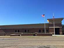 East façade of Calhoun County Courthouse | |
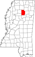 Location in the U.S. state of Mississippi | |
 Mississippi's location in the U.S. | |
| Founded | 1852 |
| Named for | John C. Calhoun |
| Seat | Pittsboro |
| Largest town | Bruce |
| Area | |
| • Total | 588 sq mi (1,523 km2) |
| • Land | 587 sq mi (1,520 km2) |
| • Water | 1.4 sq mi (4 km2), 0.2% |
| Population | |
| • (2010) | 14,962 |
| • Density | 26/sq mi (10/km2) |
| Congressional district | 1st |
| Time zone | Central: UTC−6/−5 |
| Website |
calhouncoms |
Calhoun County is a county located in the U.S. state of Mississippi. As of the 2010 census, the population was 14,962.[1] Its county seat is Pittsboro.[2] The county is named after John C. Calhoun, the U.S. Vice President and U.S. Senator from South Carolina.
Geography
According to the U.S. Census Bureau, the county has a total area of 588 square miles (1,520 km2), of which 587 square miles (1,520 km2) is land and 1.4 square miles (3.6 km2) (0.2%) is water.[3]
Adjacent counties
- Lafayette County (north)
- Pontotoc County (northeast)
- Chickasaw County (east)
- Webster County (south)
- Grenada County (southwest)
- Yalobusha County (west)
Transportation
Major highways
Airport
The Calhoun County Airport is a county-owned public-use airport located one nautical mile (1.2 mi, 1.9 km) southwest of the central business district of Pittsboro, Mississippi.[4]
Demographics
| Historical population | |||
|---|---|---|---|
| Census | Pop. | %± | |
| 1860 | 9,518 | — | |
| 1870 | 10,561 | 11.0% | |
| 1880 | 13,492 | 27.8% | |
| 1900 | 16,512 | — | |
| 1910 | 17,726 | 7.4% | |
| 1920 | 16,823 | −5.1% | |
| 1930 | 18,080 | 7.5% | |
| 1940 | 20,893 | 15.6% | |
| 1950 | 18,369 | −12.1% | |
| 1960 | 15,941 | −13.2% | |
| 1970 | 14,623 | −8.3% | |
| 1980 | 15,664 | 7.1% | |
| 1990 | 14,908 | −4.8% | |
| 2000 | 15,069 | 1.1% | |
| 2010 | 14,962 | −0.7% | |
| Est. 2016 | 14,610 | [5] | −2.4% |
| U.S. Decennial Census[6] 1790-1960[7] 1900-1990[8] 1990-2000[9] 2010-2013[1] | |||
As of the census[10] of 2000, there were 15,069 people, 6,019 households, and 4,255 families residing in the county. The population density was 26 people per square mile (10/km²). There were 6,902 housing units at an average density of 12 per square mile (5/km²). The racial makeup of the county was 69.41% White or Caucasian, 28.65% Black or African American, 0.13% Native American, 0.06% Asian, 0.03% Pacific Islander, 1.11% from other races, and 0.59% from two or more races. 2.11% of the population were Hispanic or Latino of any race.
According to the census[10] of 2000, the largest ancestry groups in Calhoun County were English 64.4%, African 29% and Scots-Irish 4.5%
There were 6,019 households out of which 31.60% had children under the age of 18 living with them, 51.00% were married couples living together, 15.40% had a female householder with no husband present, and 29.30% were non-families. 27.10% of all households were made up of individuals and 13.90% had someone living alone who was 65 years of age or older. The average household size was 2.46 and the average family size was 2.97.
In the county, the population was spread out with 25.20% under the age of 18, 8.40% from 18 to 24, 27.00% from 25 to 44, 22.70% from 45 to 64, and 16.70% who were 65 years of age or older. The median age was 37 years. For every 100 females there were 90.70 males. For every 100 females age 18 and over, there were 87.00 males.
The median income for a household in the county was $27,113, and the median income for a family was $34,407. Males had a median income of $26,458 versus $19,491 for females. The per capita income for the county was $15,106. About 14.90% of families and 18.10% of the population were below the poverty line, including 24.20% of those under age 18 and 21.80% of those age 65 or over.
Education
In addition to the public high schools of Bruce, Calhoun City, and Vardaman, Calhoun Academy is a small K-12 private school located between Pittsboro and Calhoun City. The school serves Calhoun and the surrounding counties. Their sports teams are known as the Cougars.[11]
Communities
Towns
Villages
- Big Creek
- Pittsboro (county seat)
- Slate Springs
Unincorporated communities
Politics
| Year | Republican | Democratic | Third parties |
|---|---|---|---|
| 2016 | 68.6% 4,390 | 29.9% 1,910 | 1.5% 96 |
| 2012 | 62.4% 4,412 | 36.6% 2,586 | 1.0% 70 |
| 2008 | 63.5% 4,467 | 35.9% 2,522 | 0.6% 45 |
| 2004 | 64.6% 4,131 | 35.0% 2,234 | 0.4% 27 |
| 2000 | 59.9% 3,448 | 39.1% 2,251 | 1.0% 59 |
| 1996 | 49.2% 2,470 | 43.4% 2,178 | 7.4% 373 |
| 1992 | 50.9% 3,191 | 39.3% 2,462 | 9.9% 620 |
| 1988 | 61.6% 3,375 | 38.0% 2,086 | 0.4% 22 |
| 1984 | 67.1% 3,579 | 32.8% 1,749 | 0.2% 9 |
| 1980 | 42.9% 2,579 | 54.7% 3,295 | 2.4% 145 |
| 1976 | 39.5% 1,892 | 56.9% 2,724 | 3.6% 172 |
| 1972 | 90.4% 3,023 | 7.3% 245 | 2.3% 77 |
| 1968 | 7.2% 394 | 5.0% 276 | 87.8% 4,823 |
| 1964 | 91.6% 3,224 | 8.4% 294 | |
| 1960 | 15.7% 383 | 31.3% 765 | 53.1% 1,299 |
| 1956 | 13.6% 301 | 79.5% 1,763 | 6.9% 153 |
| 1952 | 23.2% 691 | 76.8% 2,284 | |
| 1948 | 1.9% 36 | 41.4% 786 | 56.7% 1,076 |
| 1944 | 4.5% 97 | 95.5% 2,072 | |
| 1940 | 3.6% 74 | 96.4% 1,958 | |
| 1936 | 2.3% 40 | 97.6% 1,691 | 0.1% 2 |
| 1932 | 1.4% 27 | 98.4% 1,923 | 0.2% 4 |
| 1928 | 18.1% 283 | 81.9% 1,277 | |
| 1924 | 4.9% 69 | 80.8% 1,129 | 14.2% 199 |
| 1920 | 14.9% 160 | 81.3% 875 | 3.8% 41 |
| 1916 | 3.5% 45 | 93.9% 1,225 | 2.6% 34 |
| 1912 | 1.6% 17 | 88.8% 937 | 9.6% 101 |
See also
Footnotes
- 1 2 "State & County QuickFacts". United States Census Bureau. Retrieved September 3, 2013.
- ↑ "Find a County". National Association of Counties. Archived from the original on 2011-05-31. Retrieved 2011-06-07.
- ↑ "2010 Census Gazetteer Files". United States Census Bureau. August 22, 2012. Archived from the original on September 28, 2013. Retrieved November 3, 2014.
- ↑ FAA Airport Master Record for 04M (Form 5010 PDF). Federal Aviation Administration. Effective 30 June 2011.
- ↑ "Population and Housing Unit Estimates". Retrieved June 9, 2017.
- ↑ "U.S. Decennial Census". United States Census Bureau. Archived from the original on May 12, 2015. Retrieved November 3, 2014.
- ↑ "Historical Census Browser". University of Virginia Library. Retrieved November 3, 2014.
- ↑ "Population of Counties by Decennial Census: 1900 to 1990". United States Census Bureau. Retrieved November 3, 2014.
- ↑ "Census 2000 PHC-T-4. Ranking Tables for Counties: 1990 and 2000" (PDF). United States Census Bureau. Retrieved November 3, 2014.
- 1 2 "American FactFinder". United States Census Bureau. Archived from the original on 2013-09-11. Retrieved 2008-01-31.
- ↑ "About". Calhoun Academy. Retrieved December 28, 2016.
- ↑ Leip, David. "Dave Leip's Atlas of U.S. Presidential Elections". uselectionatlas.org. Retrieved 2018-03-05.
Further reading
- Leon Burgess, M.D.L. Stephens and Calhoun County, Mississippi. Carrollton, MS: Pioneer Publishing Co., 1998.
- Calhoun County Historical and Genealogical Society, Calhoun County Mississippi: A Pictorial History. Humboldt, TN: Rose Publishing Company, 1997.
- Ken Nail, History of Calhoun County. n.c.: Calhoun County School District, 1975.
- J.S. Ryan and Thomas Martin Murphree, History of Calhoun County, Mississippi. Pittsboro, MS: Calhoun Monitor, 1904.
- David G. Sansing, A History of Calhoun County, Mississippi. MA thesis. Mississippi College, 1959.
Places adjacent to Calhoun County, Mississippi | ||||||||||
|---|---|---|---|---|---|---|---|---|---|---|
| ||||||||||
Municipalities and communities of Calhoun County, Mississippi, United States | ||
|---|---|---|
| Towns | | |
| Villages | ||
| Unincorporated communities | ||
| Ghost towns | ||
.svg.png)