Bolivar County, Mississippi
| Bolivar County, Mississippi | |
|---|---|
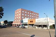 Grover Hotel in Downtown Cleveland Historic District. | |
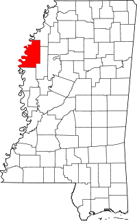 Location in the U.S. state of Mississippi | |
 Mississippi's location in the U.S. | |
| Founded | 1836 |
| Named for | Simón Bolívar |
| Seat | Rosedale and Cleveland |
| Largest city | Cleveland |
| Area | |
| • Total | 906 sq mi (2,347 km2) |
| • Land | 877 sq mi (2,271 km2) |
| • Water | 29 sq mi (75 km2), 3.2% |
| Population | |
| • (2010) | 34,145 |
| • Density | 39/sq mi (15/km2) |
| Congressional district | 2nd |
| Time zone | Central: UTC−6/−5 |
| Website |
www |
Bolivar County is a county located on the western border of the U.S. state of Mississippi. As of the 2010 census, the population was 34,145.[1] Its county seats are Rosedale and Cleveland.[2] The county is named in honor of Simón Bolívar, early 19th-century leader of the liberation of several South American colonies from Spain.
The Cleveland, MS Micropolitan Statistical Area includes all of Bolivar County. It is located in the Mississippi Delta, or Yazoo Basin, of Mississippi. This area was first developed for cotton plantations. Large industrial-scale agricultural operations have reduced the number of farm workers needed, and the population is half of its peak in 1930. Today soybeans are also a commodity crop. The county had 14 documented lynchings in the period from 1877 to 1950.[3]
Geography
According to the U.S. Census Bureau, the county has a total area of 906 square miles (2,350 km2), of which 877 square miles (2,270 km2) is land and 29 square miles (75 km2) (3.2%) is water.[4] It is the second-largest county in Mississippi by land area and fourth-largest by total area.
Major highways
Adjacent counties
- Coahoma County (north)
- Sunflower County (east)
- Washington County (south)
- Desha County, Arkansas (west)
National protected area
Demographics
| Historical population | |||
|---|---|---|---|
| Census | Pop. | %± | |
| 1840 | 1,356 | — | |
| 1850 | 2,577 | 90.0% | |
| 1860 | 10,471 | 306.3% | |
| 1870 | 9,732 | −7.1% | |
| 1880 | 18,652 | 91.7% | |
| 1890 | 29,980 | 60.7% | |
| 1900 | 35,427 | 18.2% | |
| 1910 | 48,905 | 38.0% | |
| 1920 | 57,669 | 17.9% | |
| 1930 | 71,051 | 23.2% | |
| 1940 | 67,564 | −4.9% | |
| 1950 | 63,004 | −6.7% | |
| 1960 | 54,464 | −13.6% | |
| 1970 | 49,409 | −9.3% | |
| 1980 | 45,965 | −7.0% | |
| 1990 | 41,875 | −8.9% | |
| 2000 | 40,633 | −3.0% | |
| 2010 | 34,145 | −16.0% | |
| Est. 2016 | 32,737 | [5] | −4.1% |
| U.S. Decennial Census[6] 1790-1960[7] 1900-1990[8] 1990-2000[9] 2010-2013[1] | |||
As of the 2010 United States Census, there were 34,145 people residing in the county. 64.5% were Black or African American, 33.5% White, 0.6% Asian, 0.1% Native American, 0.9% of some other race and 0.6% of two or more races. 1.9% were Hispanic or Latino (of any race).
As of the census[10] of 2000, there were 40,633 people, 13,776 households, and 9,725 families residing in the county. The population density was 46 people per square mile (18/km²). There were 14,939 housing units at an average density of [7] per square mile (7/km²). The racial makeup of the county was 65.11% Black or African American, 33.24% White, 0.10% Native American, 0.49% Asian, 0.01% Pacific Islander, 0.48% from other races, and 0.56% from two or more races. 1.17% of the population were Hispanic or Latino of any race.
There were 13,776 households out of which 35.20% had children under the age of 18 living with them, 38.20% were married couples living together, 27.30% had a female householder with no husband present, and 29.40% were non-families. 25.30% of all households were made up of individuals and 9.90% had someone living alone who was 65 years of age or older. The average household size was 2.79 and the average family size was 3.36.
In the county, the population was spread out with 29.60% under the age of 18, 14.00% from 18 to 24, 25.70% from 25 to 44, 19.60% from 45 to 64, and 11.00% who were 65 years of age or older. The median age was 30 years. For every 100 females there were 87.80 males. For every 100 females age 18 and over, there were 81.70 males.
The median income for a household in the county was $23,428, and the median income for a family was $27,301. Males had a median income of $27,643 versus $20,774 for females. The per capita income for the county was $12,088. About 27.90% of families and 33.30% of the population were below the poverty line, including 43.90% of those under age 18 and 27.90% of those age 65 or over.
Life expectancy
According to the most recent data on U.S. life expectancy, published in 2010 by the Institute for Health Metrics and Evaluation, a male in Bolivar County could expect to live 65.0 years, the second shortest for any county in the United States, following McDowell County, West Virginia. The national average is 76.1 years for a male.[11]
Senators Robert F. Kennedy and Joseph S. Clark, Jr. had visited "pockets of poverty" in the Mississippi Delta 40 years earlier. In Cleveland, they observed barefoot, underfed African-American children in tattered clothing, with vacant expressions and distended bellies. Kennedy stated that he thought he had seen the worst poverty in the nation in West Virginia, but it paled in comparison to the poverty he observed in Cleveland.[12]
Government
Bolivar County is governed via a five-member board of supervisors. Each member is elected from a single-member district. The county is led by a county administrator, who is appointed by the board.
Education
Colleges and universities
- Delta State University (Cleveland)
The county is within the boundaries of two community college districts: Coahoma Community College and Mississippi Delta Community College.[13][14] Their main campuses respectfully are in unincorporated Coahoma County and Moorhead in Sunflower County.
History
As recently as the 1960s the school board of Bolivar County censored what black children were allowed to learn, and mandated that "Neither foreign languages nor civics shall be taught in Negro schools. Nor shall American history from 1860 to 1875 be taught.”[15]
Public School Districts
School districts:
- Cleveland School District (Cleveland)
- North Bolivar Consolidated School District (Mound Bayou; previously in Shelby)
- West Bolivar Consolidated School District (Rosedale)
Former school districts:
- Benoit School District (Benoit)
- Mound Bayou School District (Mound Bayou)
- Shaw School District (Shaw)
The five school districts, other than the Cleveland School District, are among the 20 smallest of the 152 school districts in the State of Mississippi.[16] In the State of Mississippi, Bolivar County was the only county that had six school districts.[17] Consolidation was urged to save money and facilitate cooperation. In 2012 the Mississippi Senate Education Committee passed a bill asking the State of Mississippi to consolidate the six school districts in Bolivar County to three or two.[16] The Mississippi Senate passed the bill 37-11.[17]
Private School
- Bayou Academy (Cleveland)
Media
The Bolivar Commercial is distributed in Bolivar County.[18]
Politics
| Year | Republican | Democratic | Third parties |
|---|---|---|---|
| 2016 | 33.2% 4,590 | 65.4% 9,046 | 1.4% 188 |
| 2012 | 30.5% 4,701 | 68.6% 10,582 | 0.9% 145 |
| 2008 | 31.8% 4,891 | 67.2% 10,334 | 1.0% 156 |
| 2004 | 36.2% 5,535 | 62.9% 9,631 | 0.9% 141 |
| 2000 | 35.8% 4,847 | 62.3% 8,436 | 1.9% 255 |
| 1996 | 30.6% 4,027 | 65.8% 8,670 | 3.6% 479 |
| 1992 | 33.4% 4,752 | 61.9% 8,801 | 4.7% 673 |
| 1988 | 43.3% 6,105 | 54.0% 7,606 | 2.7% 374 |
| 1984 | 43.9% 6,939 | 55.4% 8,769 | 0.7% 116 |
| 1980 | 35.5% 5,148 | 61.0% 8,839 | 3.5% 504 |
| 1976 | 39.9% 5,136 | 58.7% 7,561 | 1.4% 178 |
| 1972 | 66.1% 7,397 | 32.3% 3,616 | 1.6% 174 |
| 1968 | 15.6% 1,790 | 40.8% 4,696 | 43.6% 5,018 |
| 1964 | 86.5% 4,680 | 13.5% 731 | |
| 1960 | 26.9% 1,012 | 29.7% 1,119 | 43.5% 1,638 |
| 1956 | 21.5% 754 | 33.5% 1,176 | 45.0% 1,581 |
| 1952 | 53.2% 2,096 | 46.8% 1,843 | |
| 1948 | 4.0% 115 | 7.5% 219 | 88.5% 2,580 |
| 1944 | 13.4% 378 | 86.6% 2,444 | |
| 1940 | 7.3% 234 | 92.7% 2,974 | 0.0% 1 |
| 1936 | 4.2% 101 | 95.8% 2,296 | |
| 1932 | 9.5% 204 | 90.2% 1,941 | 0.3% 6 |
| 1928 | 12.1% 266 | 87.9% 1,939 | |
| 1924 | 16.9% 266 | 77.0% 1,212 | 6.1% 96 |
| 1920 | 23.8% 326 | 75.8% 1,039 | 0.4% 5 |
| 1912 | 2.8% 10 | 91.0% 324 | 6.2% 22 |
Communities
Cities
- Cleveland (county seat)
- Rosedale (county seat)
- Mound Bayou
- Shaw (small portion in Sunflower County)
- Shelby
Towns
Unincorporated places
Ghost towns
Notable people
- Mary Booze
- Charles Capps
- Charles Clark (judge)
- Medgar Evers
- T.R.M. Howard
- Amzie Moore
- Peter B. Starke, state representative and state senator, Confederate general in the Civil War
See also
References
- 1 2 "State & County QuickFacts". United States Census Bureau. Retrieved September 2, 2013.
- ↑ "Find a County". National Association of Counties. Archived from the original on 2011-05-31. Retrieved 2011-06-07.
- ↑ Lynching in America, 2nd edition, Supplement by County, p. 6
- ↑ "2010 Census Gazetteer Files". United States Census Bureau. August 22, 2012. Archived from the original on September 28, 2013. Retrieved November 2, 2014.
- ↑ "Population and Housing Unit Estimates". Retrieved June 9, 2017.
- ↑ "U.S. Decennial Census". United States Census Bureau. Archived from the original on May 12, 2015. Retrieved November 2, 2014.
- ↑ "Historical Census Browser". University of Virginia Library. Retrieved November 2, 2014.
- ↑ "Population of Counties by Decennial Census: 1900 to 1990". United States Census Bureau. Retrieved November 2, 2014.
- ↑ "Census 2000 PHC-T-4. Ranking Tables for Counties: 1990 and 2000" (PDF). United States Census Bureau. Retrieved November 2, 2014.
- ↑ "American FactFinder". United States Census Bureau. Archived from the original on 2013-09-11. Retrieved 2008-01-31.
- ↑ "Life Expectancy, Obesity, and Physical Activity". Institute for Health Metrics and Evaluation. 2010.
- ↑ Schmitt, Edward R. (2011). President of the Other America: Robert Kennedy and the Politics of Poverty. University of Massachusetts Press. pp. 178, 179. ISBN 1558499040.
- ↑ "Student Residency." Coahoma Community College. Retrieved on July 8, 2017.
- ↑ "Message from the President." Mississippi Delta Community College. Retrieved on July 8, 2017.
- ↑ Carmichael, Stokely; Michael Thelwell (2003). Ready for Revolution. Scribner.
- 1 2 Amy, Jeff. "Bill forces merger of Bolivar school districts." Associated Press at the Houston Chronicle. Tuesday March 6, 2012. Retrieved on March 25, 2012. Archive link at The Mississippi Link
- 1 2 Amy, Jeff. "Miss. bill would force 6 Bolivar County school districts to merge into 3 or fewer." The Republic. March 14, 2012. Retrieved on March 24, 2012.
- ↑ "bc_masthead1.gif." The Bolivar Commercial. Retrieved on April 15, 2012.
- ↑ Leip, David. "Dave Leip's Atlas of U.S. Presidential Elections". uselectionatlas.org. Retrieved 2018-03-04.
External links
Places adjacent to Bolivar County, Mississippi | ||||||||||
|---|---|---|---|---|---|---|---|---|---|---|
| ||||||||||
Municipalities and communities of Bolivar County, Mississippi, United States | ||
|---|---|---|
| Cities | | |
| Towns | ||
| Unincorporated communities | ||
| Ghost towns | ||
| Footnotes | ‡This populated place also has portions in an adjacent county or counties | |
.svg.png)