Perry County, Mississippi
| Perry County, Mississippi | |
|---|---|
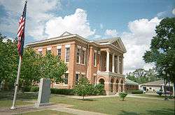 Perry County courthouse New Augusta | |
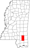 Location in the U.S. state of Mississippi | |
 Mississippi's location in the U.S. | |
| Founded | 1820 |
| Named for | Oliver Hazard Perry |
| Seat | New Augusta |
| Largest town | Richton |
| Area | |
| • Total | 650 sq mi (1,683 km2) |
| • Land | 647 sq mi (1,676 km2) |
| • Water | 3.0 sq mi (8 km2), 0.5% |
| Population | |
| • (2010) | 12,250 |
| • Density | 19/sq mi (7/km2) |
| Congressional district | 4th |
| Time zone | Central: UTC−6/−5 |
Perry County is a county located in the U.S. state of Mississippi. As of the 2010 census, the population was 12,250.[1] The county seat is New Augusta.[2] The county is named after the War of 1812 naval hero, Oliver Hazard Perry.
Perry County is part of the Hattiesburg, MS Metropolitan Statistical Area.
Until 1906, the county seat was the old town of Augusta, near the center of the county on the east bank of the Leaf River. At Old Augusta, the outlaw James Copeland was executed by hanging on October 30, 1857.[3] Old Augusta remains a small village today. New Augusta, two miles south of Old Augusta, was made the county seat of Perry County, because it was situated on the Mobile, Jackson & Kansas City Railroad.[4]
Geography
According to the U.S. Census Bureau, the county has a total area of 650 square miles (1,700 km2), of which 647 square miles (1,680 km2) is land and 3.0 square miles (7.8 km2) (0.5%) is water.[5]
Major highways
Adjacent counties
- Wayne County (northeast)
- Greene County (east)
- George County (southeast)
- Stone County (south)
- Forrest County (west)
- Jones County (northwest)
National protected area
Demographics
| Historical population | |||
|---|---|---|---|
| Census | Pop. | %± | |
| 1820 | 2,037 | — | |
| 1830 | 2,300 | 12.9% | |
| 1840 | 1,889 | −17.9% | |
| 1850 | 2,438 | 29.1% | |
| 1860 | 2,606 | 6.9% | |
| 1870 | 2,694 | 3.4% | |
| 1880 | 3,427 | 27.2% | |
| 1890 | 6,494 | 89.5% | |
| 1900 | 14,682 | 126.1% | |
| 1910 | 7,685 | −47.7% | |
| 1920 | 8,987 | 16.9% | |
| 1930 | 8,197 | −8.8% | |
| 1940 | 9,292 | 13.4% | |
| 1950 | 9,108 | −2.0% | |
| 1960 | 8,745 | −4.0% | |
| 1970 | 9,065 | 3.7% | |
| 1980 | 9,864 | 8.8% | |
| 1990 | 10,865 | 10.1% | |
| 2000 | 12,138 | 11.7% | |
| 2010 | 12,250 | 0.9% | |
| Est. 2016 | 12,245 | [6] | 0.0% |
| U.S. Decennial Census[7] 1790-1960[8] 1900-1990[9] 1990-2000[10] 2010-2013[1] | |||
As of the census[11] of 2000, there were 12,138 people, 4,420 households, and 3,332 families residing in the county. The population density was 19 people per square mile (7/km²). There were 5,107 housing units at an average density of 8 per square mile (3/km²). The racial makeup of the county was 76.17% White, 22.59% Black or African American, 0.33% Native American, 0.12% Asian, 0.05% Pacific Islander, 0.28% from other races, and 0.47% from two or more races. 1.01% of the population were Hispanic or Latino of any race.
There were 4,420 households out of which 37.60% had children under the age of 18 living with them, 58.10% were married couples living together, 13.20% had a female householder with no husband present, and 24.60% were non-families. 21.90% of all households were made up of individuals and 8.70% had someone living alone who was 65 years of age or older. The average household size was 2.72 and the average family size was 3.18.
In the county, the population was spread out with 28.70% under the age of 18, 10.00% from 18 to 24, 28.00% from 25 to 44, 22.20% from 45 to 64, and 11.10% who were 65 years of age or older. The median age was 34 years. For every 100 females, there were 95.60 males. For every 100 females age 18 and over, there were 91.10 males.
The median income for a household in the county was $27,189, and the median income for a family was $32,791. Males had a median income of $29,130 versus $18,632 for females. The per capita income for the county was $12,837. About 19.60% of families and 22.00% of the population were below the poverty line, including 28.60% of those under age 18 and 25.50% of those age 65 or over.
Communities
Towns
- Beaumont
- New Augusta (county seat)
- Richton
Unincorporated communities
Notable people
- Swords Lee, timber owner and member of the Louisiana House of Representatives for Grant Parish, 1904-1908; born in Perry County in 1859[12]
Politics
| Year | Republican | Democratic | Third parties |
|---|---|---|---|
| 2016 | 76.1% 4,135 | 22.5% 1,220 | 1.4% 77 |
| 2012 | 72.3% 4,137 | 26.7% 1,527 | 1.0% 58 |
| 2008 | 71.8% 4,067 | 27.1% 1,533 | 1.1% 64 |
| 2004 | 74.5% 3,747 | 25.1% 1,261 | 0.4% 22 |
| 2000 | 69.4% 3,026 | 29.5% 1,285 | 1.1% 48 |
| 1996 | 53.7% 2,178 | 34.9% 1,413 | 11.4% 463 |
| 1992 | 56.4% 2,538 | 33.1% 1,490 | 10.5% 473 |
| 1988 | 68.6% 2,983 | 30.5% 1,326 | 0.9% 38 |
| 1984 | 65.3% 3,098 | 29.8% 1,415 | 4.9% 231 |
| 1980 | 52.9% 2,255 | 45.9% 1,957 | 1.2% 51 |
| 1976 | 41.0% 1,527 | 52.8% 1,965 | 6.3% 233 |
| 1972 | 84.1% 2,689 | 14.0% 446 | 1.9% 61 |
| 1968 | 7.1% 227 | 13.7% 439 | 79.2% 2,541 |
| 1964 | 86.4% 1,775 | 13.6% 279 | |
| 1960 | 20.4% 274 | 38.2% 514 | 41.4% 556 |
| 1956 | 31.6% 347 | 52.8% 581 | 15.6% 172 |
| 1952 | 39.5% 511 | 60.5% 782 | |
| 1948 | 2.9% 25 | 9.9% 87 | 87.2% 765 |
| 1944 | 5.2% 44 | 94.8% 796 | |
| 1940 | 2.1% 18 | 97.9% 828 | |
| 1936 | 2.1% 16 | 97.9% 737 | |
| 1932 | 2.8% 15 | 96.5% 523 | 0.7% 4 |
| 1928 | 49.5% 277 | 50.5% 283 | |
| 1924 | 12.1% 55 | 84.2% 383 | 3.7% 17 |
| 1920 | 20.0% 69 | 78.6% 271 | 1.5% 5 |
| 1916 | 7.1% 32 | 87.8% 395 | 5.1% 23 |
| 1912 | 1.3% 4 | 81.9% 257 | 16.9% 53 |
See also
References
- 1 2 "State & County QuickFacts". United States Census Bureau. Archived from the original on July 16, 2011. Retrieved September 5, 2013.
- ↑ "Find a County". National Association of Counties. Retrieved 2011-06-07.
- ↑ The Notorious Copeland Gang.
- ↑ Perry County, Mississippi Genealogy and History
- ↑ "2010 Census Gazetteer Files". United States Census Bureau. August 22, 2012. Archived from the original on September 28, 2013. Retrieved November 6, 2014.
- ↑ "Population and Housing Unit Estimates". Retrieved June 9, 2017.
- ↑ "U.S. Decennial Census". United States Census Bureau. Retrieved November 6, 2014.
- ↑ "Historical Census Browser". University of Virginia Library. Retrieved November 6, 2014.
- ↑ "Population of Counties by Decennial Census: 1900 to 1990". United States Census Bureau. Retrieved November 6, 2014.
- ↑ "Census 2000 PHC-T-4. Ranking Tables for Counties: 1990 and 2000" (PDF). United States Census Bureau. Retrieved November 6, 2014.
- ↑ "American FactFinder". United States Census Bureau. Retrieved 2008-01-31.
- ↑ "Col. Stephen R. Lee of Alexandria Dies at His Home Feb. 13: Industrial and Political Leader, Descendant of Famous Lees". Winnfield, Louisiana: Winnfield News-American. February 22, 1929. Retrieved May 23, 2015.
- ↑ Leip, David. "Dave Leip's Atlas of U.S. Presidential Elections". uselectionatlas.org. Retrieved 2018-02-07.
Places adjacent to Perry County, Mississippi | ||||||||||
|---|---|---|---|---|---|---|---|---|---|---|
| ||||||||||
Municipalities and communities of Perry County, Mississippi, United States | ||
|---|---|---|
| Towns | | |
| Unincorporated communities | ||
.svg.png)